Sundridge

“Sunny Sundridge village by the lake, only two and a half hours from Toronto.”  Yeah right!  Lake – yes, sun – maybe (it rained the first two times I visited, and was cloudy on the third).  But two and a half hours north of Toronto?  Maybe at 3 AM doing 140 the whole way and not seeing a truck the whole time. Or maybe I just drive too slowly…

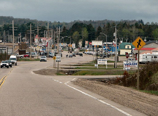
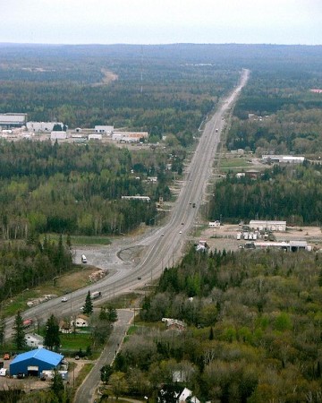
Highway 11 near Sundridge, Ontario

(Photo: user P199 at Wiki Commons.)

Sundridge is a village of about 1000 people strewn along the east side of Highway 11.  Established in 1889 on the shores of Lake Bernard, Sundridge is a former lumber and rail town that now finds itself as pretty much the northernmost extent of southern Ontario cottage country.  One my highschool teachers left their job for a high school in Sundridge, apparently for the solitude and seclusion.  Let me tell you, if you’re looking for quiet and minimal company this is the right place.  Sundridge is small and, for a southern Ontario town, situated pretty far north.

Sundridge is kinda funny because it’s a name no-one really wanted.  Originally the town was supposed to be named Sunny Ridge, but when they applied for the name in the late 1800’s Canada Post made a mistake and registered it as Sundridge.  As long as the mail came it really didn’t matter, so it stuck.

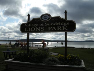
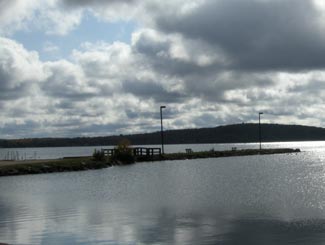
Sundridge Lake Front park, highway 11

This photo is so bad I’m almost proud of it

The Sundridge that most travellers see is a relatively nondescript rail crossing on the highway with some truckstops and a factory or two on Highway 11.  However if you turn into town you’ll find that although tiny, Sundridge isn’t half bad.  There is a nice little waterfront park with a playground and a little beach on Lake Bernard.  There is a “resort hotel”, a few car dealerships, a grocery store, a LCBO, and a Legion, along with a few other stores like Home Hardware. There is Ten Gables Golf Course, fishing charters, and snowmobiling, icefishing, and sugar shacks in the winter.  Sundridge also hosts an Agricultural Fair in the fall.

Sundridge made national news in August 2008 when the employees of the local Ford dealer won half of Canada’s second-largest lottery jackpot ever. Twenty-five people split 22.5$ million. The owner said that he didn’t expect to lose anyone to retirement right away…they must be a really dedicated lot.

Being in cottage country means that Sundridge has a few more amenities than its neighbours to the north.  There are five bed and breakfasts (Lakeview, Maple Sugar, Mitchell’s, Belrose, and Entwood Forest,) the Relax Shack Retreat, Allenby Cottages, a trailer camp, and a few motels.

For food there is Danny’s Justa Pasta a bit south of town, Double Decker burgers, Ha’s Chinese, a deli, a café, and the Stieirhut Schnitzel Haus (which I’ve always wanted to try, but never have – I love schnitzel).  I had a good breakfast at Jim and Elsie’s Café. In town I also bought the most stale, overpriced croissant ever – I didn’t know that the price of croissants was indexed to the price of gas to rise as you go up the highway.

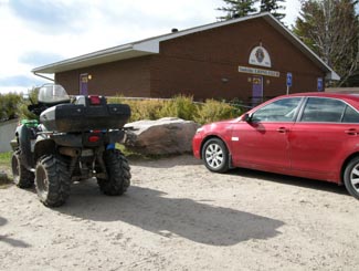
Sundridge ATV parking, Highway 11

ATVs parked right beside cars like it’s normal? You know northern Ontario is beckoning…!

Sundridge waterfront - way nicer than this photo

Sundridge waterfront – way nicer than this photo

North Bay

Although considered to be in northern Ontario, if you look at it North Bay really isn’t that far north.

“Just north enough to be perfect” according to its slogan, North Bay is the second city of Ontario’s near north (after Sudbury.)

Considering what southern Ontario considers to be ‘north’, maybe “just north enough to be perfect” should be Barrie’s slogan? Kidding…!North Bay, Ontario, Highway 11

Explored by Samuel de Champlain, North Bay wasn’t founded until 1891.  Primarily a railway town, North Bay once harboured massive ambitions of being Canada’s Panama – there were plans for a canal stretching from the Ottawa River through the town to Lake Nipissing, which would have essentially been a massive shortcut for boats en route from Thunder Bay.  This never materialized.  North Bay did however play an important role during the silver rushes in Cobalt as it was the hub of both the CPR and the ONTC line up to northeastern Ontario. Today, North Bay is largely a university, military, and (most importantly) a transportation town.

Highway 11 ontario north bay highway11.ca

Highway 11 heading out of North Bay (Credit: P199 from Wiki Commons)

I’ve driven through North Bay five times, and stopped in a couple of other times for visits of a few hours.  It has all the amenities a trveller could need – from motels to real hotels, from diners to chain restaurants, from no name doughnut stops to Tim Horton’s.

North Bay is essentially the last place to get a full range of big city shops, services, and franchises before Timmins, or if you plan to stay solely on Highway 11, the last place before Thunder Bay.. I was once told by a facetious friend that North Bay is Cree for “a place on the lake where the gas is cheaper.”  While that’s obviously a joke, the general point about gas prices is true – sometimes as much as 15 cents cheaper than its more northern counterparts.

Lake Nipplesing, North Bay, highway 11

Lake Nippissing under clouds.

North Bay is home to a really nice restored theatre – the Capitol Centre – that hosts plays and concerts. (I got dragged to an Anne of Green Gables play while we were there…and I can’t believe I’m admitting this but it was actually kind of good.  The island, the island, we’re from Prince Edward Island…we’re island, we’re island throughandthrough…)  Although the theatre doesn’t immediately catch the eye (it’s on Main St, or Oak St, I can’t remember) the inside is really quite nice. There truly isn’t a bad seat in the house.

North Bay was home to Mike Harris, a two-term Ontario Premier during the late 1990s in Ontario whose name pretty much became a curse-word if you were a public school student at the time.  He’s famous for the coining the phrase “common sense revolution.” Oh, and the Dionne Quintuplets were born in nearby Corbeil Callander.  Their exploitation brought a fair amount of money to North Bay during the depression.  Kids in the Hall comedian Scott Thompson was born in North Bay (I think he grew up in Scarborough though), as is weatherperson Susan Hay and a pretty not so great band called High Holy Days.

Plan in North Bay, highway 11, Ontario

North Bay’s “some big weird thing” is a bit more refined than some other northern Ontario towns

North Bay is also famous for being the hometown of Roy Thomson, the founder of the Thomson media empire and the namesake of Toronto’s Roy Thomson Hall, one of Canada’s premiere music venues. Roy Thomson started out selling radios door-to-door in North Bay. This interest in radio led to him taking over the local radio station, taking over or establishing more radio stations, then expeanding into newspapers – eventually making him one of Canada’s most successful businessmen.

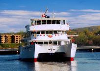
North Bay cruise tour highway 11

I once chuckled at an acquaintance who recounted their engagement story, which occurred under a Tuscan sunset.  I shouldn’t have laughed – I almost proposed on a boat tour of Lake Nipissing

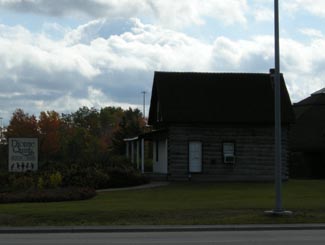
Tourist activities include the Commanda boat tours on Lake Nipissing, and the beach, walkways, and mini train ride at the city’s waterfront.  There are plays (Nipissing Stage Company) and festivals (The Heritage Festival every August Civic holiday.)  The Dream Catcher Express used to run a day-trip train to Temagami to view the leaves in the fall – but that’s been cancelled since the government shut down the ONTC. There is also the original Dionne House, where to Dionne quints were born (the house pictured second from top on the left), which has been moved into town and turned into a little museum. The museum is open from Spring to late October, and entrance is about 3$ each, and is worth a visit if you’re in town.

Dionne House Museum, Ontario, Highway 11

I never cease to amaze myself with how crap my photos can get. This is the Dionne Quints Museum house.

What else can I say about North Bay?  You know, this site is kinda focused on the more northern towns, like Timmins, so I guess I’m not always putting as much content up about places like Barrie or North Bay, etc. I guess since North Bay is a bit bigger than the average town on this site, there is less I have to tell you. North Bay is pretty nice, it seems like a good place to live and a great place to grow up – but this site is a bit more about the smaller, more remote towns to its north. (I got flack from a poster on the Huntsville page for this site’s north-centric focus, I’m waiting for same flack to be posted on behalf of North Bay too…)

Fun in North Bay, Highway 11

For a while I had no photos of North Bay, and this was the first that came up in google

Cobalt

Cobalt, OntarioIn my travels along Highway 11 I’ve noticed that some towns are:

And then there are some that are just plain cool.

Enter Cobalt.

Cobalt is just really neat.  Part of it is the history.  Part of it is the town’s independent streak.  But mostly, it’s just so old and, well, old, that it’s really interesting.

From “Yikes” to “Cool”

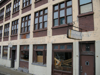
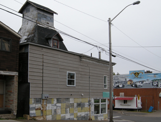
My first impression of Cobalt was “oh god.”  And not in a good way.  But boy was I wrong. Cobalt is the kind of town that would have five taverns but no grocery store. And that’s what makes it so interesting.Abandoned storefront in Cobalt, a reminder of its heydey

Cobalt headframe, hgihway 11 Ontario

Preserved mine headframe in Cobalt – really cool

It was when I stopped to take a break from driving that I really saw my surroundings.  I realized that what looked old and run down was simply historic.  That was looked grotty and old really had a tonne of character. That instead of tearing down older buildings and erecting cheap, shoddy new ones in their place, Cobalt had preserved its history. A history they were proud of. This place wasn’t run down, it was preserved.  Cobalt was named Ontario’s most historic town for a reason.

Sure, there aren’t a tonne of stores or boutiques.  But at least there aren’t a tonne of places selling crap either.  There is no grocery store left in town (it closed in 1992 when the store owner cleared out the remaining products and held dance parties in the store to commemorate its closing), but what else is there is because it needs to be there – like museums, mine shafts, and bars.  More than a few of them.

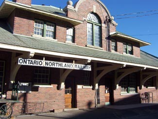
Cobalt Train Station, Highway 11

Cobalt ONTC station

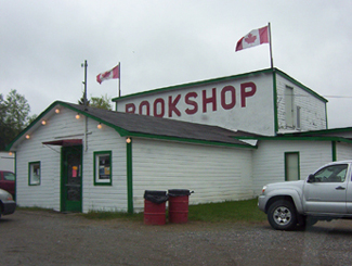
Highway 11 Book Shop, now closed. Cobalt, OntarioThe Highway Book Shop was a classic tourist destination that never feels like a tourist destination.  It was a family-run used bookshop on Highway 11 just outside of Cobalt and it is not only worth a visit, it is worth some time.  Maps, books, magazines, teaching materials, kid’s lit, old books, new books, big books, rare books – you wouldn’t have believed all the crap they have in there.  I think I spent an hour on two separate occasions perusing the cramped store. It might smell like your grandmother’s basement, but it’s really neat, and no visit to Temiskaming is complete without a stop, in my opinion. Sadly, the icon has closed.  Ready to retire for years, the owners couldn’t find anyone to take the store on and had to shut one of Highway 11’s best attractions down.

Cobalt Classic Theatre is the only remaining theatre from Cobalt’s heyday in 1920s.  While other towns were using economic development funds to build golf courses, Cobalt restored the old Classic Theatre in 1993 and now hosts students, playwrights, and actors from across Ontario. The theatre is restored to what it looked like in the 1920s and is a focal point for the community.

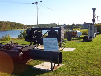
Cobalt, mining equipment, Highway 11

Antique mining equipment on display at the lakefront.  Other towns would have just thrown this stuff out.  Cobalt, refreshingly, doesn’t run from its roots.

Mine headframe now a bar, Cobalt, Ontario

This headframe is now the world’s only bar in a mine headframe! That’s revitalization, northern Ontario style.

The Cobalt Mining Museum has the world’s largest display of silver and offers the only underground mine tour that I’ve seen outside of Timmins.  The Bunker Military Museum has a good collection of memorabilia, the Great Canadian Mine show displays mining technology, and there is also a firefighter museum in town.

Cobalt also has two separate self-guided walks.  The Cobalt Walking Tour brings you through town past historic buildings and historical places, while the Heritage Silver Trail is a self guided tour of many of the abandoned mine headframes in the area.

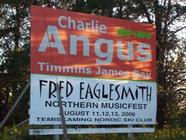
There’s more.  There is Fred’s Northern Picnic, an annual music festival that the local Member of Parliament usually plays at (he’s a musician by trade) and where you get three days of music and free camping for like $60.  The Silver Street Cafe has good food and decent prices, and they also cater local events with real food (forget hamburgers and hot dogs, think steak on a bun and pulled pork with onions.)  The Silverland Inn and Motel is a restored hotel from Cobalt’s mining heyday and also serves food.  There is a stained glass shop, a gem shop, and Iddy Biddy Petting Farm.  Cobalt also has more murals than Nipigon.

Fred's Northern Picnic, featuring MP Charlie Angus, Cobalt, ON

Not sure if they’re still running Fred’s Northern Picnic, but that’s where I saw Serena Ryder before she was big, and the local MP get up and do a set too

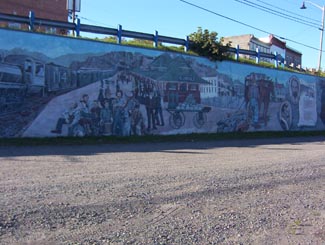
History of Cobalt Mural, Cobalt Highway 11Hockey, Streetcars, and Casa Loma

I read in the James Bay tourist brochure that there is a legend that Cobalt blacksmith Fred Larose threw his hammer at a fox, uncovering a rich vein of silver in the process.  Further silver and mineral deposits were found in 1903, triggering a mining rush like no other in northern Ontario.  The significance of the Cobalt finds supposedly led to riots over mining stocks in New York City.  Others say that Cobalt built Bay Street (Toronto’s Wall Street.)  A testament to the town’s wealth, the Cobalt Silver Kings played the 1909 season in the NHA, the NHL’s precursor. Another first in Cobalt include the Temiskaming Streetcar Line, which was installed between Cobalt and Haileybury, and was the first streetcar system north of Toronto.

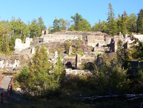
Mining ruins, Cobalt, Highway 11 Ontario

Mining ruins east of town

Cobalt Lake, Ontario

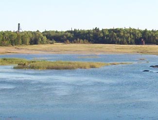
Cobalt Lake, once drained, then filled, now restored

In addition, the mines of Cobalt built Casa Loma, the famous “castle” built upon Spadina Heights in Toronto. Sir Henry Mill Pellatt was a wealthy Canadian mine owner (some say Canada’s richest man at the time.) It was his mining operations in Cobalt that allowed him to gather the immense wealth to build Casa Loma. Construction began in 1911 and took more than three years, 3.5$ million, and more than 300 full-time workers. With 98 rooms, it was the largest residence in Canada at the time. Pellat eventually lost his residence, as the Depression and the decline of mining in Cobalt led to his financial ruin. Casa Loma was essentially built with the revenues Sir Henry Mill Pellatt gained by draining Cobalt Lake for silver mining.

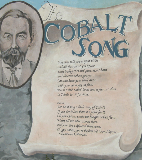
The Cobalt rush eventually produced more than $260 million worth of silver, countless myths and stories about how and where silver was found, who struck it rich, and who lost their pants in speculation. The Cobalt silver rush resulted in a whole little Cobalt culture developing – embodied by the Cobalt Song (click here to download the sheet music.) Cobalt led to the founding towns like North Cobalt (a bedroom town for miners) and Haileybury (a bedroom town for wealthy mine owners.) The mining boom in Cobalt also paved the way for exploration further north, which led to massive gold finds in Timmins and Kirkland Lake, both of which far exceeded the value of the mines of Cobalt in the long-run.

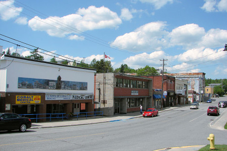
Cobalt, Ontario, downtown, highway11.ca Ontario Highway 11

I could move this photo of downtown Cobalt closer to the text that talks about downtown Cobalt but in wordpress moving photos around is a pain in the rear. (Credit: User P199 at Wiki Commons.)

Although Cobalt survived the usual northern Ontario disasters, including a typhoid outbreak in 1909, and Great Fire of 1922, it couldn’t survive the decline of mining.  Well, it survived, but it’s much smaller today and mining no longer exists.  There is some exploration for diamonds, but I don’t think they’ve been found.  I’ve heard that many of the old mines still have minerals in them, but that it’s just not economical to mine such old shafts for minerals at today’s prices. But, in the end, the history of Cobalt is one of a town that conbtinually gets kicked, but then manages to find its way back up.

Cobalt is considered the third part of the Tri Towns along with New Liskeard and Haileybury.  But for some reason it didn’t amalgamate into Temiskaming Shores in the late 1990s when the province forced municipalities to squish together.  Maybe it’s too far away.  Maybe old hostilities with North Cobalt scuppered a move.  Maybe the town is too independent.  Maybe there is still an old hockey rivalry between Cobalt and Haileybury from the one season both towns had a team in the NHA.  I’m sure someone in the town of 1200 put up a fight.  I don’t know.

I haven’t spent as much time as I would like in Cobalt, and, I must admit, haven’t visited any of the touristy things here other than the Highway Book Shop.  But I’m sure I’ll be back again.

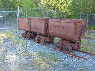
Old mining carts, Cobalt, Ontario

My grandfather worked in coal mines in Europe for a time.  Seeing these things, all I could think of was my disbelief that people actually went underground with these things…that’s ballsy

The Cobalt Song Mural, Cobalt, Highway 11 Ontario

Haileybury

Which northern Ontario town had its own street cars, was home to the guy who wrote the Hardy Boys, had the most millionaires in Canada, was the first home of the team that would become the Montréal Canadiens, and then promptly had its prosperity wiped out by a massive fire?

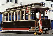
Streetcar Norhtern Ontario, Haileybury, Highway 11

Back off St. Clair Avenue West…Haileybury has had streetcars too!

The thing that makes Haileybury really northern is its history.  The rise and fall and apparent rebuilding is really interesting and, in my opinion, totally characteristic of northern Ontario.

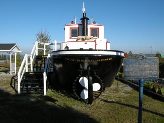
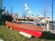
Lumber boat in Haileybury, ontario

After Longlac and Opasatika, let me guess this is a lumber boat?

Once known as Humphrey’s Depot, Haileybury was founded in the early 1900s by a former fur trader on the shores of Lake Temiskaming.  He named the town after the school he attended in England.  He tried to attract settlers with the usual propaganda leaflets, but as northern Ontarians know, there’s no better way to get the country settled than a gold rush.  And that’s what it took to get Haileybury off the ground.

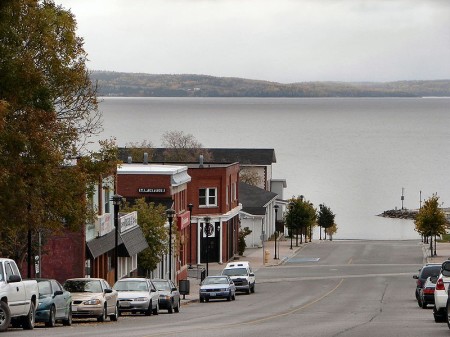
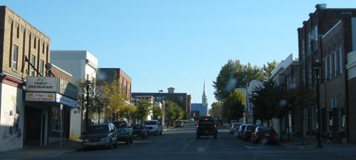
Haileybury, downtown, Highway 11 Ontario Lake

Haileybury road leading into Lake Temiskaming. (Credit; User P199 at Wiki Commons.)

Despite being named after a place in England where wealthy parents got rid of their kids, Haileybury is the start of francophone north-eastern/central Ontario.  (Or it is the end, depending on which way you’re traveling on Highway 11.)  Approximately 80 percent of Haileyburians are French-first, which is interesting given that their neighbours are primarily anglophone, particularly in New Liskeard (70 percent) and Cobalt (almost completely unilingual.)  As you go north after Haileybury, the towns almost alternate – anglo, franco, etc.

The discovery of silver in Cobalt in 1903 started a population explosion in Haileybury, as the town became a bedroom community for prospectors and mine owners.  So successful were some that a street in Haileybury was dubbed Millionaire’s Row for the wealthy people it housed.

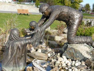
Haileybury, Ontario on Highway 11But of course, this all had to come to a tragic end with the fires of 1922, which killed 11, displaced 3500, and razed the town completely alongside New Liskeard, Dymond, and possibly Cobalt. In order to survive, many families had to hide in wells, lakes, and even down mine shafts. Many of those who escaped to the mines died when the fires, passing over the mines, sucked out the shaft’s oxygen, asphyxiating those who sought refuge underground. The town commorates the fire with a sculpture at its waterfront park, pictured below on the left.

Haileybury Today

With 4500 people, Haileybury (pronounced locally as Haileyberry) is the second largest part of the Tri-Towns and Haileybury is the seat of the Temiskaming Shores municipality, which includes New Liskeard and Dymond.  It is a quiet lakeshore community that is worth a stop if you’re not in a hurry.

Pioneer Monument, Great Fire, Haileybury, Highway 11

Monument to pioneers that survived the Great Fire by hiding in swamps, lakes, and wells

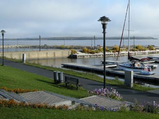
I really like the waterfront.  There is a nice little pavilion with the Pioneer’s Monument (pictured) honouring the fire of 1922.  There is a little beach and a modern marina as well.  The view is nice across the lake to Quebec and in the summer you’ll see a number of boats on the water as Lake Temiskaming is the end of the scenic Ottawa River route, which is popular with boaters.  The waterfront is worth a drive, if not a full stop.

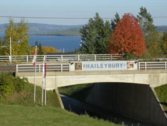
Haileybury on the shores of Lake Temiskaming

Haileybury on the shores of Lake Temiskaming

In terms of tourism, there is a fair amount to do.  The Haileybury Heritage Museum was built to chronicle the history of the town and tell the story of the fire.  The museum features a restored 1920s streetcar, as well as an old firepumper and a preserved tugboat that used to ply the waters of Lake Temiskaming.  You can also visit the “world famous” Haileybury School of Mines.  Haileybury is also home to the Temiskaming Art Gallery.  You can see different types of ores at the Rock Park Walk, while there is camping and golf in town as well.

I don’t remember a lot of places to eat, and I think the only Tri-Town Tim Horton’s are in New Liskeard and Dymond.  Accommodations include the Leisure Inn, Edgewater Motel and Cabins, the Haileybury Beach Motel, and the Les Suites des Presidents Suites, an upscale bed and breakfast.  New Liskeard has more places to stay and eat.  Personally I find that Haileybury, despite being very pretty and having stuff to do, is still something of a bedroom community.  It doesn’t have the same downtown nor the same ‘feel’ that New Liskeard does.  And it’s nothing like Cobalt.  At all.

Downtown Haileybury

Back to History

Haileybury was also home to the team that would become the Montreal Canadiens.  The club played the 1909 NHA season and left for Montreal.  It would become the Canadiens only two years later.  I think that’s pretty neat.

Haileybury’s streetcars were part of the Nipissing Central Railway that connected the Tri Towns, which would definitely make it unique in the north.  Heck I’m sure it ran faster then than Timmins transit does today.  Toronto also donated 87 streetcars after the great fire to help shelter the homeless.  Today there is one restored streetcar left at the Haileybury Heritage Museum.

And, to finish, Haileybury was also home to Les Macfarlane, who wrote many of the Hardy Boys novels under the pen name Franklin Dixon.

Thanks to Johnny O for the info on the Tri Towns.

The Hardy Boys's Sleuth, in Haileybury on Highway 11

I never liked the Hardy Boys. Too All-American. Too serious. Too predictable. Sure, you knew that Encyclopedia Brown was always going to figure it out too but at least he had a sense of humour. But, anyway, this is a replica of the Hardy Boys’s boat, in Haileybury.

Kirkland Lake

I almost moved to Kirkland Lake, and I’ve always kind of regretted that it didn’t work out.  Kirkland Lake is a neat little town that’s been described to me as the ‘wild west’ of northeastern Ontario.

Forty five kilometres east of the Québec border on Highway 66 (not Highway 11, we’re on a detour right now), Kirkland Lake is a largely anglophone town of about 10 000 8000, and is the largest town between North Bay and Thunder Bay on Highway 11.

Mines and Garbage

Kirkland Lake is extremely well known throughout Canada despite its small size and relatively remote location.  Since gold was struck in the early 1900s, KL has been one of Canada’s most famous mining towns, complete with gold mines, drinking hotels, and highgraders.  There’s a miner’s memorial as you come into town, which is actually quite classy and lists all the names of those who have died in mining accidents since the town began.

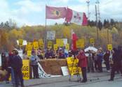
Kirkland Lake Adams Mine Protest

Adams Mine protests in Kirkland Lake in the 1990s

KL is also famous for Adams Mine – an abandoned open-pit mine that would have been the site for Toronto’s garbage, had the local community, First Nations, farmers and environmentalists not fought it so effectively.  They were in the media, they wrote thousands of letters, they united many groups that had not worked together before.

Kirkland Lake is a story across Canada showing that no matter how small you may be if you do it right and smart – you can win.  Adams Mine was seen as a huge story across Canada – so much so that the effort which started small eventually changed a lot of minds across southern Ontario.  The provincial government put the plan to rest in 2003.  The Grievous Angels, a band based in northern Ontario, wrote a song about it (the lyrics are here.)

Harry and Hockey and … other interesting stuff (that begins with the sound “wh”)

Kirkland Lake was named after Winifred Kirkland, a secretary at the old Ministry of Mines.  (Ah to be an early provincial bureaucrat – you might get a town named after you.) Kirkland Lake, arguably, has it’s own suburb – King Kirkland – which consists of about 20 houses and trailers about ten minutes east of town on the highway.

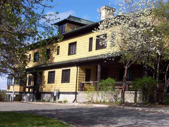
Sir Harry Oakes is probably Kirkland Lake’s most famous and most wealthy citizen. American-born, he was a prospector who finally struck it big in KL after stints in California, Australia, and the Klondike.  His mine in KL was the second largest gold mine in the Americas.  By the 1920s, Harry Oakes was Canada’s richest individual.  However in 1943, Oakes was allegedly murdered at his home in the Bahamas, and although fingers were pointed towards his son-in-law, no one was ever convicted of the crime.  Today his former house is home to the Northern Ontario Museum in KL.

Kirkland Lake Mansion museum

Harry Oakes’s former mansion – now the Kirkland Lake museum

In terms of other famous KLers, Kirkland Lake was also once home to Growing Pains star Alan Thicke, figure skater Toller Cranston, and former NHL goalie Darren Puppa.

Hockey Heritage North, Kirkland Lake OntarioOn the subject of hockey, Kirkland Lake used to be known as a hockey hotbed.  CBC broadcaster Foster Hewitt used to call KL “the town that made the NHL famous” due to so many Kirkland Lakers filling the roasters of early NHL squads.  Today KL is home to Hockey Heritage North, a museum that celebrates hockey and northern Ontario’s role in the NHL.  Hockey Heritage North has a parkinglot that’s bigger than the museum itself – seemingly twice the size of the facility – and the parkinglot is probably a bigger draw for kids learning to ride bikes or for rollerblading and skateboarding.  In three visits I’ve come to believe that Hockey Heritage North’s parkinglot is the nicest smoothest stretch of pavement in all of northern Ontario.

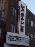
Downtown Kirkland Lake

The place to see a show in Kirkland Lake. I mean a normal show. Don’t get any ideas. Those days are over.

Way back in the day, Kirkland Lake, however, was arguably almost as famous for its red house.  KL had a reputation for being a party town, thanks in part to the mining boom and the many bachelors who ventured north to prospect and work. I have been told that one of the highlights of Kirkland Lake’s heyday was its internationally-known brothel.  Soldiers from the area went to Europe to fight in World War One and regaled Europeans with tales of “the Red House of Kirkland Lake” or “5 Main Street” which was in fact a popular brothel well-known across the north.  Supposedly the tales were so tall or so enthralling that other soldiers and even Europeans have actually come back to the area to visit Kirkland Lake’s red whorehouse.  The house itself still standing but is no longer red.

Kirkland Lake: The Town

Kirkland Lake, to me at least, is a town of contrasts.  When you enter the downtown along Government Road, it looks a bit like Huntsville in cottage country – a windy street revealing the town turn by turn, forming the backbone of an old but not pretty interesting little downtown.  Actually, I like the downtown – it’s may not be “quaint” by some people’s standards but has character. With a decent downtown and as a town of 10 000, Kirkland Lake is big by Highway 11 standards.  You don’t have to worry about whether there is a gas station or a liquor store.  There are two hotels (HoJo and Comfort Inn), a Canadian Tire, a McDonald’s, a KFC, a Subway, a pizza shop, two Tim Hortonses (heck Timmins only has three!), a northern Ontario Chinese place, the Downtown Family Restaurant, and ‘The Zone’, which is a little club sort of thing in the basement of the local MP’s office.

Yet one could say that there is very little shopping.  Other than Giant Tiger and Hart, that’s about it.  No Zellers, no Walmart, one (and a half) grocery stores, a music shop, a pawn shop, and that’s it.  The Kirkland Lake Mall has maybe about 20 shops and services.  I guess you either go to Timmins, or to Rouyn-Noranda.

Kirkland Lake Ontario's mall

Kirkland Lake has a “mall”!

For a number of years, Kirkland Lake also had a significant Jewish community. As the mining boom spread northwards, Jewish families from Eastern Europe and even the United States moved up into the Englehart and Kirkland Lake area. Some settled as farmers in the area around Krugerdorf, while others formed the backbone of the commerce that fed Northeastern Ontario’s mining towns. A synagogue was built in 1927, with land donated by Sir Harry Oakes on Station Road. The community peaking in the late 1940s at a couple hundred members. Eventually, as the sons and daughters of the community moved southwards, and as fewer immigrants came north, the community shrank, and the synoguge was turned into apartments in 1980. Kirkland Lake’s original ‘Ark’ (I think that’s the wooden structure which holds the Torah) was eventually transported to the Beth Tikvah Synagogue in Toronto. While the community may have migrated, the history and the impact of Jewish immigrants lives long in the north, in places like Kirkland Lake, Iroquois Falls, Krugerdorf, and Timmins. Check out the virtual museum at the Kirkland Lake Jewish History link at the bottom of the page for first hand stories from community members.  (Check out KL’s Jewish history here or here.)

Kirkland Lake today still has a bit of a reputation as a hard-scrabble town. The cyclical ups and downs of the mining and logging industries make Kirkland Lake a boomtown one decade and an economic sponge the next. Just like many towns in both northern and southern Ontario, as life in Northern Ontario requires a little assistance to get by the booms and busts of the economy. Like all mining towns, Kirkland Lake is a little rough around the edges. But that’s what makes places like this interesting, and unique. Like someone posted below, KL is a mining town, past, present, and future.

Downtown Kirkland Lake

Forget the mall.  Kirkland Lake’s downtown is rough and old school and kindofabitof awesome

I have one beef with KL though, and I’ll get it off my chest now.  The signs outside the town blatantly lie.  They tell you it’s 15 kilometres to town and then 15 kilometres later you see a sign that says “Kirkland Lake 6 km” and then five minutes later you see another sign “Kirkland Lake 5 km.”  Now I’m sorry, first off you’re lying the first time, and then the second time I was driving 90 kilometres an hour and I did not manage to go only one kilometre in that span of five minutes.  It’s frustrating. Bad signage is one of my pet peeves in general.

I like Kirkland Lake.  It has a lot of potential if marketed correctly.  I’ll be back.

Gull Lake, near Kirkland Lake Ontario

Gull Lake outside of Kirkland Lake


For an archive of the 40 comments that were posted to Highway11.ca’s profile of Kirkland Lake between 2008 and 2012, please click here.

Iroquois Falls

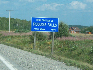
Iroquois Falls isn’t right on Highway 11 – it’s about 15 kilometres away at the end of road 67.  Founded more than 90 years ago, Iroquois Falls is home to a big pulp/paper mill and three electricity dams — all of which together used to be the world’s largest pulp and paper operation.

Iroquois Falls, OntarioIroquois Falls (pronounced locally as Urr-roquois, not Ear-roquois) is about half anglophone and half francophone.  The town is split in two by the railroad, and crisscrossed by the tracks at an innumerable amount of locations.  (I wonder if Iroquois Falls has the highest number of railroad crossings per capita in Ontario.)

Interestingly, the west half of the town seems to have English street names, while the east side’s streets are in French.  There is even rue Synagogue – a testimonial to the Jewish population that once settled in northeastern Ontario.  And while we’re on street names, there’s also Oil Tank Road, which is just begging to be the name of a country album.

Iroquois Falls was comprised of at least three communities – Iroquois Fall, Ansonville and Montrock. Amalgamation has put them all together under one municipal roof.

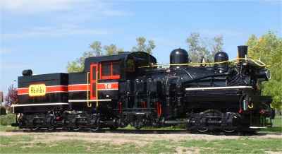
The Shay in Iroquois Falls

The Shay, Iroquois Falls’s old locomotive

The Abitibi Arena in Iroquois Falls was built entirely by community labour in 1955. Actually, at the time it was billed as the largest community labour project in North America. A large contributor to the project was personnel employed by the paper mill. If a part or piece of equipment was needed somewhere during the construction apparently it was readily made by a millwright over in the paper mill.

Iroquois Falls woodpile at the mill, Highway 11

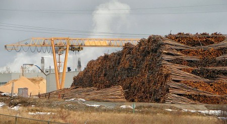
Sometimes this travel blog feels like a tour of northern Ontario woodpiles (Credit: User P199 at Wiki Commons.)

Known as “The Garden Town of the North”, Iroquois Falls is home to The Shay, an old restored locomotive that used to work the Abitibi line.  The town is also home to the Abitibi Eskimos, a junior hockey team that draws record numbers in the Northern Ontario Junior Hockey League.  I’ve heard that people come from as far as Kirkland Lake to watch the Eskies.  Iroquois Falls celebrates Paperfest in August and the Moby Pike fishing Derby in July.  There is also a Pioneer Museum in town chronicling the rise of the forestry industry and settlement of the town.Iroquois Falls Eskis logo

Iroquois Falls used to be the home of a large, wooden hotel that was served by an fantastic dining room. Unfortunately, it is no more, either being torn down or burned down at some point before I had a chance to have a meal. Randy’s Rec Room is a pub serving surprisingly good food and the service is top notch.  For food there is also the Main Street Café, the Bus Stop Chip Stand, DJ’s pizza, a diner, and a Tim Horton’s.  There’s a motel when you’re coming into town, but I don’t think the adjoining steakhouse has been in operation for years.  There are some bank branches and a caisse.  Esso (west of the tracks) and PetroCanada (east of the tracks) are in town as well. And the Silver Grill is a Chinese place serving 100 percent northern Ontario Chinese food.

Iroquois Falls is a pretty nice town.  There are nice old houses, a few parks, and a marina at Twin Falls that provides access to the massive Lake Abitibi.

Thanks to Paul for the info on Iroquois Falls.

Cochrane

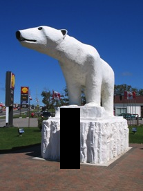
Chimo the Polar Bear in Cochrane, ON

Travel blog lesson #31 – always take a second, empty, non-person photo.  Or else you may end up with a blog full of photos of previous girlfriends.

Most towns would make a big deal of the fact that a former hockey player and doughnut baron hailed from their community.

Instead, Cochrane advertises Nanook, Aurora, and Nakita as its three most famous citizens.

Yep, we’re talking about animals.

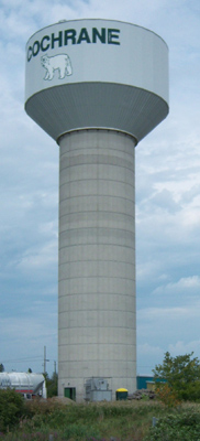
If you have a fear of polar bears, steer well clear of Cochrane. I’m just teasing – they’re well contained. Cochrane has adopted the polar bear as their town symbol, even though true polar bear habitat is more than 300 kilometres away.  There are even fake igloos in town.

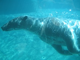
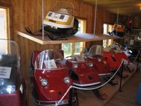
Chimo, the town mascot, is honoured with a big polar bear statue just as you enter town.  There’s also the Polar Bear Conservatory, where Nanook, Aurora, and Nakita spend their time.  There you can watch feedings, see interpretive displays, and “swim with the polar bears.” Ok, so if you’re more than 4 feet tall it is more of a wade than a swim but don’t let my teasing dissuade you – the Polar Bear Conservatory is interesting. Kids love the wading with the polar bears part. There’s also an adjacent ‘old style’ village with gas pumps, farm implements, and a collection of really awesome vintage skidoos.

Polar bear conservancy in Cochrane, Ontario

This was pretty cool, to be honest

Old Tyme Village ski-doo collection, Cochrane, Ontario

Definitely the most northern Ontario museum in northern Ontario

Cochrane is a very pretty little community of 4500 (slightly more anglophone than francophone) on Highway 11.  No matter what language you’re in, Cochrane is pronounced like cock-ran.  This might seem pretty intuitive but once in a gas station with a bunch of tourists from Belgium who kept asking how to get to a place that sounded like Cosh-rahnne and no-one, not the anglos nor the francos knew what the heck they were talking about.  I only figured it out about a year later.  Hopefully it didn’t take them that long.

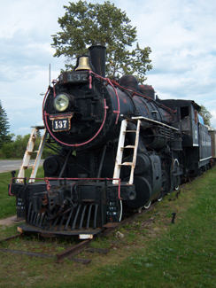
Old locomotive on display in Cochrane, Ontario

(Credit: Patrick)

It has a growing tourist industry built on the Polar Bear Express, which runs north to Moosonee twice a day in the summer.  Or at least it did, until the government stopped supporting the railway and now no-one knows what’s happening to the ONR.

Fishing and ATV expeditions often start here.  Greenwater Provincial Park is about an hour west of the town, providing fishing, swimming, and hiking around a series of kettle lakes.  Greenwater is pretty, and quiet. Also notable is the Tim Horton arena, home to the Tim Horton museum, that I didn’t have a chance to visit.

One of the coolest things about Cochrane, in my books at least, is Lake Commando. One –  that’s a sweet name.  Lake Commando. Sure, it’s more like a pond, but the words ‘Lake Commando’ just sounds so cool.  That’s awesome.  That’s even cooler than Geraldton’s Hardrock Drive, or Iroquois Falls’ Oil Tank Road. Two – it’s pretty.  It has parkland around it, a walking trail, and a quaint little bridge.  There’s also a bed and breakfast bordering the lake.

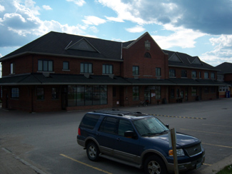
Cochrane, Ontario train station leads to James Bay

Cochrane train station.  (I do not know how to effectively use my camera in any lighting – dark or bright.)

As for amenities, since Cochrane has about 4500 people it’s fairly well served.  If you’re looking to bring out your fancy-pants you may be out of luck, but otherwise there’s everything you need.  Cochrane has a Tim Horton’s (which pays homage to the town’s most famous son with plaques on the walls, memorabilia all around), a KFC, and some other diner-style restaurants.  There’s also a rib/wing place and the Station Inn if you want a real sit-down meal, and, of course, a place serving Authentic Northern Ontario Chinese Food.

Cochrane, Ontario on Highway 11

Can you milk a polar bear? Well, Cochrane sure does. (Photo credit: Patrick)

There’s a small farmer’s market at the north end of town every Saturday, and a country store you’ll see across from the polar bear statue that sells cottagy-type stuff that you see in Muksoka.  Also, Cochrane has the last Giant Tiger on Highway 11 after Kirkland Lake.

Cochrane is also notable for receiving Ontario’s first ever permit to serve liquor on a Sunday, for a winter carnival held in the mid 1960s. Despite the devastating fires of 1910, 1911, 1916, and Cochrane still exists to this day.

Thanks to Paul for some of the Cochrane.

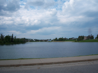
Lake Commando, Cochrane, Ontario

Lake Commando.  Still looking for Rambo River. (Come to think of it, there was a Rambo Creek near to where I grew up…800 km away)

Cochrane, Ontario off highway 11 highway11.ca

(Credit: User P199 at Wiki Commons.)

Cochrane, Ontario street

Streetscape in Cochrane

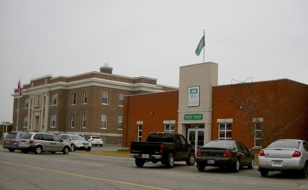
Cochrane, Ontario municipal building highway 11

A nicer Cochrane streetscape. (Credit: User P199 at Wiki Commons.)

Smooth Rock Falls

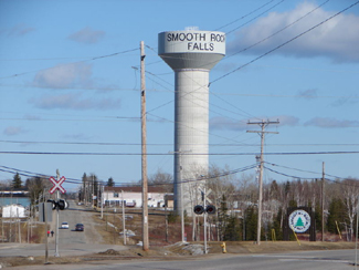
Smooth Rock Falls on Highway 11 in OntarioWhen you come into Smooth Rock from the east, don’t be fooled, what you’re seeing is not a one-story IKEA.  It’s the local hospital.

One tourist guide I picked up said that Smooth Rock was the “perfect stop over and supply center.”  Man, those guys really know how to write a tourist brochure.  Talk about underselling…Smooth Rock deserves more than that!

Jeff Buttle, the pride of Smooth Rock Falls, on Highway 11

Jeffrey Buttle, Canadian and World Champion figure skater is from Smooth Rock

Nestled along the picturesque Mattagami River, Smooth Rock is more than just a town that sounds like a radio station.  It was home to Jeffrey Buttle, a recently retired Olympic silver medalist and world champion figure skater; Louise Pitre, a singer who has appeared on Broadway; and JP Parise, a former NHLer who played in the ’72 Summit Series, has coached at the famous Minnesota Shattuck-St Mary’s hockey program, and who is also the father of New Jersey Devils’ forward Zach Parise.  Those are three people that should have their own “Welcome to Smooth Rock, the home of…” signs on the way into town. I’ll pledge 50$ toward that.

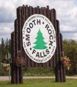
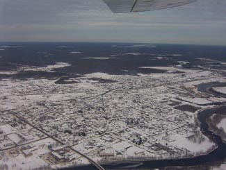
Smooth Rock is a largely francophone community of 1800 centered on the pulp and paper mill.  The problem is that “the North’s biggest little town” (their motto, I think) is about to get smaller as the mill shut down indefinitely in July 2006.  Smooth Rock is facing an uncertain future after the loss of their major employer. Which is really sad, since it’s a cute town and probably a great place to grow up and to retire. I’ve heard that the town and its residents are trying to start up a community-based venture to restart the now shuttered mill, but I don’t know if they’ve been successful.

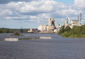
The mill, now shutdown, at Smooth Rock Falls

The mill, now shut since 2006

Smooth Rock doesn’t have a tonne of touristy-type stuff.  There’s the Forget Me Not BnB west of the river.  There’s also a nine-hole golf course, a nice park on the east side of the river, and there are some fishing opportunities as well. Smooth Rock is good place to stop on the way to Kapuskasing and a place to get gas if you’re heading up to Fraserdale.

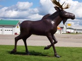
Smooth Rock Falls's highway 11 moose

Moose sculpture #234 on Highway 11

Northway Restaurant claims they have the “best poutine in the north”, although I’m sure that Poutineland in Timmins gives them a run for their money.  Audrey’s has good breakfast in a spartan setting.  There’s also Coco’s Chip Stand off the highway.  Rue Sixth is the main business section for Smooth Rock.  There’s a full-blown LCBO, an Esso, and a Tim-Br Mart.  The Moose Motel provides accommodations and SRF’s entry into the “some big weird thing” motif that is all the rage on Highway 11: a statue of a moose.  There is no Tim Horton’s or chain stores as far as I have seen.  I don’t know if there is a Chinese restaurant, but it’s northern Ontario so there must be one somewhere.Also, don’t be fooled.  There are signs advertising the “SRF Centre” on Highway 11 in both directions.  It’s not a mall – the “SRF Centre” is a truckstop with some slightly self-aggrandizing tendencies.

On an anecdotal bent, the town of Smooth Rock Falls used to plow each resident’s driveway in the winter.  I don’t know why that service ended.

Hearst

There’s something really interesting about Hearst.

Hearst is the frontier of northern Ontario – you either live in Hearst, east of Hearst, or you live waaaaaaaaaaaaaay west of it.  It even has a Northern Store (how’s that for remote.)

Hearst, Ontario on Highway 11

Hearst from the air

Where else would a town of 6000 have so many bars, the “northern ballet”, and yet still have four or five churches?

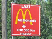
What other place keeps you in their town by telling you just how far away everywhere else is?  I mean, Longlac is 210 kilometres west, with nothing in between.  Hearst has the last McDonald’s for 500 kilometres – I know it because I checked, in person. There isn’t another McD’s until Thunder Bay

The tourist office in Hearst. Highway 11

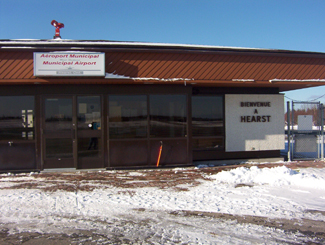
The tourist office in Hearst. So awesome.

I once applied for a government job in Hearst, but never got an interview.  To be fair, I realize now that I was woefully underqualified.  I swear that the ad had listed French as “an asset”.  Well, no French isn’t an asset – in Hearst, it’s a requirement.

One of the most interesting things about Hearst, however, is that it is the most francophone community in Ontario – something like 85-90 percent.  Hearst even has residents that only speak French, and no English.  Rue George is the downtown drag and it’s really cute, with small shops, a library, a diner, and a movie theatre showing French-language movies.  It’s reminds me of Penetanguishene, but more with more French.

Hearst, OntarioI (h)EART (h)EARST

Erst (as it is pronounced locally) is a pretty special town.  It has:

•    The motto: “The Moose capital of Canada” (or so they boast)
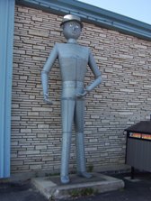
•    The only tin man on Highway 11 (he keeps watch over an appliance store)
•    The most millionaires per capita (or so someone emailed, apparently it’s due to the local forestry?)
•    The largest moose sculpture on Highway 11 (Believe me, I’ve seen them all)
•    The most suburbs (two) of any small town Highway 11 town (take that, King Kirkland or Geraldton East)
•    The most truckstops per capita (or so I’ve calculated, roughly)
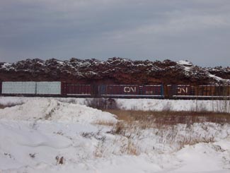
•    The biggest woodpile on Highway 11 (I’ve seen them all too)

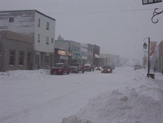
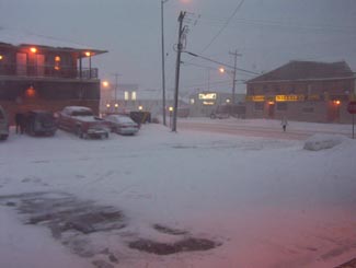
Trust me.  When it's not getting snowbombed, Hearst's downtown is super cute

Trust me. When it’s not getting snowbombed, Hearst’s downtown is super cute.  The problem is that it gets hammered all the time.

Heck, I’ve been to Hearst three times.  Most of the photos here are from the first time that I hadn’t been snowed in (because it was August.)  Both other times, I was stuck for three days in storms even that locals found nasty.

Set on the Mattawishkwia River, Hearst is a forestry town (hence the massive woodpile.)  It also has a tourism industry set around hunting, outfitters, and its proximity to three Provincial Parks:  Fushimi Lake, Missinaibi and Nagagamisis.  It is also the end of the Algoma Line, which runs fall colours rail tours from Sault Ste. Marie to Hearst.

Despite its francophone heritage, Hearst was once the site of a Slovak settlement.  Bradlo, nestled 11 kilometres south of Hearst, the community persisted until the 1950s when the residents realized that the land was agriculturally marginal, and wouldn’t support farming in a modern economy.

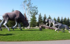
Sculpture jsut outside of Hearst

Hearst is so cool, this wolf vs. moose sculpture doesn’t even count as their “some big weird thing”…

Hearst tin man, Highway 11

…instead, this does!

Food and Fun in a Frontier Town

Hearst is a center for most of the little communities west of Kapsukasing, and is the largest town between Thunder Bay and Kapsukasing on Highway 11.  And probably for Hornepayne on Highway 631, about an hour and a half south.  (Head off-route and take a trip along 631 here.)

No McDonald's for 500 km in Hearst, Highway 11

I’ve used this photo about a twenty-two times on this website and it never gets old

Therefore, Hearst has an abundance of services.  It has the only McDonald’s and Tim Horton’s that you’ll see until Thunder Bay.  In addition to the 24-hour garage and towing company that is advertised throughout northern Ontario, there are shops downtown and food everywhere.  Hearst also has an overabundance of places that serve Northern Ontario Chinese Food.

Hearst has something for everyone – the northern ‘hotel’ scene (the Waverly or the Windsor), cafés (although Café Duo doesn’t serve coffee, go figure), fast food (McDonald’s, KFC, Subway, and the only Pizza Pizza west of Timmins), authentic chip stands (Micko’s is great), sit down restaurants (Mom’s, John’s, Pizza Place has ok pasta), fine dining (you can find filet mignon, steak, and Cuban cigars at Ailleurs), and even a little night club (OK, fine, it’s the bar at the Companion.)

Snowstorm, Hearst, Highway 11

Highway 11 in Hearst, getting walloped, again

There are motels aplenty in Hearst so you should have no trouble finding a place to stay.  (A note to those staying at the Queens Motel, keep your kids away from the funny channels at the end of the TV dial there!)  There is also hockey in the winter – in fact, Hearst is the hometown of Claude Giroux, Philadelphia Flyers superstar, as well as Pierre LeBrun, a hockey commentator who has appearanced on TSN, ESPN, and Hockey Night in Canada. Hearst is home to the local team les Elans de Hearst. And, there is bowling.

Come on, it’s northern Ontario. Of course there is bowling!

Super awesome Hearst woodpile, Highway 11

Hearst – simply the best woodpile of any Highway 11 community

Hearst, Ontario highway11.ca

And this is what happens to a woodpile on Highway 11, in Hearst (Credit: Wiki Commons contributor P199)


Hearst, Ontario airport

Not sure why I took a photo of Hearst’s airport

Thunder Bay

Thunder Bay has a big random curling rock statue?  A massive four city-block-long woodpile?  Statues of polar bears, even though polar bears live nowhere nearby?  Yes honey, we're still in northern Ontario.

Thunder Bay has a big random curling rock statue?  A massive four city-block-long woodpile? Statues of arctic animals that live nowhere nearby?  Thunder Bay may be the big city but we’re still in northern Ontario.

I once heard a pretty prominent Canadian comedian joke something to the effect that there’s a reason that the Marathon of Hope ended in Thunder Bay.

I never really got the joke.  Maybe it’s because the city’s initials stand for a deadly disease, but I haven’t figured out what he was talking about. I like Thunder Bay.

TBay has a list of things going for it. TB has probably the best lookout on Highway 11 at the Terry Fox memorial.  It also has a majestic port bordered by rock formations on both sides.  There’s a pretty decent rap song about the city that was recently written up in the Toronto Star. It is the hometown of the most pro hockey players per capita. They have their own special foods that you can’t get anywhere else – superflat Finnish pancakes and their own type of doughnut. And I’m told that it has the largest Finnish population outside of Finland (more than 10 000…)
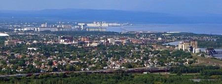
TB-16-TBay-SkylineThunder Bay:  A Tale of Two Cities

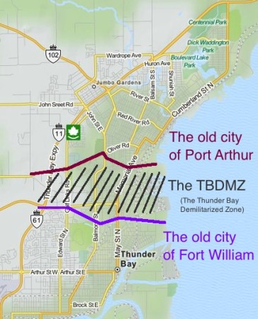
TB-16-TBay-Thunder Bay Demilitarized Zone

The TB DMZ. Keeping hostilities between Port Arthur and Fort William to a minimum since 1907.

Thunder Bay is actually two cities – Port Arthur and Fort William amalgamated in 1970.

Since then, they really haven’t come together in a physical manner.  There is a bit of a ‘no man’s land’ between north and south Thunder Bay, filled with a golf course, a hospital, an expressway, and some suburban-style office parks.  The street names change between north and south.

So how did they choose the name “Thunder Bay”? I have no idea if this is true, but I once read in a book that when Port Arthur and Fort William merged in 1970, they couldn’t decide on a common name. In order to solve the problem, they held a referendum. As always, the voters were split. Some thought it should be named “Lakehead.” While others preferred the more regal-sounding “The Lakehead.” When the final tallies were counted, the two Lakehead options combined had a majority of votes. However, with the two camps splitting most of the vote, plucky little “Thunder Bay” slipped up the middle to win a plurality. Is it true? I don’t know, but I wouldn’t be surprised.

It’s as if the two cities are still buffering against each other, or just don’t know what to do with the space between them. Is there animosity?  Bobby Curtola is from Port Arthur.  Paul Shaffer is from Fort William.  I don’t know if a rivalry exists, but there’s potential…
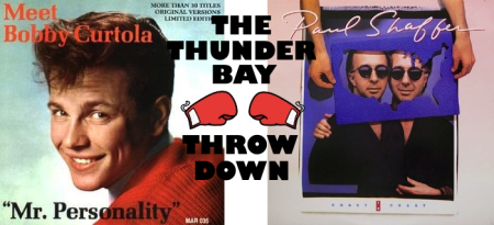
My first car had only AM radio.  Which means only oldies music.  Which means you hear a lot of Bobby Curtola to make up the CanCon requirements.

My first car had only AM radio. Which means only oldies music. Which means you hear a lot of Thunder Bay’s Bobby Curtola so the station can be in compliance with CanCon requirements.

Thunder Bay has a lot of variety in neighbourhoods.  Many parts are littered with old northern hotels and taverns (a la Timmins), while some residential areas have stately turn-of-the-century homes (a la Haileybury), while there are the 1960s suburbs (a la Etobicoke, but with bigger lawns), while Walsh Street is essentially a paved hydro corridor with homes on either side (a la Longlac.)  The whole situation means that, while Thunder Bay is a really nice city, it can be sprawly, confusing, and makes for horrible driving.
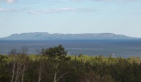
The Sleeping Giant, from Thunder Bay's waterfront

A not-so-great photo from yours truly of The Sleeping Giant, from Thunder Bay’s waterfront

Of course, nothing says ‘Thunder Bay’ to the history-conscious Canadian than grain elevators.  The prevalence of shipping means that the city is criss-crossed by train tracks, which pretty much cut off the city from most of its waterfront, save for a nice park in the north.  I think that the port in south Thunder Bay is bigger, but that the elevators in north Thunder Bay are near the waterfront park and therefore make for nicer photos.  There are beautiful views of Sleeping Giant (the big rock formation off the harbour) from both the waterfront marina park or from Hillcrest Park on High Street.

One of the coolest thing about Thunder Bay is the massive rock-bubble-things that border the south part of town.  You can’t miss them no matter where you look to the south.  They’re called the Nor’Westers (after the fur traders) and the largest (Mount McKay) is open for cars to drive up, for a small fee.  There’s something Rio de Janeiro-esque about it – they just need a statue on top, looking down over the city.

Maybe they can put a statue of a famous Thunder Bayer up there.  Again though, who to choose – Port Arthur’s Bobby Curtola or Fort William’s Paul Shaffer? I’ll pledge 50$ to that.

Thunder Bay has art grafitti. Yep it's big

Flashes of the cosmopolitan. (Photo credit: Lloyd from Wild Goose)

Thunder Bay:  The North’s New York City…?

Thunder Bay wins the north’s big city sweepstakes not only because it is the subject of a rap song (click here, the video is surprisingly good) or the presence of art graffiti but also because, compared to the rest of the north, Thunder Bay is practically a metropolis:

  • Thunder Bay has 110 000 people
  • Almost ten percent of them speak a language other than French or English (Finnish)
  • Thunder Bay has multiple occurrences of the same store or franchise
  • There are more stoplights than you can count on your hands and feet in Thunder Bay
  • Thunder Bay has satellite towns that resemble suburbs (real ones, not like the hamlets outside of Hearst or Geraldton)
  • Eight cities on four different continents around the world are twinned with Thunder Bay
  • Heck, Thunder Bay even has its own semi-pro soccer team that employs a handful of Brazilians for a few months every summer

But nothing shows off Thunder Bay’s cosmopolitan flair better than its International Friendship Garden.

The Thunder Bay Soroptimist International Friendship Garden - featuring installations from the Chinese, Dutch and Croatian communities.

The Thunder Bay Soroptimist International Friendship Garden – featuring installations from the Chinese, Dutch and Croatian communities.

The Garden was founded by various ethnic civic organizations to commemorate Canada’s centennial in 1967.  You can meet Croatia’s King Tomislav.  You can pose with the concrete geese representing Finland.  Italy, Scotland, Greece, India, the Philippines, and others are all there too.  It almost feels like a ‘mini-putt your way around the world’ exhibit that you’d find on Highway Six south of Hamilton.  Maybe it’s the Dutch windmill.  Or the random Italian villa surrounded by a chain-link fence.  Or maybe it’s the sawmill from Deutschland, which I thought was a garden shed until I spotted the faux waterwheel (sans water.)

However, you have to give TB some credit here.  It’s actually pretty cool and totally endearing. Most cities couldn’t have attempted this.  Fewer would have even considered it.

It’s more than a bit hokey, but that’s what makes it undeniably charming.  Sure, the Confucius statue and adjacent mini-pavilion looks like it could be beside Chinese restaurant in Markham, but who cares?  It’s a great park and apparently one of the ‘in’ spots for wedding photos in Thunder Bay.
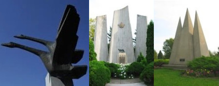
No, we're not on the set of Logan's Run, these are the Finnish, Italian and Slovakian monuments at the Thunder Bay International Friendship Garden

No, we’re not on the set of Logan’s Run, these are the Finnish, Italian and Slovakian monuments at the Thunder Bay International Friendship Garden

If you’re in Thunder Bay, you need to try a Persian. A Persian is a holeless doughnut rubbed with cinnamon and topped with a bright pink sugary raspberry glaze. They were …ahem…”invented” in Thunder Bay (in the 1930s), perfected in Thunder Bay, and only sold in Thunder Bay.
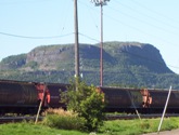
These look so much bigger in real life

The Norwesters.  These look so much bigger in real life

A Persian is like the oil-soaked goodness of a fresh farmer’s market doughnut and and the sugaryness of a Beavertail all rolled up into one bundle of super fatty northern Ontario goodness. As one of my co-workers has told me, she works with people in Thunder Bay and when she asks them about Persians, she could practically hear their mouths water through the phone. When she goes there for meetings, she buys two flats and brings them back from Thunder Bay on the plane, and only one flat makes it back alive. But if you’re gonna take the plunge – make sure you avoid the chocolate and go for the real thing – the one with the pink topping.
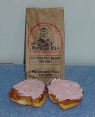
That being said, they're eerily similar to the Unique to TBay - except they look like the Paczkis of Cleveland or the doughnuts of pretty much anywhere else.

Persians – unique to TBay, tho eerily similar to the Paczkis of Cleveland or the doughnuts of pretty much anywhere else.

There are two locations that sell Persians (the doughnuts – not the ancient peoples) – one on Tungsten (out by the university), and one on Balmoral. Just look for The Persian Man.

For non-doughnut grub and shopping the major streets are Red River and Memorial in north Thunder Bay, and Arthur in south Thunder Bay.  There is a real mall, a movie complex, the only Swiss Chalet since North Bay, some other chain restaurants, but no Giant Tiger (disappointing.). At one time, TBay had the only East Side Mario’s since Timmins but Keith emailed me to deliver the bad news – it is closed.

To-Do in TB
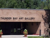
Thunder Bay - Art Gallery highway11.caAs far as culture, the Thunder Bay Art Gallery on the campus of Confederation College had a great Norval Morrisseau exhibition while I was there.  The gallery is small, but entrance is ridiculously cheap.  Thunder Bay also has a symphony, as well as a charity casino.  The corner of Algoma and Bay in north Thunder Bay is a bit of a hip spot, with some pubs, a hostel, and specialty shops nearby (a Finnish-language bookstore, and Finn-tastic Sauna and Gift Shop).  While I was there, an Italian festival had blocked off the intersection (beer tent + meatball & sausage stands + old nonnas telling you to eat more = my kind of thing!)  There’s also a really nice ballpark in Port Arthur that hosts The Thunder Bay Border Cats, a minor league team in one of the American independent leagues.

But as soon as you get start getting visions of grandeur, Thunder Bay returns to its northern roots.

There are all-you-can-eat cabbage rolls and pirogi every Friday from 12-1 at the Polish Hall on Algoma.  The Superior Bowladrome is one of four bowling alleys I counted in TB.

(Where I grew up we had double the population but only half the bowling alleys.)

There are the second- and third-tier franchises some common to the north – Robin’s Doughnuts gives Tim Horton’s a serious run for their money in northwestern Ontario, and especially in TB.  There is Tacotime, some sort of Mexican franchise that has placed its geometric cacti throughout the city. (This picture does not do those catci justice. And the food is pretty good too…)

highway11.ca TACO TIME - Thunder Bay, ON, Logan, UT, Toronto, ON

Taco Time! I’ve been obsessed with Taco Time ever since I visited the one in Thunder Bay (left photo) and came under the spell of its sort-of art deco cactus. I was overjoyed when I found one on my honeymoon in Logan, Utah, and when another opened in the Atrium on Bay in Toronto. Sadly, the Torontonians have no taste. 🙁

But for a real Thunder Bay meal, you need to go to the Hoito. It’s a diner serving traditional Finnish food, and in its heyday it was a focal point for the very politically-active Finnish community. There’s even been a book written on stories told in the diner. It’s located in the old Finnish Labour Temple, which the local community is working hard to restore.

There are also the totally random people.  I saw kids sitting unseatbelted (not even strapped in with a rope or duct-tape) on a flatbed truck, as well as roving from side-to-sid

e in the cargo hold of pickups. This wasn’t just in cottage areas, but on main drags like Arthur.  I learned that Vampiro, Canada’s top wrestler on the Mexican lucha libre circuit hails from TB.  In one of my strangest (?) memories, I witnessed a man smoking a cigar walk out of his home with his dog on a leash.  He walked across the street to a cemetery.  He let his dog poo in the cemetery, and he walked right back across the street to his home.  Gross, but funny. (Maybe this is the sort of thing that inspired White River‘s pet relief station.)

Finally, you know Thunder Bay is a true northern town as it obeys the two main laws of Highway 11 – that each city must have something big, and something in a pile.  Thunder Bay has both – its five-foot tall curling rock, and the ever-popular pile of wood.
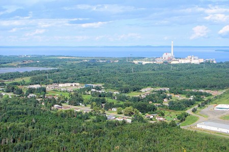
View from Fort William First Nation, near Thunder Bay, Highway 11.ca

I used to have these teeny-tiny 200 pixel square photos of the Thunder Bay waterfront on this site.  What would this website be like without User P199 at Wikimedia Commons saving everyone from my pitiful photography?  (The photo at the top of the post is also his.)
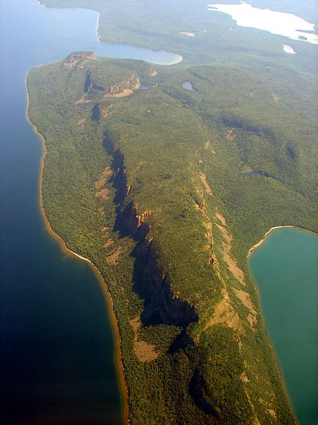
Thunder Bay - Sleeping Gia highway11.ca

An absolutely killer photo of The Sleeping Giant, thanks to Wiki Commons contributor P199