Englehart

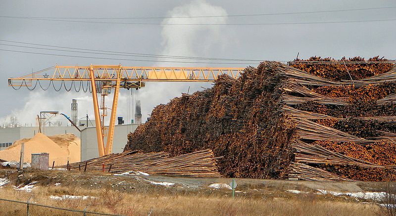
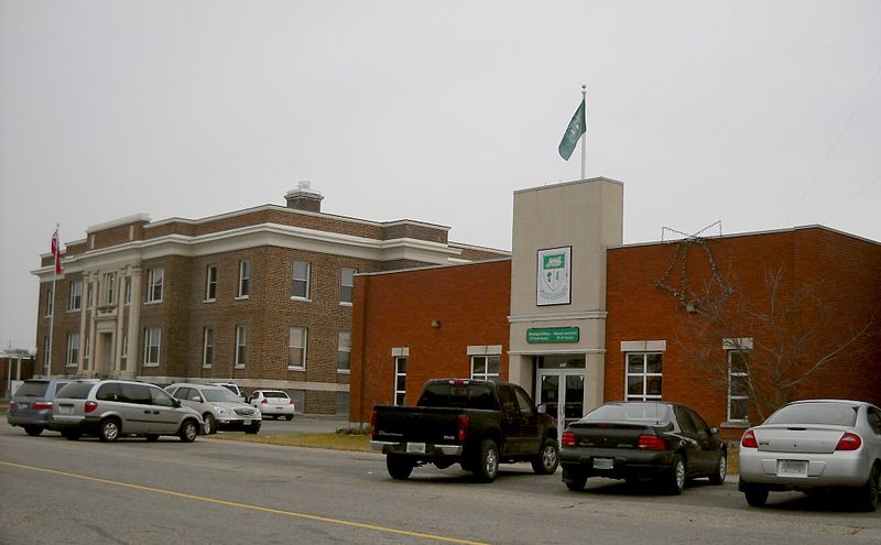
Englehart is an anglophone town of 1500 on Highway 11.  Right at the north end of the Temiskaming claybelt, you can tell that it’s near the end of farm country as there are farms all around yet the major employer is the Grant Forest Products Mill, which dominates the town from Highway 11.  Englehart is about 30 minutes from Kirkland Lake.

Englehart Grant Mill, highway 11 ontario

I had my own photo of the mill but User P199’s at Wiki commons is so much better.  This view is facing south on Ontario Highway 11.

The town was founded in 1908 and named after Jake Englehart, an American who moved to Canada at age 19 in 1860s to setup oil refineries in southern Ontario.  After achieving success in the Petrolia area, he was appointed by the Province to run the ONTC rail line in 1905.  His management brought stability and expansion to the provincial agency.  But most importantly, Englehart helped rebuild the region after the devastating fires of 1911.  He even spent his own money to feed those left homeless by the fires – he posted a sign at one of his rail stations saying that no-one need pass the station feeling hungry. In its heyday, Englehart even had a small Jewish population which helped settle immigrants into farming communities like Krugerdorf, and later provide work when these homesteads were abandoned.

Englehart has a cute, quiet downtown.  It is a town of well kept houses, manicured lawns, and cute little parkettes.  The old Temiskaming Locomotive 701 has been restored and displayed downtown – it was the last steam engine to prowl the ONTC tracks.Small-town American 1950s downtown  right in Englehart, Ontario(A note to travellers – on my first trip to Englehart we stopped at the local library to use the washroom.  That was an uncomfy decision.  It was completely awkward – don’t forget that in a town like that, everyone knows you’re a stranger and it was completely conspicuous to walk in, pee, and walk out without so much as lifting a Chatelaine off the shelves.  I mean, don’t get me wrong, no one said anything, but I just felt so conspicuous. Go at one of the gas stations on Highway 11 instead.)

Englehart has a really nice little music store called Musical Strings n’ Things that recently moved into a larger location across form the town hall.  It’s worth a visit, especially if you want to try your hand at the banjitar.  Service is great.  I’ve stopped in three times, and received better service than in any music shop I’ve ever dropped into – and I’ve never purchased a thing. And they know I’m not going to buy anything.  I’m obviously from away, and it’s unlikely that I’m going stop in Englehart for a pee, a pop, and a mandolin.  But each time, the shopkeeper tells me they’re just filling in for the owner who has just stepped out, but I’m welcome to play, try, or ogle at anything in the store.

Music store, Englehart, Ontario Highway 11

The North’s Best Music Store, as decided by … me.

A former housemate named Tara had family from the region, and she informed me of the local specialty – the Island Burger. Apparently, the hamburger is served at a Cousin’s Restaurant and is named the “Island Burger” as the hamburger is essentially an island in a sea of hot gravy and cheese curds. Sounds fantastic.

For food and drink there is the Olde Town Inn and Restaurant, a Subway, and a Coffee Time (all on Highway 11.)  In town, there is Cousin’s for burgers or pizza (although I’m not totally sure if it is still open), Kim’s Pizza Plus, and a local diner, the Sister’s Cafe, which serves breakfast, lunch, and supper platters. My partner and I stopped in at Sister’s for a weekday lunch. Being not from Englehart, and more importantly being under the age of 65, we got some pretty surprised looks from the existing patrons and even the staff, but we survived, everyone was friendly, service was great and so was lunch.

There’s a new drop-in café catering to teens on 8th Avenue, the Oasis Teen Café.  There is gas on Highway 11 and a reasonable-sized Valumart in town for those who need groceries.  Englehart also has a full blown LCBO. In terms of shopping there is Memory Lane Antiques or Treasure Chest Antiques on Highway 11, as well as Marion’s Emporium and Christmas store in town.  There’s also a little home-run spa in town.

Englehart train, highway 11

First Cochrane, next Iroquois Falls, now Englehart’s turn with the old locos

Englehart has a few tourist activities – most notably the historical museum.  There are also walking trails, one of which goes to nearby Kap-Kig-Iwan Provincial Park and its picture perfect waterfalls.  Every June the town hosts the annual Black Fly Festival, and the weekend after Labour Day means it’s fall fair time.

Of course, with Grant Forest Products in town, Englehart also has a fairly substantial woodpile.

Thanks to Justin and Tara for the Englehart info.  Check out some more photos here, here and here.

Iroquois Falls

Iroquois Falls isn’t right on Highway 11 – it’s about 15 kilometres away at the end of road 67.  Founded more than 90 years ago, Iroquois Falls is home to a big pulp/paper mill and three electricity dams — all of which together used to be the world’s largest pulp and paper operation.

Iroquois Falls, OntarioIroquois Falls (pronounced locally as Urr-roquois, not Ear-roquois) is about half anglophone and half francophone.  The town is split in two by the railroad, and crisscrossed by the tracks at an innumerable amount of locations.  (I wonder if Iroquois Falls has the highest number of railroad crossings per capita in Ontario.)

Interestingly, the west half of the town seems to have English street names, while the east side’s streets are in French.  There is even rue Synagogue – a testimonial to the Jewish population that once settled in northeastern Ontario.  And while we’re on street names, there’s also Oil Tank Road, which is just begging to be the name of a country album.

Iroquois Falls was comprised of at least three communities – Iroquois Fall, Ansonville and Montrock. Amalgamation has put them all together under one municipal roof.

The Shay in Iroquois Falls

The Shay, Iroquois Falls’s old locomotive

The Abitibi Arena in Iroquois Falls was built entirely by community labour in 1955. Actually, at the time it was billed as the largest community labour project in North America. A large contributor to the project was personnel employed by the paper mill. If a part or piece of equipment was needed somewhere during the construction apparently it was readily made by a millwright over in the paper mill.

Iroquois Falls woodpile at the mill, Highway 11

Sometimes this travel blog feels like a tour of northern Ontario woodpiles (Credit: User P199 at Wiki Commons.)

Known as “The Garden Town of the North”, Iroquois Falls is home to The Shay, an old restored locomotive that used to work the Abitibi line.  The town is also home to the Abitibi Eskimos, a junior hockey team that draws record numbers in the Northern Ontario Junior Hockey League.  I’ve heard that people come from as far as Kirkland Lake to watch the Eskies.  Iroquois Falls celebrates Paperfest in August and the Moby Pike fishing Derby in July.  There is also a Pioneer Museum in town chronicling the rise of the forestry industry and settlement of the town.Iroquois Falls Eskis logo

Iroquois Falls used to be the home of a large, wooden hotel that was served by an fantastic dining room. Unfortunately, it is no more, either being torn down or burned down at some point before I had a chance to have a meal. Randy’s Rec Room is a pub serving surprisingly good food and the service is top notch.  For food there is also the Main Street Café, the Bus Stop Chip Stand, DJ’s pizza, a diner, and a Tim Horton’s.  There’s a motel when you’re coming into town, but I don’t think the adjoining steakhouse has been in operation for years.  There are some bank branches and a caisse.  Esso (west of the tracks) and PetroCanada (east of the tracks) are in town as well. And the Silver Grill is a Chinese place serving 100 percent northern Ontario Chinese food.

Iroquois Falls is a pretty nice town.  There are nice old houses, a few parks, and a marina at Twin Falls that provides access to the massive Lake Abitibi.

Thanks to Paul for the info on Iroquois Falls.

Cochrane

Chimo the Polar Bear in Cochrane, ON

Travel blog lesson #31 – always take a second, empty, non-person photo.  Or else you may end up with a blog full of photos of previous girlfriends.

Most towns would make a big deal of the fact that a former hockey player and doughnut baron hailed from their community.

Instead, Cochrane advertises Nanook, Aurora, and Nakita as its three most famous citizens.

Yep, we’re talking about animals.

If you have a fear of polar bears, steer well clear of Cochrane. I’m just teasing – they’re well contained. Cochrane has adopted the polar bear as their town symbol, even though true polar bear habitat is more than 300 kilometres away.  There are even fake igloos in town.

Chimo, the town mascot, is honoured with a big polar bear statue just as you enter town.  There’s also the Polar Bear Conservatory, where Nanook, Aurora, and Nakita spend their time.  There you can watch feedings, see interpretive displays, and “swim with the polar bears.” Ok, so if you’re more than 4 feet tall it is more of a wade than a swim but don’t let my teasing dissuade you – the Polar Bear Conservatory is interesting. Kids love the wading with the polar bears part. There’s also an adjacent ‘old style’ village with gas pumps, farm implements, and a collection of really awesome vintage skidoos.

Polar bear conservancy in Cochrane, Ontario

This was pretty cool, to be honest

Old Tyme Village ski-doo collection, Cochrane, Ontario

Definitely the most northern Ontario museum in northern Ontario

Cochrane is a very pretty little community of 4500 (slightly more anglophone than francophone) on Highway 11.  No matter what language you’re in, Cochrane is pronounced like cock-ran.  This might seem pretty intuitive but once in a gas station with a bunch of tourists from Belgium who kept asking how to get to a place that sounded like Cosh-rahnne and no-one, not the anglos nor the francos knew what the heck they were talking about.  I only figured it out about a year later.  Hopefully it didn’t take them that long.

Old locomotive on display in Cochrane, Ontario

(Credit: Patrick)

It has a growing tourist industry built on the Polar Bear Express, which runs north to Moosonee twice a day in the summer.  Or at least it did, until the government stopped supporting the railway and now no-one knows what’s happening to the ONR.

Fishing and ATV expeditions often start here.  Greenwater Provincial Park is about an hour west of the town, providing fishing, swimming, and hiking around a series of kettle lakes.  Greenwater is pretty, and quiet. Also notable is the Tim Horton arena, home to the Tim Horton museum, that I didn’t have a chance to visit.

One of the coolest things about Cochrane, in my books at least, is Lake Commando. One –  that’s a sweet name.  Lake Commando. Sure, it’s more like a pond, but the words ‘Lake Commando’ just sounds so cool.  That’s awesome.  That’s even cooler than Geraldton’s Hardrock Drive, or Iroquois Falls’ Oil Tank Road. Two – it’s pretty.  It has parkland around it, a walking trail, and a quaint little bridge.  There’s also a bed and breakfast bordering the lake.

Cochrane, Ontario train station leads to James Bay

Cochrane train station.  (I do not know how to effectively use my camera in any lighting – dark or bright.)

As for amenities, since Cochrane has about 4500 people it’s fairly well served.  If you’re looking to bring out your fancy-pants you may be out of luck, but otherwise there’s everything you need.  Cochrane has a Tim Horton’s (which pays homage to the town’s most famous son with plaques on the walls, memorabilia all around), a KFC, and some other diner-style restaurants.  There’s also a rib/wing place and the Station Inn if you want a real sit-down meal, and, of course, a place serving Authentic Northern Ontario Chinese Food.

Cochrane, Ontario on Highway 11

Can you milk a polar bear? Well, Cochrane sure does. (Photo credit: Patrick)

There’s a small farmer’s market at the north end of town every Saturday, and a country store you’ll see across from the polar bear statue that sells cottagy-type stuff that you see in Muksoka.  Also, Cochrane has the last Giant Tiger on Highway 11 after Kirkland Lake.

Cochrane is also notable for receiving Ontario’s first ever permit to serve liquor on a Sunday, for a winter carnival held in the mid 1960s. Despite the devastating fires of 1910, 1911, 1916, and Cochrane still exists to this day.

Thanks to Paul for some of the Cochrane.

Lake Commando, Cochrane, Ontario

Lake Commando.  Still looking for Rambo River. (Come to think of it, there was a Rambo Creek near to where I grew up…800 km away)

Cochrane, Ontario off highway 11 highway11.ca

(Credit: User P199 at Wiki Commons.)

Cochrane, Ontario street

Streetscape in Cochrane

Cochrane, Ontario municipal building highway 11

A nicer Cochrane streetscape. (Credit: User P199 at Wiki Commons.)

Rainy River

Rainy River is closer to Winnipeg than Thunder Bay – and considering it’s in the same province as places as far away as Windsor, Ottawa, and Welland, you can tell why some people in the north may feel a bit disaffected. I mean, technically, it is faster to drive from Toronto to Rainy River via the US, passing through Michigan, Wisconsin and Minnesota, rather than taking Highway 17 and/or Highway 11 the whole way.

Depending on the direction you’re travelling, Rainy River is either the start or the end of Highway 11.  Atwood Street in Rainy River is the terminus of Toronto’s Yonge Street – all 1600 kilometres of it.

Highway 11 Rainy River terminus end

Although this website sort of starts in Rainy River, If you came from the south, Rainy River is the end of Highway 11, meaning you have two options: you can take Highway 600 up through Lake of The Woods, or…

Rainy River International Bridge Higway 11

…or you can take the International Bridge across Rainy River to Minnesota (This photo and the above c/o Patrick.)

International Bridge in Rainy River

(Photo: Keith)

Rainy River is the gateway to northwestern Ontario – well, if you’re coming from the west, that is.  Rainy River is about 100 kilometres west of Fort Frances on Highway 11, and about 450 kilometres west of Thunder Bay.Rainy River began with a lumber mill in 1895 and by 1901 the CNR had a stop there.  By 1904 the town was established.  Today, its importance as a railway and logging town diminished, Rainy River is home to about 1000 people.  It’s an important border crossing, with access to Minnesota, and has plenty of outdoor activities.

Rainy River Locomotive, highway11.caRainy River is home to the 4008, a restored steam locomotive that used to run the CNR route to the town.  Much like the Shay in Iroquois Falls, the train is a testament to the old logging and railway industries which once dominated northern Ontario.  There is a railway heritage museum in town detailing Rainy River’s history with the railway.

Rainy River also has a marina, sports facilities, and both a buffalo and an elk farm.  There is a lot of hunting, fishing, boating, and swimming. Rainy River is one of the towns closest to the beautiful Lake of the Woods.

Rainy River hosts a few festivals including the mid-summer Railroad Daze, the Walleye Fishing Derby, and the Rainy River Giant Pumpkin Festival.  (Doesn’t some town in Nova Scotia have a giant pumpkin festival too? Where they row the carved pumpins like boats?  I don’t know.)

Post below, or email me at info (at) highway11 (dot) ca

Rainy River, Ontario, highway 11

Rainy River is small, but is a starting point for outfitting and anything to do with Lake of the Woods. (Photo: User P199 at Wiki Commons.)

Rainy River municipal building, highway11.ca

(Photo credit: User P199 at Wiki Commons.)