Marten River

Marten River is a hamlet of about 100 people 45 kilometres south of Temagami.  On the south end of Lake Temagami, the town is largely dependent on forestry and tourism, and is home to a number of lodges and outfitters.

Marten Falls, big fish, Highway 11 Ontario

Highway 11’s largest fish? That’s what Marten Falls claims

Marten River Provincial Park has camping, hiking, and a replica 19th century logging camp.  Every July there is the annual Logging Days Festival.  It is also home to the obligatory “some big weird thing” that each town in northern Ontario seems to have – in this case, it is what they claim is Highway 11’s biggest fish, though Nipigon might have something to say about that.  (Sorry, Larder Lake, you’re disqualified.  You’re not on Highway 11 at all.)

There is a gas station in town, Marten River Outfitters, and a few little places to eat, including the Rock Pine Motel and Restaurant.

There are three lakes near Marten River – Marten Lake, Ingall Lake, and Jumping Caribou Lake.  The lake is stocked with fish and there is also hiking at the local crown game preserve.

Temagami

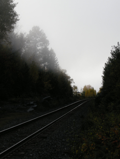
ONTC line near Temagami, Highway 11 Ontario

Nothing captures the loneliness of northern Ontario than the railway heading off into nowhere

Sure, after Huntsville the towns become sporadic, a bit less refined, and really small – but those areas are still within relatively short driving distance to either Barrie and/or North Bay.

But it is after North Bay where Ontario changes.

Towns of 10 000 become cities.

Villages of 2000 become towns.

Hamlets that wouldn’t warrant a sign in southern Ontario make it into maps, travel guides and guidebooks about the north.

Temagami is the perfect example.  Not only do you not realize just how far away it is from North Bay (more than an hour), but it’s also really small.  The dots-on-the-map before Temagami aren’t really true towns at all, they’re much closer to being dots-on-the-map. And when you get into Latchford, you realize that it is much the same as Temagami.

If you don’t have some decent cassettes for the car by now, you’re in trouble from here on in.  You’ll start seeing more transport trucks than cars. Of the few cars on the road, they’ll practically all be domestic, and will likely have an ATV in tow. The distances are only going to get larger and the roads will only get lonelier.

Temagami from Highway 11

Temagami from Highway 11

OK, so a bit about Temagami

Temagami is a town of about 1000 an hour-plus from North Bay.  The town was first settled in 1850 when the Hudson Bay Company set up a trading post on Lake Temagami.  The ONTC railways came through in 1904 as silver was found in Cobalt to the north, and Temagami became a town of trappers, traders, and prospectors.
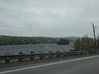
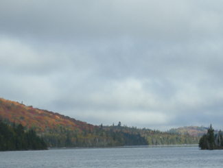
Temagami, Ontario Highway 11From Highway 11, Temagami is a land of contrasts.  Some spots can be boring as heck.  Rocks and trees, rocks and trees.  Others, however, can be surprisingly beautiful. On a recent trip to the area we didn’t take many photos of Temagami, mainly because the scenery was so majestic, it was nearly impossible to discern what was photo-worthy and what wasn’t, without taking photos practically every ten minutes. We actually experienced scenic fatigue, and by the end of our trip we were turning our noses up at lakes, forest scenes, and vistas we would have stopped for has we been in southern Ontario. And we didn’t even go into the interior, or explore Lake Temagami, which is reportedly more scenic than the area directly off Highway 11.Lake near Temagami, OntarioOne of the many reasons for Temagami’s beauty is that it is one of the last parts of accessible Ontario with old growth forest, and was the subject of intense protests against logging in the 1980s.  Temagami is Ojibway for ‘deep water by the shore.’  It is also where Englishman Archie Belaney found fame as Grey Owl, an Aboriginal devoted to environmentalism.
Today Temagami is largely dependent on forestry and tourism. There are two provincial parks nearby, Finlayson and Lady Evelyn-Smoothwater.  Temagami is a starting point for a number of all season activities, including boating, dogsledding, canoeing, cross country skiing, swimming, fishing, camping, houseboating, hunting, and guided tours.  There are also a nature interpretive centre, some craft shops, and an art gallery.
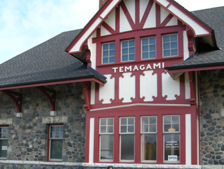
Temagami Train Station, Highway 11

Train station in Temagami

Temagami has a few tourist amenities.  There’s a gas station, the aformentioned grocery store, two outfitters (one of which was closed and for sale during our trip), two outdoors stores, two restaurants (one Chinese, and the Busy Bee) and a couple of shops.  There are numerous camps, lodges, and other places to stay, including Inn The Woods Motel and Bed and Breakfast, Leisure Island Houseboats, Linda’s Wigwams, Smoothwater Resort, and Temagami On-Ice Bungalows. There is a bit of a residential area on either side of Highway 11, and another a bit further north in what is called “Temagami North.”

Being on “Temagami Time”

You hear a lot about Temagami in the news and from friends who have cottages and cabins.  Yet I was surprised just how tiny the town is considering the tourism business up here.  There is a lot to do in Temagami if you like the outdoors.  But if you like the indoors, or just aren’t that woodsy, well, don’t expect much of a town or any indoor or evening attractions, because the town itself is miniscule, and what is available keeps weird hours – what I call “Temagami Time.”Panorama from hiking trails of HIghway 11, Temagami, Ontario

The Co-op grocery store isn’t open on Wednesdays. Many offices or stores are only open half-days. The scenic rail route from North Bay, called the Dream Catcher Express, runs a meagre six days a year. One of the town’s two restaurants closes at 6 PM on some days. The Temagami tourism welcome centre, the Caribou Mountain fire tower info centre and shop, and the train station interpretive centre and gift-shop all close after the first weekend in October.

Most surprisingly for Northern Ontario, the LCBO closes at 5 PM (go to Latchford for an agency store that stays open ’til 8 or 9.) If you’re visiting Temagami after September, you better have electricity in your cabin or be prepared to go to sleep early, because nothing will be open and it’ll be dark – during our recent trip we experienced pitch black night during the second week of October at the late hour of 7.25 PM. So if you’re heading to Temagami, especially in the fall, be prepared to live according to Temagami Time. While I’m half joking, this is actually something to think about – I only became acclimatized to being on a late fall ‘vacation’ in Temagami – going to bed early, timing trips to stores and eating supper early – by the time my mini vacation was over!

Temagami, Ontario, Highway 11

Nestled in the woods like a fairy tale is Temagami’s town site

Hiking

Temagai beavers ruin boardwalk, Highway 11

Sabotage! Wilderness 1 Hikers 0

The area used to be littered with forest fire towers that were up to 1000 metres high – one of which has been maintained as an attraction that you can climb.  My partner and I attempted a climb on a windy, wet day in October. We’re not embarassed to admit we didn’t make it all the way up. She was a bit iffy to begin with, but considering we were the only ones there, the cold, biting winds, some slippery stairs, and the requisite creaking of the structure with each gust, we abandoned our climb 3/4 of the way through. It didn’t help that it was cloudy and that the lookouts built around the tower gave us the nice views we wanted without needing to climb. (No shame in excuses for me!)  I don’t think the tower is as tall as it seems, but considering it’s on the highest point in the area, it seemed very, very tall. The tower is one kilometre from Highway 11, east on O’Connor Drive up Caribou Mountain, but isn’t really visible from the highway, unless you’re looking for it.
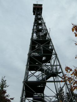
Climb Temagami's restored fire tower, Highway 11

I’ll admit it. I bailed when the tower sighed under my weight and shifted with the wind

I enjoy hiking and Temagami has a lot of opportunities to get into the forest. The one problem is that many of the hiking trails are accessible only by boat. For example, there is a renowned stand of old growth pine on Bear Island, but that’s only accessible by an hour’s canoe, or by water taxi from the marina at the end of the Lake Temagami Access Road, 25 kilometres drive south and west of the town. Others are further in the bush, such as Lady Evelyn Smoothwater Provincial Park, which are accessible only if you’re willing to paddle and portage, or willing to pay for a float plane flight. Even the White Bear Trails that are right in town require a canoe trip (or a significant hike of three hours) to reach the best old growth forests.
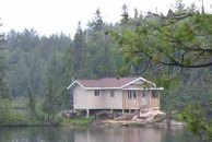
Temagami cottage, Highway 11

Raised cottage in the bush

The trails that you can reach by car tend to be at the end of long, winding, unpaved logging roads that are no longer maintained, such as those at Grand Campment Bay, 40 kilometres east of town, anything off of the two Roosevelt Roads, or at Lake Anima Nipissing, just south-west of Latchford. Many are poorly marked, and do not directly indicate their skill level. We hiked one trail that turned out to not be the paths were throught we were on, another we considered following turned out to be an ATV route, and a third we never found at all despite following directions to a T. A fourth was a great hike, but was a bit beyond our capability. (Well, maybe not beyond our actual capability, but beyond our willingness.)

Anyway, I just want to say that hiking in Temagami isn’t as easy as driving up and looking for a trail sign. It’s not onerous, but it takes some planning – you have to do a bit of homework.
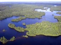
Temagai, aerial view, Highway 11

Obviously not my photo

Temagami, Ontario, Highway 11

October storm whips the waters near Temagami
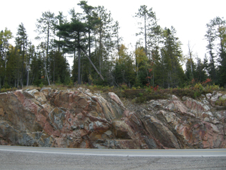
Temagami Highway 11

Rocks and trees, rocks and trees

Temagami, Highway 11

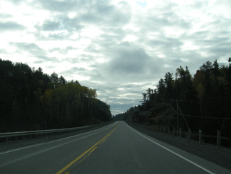
The limitless possibilities of the open road beckon in “real” northern Ontario

Highland Trail

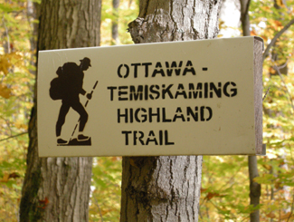
Ottawa-Temiskaming Highland Trail, near Latchford, OntarioThe Ottawa-Temiskaming Highland Trail is not a town, but a network of backwoods trails leading from Ottawa up through to Haileybury.

The trail, maintained by the Nastagwan Trails non-profit passes through Latchford, specifically through the Cliff Lake Reserve southeast of Latchford, accessible by Roosevelt Road.

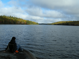
Friday Lake, on the Ottawa-Temiskaming Highland Trail

Friday Lake, on the Ottawa-Temiskaming Highland Trail

The hiking we did on the trail was great – but difficult. The trail is marked, but not always cleared, which made for a challenging, but rewarding hike along lakes, through maple forest, and over rock outcroppings blanketed by lichens.

If you’re planning to hike through Cliff Lake on the Ottawa-Temiskaming Trail, come prepared with extra layers (it can be cold, especially in the fall), lots of water, a walking stick (if possible), really good hiking shoes that are waterproof, a map (which you can buy at the North Cobalt Flea Market), and lots and lots of water.

Ottawa Temiskaming Highland Trail, Highway 11

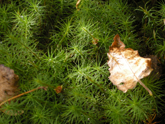
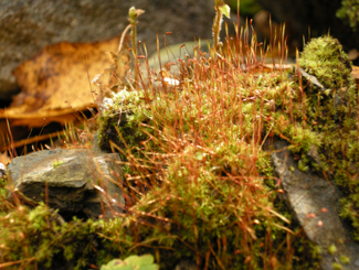
Forest floor close-up

Ottawa Temiskaming  Highland Trail, Highway 11

Not sure what this is, but it was neat

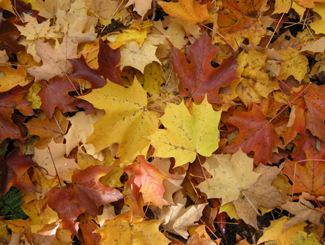
Ottawa Temiskaming Highland Trail, Highway 11

Fall colours on an early October hike

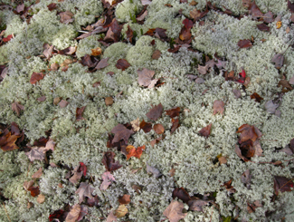
Ottawa-Temiskaming Highland Trail, Highway 11

Lots of lichen (lichens?) on the trail

 Ottawa-Temiskamind Highland Trail, Highway 11

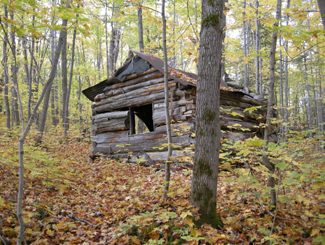
Abandoned Cliff Lake hunting and/or sugar shack

Cliff Lake, Ottawa-Temiskaming Highland Trail, Highway 11

Stream into Cliff Lake

Latchford

With the town motto of “The Best Little Town By a Dam Site”, Latchford signals the end of Temagami and the beginning of Temiskaming. (Scroll down to the bottom of the page for more photos.)

Like Smooth Rock Falls, another tourist guide I saw advises that Latchford is “the perfect stopover place for food, fuel, and tourist information” however I couldn’t really attest on my first visit – I was in a rush, Latchford was small, and you can’t stop everywhere each time you take a roadtrip. I’ve since visited and can confirm that, while tiny, Latchford is clean, quiet, and has some nice river access and good hiking nearby.

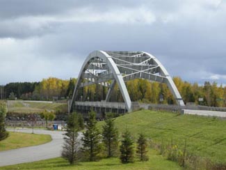
Aubrey Cosens Bridge, Latchford Ontario, Highway 11

Like a mini Skyway Bridge made of big mechano

Latchford was founded in 1902 as a logging town on the Montréal River.  Steamboats used Latchford as a home base to pick up passengers on their way up the Montreal River to Elk Lake. Today the river is crossed by the newly restored Sergeant Aubrey Cosens Bridge. (And this is the second thing named after this guy – there’s also a heritage plaque near Iroquois Falls.) The bridge buckled in the winter of 2003 after it rusted to an unsafe state.  It was closed for months, cutting off all of northeastern Ontario from he Highway 11 artery it so relied upon. Trucks were forced to detour east through Témiscamingue, Québec, up and over Lake Temiskaming and into the Tri-Towns, or west through Sudbury, Gogama, and through Timmins – until a temporary bridge was built. Thankfully, it has now been fixed.

More interestingly, Latchford used to be the home of a big casino during the Cobalt mining boom.  Many miners and prospectors would come to Latchford to party and increase their fortunes, and of course to visit the dancers and prostitutes that called the casino home.  I think the town has quieted down sufficiently since then.

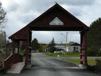
Latchford, Shortest Covered Bridge in the World, Highway 11

Latchford’s “some small weird thing” – The World’s Shortest Covered Bridge!

In Latchford there are tours along the Montréal River.  There is a little town museum (called the Latchford House of Memories) which opens in the spring and closes the second week of October. Latchford is also home to the Ontario Logging Hall of Fame, which has an old blacksmith shop, an icehouse, some old logging equipment, and a restored turn-of-the-century sawmill.  I’m surprised some environmentalists haven’t defaced the logging museum. Latchford is also known for having the world’s shortest covered bridge.  Every August they have their annual canoe and kayak races on the river. If you’re into hunting, the area around Latchford is good for bear, and is located in two prime moose areas. The whole of Highway 11 from North Bay to beyond Latchford is postered with “watch out for moose” signs everywhere.

Latchford is pretty small, but it has a decent spate of amenities. The town has its own tourist info centre (located in the municipal office) however it was closed in October when I was there last. There are many lodges, campsites, and RV sites nearby for accommodation, as well as a diner, a Chip Stand (LA Fries – it is for sale), a variety store, and a gas station in town. Latchford is home to an LCBO agency outlet which stays open until 8 or 9 PM. Wilks Restaurant (also called the Café Log Cabin Café) is housed in a trailer just north of the tourist information centre, and serves homemade food at reasonable prices. Wilks Restaurant has been highly recommended to me by people who live in the area.

Highway 11 Ontario backcountry near Latchford

An ode to Fergus. My trusty, gas-sipping steed is now longer

I’ve stayed at Bay Lee Mac Camp, which is within Latchford’s southern limits, about halfway between Latchford and Temagami. While rustic (no electricity – all lights, the stove and fridge ran on propane) the cottage was clean, quiet, and serene – I don’t think I’ve ever been in a quieter place in my life. Located right on Rib Lake, Bay Lee Mac has water access for swimming, boating, and canoeing, provide organized hikes and hunts, and is located close to the Ottawa-Temiskaming Highland Trail.

Additional outdoors activities include the fishing derby in July – check it out here if you’re interested – and WJB Greenwood Provincial Park.

Cobalt

Cobalt, OntarioIn my travels along Highway 11 I’ve noticed that some towns are:

And then there are some that are just plain cool.

Enter Cobalt.

Cobalt is just really neat.  Part of it is the history.  Part of it is the town’s independent streak.  But mostly, it’s just so old and, well, old, that it’s really interesting.

From “Yikes” to “Cool”

My first impression of Cobalt was “oh god.”  And not in a good way.  But boy was I wrong. Cobalt is the kind of town that would have five taverns but no grocery store. And that’s what makes it so interesting.Abandoned storefront in Cobalt, a reminder of its heydey

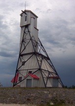
Cobalt headframe, hgihway 11 Ontario

Preserved mine headframe in Cobalt – really cool

It was when I stopped to take a break from driving that I really saw my surroundings.  I realized that what looked old and run down was simply historic.  That was looked grotty and old really had a tonne of character. That instead of tearing down older buildings and erecting cheap, shoddy new ones in their place, Cobalt had preserved its history. A history they were proud of. This place wasn’t run down, it was preserved.  Cobalt was named Ontario’s most historic town for a reason.

Sure, there aren’t a tonne of stores or boutiques.  But at least there aren’t a tonne of places selling crap either.  There is no grocery store left in town (it closed in 1992 when the store owner cleared out the remaining products and held dance parties in the store to commemorate its closing), but what else is there is because it needs to be there – like museums, mine shafts, and bars.  More than a few of them.

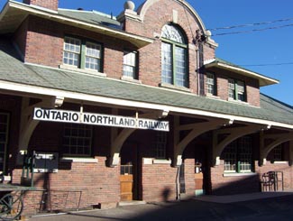
Cobalt Train Station, Highway 11

Cobalt ONTC station

Highway 11 Book Shop, now closed. Cobalt, OntarioThe Highway Book Shop was a classic tourist destination that never feels like a tourist destination.  It was a family-run used bookshop on Highway 11 just outside of Cobalt and it is not only worth a visit, it is worth some time.  Maps, books, magazines, teaching materials, kid’s lit, old books, new books, big books, rare books – you wouldn’t have believed all the crap they have in there.  I think I spent an hour on two separate occasions perusing the cramped store. It might smell like your grandmother’s basement, but it’s really neat, and no visit to Temiskaming is complete without a stop, in my opinion. Sadly, the icon has closed.  Ready to retire for years, the owners couldn’t find anyone to take the store on and had to shut one of Highway 11’s best attractions down.

Cobalt Classic Theatre is the only remaining theatre from Cobalt’s heyday in 1920s.  While other towns were using economic development funds to build golf courses, Cobalt restored the old Classic Theatre in 1993 and now hosts students, playwrights, and actors from across Ontario. The theatre is restored to what it looked like in the 1920s and is a focal point for the community.

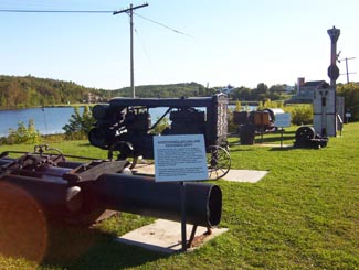
Cobalt, mining equipment, Highway 11

Antique mining equipment on display at the lakefront.  Other towns would have just thrown this stuff out.  Cobalt, refreshingly, doesn’t run from its roots.

Mine headframe now a bar, Cobalt, Ontario

This headframe is now the world’s only bar in a mine headframe! That’s revitalization, northern Ontario style.
The Cobalt Mining Museum has the world’s largest display of silver and offers the only underground mine tour that I’ve seen outside of Timmins.  The Bunker Military Museum has a good collection of memorabilia, the Great Canadian Mine show displays mining technology, and there is also a firefighter museum in town.

Cobalt also has two separate self-guided walks.  The Cobalt Walking Tour brings you through town past historic buildings and historical places, while the Heritage Silver Trail is a self guided tour of many of the abandoned mine headframes in the area.

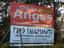
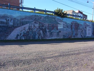
There’s more.  There is Fred’s Northern Picnic, an annual music festival that the local Member of Parliament usually plays at (he’s a musician by trade) and where you get three days of music and free camping for like $60.  The Silver Street Cafe has good food and decent prices, and they also cater local events with real food (forget hamburgers and hot dogs, think steak on a bun and pulled pork with onions.)  The Silverland Inn and Motel is a restored hotel from Cobalt’s mining heyday and also serves food.  There is a stained glass shop, a gem shop, and Iddy Biddy Petting Farm.  Cobalt also has more murals than Nipigon.

Fred's Northern Picnic, featuring MP Charlie Angus, Cobalt, ON

Not sure if they’re still running Fred’s Northern Picnic, but that’s where I saw Serena Ryder before she was big, and the local MP get up and do a set too

History of Cobalt Mural, Cobalt Highway 11Hockey, Streetcars, and Casa Loma

I read in the James Bay tourist brochure that there is a legend that Cobalt blacksmith Fred Larose threw his hammer at a fox, uncovering a rich vein of silver in the process.  Further silver and mineral deposits were found in 1903, triggering a mining rush like no other in northern Ontario.  The significance of the Cobalt finds supposedly led to riots over mining stocks in New York City.  Others say that Cobalt built Bay Street (Toronto’s Wall Street.)  A testament to the town’s wealth, the Cobalt Silver Kings played the 1909 season in the NHA, the NHL’s precursor. Another first in Cobalt include the Temiskaming Streetcar Line, which was installed between Cobalt and Haileybury, and was the first streetcar system north of Toronto.

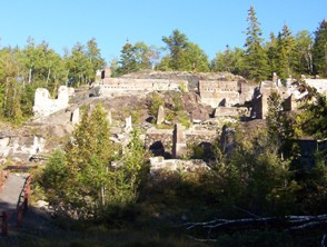
Mining ruins, Cobalt, Highway 11 Ontario

Mining ruins east of town

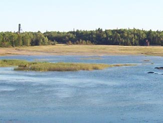
Cobalt Lake, Ontario

Cobalt Lake, once drained, then filled, now restored

In addition, the mines of Cobalt built Casa Loma, the famous “castle” built upon Spadina Heights in Toronto. Sir Henry Mill Pellatt was a wealthy Canadian mine owner (some say Canada’s richest man at the time.) It was his mining operations in Cobalt that allowed him to gather the immense wealth to build Casa Loma. Construction began in 1911 and took more than three years, 3.5$ million, and more than 300 full-time workers. With 98 rooms, it was the largest residence in Canada at the time. Pellat eventually lost his residence, as the Depression and the decline of mining in Cobalt led to his financial ruin. Casa Loma was essentially built with the revenues Sir Henry Mill Pellatt gained by draining Cobalt Lake for silver mining.

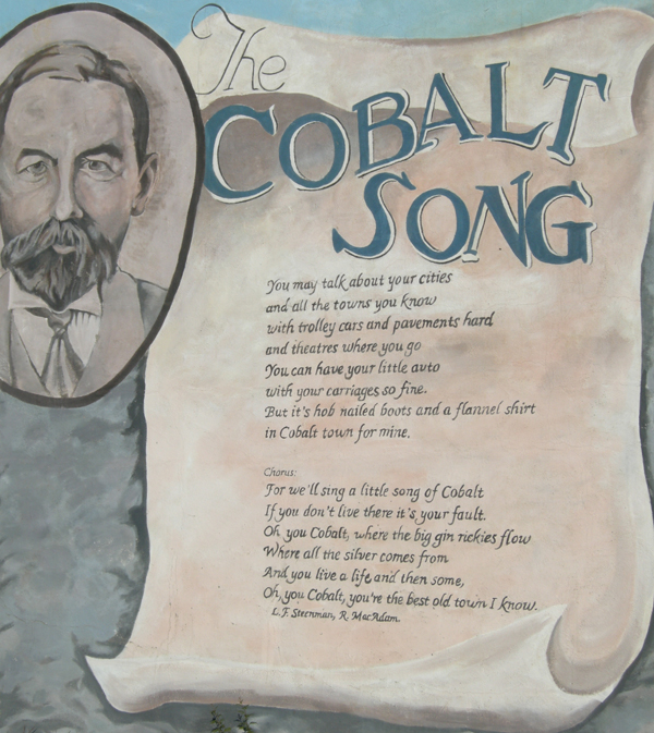
The Cobalt rush eventually produced more than $260 million worth of silver, countless myths and stories about how and where silver was found, who struck it rich, and who lost their pants in speculation. The Cobalt silver rush resulted in a whole little Cobalt culture developing – embodied by the Cobalt Song (click here to download the sheet music.) Cobalt led to the founding towns like North Cobalt (a bedroom town for miners) and Haileybury (a bedroom town for wealthy mine owners.) The mining boom in Cobalt also paved the way for exploration further north, which led to massive gold finds in Timmins and Kirkland Lake, both of which far exceeded the value of the mines of Cobalt in the long-run.

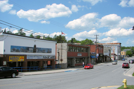
Cobalt, Ontario, downtown, highway11.ca Ontario Highway 11

I could move this photo of downtown Cobalt closer to the text that talks about downtown Cobalt but in wordpress moving photos around is a pain in the rear. (Credit: User P199 at Wiki Commons.)

Although Cobalt survived the usual northern Ontario disasters, including a typhoid outbreak in 1909, and Great Fire of 1922, it couldn’t survive the decline of mining.  Well, it survived, but it’s much smaller today and mining no longer exists.  There is some exploration for diamonds, but I don’t think they’ve been found.  I’ve heard that many of the old mines still have minerals in them, but that it’s just not economical to mine such old shafts for minerals at today’s prices. But, in the end, the history of Cobalt is one of a town that conbtinually gets kicked, but then manages to find its way back up.
Cobalt is considered the third part of the Tri Towns along with New Liskeard and Haileybury.  But for some reason it didn’t amalgamate into Temiskaming Shores in the late 1990s when the province forced municipalities to squish together.  Maybe it’s too far away.  Maybe old hostilities with North Cobalt scuppered a move.  Maybe the town is too independent.  Maybe there is still an old hockey rivalry between Cobalt and Haileybury from the one season both towns had a team in the NHA.  I’m sure someone in the town of 1200 put up a fight.  I don’t know.

I haven’t spent as much time as I would like in Cobalt, and, I must admit, haven’t visited any of the touristy things here other than the Highway Book Shop.  But I’m sure I’ll be back again.

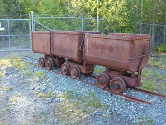
Old mining carts, Cobalt, Ontario

My grandfather worked in coal mines in Europe for a time.  Seeing these things, all I could think of was my disbelief that people actually went underground with these things…that’s ballsy

The Cobalt Song Mural, Cobalt, Highway 11 Ontario

North Cobalt

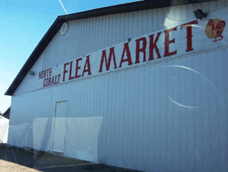
I didn’t notice the difference between Cobalt and North Cobalt while driving through the area the first time, but my recent trip to the Temiskaming region confirmed that it is indeed separate and distinct, even if only by a few minutes’ drive.north cobalt flea marketNorth Cobalt is a former mining camp established right between the towns of Cobalt and Haileybury during the silver rush in the early 1900s.  It was a stop along the Nippissing Electric Railway that ran from Dymond to Cobalt.  Along with Haileybury, North Cobalt was destroyed by the fires of 1922.

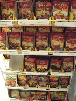
The North Cobalt Flea Market isn’t a true flea market in the usual sense of the word – it’s more like a liquidation place like the Bargain Shop or a going-out-of-business BiWay that sells everything it can get its hands on.  On my first trip, however, they had a whole whole wall full of St-Hubert sauces and mixes. Now, it’s only a rackfull. I’ve bought some each time I’ve driven through town.  I love St-Hubert.

St-Hubert Sauce Heaven at the North Cobalt Flea Market on Highway 11

Heaven. Salty, savoury, salty heaven. I HEART ST-HUB

While North Cobalt is a bit newer-looking and better kept than its predecessor, there doesn’t seem to be much to do.  There is Gramma’s Chipper, a summer-time chip stand, and a couple of gas stations that seem to have lower prices than any in the Tri-Towns.  There’s an old cemetery behind the local

Devil's Rock, North Cobalt, Highway 11

Devil’s Rock – a pawn in the tug of war between North Cobalt and Haileybury

Catholic Church.  I read in the Toronto Star once that there is an egg grading station in North Cobalt.  I also found the Maiden Bay Camp, which is on a rural road in North Cobalt.  It seems there are some abandoned towns nearby as well.  You could also venture off the main road to visit some “ghost towns“, although in northern Ontario a “ghost town” is usually just a razed or abandoned settlement – nothing like the fully-intact, faux-fronted, tumbleweed-infested ghost towns of western legend.
North Cobalt does, however, have Devil’s Rock, which provides hiking and a nice view of Lake Temiskaming.  Haileybury tries to claim it, but I have the good word of a Tri-Towns resident that the devil lives in north Cobalt.

North Cobalt became part of Haileybury in 1971 and has been part of the town ever since.  I don’t know if a separatist movement exists but considering its northern Ontario, there probably does.

North Cobalt, part of Temiskaming Shores, ONtario. (Credit: Wiki Commons User P199)

North Cobalt, part of Temiskaming Shores, Ontario. (Credit: Wiki Commons User P199)

Virginiatown / Kearns

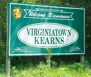
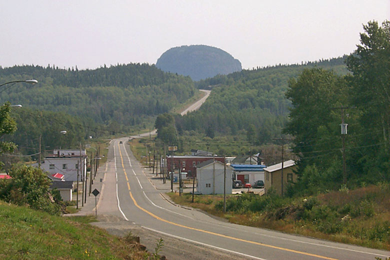
Continuing our detour off Highway 11, Virginiatown and Kearns are two villages (population approximately 800) northeast of Krugerdorf via Highway 624.  V-town is just a tad west of the Quebec border on the northeastern shore of Larder Lake.Virginiatown and Kearns, OntarioBuilt in the shadow of the great Mount Cheminis, the area known as Virginiatown is comprised of three different villages – Kearns, North Virginiatown, and Virginiatown proper. I would have done separate pages for all three but a) I don’t have a tonne of info, and b) I’m not sure where one village ends and the next one begins on a map. I think North Virginiatown is north of Highway 66, Virginiatown is south of it, and Kearns is just a kilometre or two east.

Virginiatown is actually much closer to Rouyn than Timmins or any other larger centres in Ontario. Therefore, (and I might be wrong, but) I’m pretty sure that V-town, as it is affectionately called, is a largely francophone community which had its heyday with the northeastern Ontario mining boom in the early half of the 20th century.  So, I checked this fact.  Statscan tells me that Virginiatown and area is largely francophone.  But emailers and posters (before I lost all the posts) tell me that nearly no one speaks French in V-town.  So, I don’t know.

Virginiatown, Ontario

Highway 66 traveling east into Virginiatown, with Mount Cheminis in the background

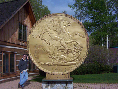
Virginiatown sprung up with the expansion of the mineral rush which began in Cobalt in the early 1900s and drove north founding towns like Kirkland Lake and Larder Lake. V-town was famous for the Kerr Addison Mine, which at one time was the richest gold deposit in North America. The gold from the first Canadian 5 ounce gold coin was mined from the Kerr Addison. Today, a coin monument stands to commemorate this Virginiatown achievement.

Like all boom towns, this had to come to an end eventually. The Kerr Addison Mine shut down in the 1990s, and while there is still exploration and some smaller gold ventures in the area, Virginiatown is pretty sleepy nowadays. Check out the link to Louie Palu’s photos below, it contains some fantastic shots of mining life in Larder Lake and Virginiatown mines.

Virginiatown coin, Ontario

Does V-town’s big weird coin outdo Larder Lake‘s flying fish?

There is a boat launch to Larder Lake, and you can access nearby Labyrinth Lake where you can catch northern pike, bass, and walleye. According to google, there is a ceramic shop in town as well. You can visit the Virginiatown Heritage House for a history of the town and its mining past, or hike the Heritage Gold Trail to view underground mining equipment.

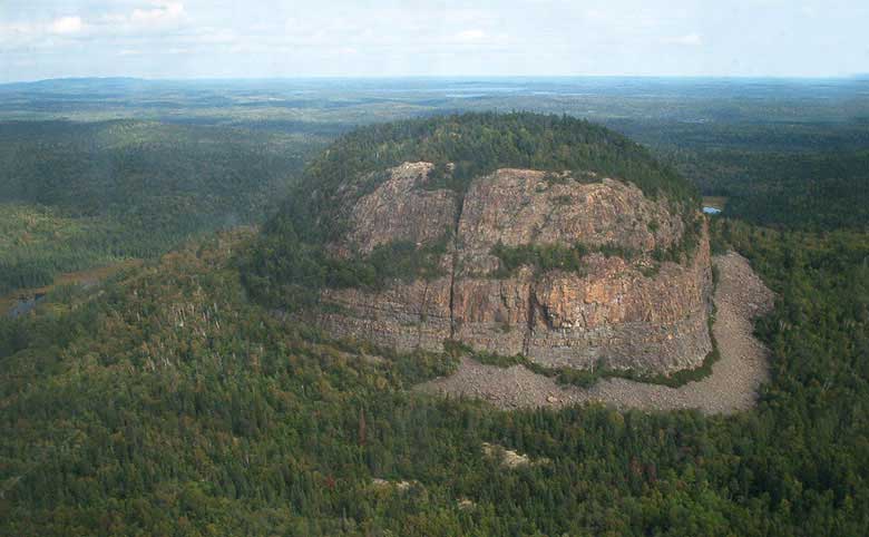
Mount Cheminis is, in my opinion, the coolest thing in the area. Shooting up from the trees like the bum of a thick marker, it rises majestically above V-town and is visible from Highway 66. You can hike up the summit from local trails. Check out some of the nice pictures in the links below. Andre emailed to let me know that Mount Cheminis (known as Mont Chaudron in French) is techhnically in Québec.

Mount Cheminis, Virginiatown, Ontario

Mount Cheminis. Awesome!

Services in town include gas (Guy’s Service Station), a small grocery store, and the usual small-town-northern-Ontario stuff like the Bear Creek Bait and Tackle shop and a curling club. Chez Lucie is a drug store, convenience store, and video rental in one, and Armando’s “Le Bar” is a local diner and watering hole. The Cheminis Lodge provides bed and breakfast facilities and lodging, as does the Hilltop Inn.

The only time I drove through Virginiatown was en route to Rouyn. I was on a schedule, so I stopped to take a picture with the big coin and that’s it. Please help me add to this page – send personal anecdotes, history, photos, and advice to info (at) highway11 (dot) ca.

For an archive of the 30 comments that were posted to Highway11.ca’s profile of Virigniatown/Kearns between 2008 and 2012, please click here.

Mattice

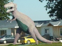
When you enter Mattice from the east, you’ll be greeted by a dinosaur.

T-Rex has no cultural significance to the town.  There isn’t a museum around.  He’s not the town mascot. To my knowledge no dinosaur bones have been found in the area. It’s just decoration on someone’s front lawn.  Think of it as an especially eccentric garden gnome.

T-Rex in Mattice, Northern Ontario, Highway 11

Mattice does its bit to continue Highway 11’s many “WTF? moments.

I’ve been told by a Mattice resident that the T-Rex was built by the owner of the Mattice Motel to attract tourists.  There used to be a stegosaurus in town, as well.  It turns out that the stegosaurus was destroyed by a new owner when the previous owner left to pursue his dinosaur dreams elsewhere.  Seriously.  It turns out he left to build a concrete Jurassic park in the Ottawa region.

A francophone town in the heart of French-speaking Ontario, Mattice (rhymes with ice) is one of these small northern towns (population approximately 500) on Highway 11 that has a little bar, an a full-blown LCBO, and a skidoo repair shop … but only the tiniest of grocery stores that would barely qualify as a fruit stand in more urban areas in southern Ontario.

Fur trading monument, Mattice, Highway 11 Ontario

Mattice used to be the launchpad for old fur trading expeditions

Set on the Missinaibi River, Mattice used to be a starting point for Voyageurs heading downstream for the fur trade.  There’s a historical plaque and one of Highway 11’s classier statues to commemorate its history.  About two kilometres upstream, there’s a traditional Aboriginal burial ground.

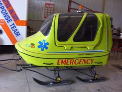
Mattice emergency service skidoo, Highway 11

Ambulance northern Ontario style
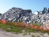
If you go north on one of Mattice’s side street you’ll find the nice riverfront park.  It’s actually quite a nice park, with a boat launch, a picnic area, and an inexplicable pile of rocks (that, it turns out, were used in the refurbishment of the Missinaibi Bridge.  And then left there for posterity’s sake.)

Rock pile, Mattice, Highway 11

Lacking a woodpile, this pile of rocks will have to do

Geraldton

Compared to the many other spots on Highway 11’s mid-west corridor, Geraldton is a relatively bustling town of 2400, apparently with its own suburbs – Jonesville and Geraldton East.

Geraldton has two town mottos – ‘Spirit of the North’ and ‘The Friendly Town with a Heart of Gold’.  It’s obvious that the town has put its golden heart to good use, as it is one of the most actively and professionally marketed towns in northern Ontario.

Geraldton, Ontario Highway 11 tourist centre

Geraldton’s fancy and new tourist center, visible from Highway 11

Thirty-eight kilometres west of Longlac, Geraldton has actively used a restored mine headspace in all its tourism literature.  The mine shaft is quire nicely restored. If you turn down Hardrock Drive (yes, it’s the best-named street in northern Ontario after Iroquois Falls’ Oil Tank Road) you’ll see a rocky landscape which I believe is the headframe’s parking lot and the starting point for the two hiking trails seen below.
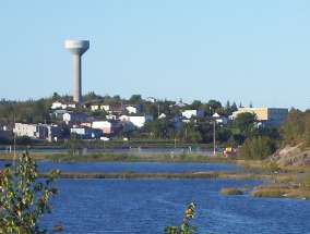
The Geraldton Discovery Centre, on Highway 11 across from the mine shaft, is also really nicely done-up.  The Discovery Centre has exhibits on the area’s forestry and mining history, current practices in both industries, and also allows you to dress up in fireman gear and have your photo taken (handy if your wife or girlfriend is into that kind of thing and you’re not a firefighter like the most of us.)Geraldton's restored mine headframe on Highway 11Geraldon is on the shores of Kenogamisis Lake, which, by the way, offers some low-level cliff diving opportunities (I don’t endorse/condone/promote/suggest doing this, I just observed some people doing while I drove past. Do not jump off cliffs into the water, it’s really dangerous.)  Geraldton also has a nice golf course and some hiking trails.

Hiking trails in Geraldton, Ontario, highway 11

I think I’ll take a pass on the first one

I happened to be in town for their annual August long-weekend Jamboree.  I was planning to stop after I saw a Bristol board sign indicating that it was in nearby Macleod Provincial Park.  With my drive time approaching the six hour mark, and the valuable contents of my wallet becoming increasingly sparse with each stop for gas and coffee and doughnuts, and the rain beginning to pour, I declined my chance to jam with the locals.

Geraldton downtown, highway11.ca Ontario

Downtown Geraldton, Ontario north of Highway 11 (Credit: User P199 at Wiki Commons.)

I missed the town itself.  Geraldton is about five kilometres north of Highway 11.  (I was tired. I was trying to make it to Nipigon without getting gas. (Danger Will Robinson.  Red alert.  BAD IDEA!)  Plus. it was raining.  I had just passed a hitchhiker and felt really really guilty but not guilty enough to take my life into my own hands in the middle of nowhere in order to save the guy from the downpour.)  Therefore I continued along Highway 11, and missed out on mainstreet Geraldton.

If you continue up the road past Geraldton, you’ll eventually hit Nakina and Aroland, two of Ontario’s more isolated northern towns.

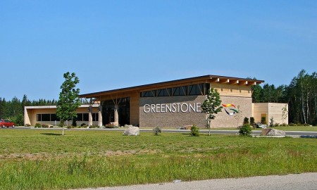
Greenstone municipal building in Geraldton, Ontario, north of Highway 11

Well this is pretty swish. (Credit: user P199 at Wiki Commons.)

Nipigon

Located on the most northern point of Lake Superior, Nipigon is pretty much the only true town between Geraldton and Thunder Bay.

You know what this means.

Out of the way Tim-Br Mart.

Move over Home Hardware.

Nipigon has a Canadian Tire…!

Nipigon, Ontario, highway11.ca marina lake superior

Even Nipigon’s little port is cute!  The lookout is up at the top of that hill in the back of the photo. (Photo: User P199 at Wiki Commons.)

When you drive into many northern towns, there’s usually a sign telling you that they’re the home of a semi-famous Canadian celebrity.

Well, fooling around on the internet one day I found out that a crater on Mars was named after Nipigon.

Why isn’t this on a sign beside the highway?  You could put “Nipigon – we’re so out of this world they named a crater on Mars after us!” or something like that.  Moonbeam would kill for this! I’d pledge 50$ toward that…

Nipigon shrine Ontario Highway 11Instead, you’re greeted by a sign that tells you that churches are open Sundays and are directed to a ‘scenic lookout’ which looks out over a cemetery.  Is this considered a God’s-eye view?  Nipigon does have an abundance of churches, and the town’s Catholic Church even has a little shrine beside its virgin Mary statue.

Hydroelectricity, fishing, forestry, tourism are the mainstays of Nipigon’s 2000 people. (I wonder if they did the census in the summer, and how that would impact the head-count – there seem to be some cottages in the area.) Nipigon is blessed with a scenic little harbour, complete with a waterfront park, a boat launch, and hiking trails.  It even has a nice kid’s bookshop, and a stained glass store to boot.  This is not your average Highway 11 town.

Paintings and Big Things

Nigion is full of murals Highway 11 OntarioWell, I take that last statement back.  Nipigon is your average Highway 11 town because, of course, it has to have its share of weirdness.  Of course, there is the mandatory “big weird thing in town”, but also in this case, it is public art.

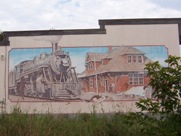
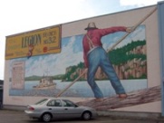
Nipigon seems to love murals.  I counted four, plus the town museum which has paintings on it as well.  The one on the Legion celebrates forestry.  Another recognizes the history of the railroad.  A third shows the town’s first general store.  A fourth celebrates ‘northern Ontario time’ – encouraging workers to call in sick in order to go fishing.  It’s a great idea. I’m a sucker for any kind of public art.
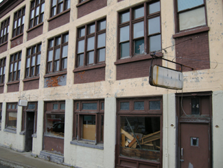
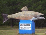
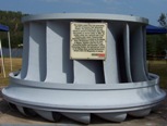
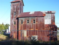
Nigion is full of murals Highway 11 OntarioLike most northern Ontario towns, Nipigon has a festival and a some big weird thing displayed in town.  Every August long weekend the town celebrates the Blueberry Blast festival, although I was there on the long weekend and didn’t see any blueberries raining down anywhere in the town.  In the “some big weird thing” category, Nipigon has two entries, 1) a historic turbine taken from the electrical plant up the river, and 2) a big trout on the highway.
Big weird thing #2 - Nipigon's trout, on Highway 11

Nipigon’s big weird thing #1 – Nipigon’s trout, on Highway 11

Nipigon is the best stop to eat or refuel before you hit Thunder Bay or Geraldton.  There is a foodmart, a Robin’s Doughnuts, multiple gas bars, a Beer Store, a Mac’s Milk, a few motels, a bank or two, a Subway where I waited 70 minutes to get a sub (beware of people coming in from camps and ordering 12 subs each), and a Pizza Pizza/KFC outlet.  Out on the highway there’s Gus’ Broasted Chicken, for those wanting a non-fast food meal.

Lots of people end up leaving Highway 11 for Highway 17 after Nipigon.  If you’re interested, check out the towns that run along Lake Superior’s shore by going off-route here.

Other random stuff

Nipigon Ontario - big weird thing #1 - hydro turbine
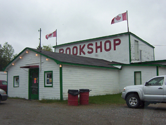
…and Nipigon’s big weird thing #2, an old hydro turbine

Oddly, east of Nipigon past Highway 11 there is an ad for construction company in based in Hearst.  That’s past Highway 11.  In the opposite direction of Hearst.  Really, it’s nowhere at all near the town.  Do the owners know where they’re being advertised?

Nipigon is also the town that got me in trouble in Grade Four.  Whilst playing Cross-Country Canada in computer class, Mme. Bennedsen caught me and three other kids giggling at the computer screen.

Now, this long before the advent of the internet, so in hindsight there wasn’t much risk we were up to anything particularly nefarious.  But maybe she was having a bad day, or maybe she was practicing her walk-stare-scold combo for use in future computer classes once the internet became a fixture of public education – whatever the reason, she rushed up toward us, eyes glaring, finger pointing, heels clicking ominously.

We looked at each other.  Once of us would have to come clean.  After multiple protestations from us that we were up to nothing, she finally flushed it from us.  And I took the hit for the four of us.  I was forced to stand before the class, head bowed, and admit out loud that there was, in fact, no town in Ontario named Nipplegone.