North of Geraldton you’ll find two towns on opposite ends of Highway 548 – Nakina, and Aroland.
Nakina is village of approximately 500 people on Highway 584. The village is situated approximately 60 kilometres north of Geraldton – making Nakina one of Ontario’s more remote towns on the road network.

At the end of one of the most northerly stretches of road in Ontario are Nakina and Aroland
With 500 people today, Nakina is essentially the remnants of an old railway town. The town was founded in 1913 due to the junction of the railway – after Nakina the rail lines branch southwards towards Toronto or east towards Quebec. This made Nakina an ideal spot for a railway centre. In its heyday, Nakina has a fully functioning roundhouse, with fuel, servicing, and train-turning facilities.
The 1940s saw Nakina get a radar base. Built in World War Two, the base was designed to protect the important locks between Lakes Huron and Superior at Sault Ste. Marie. Like many of Canada’s old radar bases, it was operated by the United States, but dismantled soon after the Second World War.
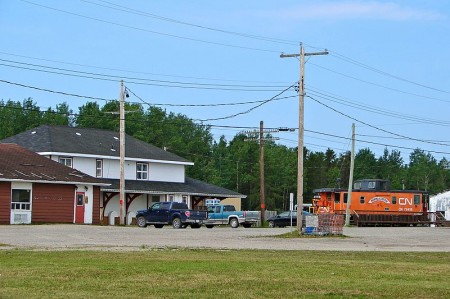
Nakina, harkening back to the old days of northern Ontario railway towns (Photo: User P199 at Wiki Commons.)
Nakina hit a boom in the 1970s when, in addition to its railway functions, the town was home to a large paper mill. This boosted the population to nearly double what it is today. Currently, however, minerals exploration and tourism are the largest industries today. Nakina is a starting point for many northern fly-in lodges. You can fly to lakes such as Makokibatan, part of the Albany River system. Fish for walleye, northern pike as well as brook trout.With both the pulp and railway industries definitely on the wane, it may be hard for Nakina to stem out-migration and beat the odds of being such a remote, northern town.
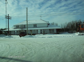
Nakina’s train station
Nakina advertizes along Highway 11 with its mascot, the “Nakina Mosquita”… I wish I had taken a photo of one of those signs. Thanks to Keith for sending in the photos of the rail station and of the end of Highway 584.
Aroland is an Oji-Cree First Nations town about 20 kilometres northwest of Nakina off Highway 584 on Highway 643. Approximately 300 people live in the community.
The surrounding area was a traditional camping ground in the late 18th and early 19th centuries due to good hunting, fishing and trapping. The Hudson Bay Company set up a trading post at nearby Kawpaskagami Lake in the early 1900s. The railway expanded to the area in 1911. According to the Chiefs of Ontario website, the Arrow Land and Logging Company, which operated in the area from 1933 to 1941, employed many Band members and contributed to the establishment of a permanent community.
The community is made up of members from many First Nations across the north, including former members from Long Lake, Fort Hope, Marten Falls, and Fort William Bands. The Aroland settlement is within the boundaries of the Robinson-Superior Treaty of 1850 and the James Bay Treaty of 1905 (known across the north as Treaty 9.)


