Huntsville

I’ve been to Huntsville at least four times, if not five.  Yet nothing really rings a bell.

I’m trying to think of what I’ve done in Huntsville, other than eat and get ready for Algonquin Provincial Park.  (Not that I have much to get ready for, being a day tripper and all.  I’ve certainly never ventured off the beaten path.  I doubt I’ve been more than a few miles from the highway.)

I once bought a flask though at the Northern General Store on the main drag right across from the Pita Pit.  Another time I had an extra pickles veggie pita too.  I once used a pita from the same Pita Pit to convince the local Beer Store (or was it LCBO?) to stay open an extra five minutes.  I’ve been to the bank in Huntsville. I got super ridiculously lost trying to find the Swiss Chalet in Huntsville.  But…most of my memories are of Algonquin.  I think that pretty much sums up my activities in Huntsville.

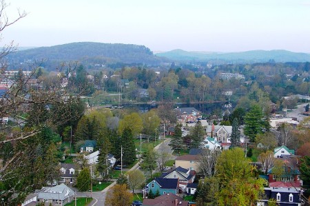
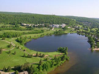
Hunstville from above, highway11.ca Ontario

Huntsville from a lookout. (Credit: User P199 at Wiki Commons.)

Huntsville is the last real town on Highway 11 before North Bay and is also the last major centre in Muskoka cottage country. Huntsville is an important cottage and camping area, boosted by two fancy resorts, close access to Arrowhead and Oxtongue Lake Provincial Parks, and the busiest access point to Algonquin Provincial Park.

Huntsville is pretty cute.  There’s a nice little winding downtown (that reminds me a bit of Kirkland Lake, but nicer) that skirts around the lake, and the town is very much cottage country magnet full of stores and services both useful and tacky.

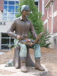
Tom Thomson Statue, Huntsville, Highway 11

Statue of Tom Thomson, group of seven founder (though he was never a member)

Huntsville hosts an annual arts festival.  The town is home the Muskoka Museum, an art gallery, and the new Algonquin Arts Theatre which produces plays during cottage season.  There is also an annual book reading festival, the Firefly Festival in July, and a summer car show.

Founded in 1869 as an agricultural post, Huntsville today is a town of 18 000 focused on tourism, cottaging, and a bit of manufacturing.  Algonquin Provincial Park is about 60 kilometres east and that means that there are numerous lodges, inns, motels, and outfitters in and outside of the city.

The Wolf Den Bunkhouse, about 30 minutes east in Dwight, is a great little hostel with cottages as well as single rooms in a neat log house.  In addition to a Pita Pit, Huntsville has a Harvey’s, an East Side Mario’s, a Swiss Chalet, and a movie theatre.

Huntsville also has two top notch resorts – Hidden Valley and Deerhurst, the latter being where Shania Twain got her start.  There is train (not twain) and bus access from the ONTC, and Huntsville is the proud owner of a one-route municipal bus system.

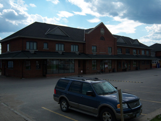
HUnstville's town hall slash theatre, highway 11

HUntsville’s new town hall and the Algonquin Theatre, which hosts a comedy festival during cottage season (Credit: User P199 at Wiki Commons.)

Motels, Highway 11, Huntsville

Highway 11 is littered with B-list motels near Huntsville that look empty and forlorn in the off-season.  But in tourist season, they sure fill-up.

Untsville, highway 11, deerhurst resort

Deerhurst Resort.  Obviously not my photo.

Shania Twain played in Huntsville before she was a superstar

Sure Huntsville.  You can try to steal her from Timmins but you will never succeed

South River

The flamboyantly-named South River is a town of about 1100 people just 45 minutes south of North Bay.

I have to admit, my acquaintance with South River has always been brief.  I don’t usually stop in South River – if I’m still up for a coffee I usually get it in Sundridge, and bomb it the rest of the way to Orillia (if I’m headed south) or to North Bay (if I’m going north.)

South River is really a village with a bit of an outdoorsy bent due to its proximity to Algonquin.  For those not fond of Mother Nature there is an annual arts festival and the South River Black Fly Festival that tries to put a super spin on a super pest, or at least showcase the area’s most famous local invention – the Black Fly Suit.

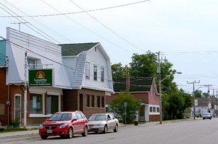
South River, Highway 11 Ontario highway11.ca

The main drag in South River, Ontario, just off Highway 11 (Photo: User P199 at Wiki Commons.)

South River history has some interesting aspects.  South River was founded in the 1860s when Fraser Lumber started logging nearby Algonquin Provincial Park.  Hotels sprouted up in 1881, hydroelectricity twenty years later, and in 1907 the town was officially formed.  South River was home to the Standard Chemical Company, which made wood alcohol and other forest-derived products.  In 1934, Italian and Finnish workers led a massive strike.  German prisoners of war were held in South River in the 1940s, with the more radical ones sent further up Highway 11 to Monteith.  South River also sold the Shay locomotive to Abitibi Consolidated for use further north. The Shay now sits in Iroquois Falls.  It is now home to the Bear Chair Company.

South River is important due to its paddler’s entrance to Algonquin Provincial Park.  South River is the second busiest park access after Highway 60 east of Huntsville.  There are camping, hiking, canoeing, and fishing opportunities in South River due to its proximity to Algonquin and Mikisew Provincial Parks.

There is a local farmer’s market in the summer and some small art studios with pottery and glassware.  There is also a train station, an arena with year-round ice, a curling club, tennis courts, a baseball field, library, daycare, Legion, and two retirement complexes.  And a beer store and an LCBO.

South River is home to the Hockey Opportunity Camp, Swift Canoes and Kayaks, and, as I’ve been told via email more than once, it is also home to “Mr. Meat”, which is supposedly a pretty good grocery store that sells a variety of high quality, ultra-fresh meats.

Marten River

Marten River is a hamlet of about 100 people 45 kilometres south of Temagami.  On the south end of Lake Temagami, the town is largely dependent on forestry and tourism, and is home to a number of lodges and outfitters.

Marten Falls, big fish, Highway 11 Ontario

Highway 11’s largest fish? That’s what Marten Falls claims

Marten River Provincial Park has camping, hiking, and a replica 19th century logging camp.  Every July there is the annual Logging Days Festival.  It is also home to the obligatory “some big weird thing” that each town in northern Ontario seems to have – in this case, it is what they claim is Highway 11’s biggest fish, though Nipigon might have something to say about that.  (Sorry, Larder Lake, you’re disqualified.  You’re not on Highway 11 at all.)

There is a gas station in town, Marten River Outfitters, and a few little places to eat, including the Rock Pine Motel and Restaurant.

There are three lakes near Marten River – Marten Lake, Ingall Lake, and Jumping Caribou Lake.  The lake is stocked with fish and there is also hiking at the local crown game preserve.

Temagami

ONTC line near Temagami, Highway 11 Ontario

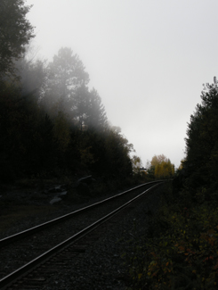
Nothing captures the loneliness of northern Ontario than the railway heading off into nowhere

Sure, after Huntsville the towns become sporadic, a bit less refined, and really small – but those areas are still within relatively short driving distance to either Barrie and/or North Bay.

But it is after North Bay where Ontario changes.

Towns of 10 000 become cities.

Villages of 2000 become towns.

Hamlets that wouldn’t warrant a sign in southern Ontario make it into maps, travel guides and guidebooks about the north.

Temagami is the perfect example.  Not only do you not realize just how far away it is from North Bay (more than an hour), but it’s also really small.  The dots-on-the-map before Temagami aren’t really true towns at all, they’re much closer to being dots-on-the-map. And when you get into Latchford, you realize that it is much the same as Temagami.

If you don’t have some decent cassettes for the car by now, you’re in trouble from here on in.  You’ll start seeing more transport trucks than cars. Of the few cars on the road, they’ll practically all be domestic, and will likely have an ATV in tow. The distances are only going to get larger and the roads will only get lonelier.

Temagami from Highway 11

Temagami from Highway 11

OK, so a bit about Temagami

Temagami is a town of about 1000 an hour-plus from North Bay.  The town was first settled in 1850 when the Hudson Bay Company set up a trading post on Lake Temagami.  The ONTC railways came through in 1904 as silver was found in Cobalt to the north, and Temagami became a town of trappers, traders, and prospectors.
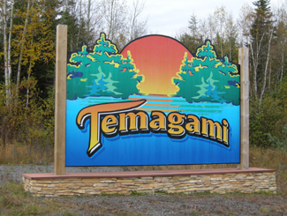
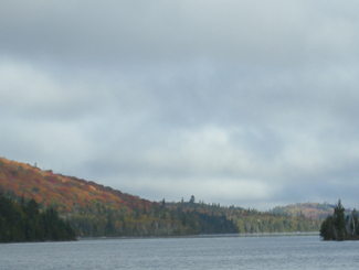
Temagami, Ontario Highway 11From Highway 11, Temagami is a land of contrasts.  Some spots can be boring as heck.  Rocks and trees, rocks and trees.  Others, however, can be surprisingly beautiful. On a recent trip to the area we didn’t take many photos of Temagami, mainly because the scenery was so majestic, it was nearly impossible to discern what was photo-worthy and what wasn’t, without taking photos practically every ten minutes. We actually experienced scenic fatigue, and by the end of our trip we were turning our noses up at lakes, forest scenes, and vistas we would have stopped for has we been in southern Ontario. And we didn’t even go into the interior, or explore Lake Temagami, which is reportedly more scenic than the area directly off Highway 11.Lake near Temagami, OntarioOne of the many reasons for Temagami’s beauty is that it is one of the last parts of accessible Ontario with old growth forest, and was the subject of intense protests against logging in the 1980s.  Temagami is Ojibway for ‘deep water by the shore.’  It is also where Englishman Archie Belaney found fame as Grey Owl, an Aboriginal devoted to environmentalism.
Today Temagami is largely dependent on forestry and tourism. There are two provincial parks nearby, Finlayson and Lady Evelyn-Smoothwater.  Temagami is a starting point for a number of all season activities, including boating, dogsledding, canoeing, cross country skiing, swimming, fishing, camping, houseboating, hunting, and guided tours.  There are also a nature interpretive centre, some craft shops, and an art gallery.
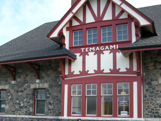
Temagami Train Station, Highway 11

Train station in Temagami

Temagami has a few tourist amenities.  There’s a gas station, the aformentioned grocery store, two outfitters (one of which was closed and for sale during our trip), two outdoors stores, two restaurants (one Chinese, and the Busy Bee) and a couple of shops.  There are numerous camps, lodges, and other places to stay, including Inn The Woods Motel and Bed and Breakfast, Leisure Island Houseboats, Linda’s Wigwams, Smoothwater Resort, and Temagami On-Ice Bungalows. There is a bit of a residential area on either side of Highway 11, and another a bit further north in what is called “Temagami North.”

Being on “Temagami Time”

You hear a lot about Temagami in the news and from friends who have cottages and cabins.  Yet I was surprised just how tiny the town is considering the tourism business up here.  There is a lot to do in Temagami if you like the outdoors.  But if you like the indoors, or just aren’t that woodsy, well, don’t expect much of a town or any indoor or evening attractions, because the town itself is miniscule, and what is available keeps weird hours – what I call “Temagami Time.”Panorama from hiking trails of HIghway 11, Temagami, Ontario

The Co-op grocery store isn’t open on Wednesdays. Many offices or stores are only open half-days. The scenic rail route from North Bay, called the Dream Catcher Express, runs a meagre six days a year. One of the town’s two restaurants closes at 6 PM on some days. The Temagami tourism welcome centre, the Caribou Mountain fire tower info centre and shop, and the train station interpretive centre and gift-shop all close after the first weekend in October.

Most surprisingly for Northern Ontario, the LCBO closes at 5 PM (go to Latchford for an agency store that stays open ’til 8 or 9.) If you’re visiting Temagami after September, you better have electricity in your cabin or be prepared to go to sleep early, because nothing will be open and it’ll be dark – during our recent trip we experienced pitch black night during the second week of October at the late hour of 7.25 PM. So if you’re heading to Temagami, especially in the fall, be prepared to live according to Temagami Time. While I’m half joking, this is actually something to think about – I only became acclimatized to being on a late fall ‘vacation’ in Temagami – going to bed early, timing trips to stores and eating supper early – by the time my mini vacation was over!

Temagami, Ontario, Highway 11

Nestled in the woods like a fairy tale is Temagami’s town site

Hiking

Temagai beavers ruin boardwalk, Highway 11

Sabotage! Wilderness 1 Hikers 0

The area used to be littered with forest fire towers that were up to 1000 metres high – one of which has been maintained as an attraction that you can climb.  My partner and I attempted a climb on a windy, wet day in October. We’re not embarassed to admit we didn’t make it all the way up. She was a bit iffy to begin with, but considering we were the only ones there, the cold, biting winds, some slippery stairs, and the requisite creaking of the structure with each gust, we abandoned our climb 3/4 of the way through. It didn’t help that it was cloudy and that the lookouts built around the tower gave us the nice views we wanted without needing to climb. (No shame in excuses for me!)  I don’t think the tower is as tall as it seems, but considering it’s on the highest point in the area, it seemed very, very tall. The tower is one kilometre from Highway 11, east on O’Connor Drive up Caribou Mountain, but isn’t really visible from the highway, unless you’re looking for it.
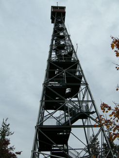
Climb Temagami's restored fire tower, Highway 11

I’ll admit it. I bailed when the tower sighed under my weight and shifted with the wind

I enjoy hiking and Temagami has a lot of opportunities to get into the forest. The one problem is that many of the hiking trails are accessible only by boat. For example, there is a renowned stand of old growth pine on Bear Island, but that’s only accessible by an hour’s canoe, or by water taxi from the marina at the end of the Lake Temagami Access Road, 25 kilometres drive south and west of the town. Others are further in the bush, such as Lady Evelyn Smoothwater Provincial Park, which are accessible only if you’re willing to paddle and portage, or willing to pay for a float plane flight. Even the White Bear Trails that are right in town require a canoe trip (or a significant hike of three hours) to reach the best old growth forests.
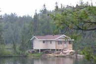
Temagami cottage, Highway 11

Raised cottage in the bush

The trails that you can reach by car tend to be at the end of long, winding, unpaved logging roads that are no longer maintained, such as those at Grand Campment Bay, 40 kilometres east of town, anything off of the two Roosevelt Roads, or at Lake Anima Nipissing, just south-west of Latchford. Many are poorly marked, and do not directly indicate their skill level. We hiked one trail that turned out to not be the paths were throught we were on, another we considered following turned out to be an ATV route, and a third we never found at all despite following directions to a T. A fourth was a great hike, but was a bit beyond our capability. (Well, maybe not beyond our actual capability, but beyond our willingness.)

Anyway, I just want to say that hiking in Temagami isn’t as easy as driving up and looking for a trail sign. It’s not onerous, but it takes some planning – you have to do a bit of homework.
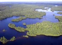
Temagai, aerial view, Highway 11

Obviously not my photo

Temagami, Ontario, Highway 11

October storm whips the waters near Temagami
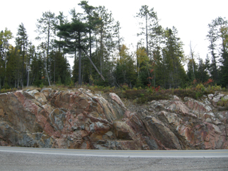
Temagami Highway 11

Rocks and trees, rocks and trees

Temagami, Highway 11

The limitless possibilities of the open road beckon in “real” northern Ontario
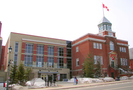
Iroquois Falls

Iroquois Falls isn’t right on Highway 11 – it’s about 15 kilometres away at the end of road 67.  Founded more than 90 years ago, Iroquois Falls is home to a big pulp/paper mill and three electricity dams — all of which together used to be the world’s largest pulp and paper operation.

Iroquois Falls, OntarioIroquois Falls (pronounced locally as Urr-roquois, not Ear-roquois) is about half anglophone and half francophone.  The town is split in two by the railroad, and crisscrossed by the tracks at an innumerable amount of locations.  (I wonder if Iroquois Falls has the highest number of railroad crossings per capita in Ontario.)

Interestingly, the west half of the town seems to have English street names, while the east side’s streets are in French.  There is even rue Synagogue – a testimonial to the Jewish population that once settled in northeastern Ontario.  And while we’re on street names, there’s also Oil Tank Road, which is just begging to be the name of a country album.

Iroquois Falls was comprised of at least three communities – Iroquois Fall, Ansonville and Montrock. Amalgamation has put them all together under one municipal roof.

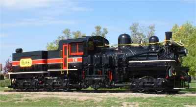
The Shay in Iroquois Falls

The Shay, Iroquois Falls’s old locomotive

The Abitibi Arena in Iroquois Falls was built entirely by community labour in 1955. Actually, at the time it was billed as the largest community labour project in North America. A large contributor to the project was personnel employed by the paper mill. If a part or piece of equipment was needed somewhere during the construction apparently it was readily made by a millwright over in the paper mill.

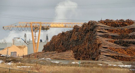
Iroquois Falls woodpile at the mill, Highway 11

Sometimes this travel blog feels like a tour of northern Ontario woodpiles (Credit: User P199 at Wiki Commons.)
Known as “The Garden Town of the North”, Iroquois Falls is home to The Shay, an old restored locomotive that used to work the Abitibi line.  The town is also home to the Abitibi Eskimos, a junior hockey team that draws record numbers in the Northern Ontario Junior Hockey League.  I’ve heard that people come from as far as Kirkland Lake to watch the Eskies.  Iroquois Falls celebrates Paperfest in August and the Moby Pike fishing Derby in July.  There is also a Pioneer Museum in town chronicling the rise of the forestry industry and settlement of the town.Iroquois Falls Eskis logo

Iroquois Falls used to be the home of a large, wooden hotel that was served by an fantastic dining room. Unfortunately, it is no more, either being torn down or burned down at some point before I had a chance to have a meal. Randy’s Rec Room is a pub serving surprisingly good food and the service is top notch.  For food there is also the Main Street Café, the Bus Stop Chip Stand, DJ’s pizza, a diner, and a Tim Horton’s.  There’s a motel when you’re coming into town, but I don’t think the adjoining steakhouse has been in operation for years.  There are some bank branches and a caisse.  Esso (west of the tracks) and PetroCanada (east of the tracks) are in town as well. And the Silver Grill is a Chinese place serving 100 percent northern Ontario Chinese food.
Iroquois Falls is a pretty nice town.  There are nice old houses, a few parks, and a marina at Twin Falls that provides access to the massive Lake Abitibi.

Thanks to Paul for the info on Iroquois Falls.

Cochrane

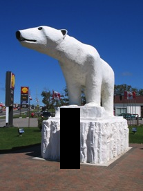
Chimo the Polar Bear in Cochrane, ON

Travel blog lesson #31 – always take a second, empty, non-person photo.  Or else you may end up with a blog full of photos of previous girlfriends.

Most towns would make a big deal of the fact that a former hockey player and doughnut baron hailed from their community.

Instead, Cochrane advertises Nanook, Aurora, and Nakita as its three most famous citizens.

Yep, we’re talking about animals.

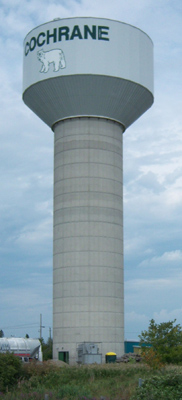
If you have a fear of polar bears, steer well clear of Cochrane. I’m just teasing – they’re well contained. Cochrane has adopted the polar bear as their town symbol, even though true polar bear habitat is more than 300 kilometres away.  There are even fake igloos in town.

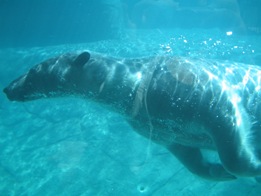
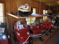
Chimo, the town mascot, is honoured with a big polar bear statue just as you enter town.  There’s also the Polar Bear Conservatory, where Nanook, Aurora, and Nakita spend their time.  There you can watch feedings, see interpretive displays, and “swim with the polar bears.” Ok, so if you’re more than 4 feet tall it is more of a wade than a swim but don’t let my teasing dissuade you – the Polar Bear Conservatory is interesting. Kids love the wading with the polar bears part. There’s also an adjacent ‘old style’ village with gas pumps, farm implements, and a collection of really awesome vintage skidoos.

Polar bear conservancy in Cochrane, Ontario

This was pretty cool, to be honest

Old Tyme Village ski-doo collection, Cochrane, Ontario

Definitely the most northern Ontario museum in northern Ontario
Cochrane is a very pretty little community of 4500 (slightly more anglophone than francophone) on Highway 11.  No matter what language you’re in, Cochrane is pronounced like cock-ran.  This might seem pretty intuitive but once in a gas station with a bunch of tourists from Belgium who kept asking how to get to a place that sounded like Cosh-rahnne and no-one, not the anglos nor the francos knew what the heck they were talking about.  I only figured it out about a year later.  Hopefully it didn’t take them that long.

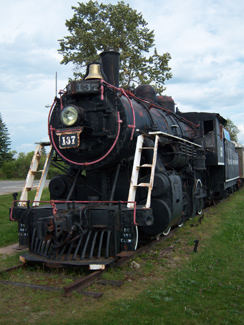
Old locomotive on display in Cochrane, Ontario

(Credit: Patrick)

It has a growing tourist industry built on the Polar Bear Express, which runs north to Moosonee twice a day in the summer.  Or at least it did, until the government stopped supporting the railway and now no-one knows what’s happening to the ONR.

Fishing and ATV expeditions often start here.  Greenwater Provincial Park is about an hour west of the town, providing fishing, swimming, and hiking around a series of kettle lakes.  Greenwater is pretty, and quiet. Also notable is the Tim Horton arena, home to the Tim Horton museum, that I didn’t have a chance to visit.

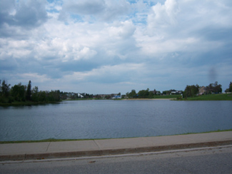
One of the coolest things about Cochrane, in my books at least, is Lake Commando. One –  that’s a sweet name.  Lake Commando. Sure, it’s more like a pond, but the words ‘Lake Commando’ just sounds so cool.  That’s awesome.  That’s even cooler than Geraldton’s Hardrock Drive, or Iroquois Falls’ Oil Tank Road. Two – it’s pretty.  It has parkland around it, a walking trail, and a quaint little bridge.  There’s also a bed and breakfast bordering the lake.

Cochrane, Ontario train station leads to James Bay

Cochrane train station.  (I do not know how to effectively use my camera in any lighting – dark or bright.)

As for amenities, since Cochrane has about 4500 people it’s fairly well served.  If you’re looking to bring out your fancy-pants you may be out of luck, but otherwise there’s everything you need.  Cochrane has a Tim Horton’s (which pays homage to the town’s most famous son with plaques on the walls, memorabilia all around), a KFC, and some other diner-style restaurants.  There’s also a rib/wing place and the Station Inn if you want a real sit-down meal, and, of course, a place serving Authentic Northern Ontario Chinese Food.
Cochrane, Ontario on Highway 11

Can you milk a polar bear? Well, Cochrane sure does. (Photo credit: Patrick)

There’s a small farmer’s market at the north end of town every Saturday, and a country store you’ll see across from the polar bear statue that sells cottagy-type stuff that you see in Muksoka.  Also, Cochrane has the last Giant Tiger on Highway 11 after Kirkland Lake.

Cochrane is also notable for receiving Ontario’s first ever permit to serve liquor on a Sunday, for a winter carnival held in the mid 1960s. Despite the devastating fires of 1910, 1911, 1916, and Cochrane still exists to this day.

Thanks to Paul for some of the Cochrane.

Lake Commando, Cochrane, Ontario

Lake Commando.  Still looking for Rambo River. (Come to think of it, there was a Rambo Creek near to where I grew up…800 km away)

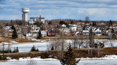
Cochrane, Ontario off highway 11 highway11.ca

(Credit: User P199 at Wiki Commons.)

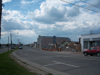
Cochrane, Ontario street

Streetscape in Cochrane

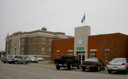
Cochrane, Ontario municipal building highway 11

A nicer Cochrane streetscape. (Credit: User P199 at Wiki Commons.)

Moonbeam

Ah, Moonbeam.  It’s so cute.  And so goofy.  That’s why it’s so neat.  I like Moonbeam.

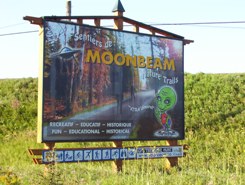
Moonbeam, Ontario welcome alien sign on Highway 11

I want to say that the alien’s name is Youpi, but I think that’s the name of the Montréal Expos’s mascot

Moonbeam is a small francophone town of about 1000 (which is big compared to places like Mattice, let alone Harty!)  It is so clean, so well kept, and, well, so spunky.

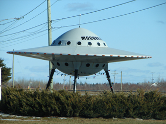
From what I’ve been told, the town got its name from railway workers who insisted that a beam of light from the moon hit the tracks one night.  And thus Moonbeam was named.  And with the help of hippies and a few dedicated locals, the name stuck.Moonbeam, Ontario's flying saucer on highway 11Moonbeam loves its space theme.  The flying saucer is one of Highway 11’s most famous monuments and is known throughout Ontario.  There is the Blue Moon Motel and Chip Stand (motel + chip truck = awesome combo) which features space stuff on its signs.  Moonbeam has its own mascot which is a little green alien whose name I can’t remember.  He’s on all their signs which are all over Highway 11’s eastern portion. I think I even have him on a shirt pin.

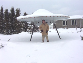
Alien ship stuck in Moonbeam, Ontario because of the cold

It was so cold I had to wear my gorilla gloves. I can’t believe we posed outside without a hat

But it’s not all rockets and asteroids with Moonbeam.  They have a vision and they’re realizing it.  There’s the Centre Culturel and the Leonard Art Gallery.  The town has some of the best hiking, cycling, and walking trails in northeastern Ontario.  Moonbeam has its own snowmobile club with trails that are groomed in the winter (it’s the first place I’ve ever seen a snowmobile trail groomer.)  Just north of town there is Remi Lake and René Brunelle Provincial Park, which I’m told has a waterslide.  There is also fishing, swimming, and canoeing/kayaking.

Moonbeam’s most famous son would be sculptor Maurice Gaudreault.  Gaudreault is well-known within Canadian ceramic circles for his work depicting life in northern Ontario through clay.
Gaudreault sculptureMoonbeam's famous Gaudreault

Gaudreault sculpture

There’s also a short film called Leaving Moonbeam about a young girl trying to hitch a ride out of Moonbeam.

Moonbeam actually has a fair amount to do and is totally worth a stop, or even more so, an actual visit.

Geraldton

Compared to the many other spots on Highway 11’s mid-west corridor, Geraldton is a relatively bustling town of 2400, apparently with its own suburbs – Jonesville and Geraldton East.

Geraldton has two town mottos – ‘Spirit of the North’ and ‘The Friendly Town with a Heart of Gold’.  It’s obvious that the town has put its golden heart to good use, as it is one of the most actively and professionally marketed towns in northern Ontario.

Geraldton, Ontario Highway 11 tourist centre

Geraldton’s fancy and new tourist center, visible from Highway 11

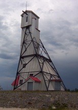
Thirty-eight kilometres west of Longlac, Geraldton has actively used a restored mine headspace in all its tourism literature.  The mine shaft is quire nicely restored. If you turn down Hardrock Drive (yes, it’s the best-named street in northern Ontario after Iroquois Falls’ Oil Tank Road) you’ll see a rocky landscape which I believe is the headframe’s parking lot and the starting point for the two hiking trails seen below.
The Geraldton Discovery Centre, on Highway 11 across from the mine shaft, is also really nicely done-up.  The Discovery Centre has exhibits on the area’s forestry and mining history, current practices in both industries, and also allows you to dress up in fireman gear and have your photo taken (handy if your wife or girlfriend is into that kind of thing and you’re not a firefighter like the most of us.)Geraldton's restored mine headframe on Highway 11Geraldon is on the shores of Kenogamisis Lake, which, by the way, offers some low-level cliff diving opportunities (I don’t endorse/condone/promote/suggest doing this, I just observed some people doing while I drove past. Do not jump off cliffs into the water, it’s really dangerous.)  Geraldton also has a nice golf course and some hiking trails.

Hiking trails in Geraldton, Ontario, highway 11

I think I’ll take a pass on the first one

I happened to be in town for their annual August long-weekend Jamboree.  I was planning to stop after I saw a Bristol board sign indicating that it was in nearby Macleod Provincial Park.  With my drive time approaching the six hour mark, and the valuable contents of my wallet becoming increasingly sparse with each stop for gas and coffee and doughnuts, and the rain beginning to pour, I declined my chance to jam with the locals.

Geraldton downtown, highway11.ca Ontario

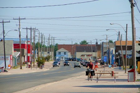
Downtown Geraldton, Ontario north of Highway 11 (Credit: User P199 at Wiki Commons.)

I missed the town itself.  Geraldton is about five kilometres north of Highway 11.  (I was tired. I was trying to make it to Nipigon without getting gas. (Danger Will Robinson.  Red alert.  BAD IDEA!)  Plus. it was raining.  I had just passed a hitchhiker and felt really really guilty but not guilty enough to take my life into my own hands in the middle of nowhere in order to save the guy from the downpour.)  Therefore I continued along Highway 11, and missed out on mainstreet Geraldton.

If you continue up the road past Geraldton, you’ll eventually hit Nakina and Aroland, two of Ontario’s more isolated northern towns.

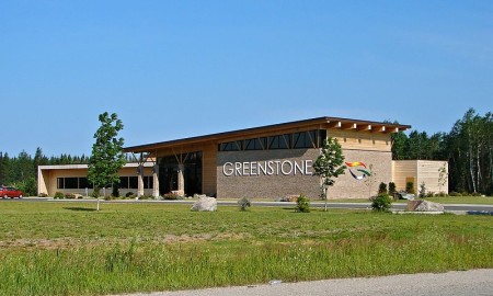
Greenstone municipal building in Geraldton, Ontario, north of Highway 11

Well this is pretty swish. (Credit: user P199 at Wiki Commons.)

Beardmore

Eighty kilometres west of Geraldton is Beardmore, the “Gateway to Lake Nipigon.”

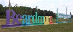
Welcome to Beardmore, Ontario

Not a pride parade float, it’s the welcome to Beardmore sign!

Beardmore started out as a flag station on the CNR before finding itself in the middle of the Lake Nipigon gold ‘rush’ in the 1930s.  The town faced ‘rapid expansion’ after gold was found on the Sturgeon River, as evidenced by the Timmins-style hotels that unfortunately no longer serve as watering holes for the community.

Today, it’s a town of about 200 people focusing on forestry and serving as a take-off point for camping and boating near Lake Nipigon.  So it’s pretty small, and pretty quiet.  But what Beardmore lacks in amenities it makes up in uniqueness. I liked Beardmore.

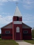
Beardmore church

A church in Beardmore – completely unrelated to the text that appears above or below this photo

Beardmore is known for Vikings.

The Beardmore Relics, which were purported to be a cache of Viking artifacts, were found near the town in the early 1930s.

The relics – including an old sword, and axe, and a piece of a shield – were supposedly found while a prospector was panning for gold, and for a time were claimed as evidence that Vikings explored much further than Vinland, Markland, and Helluland while they were in North America, and that they explored parts of northern Ontario and maybe even Minnesota.
The Royal Ontario Museum purchased the relics and displayed them for about twenty years until they were forced to hold a public enquiry as to whether the relics were actually found in Beardmore, or imported by Scandinavian settlers desperate for a historic taste of home and passed off as a discovery in an elobarate hoax.
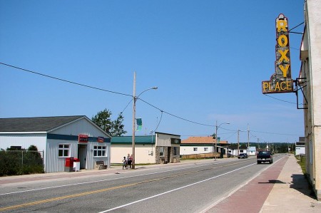
Beardmore, Ontario on Highway 11 Ontario highway11.ca
Highway 11 as it runs through Beardmore, Ontario.  Note the lounge-hotel at right, once a fixture of every town in northern Ontario.  (Photo: User P199 at Wiki Commons.)

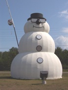
In the “some big weird thing” sweepstakes Beardmore doesn’t disappoint.  Beardmore is also home to what it claims is the world’s largest snowman.  Does the title still count even though he’s not made of snow?  During the summer, the apparently nameless snowman sports sunglasses and fishing rod to signify that anything you can do, a snowman can do way cooler.

Beardmore, Highway 11's snowman capital, with the world's largest " snowman "

Neither rain, nor sleet, nor heat, nor hail will keep Beardmore’s snowman from standing watch over the community

The town sign isn’t just a normal wooden sign.  They’ve spelled out Beardmore on railroad ties in rainbow-coloured letters that you can’t miss. The town also has these nice new ‘Welcome to Beardmore’ pennants hanging from the lampposts.

This is what I love about Highway 11 communities.  They have pride. They have spunk. They have a sense of community. And this sense of community means that they’re not afraid to try.

Sometimes when you’re from a larger place you forget that, no matter where you’re from or where you live, everyone has some sense of pride in their hometown.  Beardmore is a place that reminds you of this.

Beardmore, Ontario war memorial - Highway 11Today Beardmore is a forestry and outfitting town, with a baseball field, a church, some gas stations and about 40 or 50 houses.  There is a Legion in town too.  Beardmore is the only real stop between Geraldton and Lake Nipigon, a 170 kilometre journey.
Beardmore is also where renowned artist Norval Morrisseau first showed his work to a Toronto exhibitor.

Lake Nipigon

My map indicated that there were three communities on Highway 11 between Geraldton and Nipigon – Rocky Bay, Macdiarmid, and Orient Bay.  This may or may not be true.

Rocky Bay is home to the Rocky Bay First Nation.  It is actually off Highway 11 and I didn’t venture in as time and gas were becoming an issue.  (Note to readers, fill up in Beardmore.)

The only thing I saw named Macdiarmid was a dirt road.

I couldn’t find Orient Bay either, although truth be told I was getting weary of driving on this particular trip and didn’t really give it a good look.  It might be the name of a lodge or an outfitters station, but I didn’t see it.

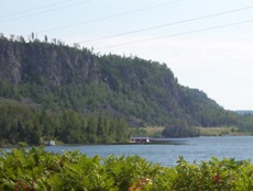
Beautiful cliffs of Lake Nipigon

Beautiful cliffs of Lake Nipigon

But what is great about this part of Highway 11 is the drive itself.  The scenery is absolutely fantastic.  Stunning cliffs are the result of geological processes that have left the Pijitawabik Palisades as some of the most awe-inspiring views on Highway 11 .  The highway is bordered by countless lakes which are nestled between beautiful rocky outcroppings that jut from the landscape like bumps on a log.

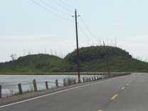
Weird bumpy rock formations follow Highway 11 in the Lake Nipigon area

Weird bumpy rock formations follow Highway 11 in the Lake Nipigon area

This drive is sincerely one of northern Ontario’s most scenic drives.  So if you’re already out this way, don’t rush through – it is worth stopping and enjoying.

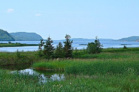
Lake Nipigon marshes off highway 11 ontario highway11.ca
Lake Nipigon Wetlands with cliffs in the background. I love Ontario. (Credit: User P199 at Wiki Commons.)