Iroquois Falls

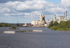
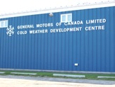
Iroquois Falls isn’t right on Highway 11 – it’s about 15 kilometres away at the end of road 67.  Founded more than 90 years ago, Iroquois Falls is home to a big pulp/paper mill and three electricity dams — all of which together used to be the world’s largest pulp and paper operation.

Iroquois Falls, Ontario
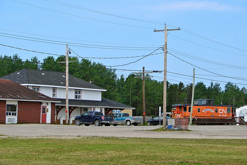
Iroquois Falls (pronounced locally as Urr-roquois, not Ear-roquois) is about half anglophone and half francophone.  The town is split in two by the railroad, and crisscrossed by the tracks at an innumerable amount of locations.  (I wonder if Iroquois Falls has the highest number of railroad crossings per capita in Ontario.)

Interestingly, the west half of the town seems to have English street names, while the east side’s streets are in French.  There is even rue Synagogue – a testimonial to the Jewish population that once settled in northeastern Ontario.  And while we’re on street names, there’s also Oil Tank Road, which is just begging to be the name of a country album.

Iroquois Falls was comprised of at least three communities – Iroquois Fall, Ansonville and Montrock. Amalgamation has put them all together under one municipal roof.

The Shay in Iroquois Falls

The Shay, Iroquois Falls’s old locomotive

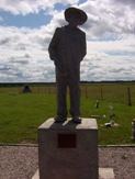
The Abitibi Arena in Iroquois Falls was built entirely by community labour in 1955. Actually, at the time it was billed as the largest community labour project in North America. A large contributor to the project was personnel employed by the paper mill. If a part or piece of equipment was needed somewhere during the construction apparently it was readily made by a millwright over in the paper mill.

Iroquois Falls woodpile at the mill, Highway 11

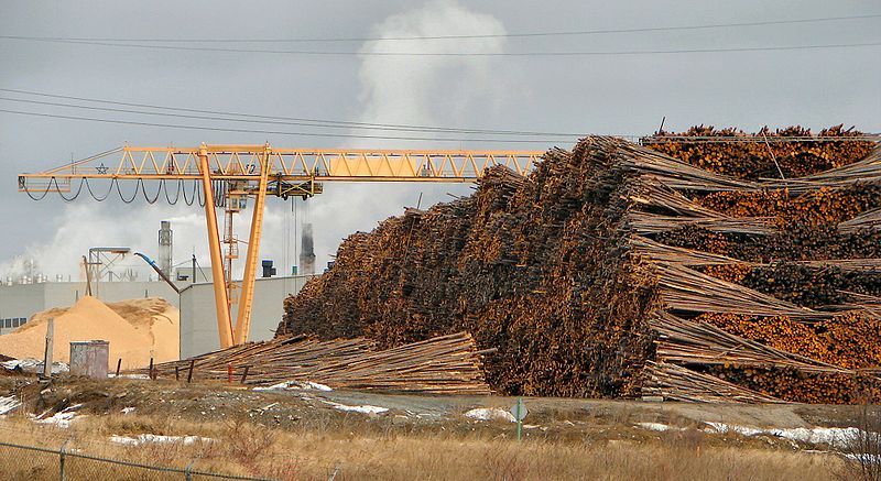
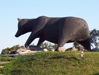
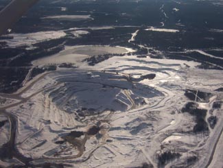
Sometimes this travel blog feels like a tour of northern Ontario woodpiles (Credit: User P199 at Wiki Commons.)

Known as “The Garden Town of the North”, Iroquois Falls is home to The Shay, an old restored locomotive that used to work the Abitibi line.  The town is also home to the Abitibi Eskimos, a junior hockey team that draws record numbers in the Northern Ontario Junior Hockey League.  I’ve heard that people come from as far as Kirkland Lake to watch the Eskies.  Iroquois Falls celebrates Paperfest in August and the Moby Pike fishing Derby in July.  There is also a Pioneer Museum in town chronicling the rise of the forestry industry and settlement of the town.Iroquois Falls Eskis logo

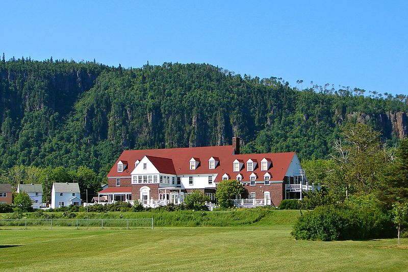
Iroquois Falls used to be the home of a large, wooden hotel that was served by an fantastic dining room. Unfortunately, it is no more, either being torn down or burned down at some point before I had a chance to have a meal. Randy’s Rec Room is a pub serving surprisingly good food and the service is top notch.  For food there is also the Main Street Café, the Bus Stop Chip Stand, DJ’s pizza, a diner, and a Tim Horton’s.  There’s a motel when you’re coming into town, but I don’t think the adjoining steakhouse has been in operation for years.  There are some bank branches and a caisse.  Esso (west of the tracks) and PetroCanada (east of the tracks) are in town as well. And the Silver Grill is a Chinese place serving 100 percent northern Ontario Chinese food.

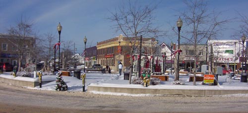
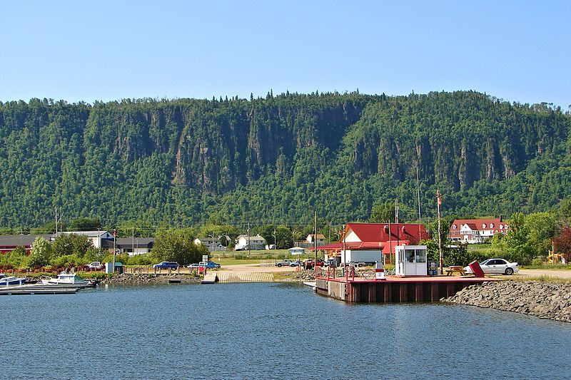
Iroquois Falls is a pretty nice town.  There are nice old houses, a few parks, and a marina at Twin Falls that provides access to the massive Lake Abitibi.

Thanks to Paul for the info on Iroquois Falls.

Smooth Rock Falls

Smooth Rock Falls on Highway 11 in OntarioWhen you come into Smooth Rock from the east, don’t be fooled, what you’re seeing is not a one-story IKEA.  It’s the local hospital.

One tourist guide I picked up said that Smooth Rock was the “perfect stop over and supply center.”  Man, those guys really know how to write a tourist brochure.  Talk about underselling…Smooth Rock deserves more than that!

Jeff Buttle, the pride of Smooth Rock Falls, on Highway 11

Jeffrey Buttle, Canadian and World Champion figure skater is from Smooth Rock

Nestled along the picturesque Mattagami River, Smooth Rock is more than just a town that sounds like a radio station.  It was home to Jeffrey Buttle, a recently retired Olympic silver medalist and world champion figure skater; Louise Pitre, a singer who has appeared on Broadway; and JP Parise, a former NHLer who played in the ’72 Summit Series, has coached at the famous Minnesota Shattuck-St Mary’s hockey program, and who is also the father of New Jersey Devils’ forward Zach Parise.  Those are three people that should have their own “Welcome to Smooth Rock, the home of…” signs on the way into town. I’ll pledge 50$ toward that.

Smooth Rock is a largely francophone community of 1800 centered on the pulp and paper mill.  The problem is that “the North’s biggest little town” (their motto, I think) is about to get smaller as the mill shut down indefinitely in July 2006.  Smooth Rock is facing an uncertain future after the loss of their major employer. Which is really sad, since it’s a cute town and probably a great place to grow up and to retire. I’ve heard that the town and its residents are trying to start up a community-based venture to restart the now shuttered mill, but I don’t know if they’ve been successful.

The mill, now shutdown, at Smooth Rock Falls

The mill, now shut since 2006

Smooth Rock doesn’t have a tonne of touristy-type stuff.  There’s the Forget Me Not BnB west of the river.  There’s also a nine-hole golf course, a nice park on the east side of the river, and there are some fishing opportunities as well. Smooth Rock is good place to stop on the way to Kapuskasing and a place to get gas if you’re heading up to Fraserdale.

Smooth Rock Falls's highway 11 moose

Moose sculpture #234 on Highway 11

Northway Restaurant claims they have the “best poutine in the north”, although I’m sure that Poutineland in Timmins gives them a run for their money.  Audrey’s has good breakfast in a spartan setting.  There’s also Coco’s Chip Stand off the highway.  Rue Sixth is the main business section for Smooth Rock.  There’s a full-blown LCBO, an Esso, and a Tim-Br Mart.  The Moose Motel provides accommodations and SRF’s entry into the “some big weird thing” motif that is all the rage on Highway 11: a statue of a moose.  There is no Tim Horton’s or chain stores as far as I have seen.  I don’t know if there is a Chinese restaurant, but it’s northern Ontario so there must be one somewhere.Also, don’t be fooled.  There are signs advertising the “SRF Centre” on Highway 11 in both directions.  It’s not a mall – the “SRF Centre” is a truckstop with some slightly self-aggrandizing tendencies.

On an anecdotal bent, the town of Smooth Rock Falls used to plow each resident’s driveway in the winter.  I don’t know why that service ended.

Kapuskasing

Kapuskaing, Cold Weather Test Centre, GM, Highway 11 Ontario

Nothing says “welcome, why don’t you stay a while?” like seeing the Cold Weather test centre from your car window

Which Highway 11 town has 9000 people, more than 50 shops and services and was the hometown of the director of movies like Terminator, Aliens, True Lies, Titanic and Avatar?

Yep, Kapuskasing is kindofabigdeal in Highway 11 terms.

Kap has some neat sites.  The old Ontario Northland train station has been recently fixed up and has a little area for art exhibitions from the area.  There’s an old locomotive adjacent to the station that houses train memorabilia and neat facts about the CNR’s history.

Highway 11 Ontario, Kapuskasing, bear

Kap’s entry into the “some big weird thing” – a bear

Originally named Macpherson, the ‘model town of the North’ was built around the pulp mill that originally supplied paper to the New York Times.  When they built the mill, they decided to build a company town, and since it was a company town they planned it as the ‘model town of the north’ complete with planned parks (quite nice), its own power supply (which used to serve the town and mill exclusively), and an English-style traffic circle, which residents and visitors alike find confusing to this day.

MOdel Town of the North, Kapuskasing's roundabout

You know roundabouts are confusing when they are a pain even in a town this small

With about 9000 people, Kapuskasing is the largest town on Highway 11 between Kirkland Lake and Thunder Bay.  It’s even has its own spot on the North American professional lumberjackery circuit.  Every July the Kapuskasing Lumberjack Festival is broadcast live on television across Canada, and maybe even into the States. (Heck, Canada doesn’t even have a soccer league, but it has a lumberjack circuit?  And is sustainable with stops in towns like Kap?  Who would have guessed it…)

POWs

Kapuskasing POW memorial, Highway 11I was surprised to find, by accident, two little memorials just west of Kap.  There’s one for Ukrainian-Canadian detainees tha

t were interred near Kap during the First World War (the photo of the guy with the hat.)  Further in off the highway there’s one for German/Austrian/Turkish Prisoners Of War (the photo with the little crosses) that died while being imprisoned.

I found out from some locals at the site that during the First World War Kap was the site of a POW camp.  It was decided that

Kapuskasing POW camp memorial, Highway 11 Ontario

Kapuskasing POW camp memorial

Kapuskasing was perfect because at the time the only way in and out of town, at that time, was by train.  In other words, everyone detained there was stuck – there was no way to escape and nowhere to go if you did.  They used their labour to clear land for Kapuskasing’s experimental farm, which is right beside the 24 graves of the POWs.

In addition, Paul emailed me to tell me about Kapuskasing’s former life as a station on the ONR rail line. Every time a train derailed, the local foreman of the track maintenance crew at Kapuskasing was required to file a report with the head office of ONR in Toronto. His reports were apparently quite lengthy and detailed. After receiving many of these “eloquent” and “descriptive” reports, about train derailments the foreman (named Flanigan) was advised by the head office people to write reports that weren’t so lengthy. So, after the next derailment, the following telegram was received in the head office, as follows:

Re: ONR train derailment at Kapuskasing:
”Off again – on again – gone again” (Signed) FLANIGAN.

Farm near Kapuskasing. Highway 11

Still farm country this far north

Kapuskasing Today

Like all the francophone towns (it’s about 30/70 anglo/franco) of the north, Kapuskasing is really quite nice.  Although a James Bay tourism brochure bogusly claims that Kap is a town of “street dances” (who wrote that thing?), there is a fair amount to do for a city of its size.

Kapuskasing train station

Kap’s train station is pretty magnifique, with a museum and gallery

There is a farmer’s market in the summer.  If you can make it past the downtown traffic circle in the direction of your desire, you’ll find a really nice lakefront park and some good walking paths.

Kap has a bunch of services that are too long to go into detail here.  What’s important is that there is a Tim Horton’s.  There’s a McDonald’s too.  There are some honest-to-goodness northern Ontario Chinese food restaurants.  There is a Walmart but no Giant Tiger.  Apparently Kapuskasing also has the most productive Casey’s restaurant in all of Ontario.  Take that, Front and University (the downtown Toronto location.)

Pub Max, right on Highway 11, also has good food, especially the chicken salad sandwich.  There are two touristy stores on Highway 11 in Kap, namely Marbleworks and the Moonbeam Country Store.

Agrium Mine, Kapuskasing

Aerial view of a mine, near Kapuskasing

Nakina / Aroland

North of Geraldton you’ll find two towns on opposite ends of Highway 548 – Nakina, and Aroland.

Nakina is village of approximately 500 people on Highway 584. The village is situated approximately 60 kilometres north of Geraldton – making Nakina one of Ontario’s more remote towns on the road network.

Nakina highway ending, Ontario highway11.ca

At the end of one of the most northerly stretches of road in Ontario are Nakina and Aroland

With 500 people today, Nakina is essentially the remnants of an old railway town. The town was founded in 1913 due to the junction of the railway – after Nakina the rail lines branch southwards towards Toronto or east towards Quebec. This made Nakina an ideal spot for a railway centre. In its heyday, Nakina has a fully functioning roundhouse, with fuel, servicing, and train-turning facilities.

The 1940s saw Nakina get a radar base. Built in World War Two, the base was designed to protect the important locks between Lakes Huron and Superior at Sault Ste. Marie. Like many of Canada’s old radar bases, it was operated by the United States, but dismantled soon after the Second World War.

Nakina, Ontairo way up north a fair bit off Highway 11

Nakina, harkening back to the old days of northern Ontario railway towns (Photo: User P199 at Wiki Commons.)

Nakina hit a boom in the 1970s when, in addition to its railway functions, the town was home to a large paper mill. This boosted the population to nearly double what it is today. Currently, however, minerals exploration and tourism are the largest industries today. Nakina is a starting point for many northern fly-in lodges. You can fly to lakes such as Makokibatan, part of the Albany River system. Fish for walleye, northern pike as well as brook trout.With both the pulp and railway industries definitely on the wane, it may be hard for Nakina to stem out-migration and beat the odds of being such a remote, northern town.

Train station in Nakina, Ontario Highway 11 Homepage

Nakina’s train station

Nakina advertizes along Highway 11 with its mascot, the “Nakina Mosquita”… I wish I had taken a photo of one of those signs. Thanks to Keith for sending in the photos of the rail station and of the end of Highway 584.

Aroland is an Oji-Cree First Nations town about 20 kilometres northwest of Nakina off Highway 584 on Highway 643. Approximately 300 people live in the community.

The surrounding area was a traditional camping ground in the late 18th and early 19th centuries due to good hunting, fishing and trapping. The Hudson Bay Company set up a trading post at nearby Kawpaskagami Lake in the early 1900s. The railway expanded to the area in 1911. According to the Chiefs of Ontario website, the Arrow Land and Logging Company, which operated in the area from 1933 to 1941, employed many Band members and contributed to the establishment of a permanent community.

The community is made up of members from many First Nations across the north, including former members from Long Lake, Fort Hope, Marten Falls, and Fort William Bands. The Aroland settlement is within the boundaries of the Robinson-Superior Treaty of 1850 and the James Bay Treaty of 1905 (known across the north as Treaty 9.)

Red Rock

A former forestry and mill town of approximately 1000 people, Red Rock is about nine kilometres miles from Highway 11.

Red Rock, highway11.ca, Highway 11 Ontario

If this is Red Rock, it is freakin’ gorgeous. (Photo: Wiki Commons user P199)

I didn’t venture off the highway but Red Rock known for wonderful views of the local cliffs, as well as for continuing the proud Highway 11 tradition of summer musical festivals – Red Rock hosts the annual Live from the Rock Folk Festival which takes place the second week of August.

The town also hosts an annual mountain run.  The town also features a beachfront, marina, and boardwalk – just turn south at the abandoned tavern.  The Red Rock Inn provides accommodation in town.

Red Rock Inn, Highway11.ca

The Red Rock Inn. (Credit: User P199 at Wiki Commons.)

Fort Frances

With a population of around 8000, Fort Frances is the largest town on Highway 11 west of Thunder Bay. Fort Frances is on the border with Minnesota, which you can cross to via the International Bridge.

Fort Frances got its start as a fur trading crossroads.  No less than four independent fur trading companies set up shop where Rainy River meets the lake of the same name.  The Northwest Company, Fort St-Pierre (a French fur trading station,) the American Fur Company, and later an HBC outpost named after the wife of its governor were all present in the area.

The modern town was founded in 1903 around the local paper mill and its power generating station. The last I heard, the mill was facing a crisis with a shut-down potentially on the horizon for its 700 employees.  I don’t know what they’ll do with the hydro station if the mill shuts down – it’ll probably be kept online to generate power regardless.  You can take a tour of the mill if you call ahead.Like every good town on Ontario’s Highway 11, Fort Frances has a few big, weird, random things in town.  One is the Mermaid Statue on Copenhagen Island just off in Rainy Lake, apparently made by some Hans Christian Andersen fan.  And there’s also a really big chair in one of their parks.  I’m not sure if they have a competition with fellow big chair enthusiast Highway 11 towns Gravenhurst and Callander.

Fort Frances Chair and Mermaid

Fort Frances’ mermaid is more Hans Christian Andersen than Walt Disney. And if probably a lot more comfortable on that rock than she be in Fort Frances’ big chair.

In terms of tourist stuff, For Frances has a museum which recently celebrated the town’s centennial.  There are the requisite lodges and wilderness outfitters found in northwest Ontario.  Fort Frances has a nice waterfront and hosts the annual Fun in the Sun festival on Canada Day, with children’s activities, food, fish and chips, bathtub races, and more (according to the municipal website.)  There is also a two week long festival of the arts hosted by the town in April.

Just seven kilometres east of Fort Frances you can travel the Noden Causeway, which goes from island to island with nice views.  There is also the Kitchen Creek Golf Club just outside of town.

Other interesting things about Fort Frances include that more than one quarter of the population is Ukrainian, that it was hit by a Tornado in 1945, and that it hosts the annual Canadian Bass Fishing Championship.

Sunset on the River near Fort Frances, with the bridge crossing to Minnesota in the photo above this one.