Innisfil

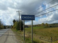
Innisfil is the town in Ontario.  Innisfail is its namesake out in Alberta.  I’m going to get that out of the way and try my best not to make any typos and avoid any negative emails.  For this site, typing Innisfail would be an epic fail.

Highway 11 Ontairo, Innisfil, highway11.ca

For years, David Wilcox was never invited to play my hometown’s summer festival because the organizers thought that his crowd (baby boomer dads?) was “too rowdy”

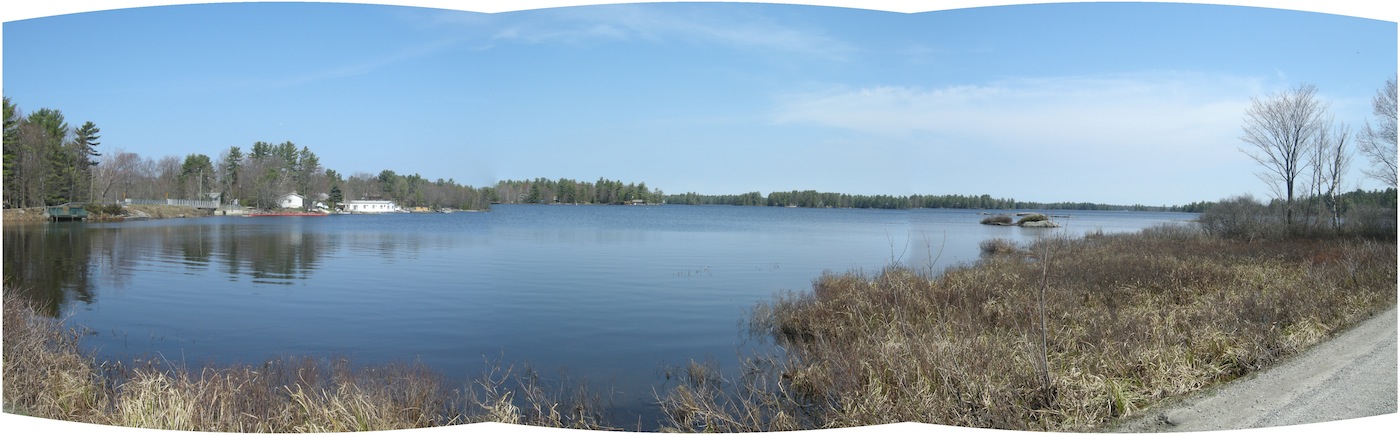
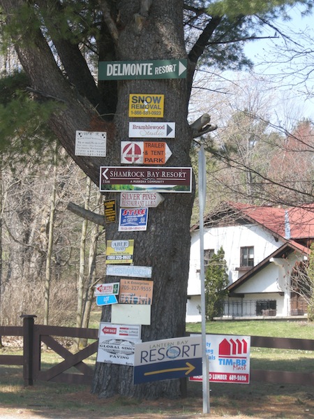
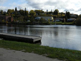
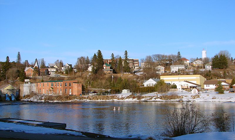
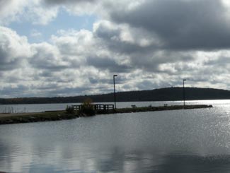
Innisfil is pretty well-known throughout southern and central Ontario for its beach on Lake Simcoe and its outlet malls on Highway 400 near Cookstown.   After driving down Highway 11 south of Barrie, however, I gotta say that I’m a little confused.

I knew that, administratively, Innisfil encompassed a collection of villages and hamlets south of Barrie and along the western shore of Lake Simcoe.  But, I always thought that there was a specific settlement named Innisfil on Yonge Street / Highway 11.  That may be the case, but it wasn’t apparent during my recent trip on Highway 11.  My map reads: St. Paul’s, Stroud, Barclay, Churchill, Fennell, Coulson’s Hill, and then Bradford.  No Innisfil in sight, other than in block letters over the region.

Innisfil has changed a lot since its first settlement in the late 1800s.  After more than a half-century as a farming region, Innisfil has slowly become more commuter-focused.  At one time, almost every house on Lake Simcoe was a recreational property.  Today, more than 90 percent are year-round permanent residences.

Though the Ontario Stock Yards moved here from Toronto in 1993, Innisfil has gradually become less agricultural.  It lost land to Barrie in 1967, 1982, 1993, and 2010 despite pressure to facilitate development for commuter residents bound for Barrie or Toronto.  Book-ended by Barrie’s 135 000 people and Newmarket’s 80 000, Innisfil’s 32 000 (spread over over seven or eight communities) are facing the squeeze of urbanization.  Contrast this to the depopulation problems faced by communities an hour or two further north and you’ll have a good sense of how Ontario’s diversity can be a challenge in creating political and societal consensus province-wide.

Innisfil, Ontario on Highway 11 farming highway11.ca

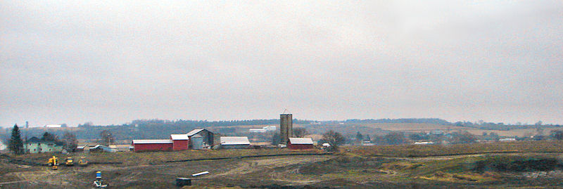
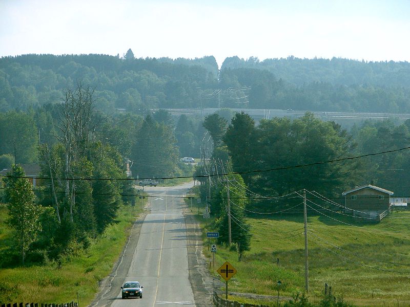
Farms outside Innisfil, Ontario on Highway 11 (Credit: User P199 at Wiki Commons.)

I don’t often advocate leaving Highway 11 for 400-series highways, but in the case of Innisfil you have my blessing.  Not only if you’re going to the beach, but also if you’re looking for antiques.  The Roadshow 400 Antique Mall is located right on Highway 400.  And it is really fantastic, open during the week and weekends, with some of the best selection of antiques available day-in-day-out in Ontario.  (It gives Southworks in Cambridge a run for its money.)  And the yellow-and-black chip truck in the parking lot has a pretty decent poutine.

Antiques in Innisfil, highway11.ca Ontario

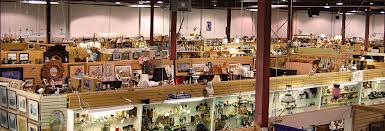
Don’t get distracted by the neighbouring flea market, focus on the antique mall at the east end of the complex.

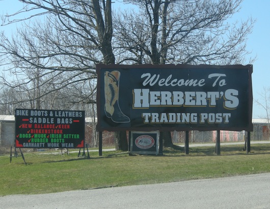
The other reason to head off Highway 11 in Innisfil is Herbert’s Western Boots and Western Wear.  One of two cowboy boots stores on Highway 11, Herbert’s has the best selection in western boots in the area, and I can attest that staff are helpful and low-pressure – willing to help you for hours if need-be, even if you can’t find the pair for you.  (Keleher’s Western Boots and Tack, also in Cambridge, has a slightly larger selection.)

Innisfil, Ontario, Cowbow Boots Herbert's Western Wear, Highway11.ca

Uhh, yup we’re not in Toronto anymore.

Orillia

Orillia is an interesting town.

A bit of a mix of blue-collar rural town-dwellers, working-class provincial employees, and left-leaning urban-escapee folkies, Orillia is a strange brew – the kind of place where you’ll see a lineup at both the spelt-flour bread stall and the Dairy Queen.  Imagine Guelph without the university.Orillia, Ontario Highway 11My first substantial visit to Orillia came in March. And I must say, even in the drab, dreary days that aren’t quite winter but aren’t quite spring, I was pretty impressed.

Orillia has enacted by-laws to try to keep its downtown quaint and small-towny. And they’ve succeeded.  Downtown Orillia is pretty cute.

There are many independent and specialty stores. We visited a specialty kid clothier. A store that sold upscale pet accessories. Apple Annie’s bakery and breakfast that sold french desserts alongside pancakes and waffles. Hudson’s kitchen store that sold everything from fancy La Creuset enameled cookware to cat-themed soap dishes, where I finally found myself a plastic thing to help scoop chopped and diced vegetables. The main street was pretty full, for a good three blocks. I can only imagine that it is cuter, busier, and even nicer in the summer.

Downtown Orillia, Highway 11

Downtown Orillia is cuter when it’s not winter and when I’m not the photographer

Home of the Ontario Provincial Police, Orillia is a town of 32 000 people about 45 minutes north of Barrie on Highway 11.  One hundred and thirty five kilometres north of Toronto, Orillia has waterfront on both Lakes Couchiching and Simcoe.  Home to the Stephen Leacock Museum, the Orillia Opera House, and the Orillia Museum of Art and History, Orillia also has a nice waterfront park with a boat launch, walking trails, and a boardwalk.

Orillia was founded in 1867 and has been home to eminent Canadians such as author Stephen Leacock and musician Gordon Lightfoot.  It was the first North American municipality to adopt daylight saving time.  Today Orillia is a retirement and casino community, as nearby Casino Rama draws both gamblers and seniors.  It has almost 20 doughnut shops.  ___Insert OPP police joke here___

The Orillia Opera House is a pretty impressive building. With two turrets, it stands out in downtown Orillia, and is pretty much unmissable. The Orillia Opera House hosts plays, concerts, and even comedy. In the back, the Opera House hosts a farmer’s market every Saturday morning, that runs through winter (we bought some jam.) The morning we were there, there were about five older men and women standing outside the opera house, protesting against war. For no particular reason, as far as I could tell, except that it seemed like something they probably did every Saturday morning since they moved there in the 1960s. Wrapped in wollen blankets, ready with pamphlets, rainbow flags, and thermoses, these grown-old hippies showed pure dedication, even if they were small in numbers.

Opera House, Orillia, Ontario

Every Saturday Orillia’s Opera House hosts a farmer’s market and a protest for peace

Orillia is well known for the Mariposa Folk Festival and less well known for its annual perch fishing derby. There is also a store across from the Opera House that sells bongs, and only bongs. I know that Orillia has the leftover hippie element from its folk music days, but a store specializing in selling technicolour, skull-and-crossbones, flaming ninja bongs? The woman in the store was nice enough to let me take a photo. And this is only one half of the store.

Other than Opera, hippies, folk music and maybe the bong store, Orillia is also known for is Weber’s Hamburgers.  This place is so popular that it built its own pedestrian overpass over Highway 11.  Sometimes the lineup stretches over Highway 11.  This is a popular stopping spot for people on their way to cottage country.  I’ve heard of many people who swear by their burgers but with a big lineup and a Harvey’s in Orillia, I’ve never stopped.

Highway 11 overpass, pedestrian, Orillia, webers

Pedestrian overpass on Highway 11 built to serve customers of Weber’s Hamburgers, near Orillia, Ontario

Best bong store ever, Orillia, Highway 11 Ontario

I’m guessing this bong store serves the folk music crowd more than the opera crowd in Orillia, Ontario.  They told me that people come from as far as Huntsville and that I wasn’t the first to ask to take a photo.

Kahshe Lake / Severn Bridge

MK-05-KahsheLake-SignKashshe Lake is a small cottage community a bit to the east of Highway 11 south of Muskoka Falls about 25 minutes north of Orillia.

Kahshe Lake began as a series of logging camps in the 1860s.  A guy named James Grant soon built a sawmill near the lake and others followed, eventually building a hotel and a general store.  However James Grant died and the rest fell into disrepair.  Kahshe Lake was then abandoned and eventually become a cottage community.

There two ideas of what “Kahshe” means.  Some think it came from an Aboriginal word Kah-she-she-bog-a-mog, which, according to one source, means Lake of Many Ducks and Birds.

This is cooler in person - a solar-heated seedling-starting operation in Kahshe Lake, on Highway 11

This is cooler in person – a solar-heated seedling-starting operation in Kahshe Lake, on Highway 11

Others think that Kahshe means healings waters.  The lake itself is “Tea Coloured”, due to a high level of dissolved organics and is said to have healing properties.

Kahshe Lake Barrens Conservation Reserve is home to numerous provincially and nationally rare plant and animal species. It is ecologically significant because of its large size and lack of habitat fragmentation.

I’ve always just passed it by when driving Highway 11 but one spring I took a mid-day drive up to explore.

Who buys these things?  I'm talking about the bear statues for sale along Highway 11, not the family plots at the Symington cemetery in Kahshe Lake

Who buys these things? I’m talking about the bear statues for sale along Highway 11, not the family plots at the Symington cemetery in Kahshe Lake

There wasn’t much beyond the usual-yet-random highway-facing stores of a cottage country thoroughfare, like an RV dealer, an inflatables repair service, and a store that sells Muskoka chairs and carved wooden bears.  Most notable was the Symington Township pioneer cemetery and the really cool solar nursery setup that one of the local greenhouses has on the east side of Highway 11.

North Kahshe Lake road passes through some year-round houses, ending at a small private marina.  South Kahshe Lake road leads to a small cottage community whose main road peters out into a single-lane gravel path adorned with beware of flood signs.  I didn’t go past that point, though I did stop to enjoy the absolute silence – bullfrogs, bulrushes, leaves, the wind – just five minutes from a bustling, 120-kilometre per hour highway.

Kahshe Lake, at the end of South Kahshe Lake Road, just east of Highway 11 / Yonge Street

Kahshe Lake, at the end of South Kahshe Lake Road, just east of Highway 11 / Yonge Street

Severn Bridge

Severn Bridge, Ontario on Highway 11 / Yonge Street - the town sign, the community hall and the church

Severn Bridge, Ontario on Highway 11 / Yonge Street – the town sign, the community hall and the church

Severn Bridge was named after the Severn River, which divides England and Wales and is criss-crossed by many bridges.  It is on the Severn-Trent Waterway that connects the Trent River to Georgian Bay via the Severn.

Severn Bridge was founded in the mid 1800s as a logging camp.  From there it developed: the post office came in 1861, the railway in the 1870s, and Highway 11 in 1927.  Today it is a town of about 300 half way between Orillia and Gravenhurst.  There is a small hydroelectric dam and otherwise it’s all about cottage country tourism.  And bird breeding.

Severn Bridge - still a southern Ontario town with the agricultural society and permanent fairgrounds

Severn Bridge – still a southern Ontario town with the agricultural society and permanent fairgrounds

Cute but tiny Severn Bridge is one of the first highway-side towns you north of the Lake Simcoe strip of Highway 11 just outside of Orillia.  Severn Bridge straddles Highway 11, with the Rowing Club and the boat dock and the Shamrock Bay Marina east of the highway and the town proper, including a local potter, an independent gas station, two auto repair shops, an old community centre, a really nice elementary school, and an agricultural society on the east side.

Close by there is the Muskoka Wildlife Centre which offers education programs for kids.  Severn Bridge has two bed and breakfasts (Sparrow’s Nest and Severn Shores) and hosts an annual fall fair at the agricultural society grounds.

I can only wonder how many times this street sign has been stolen

I can only wonder how many times this street sign has been stolen from just outside Severn Bridge

Severn Bridge boat launch on the Severn River, right by the rowing club.  If I recall correctly, the dock is not public

Severn Bridge boat launch on the Severn River, right by the rowing club. If I recall correctly, the dock is not public

Severn Bridge's tree of signs

Severn Bridge’s tree of signs

Bracebridge

I never actually meant to visit Bracebridge.

I was heading for Muskoka Falls when I had my head turned by a highway sign advertising a McDonald’s, a Harvey’s and a Subway just a couple of kilometres from my intended destination.  I didn’t need food – I had a sandwich packed from home.  I didn’t need coffee – I’d already had one extra large one-cream-two-sugar and one small one-cream-two-sugar from Tim Horton’s.  I didn’t need anything sweet – I was saving that treat for a milkshake somewhere along the way back.

But I really had to pee.

Bracebridge, Ontario, off Highway 11 highway11.ca

Bracebridge, Ontario and North Falls, off Highway 11 (Credit: User P199 from Wiki Commons.)

So instead of turning right to Muskoka Falls I turned left, following the instructions of the sign.  I’m sure it really didn’t take as long as it felt, but when you have to pee as bad as that kid in the Robert Munsch book, one minute feels like 10.

I followed a winding road through old farm land, a short bit of bush, past a cement plant, past a conveyor belt factory.  I don’t know what I might have missed or where I missed it, but I never saw another sign for any of those fast food joints.  I passed dinosaur, and a strangely placed totem pole and statue of a nurse, until I was faced by Marty’s World Famous restaurant, an ice cream parlour, and a couple of stores that sold cottagey stuff.

Somehow I had ended up on Manitoba Street.  I was smack-dab in the cutesy cottage country downtown of Bracebridge.

Bracebridge is a town of 13 000 right smack dab in the middle of cottage country.  It is one of the three main towns of Muskoka, the other two being Gravenhurst and Huntsville.  It is not directly on Highway 11 – just a smidge west of it.

Downtown Bracebridge, Ontario, just west of Highway 11 / Yonge Street

Downtown Bracebridge, Ontario, just west of Highway 11 / Yonge Street

Named after the book Bracebridge Hall by Washington Irving.  I believe the local postmaster was reading it at the time the town was to be named.  Gravenhurst also had the same postmaster, and was also named after something in the same book.  Bracebridge is exactly halfway between the equator and the North Pole.

Bracebridge was founded on the backs of a number of different industries, including furs, agriculture, brewing, logging, milling, and hydroelectricity.  In fact, Bracebridge was the first town in Ontario to have its own hydroelectric generation due to North Falls (see the falls tour).  There is still some hydro generation, and there is still a brewery too.

Today Bracebridge, being in the heart of the Muskokas, is all about tourism – as evidenced by another random dinosaur, a distinctly aubergine-painted bike shop and a store advertising the largest selection of Muskoka tshirts in the country (I knew that Muskoka had appropriated the Adirondack chair, but I didn’t know Muskoka it had laid claim to its own style of clothing.)

SANTA! I KNOW HIM! HE LIVES IN BRACEBRIDGE

Oh man I wanted to go here so bad when I was a ten five year old

Being a tourist town, Bracebridge is relatively full of places to eat, drink, and sleep and have fun.  You’ll have no problem finding accommodation.  I mean, book ahead of course (especially during the summer!) and don’t just show up expecting to find something.  But you don’t need me to tell you where to go in cottage country because places abound.

The main tourist attraction in Bracebridde, aside from cottages, is Santa’s Village.  I have a friend who is 37 years old and he can’t stop telling me how magical it is.  Whatever.  Maybe because it is relatively cheap.  He also likes that it’s in off the highway and in the bush.  It’s low key and kid oriented, but supposedly inexpensive and not too touristy.  And it’s full of men with bad beards, if you’re into that kinda thing.

Bracebridge is home to Woodchester Villa, one of the finest octagonal houses in Canada.  As well, Guha’s Lions and Tigers is a little lion and tiger zoo in Bracebridge and is another one for the kids to see.  There is also golf, boating, art, parks, cottaging, camping, snowmobiling, a water park, a movie theatre, a little film festival put on by the highschool, and the Festival of the Falls which celebrates the 22 waterfalls within Bracebridge’s fairly expansive town limits (one of them is even referred to as the north’s Niagara Falls – someone should tell that to Kakabeka.)   I arrived in town about a month after the floods of 2013 – which shut down Highway 11 in a few spots – and the waterfalls were still running high.

Bracebridge has all of the hallmarks of rural/northern Ontario touristiness - the tacky shops, the hokey Canadiana, and big weird random big things for the kids.

Bracebridge has all of the hallmarks of rural/northern Ontario touristiness – the tacky shops, the hokey Canadiana, and big weird random big things for the kids.

This was kinda neat - a statue commemorating a local midwife whose naturopathic discoveries, based on knowledge from local First Nations

This was kinda neat – a statue commemorating a local midwife for her naturopathic remedies based on knowledge from local First Nations

On my last visit, volunteers were repainting Bracebridge's old hydro station - it's going to be a town museum.

On my last visit, volunteers were repainting Bracebridge’s old hydro station – it’s going to be a town museum.

This tree location makes no sense.  Come on Bracebridge!

This tree location makes no sense. Come on Bracebridge!  Way to ruin a great photo spot.

So this Ontario Public Health sign was up in the washroom of the visitor's centre, where I parked in Bracebridge.  And I got to reading it.  Does anyone truly wash their hands for a full 15 seconds?  This was news to me.  So I followed their advice - and re-washed my hands whilst humming "Row, Row, Row Your Boat" aloud to myself...only to be interrupted by a knock at the washroom door - the staff attendant had heard me humming, and wanted to check on me to see if I was alright.

So this Ontario Public Health sign was up in the washroom of the visitor’s centre, where I parked in Bracebridge. And I got to reading it. Does anyone truly wash their hands for a full 15 seconds? This was news to me. So I followed their advice – and proceeded to thoroughly wash my hands … only to be interrupted by a knock on the washroom door.  The staff attendant wanted to check on me to see if I was alright – apparently I had been mindlessly singing “Row Row Row Your Boat” just a little too loudly.

Port Sydney / Utterson

MK-09-PortSydney-Sign2Sometimes I think I’m really bad at being away from home.  Despite having a travel blog, I’m actually not much of a traveller.  But despite being not much of a traveller, the number of opportunities I’ve squandered while being out of town are embarrassing.

  • I once turned down the chance to hike a mountain in Grand Teton National Park because I was too lazy to pack a lunch.
  • I could have come into some incredibly fine handmade Cree moose-hide gloves, complete with beadwork, but I was worried about landing in Timmins without any cash.  (What if the bank machine is out?)
  • I once passed on a hands-on biologist’s tour of state-of-the-art cattle grazing practices, based on the traditional grazing practices of buffalo, in Montana because I was sore from an hour’s horse ride.
  • I caused my wife to miss the biggest antiques festival in Ohio only to find out that Cleveland puts the “Little” in “Little Italy.
  • I missed out on what will probably be a once-in-a-lifetime the chance to visit my grandmother’s original hometown near Budapest because I was too worried about whether the cabbies in Hungary would know enough English to get me from the airport to the city, so I opted to go to more English-speaking Sweden instead.
  • I bailed early from a hell-raising American Legion singles party in Massachusetts because, well, ok it wasn’t just me – me and my friends we were young, from Canada, and all got a little nervous at the potential prospect of being further hit on by some really strange people.
  • I didn’t get to visit the Idaho Potato Museum because I was hell-bent on getting a milkshake from a Salt Lake City fast food place I’d seen on TV.  It turned out it was closed on Sundays.

OK, so maybe that last one wasn’t the biggest missed opportunity in the world.  But anyway, you’d never expect it, but Port Sydney is also one of these times.

Port Sydney is a small little town about 20 minutes south of Huntsville.  It isn’t on Highway 11, but I’ve included it because it’s close, and I once got lost looking for the Huntsville Swiss Chalet and ended up in Port Sydney instead.

Yeah. I got really really lost.

I’d promised my companion one restaurant meal in exchange for her agreeing to spend a valuable long-weekend day-hiking the Opeongo Trail.  And I’d been to the Swiss Chalet once before – seeking refuge from a bad biology trip in university with some other non-nature-inclined suburban students.  So I figured I knew where it was: one exit south of Huntsville of Highway 11.

Not so.  And after two hours of driving backroad after backroad, u-turn and u-turn, detour after flailing detour, I ended up on a tidy road that hugged a small lake.

People were everywhere.  The street was packed.  Boats were on the water, kids in it.   Kids were lining up for games.  Parents were milling about in sandals holding ice cream, sausages, roast corn, beer.  We were in the middle of nowhere and people were everywhere.  I’m pretty sure there were fireworks planned off in the distance.

Someone was motioning me to pull over. “You can park up the hill a bit” he mentioned when I lowered my window.  He was surprised to see me inch on through.  “Got plans tonight then?” he said, or something to that effect.  He waved for me to move up into the parking but I just kept going forward, slowly, saying nothing.  Eventually he cleared a path of kids and I continued on my way.

It was Port Sydney’s annual festival.  Too nervous to be found out as a non-cottager, I passed it up to go to Swiss Chalet instead.

The Port Sydney area has been settled since 1861.  Albert Sydney Smith founded the town ten years later when he took over an abandoned mill and a dam.  A plan for the village was created and it grew with the logging industry, until the railroad decided to bypass the town for Utterson.  Logging then dwindled in importance and the tourist trade took over.

Port Sydney is really quite cute and is situated on a nice bit of waterfront along Mary Lake.  There is a dam nearby, rapids, and the beach in town is the largest in the Muskoka area.  There are bed and breakfasts and lodges in and around Port Sydney.

Port Sydney also had the oldest church in Muskoka until it was recently destroyed by arson.  A new church has been built in its place and there is a plaque commemorating the old one.

Port Sydney, Highway 11, Ontario

Lake and islands near Port Sydney, Ontario, just off Highway 11

At the junction of highway 141 and old Muskoka Road, Utterson is just west of Highway 11 and not far from either Port Sydney or Huntsville.  Utterson was a stop on the old Canadian National Railway, and pretty much made nearby Port Sydney switch from lumber to tourism after the railway passed it by.

Utterson has a golf club, Muskoka Motion Boat Rentals, at least three bed and breakfasts (Secluded Trails, Streeter’s Landing, and Accents of Muskoka), Wilson’s Lodge, Sandwood trailer park, and a bunch of others places in the area to stay.  Mile Lake is nearby and there is a lot of fishing and camping in the area.  I’ve only passed through Utterson, so I don’t have too much to say about it.  If you know of it, have any photos, or have anything at all to add please email me:  info (at) highway11 (dot) ca

Port Sydney, Ontario muskoka

Dock at Port Sydney

Huntsville

I’ve been to Huntsville at least four times, if not five.  Yet nothing really rings a bell.

I’m trying to think of what I’ve done in Huntsville, other than eat and get ready for Algonquin Provincial Park.  (Not that I have much to get ready for, being a day tripper and all.  I’ve certainly never ventured off the beaten path.  I doubt I’ve been more than a few miles from the highway.)

I once bought a flask though at the Northern General Store on the main drag right across from the Pita Pit.  Another time I had an extra pickles veggie pita too.  I once used a pita from the same Pita Pit to convince the local Beer Store (or was it LCBO?) to stay open an extra five minutes.  I’ve been to the bank in Huntsville. I got super ridiculously lost trying to find the Swiss Chalet in Huntsville.  But…most of my memories are of Algonquin.  I think that pretty much sums up my activities in Huntsville.

Hunstville from above, highway11.ca Ontario

Huntsville from a lookout. (Credit: User P199 at Wiki Commons.)

Huntsville is the last real town on Highway 11 before North Bay and is also the last major centre in Muskoka cottage country. Huntsville is an important cottage and camping area, boosted by two fancy resorts, close access to Arrowhead and Oxtongue Lake Provincial Parks, and the busiest access point to Algonquin Provincial Park.

Huntsville is pretty cute.  There’s a nice little winding downtown (that reminds me a bit of Kirkland Lake, but nicer) that skirts around the lake, and the town is very much cottage country magnet full of stores and services both useful and tacky.

Tom Thomson Statue, Huntsville, Highway 11

Statue of Tom Thomson, group of seven founder (though he was never a member)

Huntsville hosts an annual arts festival.  The town is home the Muskoka Museum, an art gallery, and the new Algonquin Arts Theatre which produces plays during cottage season.  There is also an annual book reading festival, the Firefly Festival in July, and a summer car show.

Founded in 1869 as an agricultural post, Huntsville today is a town of 18 000 focused on tourism, cottaging, and a bit of manufacturing.  Algonquin Provincial Park is about 60 kilometres east and that means that there are numerous lodges, inns, motels, and outfitters in and outside of the city.

The Wolf Den Bunkhouse, about 30 minutes east in Dwight, is a great little hostel with cottages as well as single rooms in a neat log house.  In addition to a Pita Pit, Huntsville has a Harvey’s, an East Side Mario’s, a Swiss Chalet, and a movie theatre.

Huntsville also has two top notch resorts – Hidden Valley and Deerhurst, the latter being where Shania Twain got her start.  There is train (not twain) and bus access from the ONTC, and Huntsville is the proud owner of a one-route municipal bus system.

HUnstville's town hall slash theatre, highway 11

HUntsville’s new town hall and the Algonquin Theatre, which hosts a comedy festival during cottage season (Credit: User P199 at Wiki Commons.)

Motels, Highway 11, Huntsville

Highway 11 is littered with B-list motels near Huntsville that look empty and forlorn in the off-season.  But in tourist season, they sure fill-up.

Untsville, highway 11, deerhurst resort

Deerhurst Resort.  Obviously not my photo.

Shania Twain played in Huntsville before she was a superstar

Sure Huntsville.  You can try to steal her from Timmins but you will never succeed

Katrine / Emsdale

Katrine is one of a few tiny hamlets south of Burk’s Falls.

Katrine, Ontario, highway 11

Katrine Winter Carnival

Katrine is bordered on one side by Highway 11 and on the other by Doe Lake.  Katrine holds a number of little festivals during the year, including Summerfest, Octoberfest (I’m not sure if it’s a fall fair or a beer fair), and the Katrine Winterfest Karnival.  Doe View Cottages offers lodging.

There is a nine-hole golf course on the Magnetawan river just outside of Katrine.  The area also offers fishing, camping, and swimming at the Doe Lake beach.

Emsdale, Ontario, Highway 11South of Katrine is Emsdale, a little cluster of houses just a bit off Highway 11 north of Huntsville.

The main attraction in Emsdale is Brooks (not Burk’s) Falls, which has a park, a picnic area, and some hiking trails.  Clear Lake, which is just south of the community, has a public beach and a number of nice housekeeping cottage rentals.  There is a flower farm nearby which specializes in lilies.  Emsdale also has the Perry Old Timer Museum just outside of town.

Booker’s Clear Lake Cottages and Penbrook Resort offer some backroads accommodation near Emsdale.  I’ve read that there is a historical cemetery in town.  Potential activities include ice fishing, cross country skiing, canoeing, bass and trout fishing, and the Seguin Park to Park trail.

There is a gas station just outside of town on the highway. In Emsdale, there is Two Jacks Pizza, although on my drive through I couldn’t tell if it was still open.

Feel free to send me an email or post a comment below if you have anything to add.

Emsdale, ontario, Highway 11

Yes, I took a photo of a garage in Emsdale. No, I don’t not know why.

Highway 11 in Ontario, near Emsdale highway11.ca

Hills near Emsdale, Ontario, just off Highway 11. (Photo: User P199 at Wiki Commons.)

Burk’s Falls

Burk's Falls, Highway 11Burk’s Falls is a nice village of about 1000 on Highway 11 between Huntsville and North Bay.  It was first settled by loggers in the 1860s.  Eventually the village was built on the banks of the Magnetawan river in 1890.  Burk’s Falls is pretty small and pretty quiet.  They host an annual fall fair on Labour Day weekend, which pretty much coincides with all the other local fall fairs as well.  (You’d think someone would stagger these on the schedule.)  The village hosts Towne Theatre during the summer and there is also Winterfest held during the second week of January.

Burk’s Falls has heritage river walk, a little art gallery, and a pioneer museum which is housed in an 1893 one-room schoolhouse.  There is also Stan Darling Park on the Magnetawan River.  And according to one website, you should visit the post office to start your visit, because “the girls there are quite wonderful.”  (Don’t ask.  I have no idea.  The best I can say is that sometimes when you’re scouring google for info on a relatively small place the comments get a bit more interesting than your usual big-city reviews or complaints.)

Burk's Falls bridge, Highway 11

Bridge in Burk’s Falls over the Magnetawan River

Awsome, Arm wrestling champ, Burk's Falls

Burk’s Falls is home to a former Arm Wrestling Champ of the World.  This is awesome.

The bridge over the Magnetawan River at the dam is nice and provides for some nice views of the river and the town. Burk’s Falls also has a boat launch, and a little tourist info centre that serves cappuccino.

In town there’s a Royal Bank, a credit union, a bowling alley, a Tim-BR Mart, a curling rink, and an LCBO. Be warned though, that this LCBO stocks beer almost exclusively in two-fours, and almost exclusively in run-of-the-mill brands like Wildcat, Carling, and Molson’s Ex. I went in looking for six-pack of middle-of-the-road quality, and there was nothing. Not even Lakeport. The only sixes they had were Heineken. Everything else was a huge case, and not-so-great.  Local industry in Burk’s Falls includes a window factory and a muffler plant.

Burk’s Falls was very small, so I felt a bit conspicuous taking photos of the town’s main street. I managed to take a photo from across the river.  True to form, it is a terrible photo so it is followed by one from User P199 at Wikimedia Commons.

Burk's Falls, Highway 11

My photo:  View of Burk’s Falls, Ontario from across the water

Burk's Falls, Ontario, Highway 11

I spent about ten minutes trying to get a decent photo of Burk’s Falls.  I bet this photo took P199 of Wiki Commons all of five seconds to take.

Hydro Dam, Burks Falls

Hydro Dam on the Magnetawan River in Burk’s Falls

Burk's Falls

Magnetawan River in Burk’s Falls, near the picnic area in town.

Burk's Falls post office off highway 11

Sundridge

“Sunny Sundridge village by the lake, only two and a half hours from Toronto.”  Yeah right!  Lake – yes, sun – maybe (it rained the first two times I visited, and was cloudy on the third).  But two and a half hours north of Toronto?  Maybe at 3 AM doing 140 the whole way and not seeing a truck the whole time. Or maybe I just drive too slowly…

Highway 11 near Sundridge, Ontario

(Photo: user P199 at Wiki Commons.)

Sundridge is a village of about 1000 people strewn along the east side of Highway 11.  Established in 1889 on the shores of Lake Bernard, Sundridge is a former lumber and rail town that now finds itself as pretty much the northernmost extent of southern Ontario cottage country.  One my highschool teachers left their job for a high school in Sundridge, apparently for the solitude and seclusion.  Let me tell you, if you’re looking for quiet and minimal company this is the right place.  Sundridge is small and, for a southern Ontario town, situated pretty far north.

Sundridge is kinda funny because it’s a name no-one really wanted.  Originally the town was supposed to be named Sunny Ridge, but when they applied for the name in the late 1800’s Canada Post made a mistake and registered it as Sundridge.  As long as the mail came it really didn’t matter, so it stuck.

Sundridge Lake Front park, highway 11

This photo is so bad I’m almost proud of it

The Sundridge that most travellers see is a relatively nondescript rail crossing on the highway with some truckstops and a factory or two on Highway 11.  However if you turn into town you’ll find that although tiny, Sundridge isn’t half bad.  There is a nice little waterfront park with a playground and a little beach on Lake Bernard.  There is a “resort hotel”, a few car dealerships, a grocery store, a LCBO, and a Legion, along with a few other stores like Home Hardware. There is Ten Gables Golf Course, fishing charters, and snowmobiling, icefishing, and sugar shacks in the winter.  Sundridge also hosts an Agricultural Fair in the fall.

Sundridge made national news in August 2008 when the employees of the local Ford dealer won half of Canada’s second-largest lottery jackpot ever. Twenty-five people split 22.5$ million. The owner said that he didn’t expect to lose anyone to retirement right away…they must be a really dedicated lot.

Being in cottage country means that Sundridge has a few more amenities than its neighbours to the north.  There are five bed and breakfasts (Lakeview, Maple Sugar, Mitchell’s, Belrose, and Entwood Forest,) the Relax Shack Retreat, Allenby Cottages, a trailer camp, and a few motels.

For food there is Danny’s Justa Pasta a bit south of town, Double Decker burgers, Ha’s Chinese, a deli, a café, and the Stieirhut Schnitzel Haus (which I’ve always wanted to try, but never have – I love schnitzel).  I had a good breakfast at Jim and Elsie’s Café. In town I also bought the most stale, overpriced croissant ever – I didn’t know that the price of croissants was indexed to the price of gas to rise as you go up the highway.

Sundridge ATV parking, Highway 11

ATVs parked right beside cars like it’s normal? You know northern Ontario is beckoning…!

Sundridge waterfront - way nicer than this photo

Sundridge waterfront – way nicer than this photo

South River

The flamboyantly-named South River is a town of about 1100 people just 45 minutes south of North Bay.

I have to admit, my acquaintance with South River has always been brief.  I don’t usually stop in South River – if I’m still up for a coffee I usually get it in Sundridge, and bomb it the rest of the way to Orillia (if I’m headed south) or to North Bay (if I’m going north.)

South River is really a village with a bit of an outdoorsy bent due to its proximity to Algonquin.  For those not fond of Mother Nature there is an annual arts festival and the South River Black Fly Festival that tries to put a super spin on a super pest, or at least showcase the area’s most famous local invention – the Black Fly Suit.

South River, Highway 11 Ontario highway11.ca

The main drag in South River, Ontario, just off Highway 11 (Photo: User P199 at Wiki Commons.)

South River history has some interesting aspects.  South River was founded in the 1860s when Fraser Lumber started logging nearby Algonquin Provincial Park.  Hotels sprouted up in 1881, hydroelectricity twenty years later, and in 1907 the town was officially formed.  South River was home to the Standard Chemical Company, which made wood alcohol and other forest-derived products.  In 1934, Italian and Finnish workers led a massive strike.  German prisoners of war were held in South River in the 1940s, with the more radical ones sent further up Highway 11 to Monteith.  South River also sold the Shay locomotive to Abitibi Consolidated for use further north. The Shay now sits in Iroquois Falls.  It is now home to the Bear Chair Company.

South River is important due to its paddler’s entrance to Algonquin Provincial Park.  South River is the second busiest park access after Highway 60 east of Huntsville.  There are camping, hiking, canoeing, and fishing opportunities in South River due to its proximity to Algonquin and Mikisew Provincial Parks.

There is a local farmer’s market in the summer and some small art studios with pottery and glassware.  There is also a train station, an arena with year-round ice, a curling club, tennis courts, a baseball field, library, daycare, Legion, and two retirement complexes.  And a beer store and an LCBO.

South River is home to the Hockey Opportunity Camp, Swift Canoes and Kayaks, and, as I’ve been told via email more than once, it is also home to “Mr. Meat”, which is supposedly a pretty good grocery store that sells a variety of high quality, ultra-fresh meats.