Tilden Lake / Cooks Mills

I first heard of Tilden Lake when my local Rotary Club donated a firetruck to the community.  About six hours north of my hometown, the community is about 40 kilometres north of North Bay in Temagami cottage country.Tilden Lake, highway 11 ontario

Tilden Lake is a community of about 400, which swells in the summer as the cottage population increases.  It offers cottage, camping, boating, and outfitting opportunities.  There is a beautiful cottage for sale near Tilden Lake that comes up every time I do a google search for the community.  It is gorgeous.

Tilden Lake has an old MNR fire tower that is no longer maintained, so don’t climb it.

HIghway11.ca Tilden Lake north of North Bay, Ontario on highway 11

(Credit: User P199 at Wiki Commons)

Cooks Mills is just south of Tilden Lake – the first dot on my map on Highway 11 after North Bay.

After wondering for about 45 minutes when we were going to hit Cooks Mills, and wondering just how long this drive really was, we came upon Tilden Lake.

Highland Trail

Ottawa-Temiskaming Highland Trail, near Latchford, OntarioThe Ottawa-Temiskaming Highland Trail is not a town, but a network of backwoods trails leading from Ottawa up through to Haileybury.

The trail, maintained by the Nastagwan Trails non-profit passes through Latchford, specifically through the Cliff Lake Reserve southeast of Latchford, accessible by Roosevelt Road.

Friday Lake, on the Ottawa-Temiskaming Highland Trail

Friday Lake, on the Ottawa-Temiskaming Highland Trail

The hiking we did on the trail was great – but difficult. The trail is marked, but not always cleared, which made for a challenging, but rewarding hike along lakes, through maple forest, and over rock outcroppings blanketed by lichens.

If you’re planning to hike through Cliff Lake on the Ottawa-Temiskaming Trail, come prepared with extra layers (it can be cold, especially in the fall), lots of water, a walking stick (if possible), really good hiking shoes that are waterproof, a map (which you can buy at the North Cobalt Flea Market), and lots and lots of water.

Ottawa Temiskaming Highland Trail, Highway 11

Forest floor close-up

Ottawa Temiskaming  Highland Trail, Highway 11

Not sure what this is, but it was neat

Ottawa Temiskaming Highland Trail, Highway 11

Fall colours on an early October hike

Ottawa-Temiskaming Highland Trail, Highway 11

Lots of lichen (lichens?) on the trail

 Ottawa-Temiskamind Highland Trail, Highway 11

Abandoned Cliff Lake hunting and/or sugar shack

Cliff Lake, Ottawa-Temiskaming Highland Trail, Highway 11

Stream into Cliff Lake

Empty Highway

Highway 11 distance, Longlac

It’s feels like 399 km from Constance Lake to Longlac

The 200 kilometres between Constance Lake and Longlac is one of the most annoying drives I have faced.

Not because the roads are bad, or the scenery stinks, or it’s a hard drive – not at all.  It’s not even really that long or that boring.  But there are two problems.

One —  there is almost nothing there.  And I really mean almost nothing.  I counted five houses between Hearst and Longlac.  Three of those were associated with wilderness businesses.  There were a few derelict truck stops and out-of-business motels which serve as reminders of past attempts at economic development and the larger retreat of business from northern Ontario.  There was a moose crossing roadsign that someone had defaced by adding an exuberant silhouette of moose genitalia (but there was a truck racing behind me so I couldn’t stop for a photo.)  There is literally nothing for 200 maybe 250 kilometres, and that’s weird when you’re from southern Ontario.  Get gas in either Hearst or Longlac, as may be only one stop on the way, if at all.Abandoned gas station, Highway 11

Two — the drive is a pain because signs keep reminding you every 20 kilometres that, in what seemed like at least an hour, you’ve actually only travelled 20 kilometres.  I don’t need to know that often that the drive is long, I know it already!  How about updating me every 50 kilometres, that’ll feel like progress.

There is however one nice rest station with running water, picnic tables, and washrooms (but no shops or gas.)  It’s at Klotz Lake where, if you really want a break, you can even go swimming.

Klotz Lake rest station, Highway 11

I am super awesome at photography, non?

Jellicoe (and Nezan and/or Nezah, and Tansleyville)

Jellicoe, Ontario, west of Geraldton on Highway 11 (Photo credit: Wiki Commons User P199)

Jellicoe, Ontario, west of Geraldton on Highway 11 (Photo credit: Wiki Commons User P199)

Depending on the map you’re using, one, two, or all of three of Nezan, Nezah, and Tansleyville exist as dots on the map west of Jellicoe.

Although they exist on my map, they didn’t exist on the road as I drove it – I saw one house that might be Tansleyville, while I found an intersection that might qualify as Nezan, or possibly Nezah.  And that’s it.

Jellicoe is the kind of place that makes the francophone hamlets like Mattice and Moonbeam on Highway 11 look big.  There are about a dozen houses and cottages in Jellicoe, many of which are on the shores of a small lake that had beautiful emerald-green water the day that I visited.  (Too bad it didn’t turn out in my photo.)

This photo doesn't show it, but the lake was serene and green (in a good way)

This photo doesn’t show it, but the lake was serene and green (in a good way)

The town is pretty small. It was really quiet the day I was there. The church was closed, there were some other buildings – some cottages, a few boarded up – and some old election signs up on a few trees. It was really really quiet.

As for services, there’s a hunting store and gas station, and that’s all I noticed on that day.  When going to Geraldton (50 kilometres away) is considered a trip to the city, you know you’re remote.

TB-04-Jellicoe-Church

Jellicoe also features Colimar Lodges and Chalets about five minutes west of town. I’ve only been through once so please fill in anything I missed below.

Lake Nipigon

My map indicated that there were three communities on Highway 11 between Geraldton and Nipigon – Rocky Bay, Macdiarmid, and Orient Bay.  This may or may not be true.

Rocky Bay is home to the Rocky Bay First Nation.  It is actually off Highway 11 and I didn’t venture in as time and gas were becoming an issue.  (Note to readers, fill up in Beardmore.)

The only thing I saw named Macdiarmid was a dirt road.

I couldn’t find Orient Bay either, although truth be told I was getting weary of driving on this particular trip and didn’t really give it a good look.  It might be the name of a lodge or an outfitters station, but I didn’t see it.

Beautiful cliffs of Lake Nipigon

Beautiful cliffs of Lake Nipigon

But what is great about this part of Highway 11 is the drive itself.  The scenery is absolutely fantastic.  Stunning cliffs are the result of geological processes that have left the Pijitawabik Palisades as some of the most awe-inspiring views on Highway 11 .  The highway is bordered by countless lakes which are nestled between beautiful rocky outcroppings that jut from the landscape like bumps on a log.

Weird bumpy rock formations follow Highway 11 in the Lake Nipigon area

Weird bumpy rock formations follow Highway 11 in the Lake Nipigon area

This drive is sincerely one of northern Ontario’s most scenic drives.  So if you’re already out this way, don’t rush through – it is worth stopping and enjoying.

Lake Nipigon marshes off highway 11 ontario highway11.ca

Lake Nipigon Wetlands with cliffs in the background. I love Ontario. (Credit: User P199 at Wiki Commons.)

Shebandowan / Shebaqua Corners

She-ban-do-wan, ooby do dooby do do She-ba-qua-qua

That’s not a real song.  I’ve just always thought that Shebandowan and Shebaqua Corners (well, minus the ‘Corners’) sounded like an improvised line from a minor Frankie Valli hit.

Highway 11 Lake Shebandowan

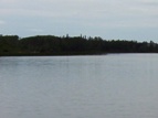
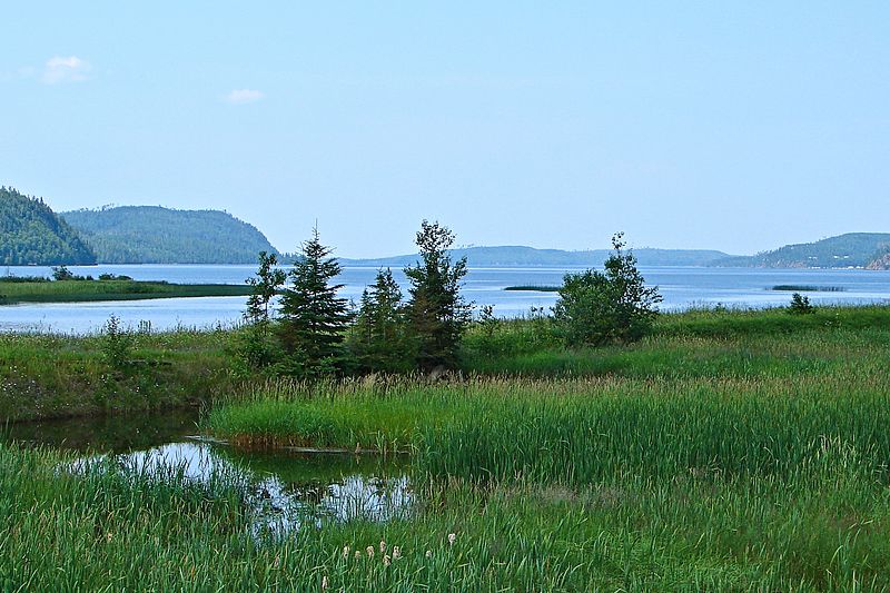
Lake Shebandowan at dusk (Photo credit: Linda)

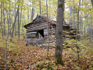
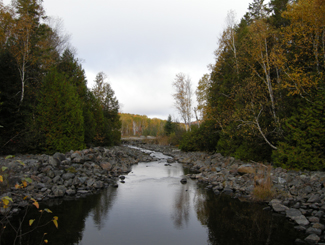
It’s kind of funny to think that even parts of Ontario as remote and in the wilderness as north-west Ontario have their own cottage countries.  Or, as they like to call them up here, “camps”.  Shebandowan is one such area – I guess if the hustle and bustle of Fort Frances or Rainy River is too much for you, you can escape here.

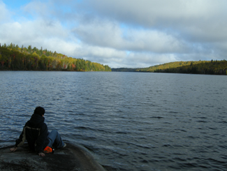
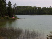
Seventy kilometres west of Thunder Bay, Shebandowan has access to three lakes (upper, middle, and lower) for swimming, boating, and fishing.  Inco used to run a mine on the south side of the lake.  There used to be a hotel in the area, but all that remains are some scattered stores.  I’m told that this area of north-western Ontario is beautiful.

Linda emailed me the photo above and to let me know that there is more going on than I’ve reported.  American visitors often frequent Beda’s Lodge. There is great pizza at the old Burstrom’s and the Shebandowan Pie Sale in August is the annual must go to event to see everyone, have a drink or two and go home with a fresh baked pie.

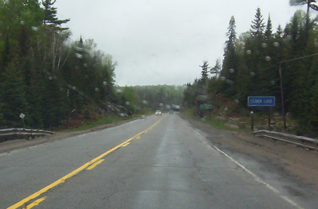
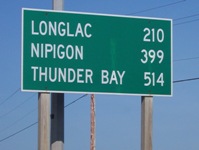
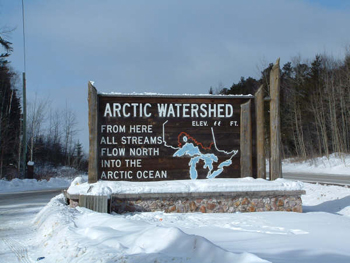
Shabaqua Corners is a small hamlet on Highway 11 west of Thunder Bay.  What’s kind of neat about Shebaqua Corners is that every single vehicle either coming or going by way of Manitobagoes through this spot as there is no other way to get through Northern Ontario from out west.

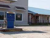
As in most truck-stop towns, Shabaqua Corners has a local diner, an LCBO, a gas station, and a store.  There used to be a hotel in town…Chris emailed to tell me that it is still open.

Shebandowan, Highway 11 Ontario highway11.ca

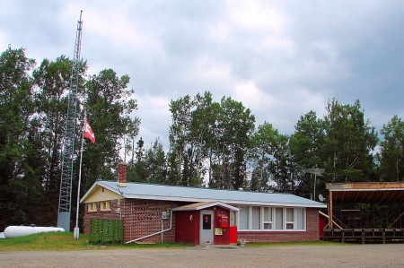
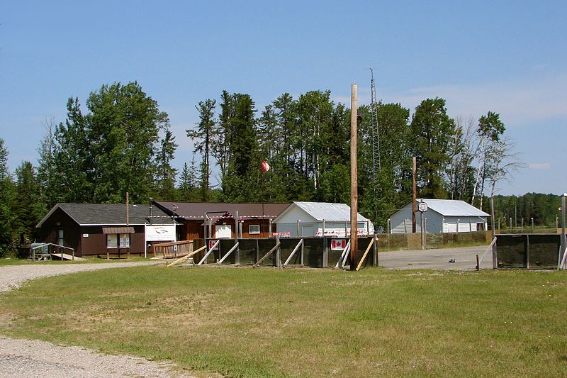
Is that a bandstand beside the municipal office in Shebandowan? If so, I wanna be on their council. (Photo: User P199 at Wiki Commons.)

Sapawe / Kashabowie

The watershed mark at Sapawe.

The watershed mark at Sapawe.

Don’t get me wrong.  Sapawe and Kashabowie are two separate places.

On the old site I used to have separate pages for Sapawe and Kashabowie as they are definitely two individual dots on the provincial highway map.

But when I had to re-do the site (thanks, Paypal, for not notifying me that they had arbitrarily cancelled my payement to the webhost, who subsequently deleted my website for non-payment of fees!) keeping Sapawe and Kashabowie separate just seemed so inefficient.

A reader tells me there isn’t a lot in Kashabowie, but that it’s a good fishing supply area with access to many lakes, a gas station, and an LCBO.

This is near Kashabowie.  Or at least somewhere within 30 kms.

This is near Kashabowie. Or at least somewhere within 30 kms.