Nipigon

Located on the most northern point of Lake Superior, Nipigon is pretty much the only true town between Geraldton and Thunder Bay.

You know what this means.

Out of the way Tim-Br Mart.

Move over Home Hardware.

Nipigon has a Canadian Tire…!

Nipigon, Ontario, highway11.ca marina lake superior

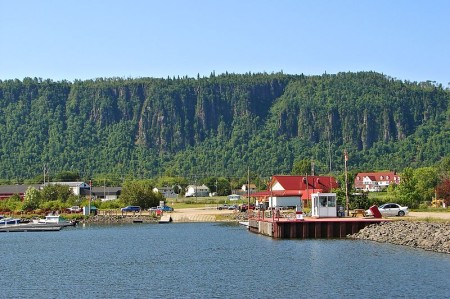
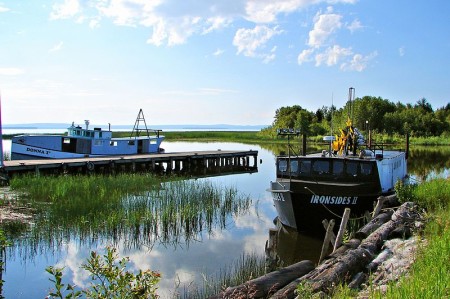
Even Nipigon’s little port is cute!  The lookout is up at the top of that hill in the back of the photo. (Photo: User P199 at Wiki Commons.)

When you drive into many northern towns, there’s usually a sign telling you that they’re the home of a semi-famous Canadian celebrity.

Well, fooling around on the internet one day I found out that a crater on Mars was named after Nipigon.

Why isn’t this on a sign beside the highway?  You could put “Nipigon – we’re so out of this world they named a crater on Mars after us!” or something like that.  Moonbeam would kill for this! I’d pledge 50$ toward that…

Nipigon shrine Ontario Highway 11Instead, you’re greeted by a sign that tells you that churches are open Sundays and are directed to a ‘scenic lookout’ which looks out over a cemetery.  Is this considered a God’s-eye view?  Nipigon does have an abundance of churches, and the town’s Catholic Church even has a little shrine beside its virgin Mary statue.

Hydroelectricity, fishing, forestry, tourism are the mainstays of Nipigon’s 2000 people. (I wonder if they did the census in the summer, and how that would impact the head-count – there seem to be some cottages in the area.) Nipigon is blessed with a scenic little harbour, complete with a waterfront park, a boat launch, and hiking trails.  It even has a nice kid’s bookshop, and a stained glass store to boot.  This is not your average Highway 11 town.

Paintings and Big Things

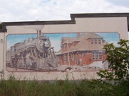
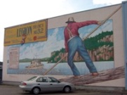
Nigion is full of murals Highway 11 OntarioWell, I take that last statement back.  Nipigon is your average Highway 11 town because, of course, it has to have its share of weirdness.  Of course, there is the mandatory “big weird thing in town”, but also in this case, it is public art.

Nipigon seems to love murals.  I counted four, plus the town museum which has paintings on it as well.  The one on the Legion celebrates forestry.  Another recognizes the history of the railroad.  A third shows the town’s first general store.  A fourth celebrates ‘northern Ontario time’ – encouraging workers to call in sick in order to go fishing.  It’s a great idea. I’m a sucker for any kind of public art.

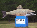
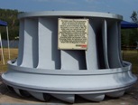
Nigion is full of murals Highway 11 OntarioLike most northern Ontario towns, Nipigon has a festival and a some big weird thing displayed in town.  Every August long weekend the town celebrates the Blueberry Blast festival, although I was there on the long weekend and didn’t see any blueberries raining down anywhere in the town.  In the “some big weird thing” category, Nipigon has two entries, 1) a historic turbine taken from the electrical plant up the river, and 2) a big trout on the highway.

Big weird thing #2 - Nipigon's trout, on Highway 11

Nipigon’s big weird thing #1 – Nipigon’s trout, on Highway 11

Nipigon is the best stop to eat or refuel before you hit Thunder Bay or Geraldton.  There is a foodmart, a Robin’s Doughnuts, multiple gas bars, a Beer Store, a Mac’s Milk, a few motels, a bank or two, a Subway where I waited 70 minutes to get a sub (beware of people coming in from camps and ordering 12 subs each), and a Pizza Pizza/KFC outlet.  Out on the highway there’s Gus’ Broasted Chicken, for those wanting a non-fast food meal.

Lots of people end up leaving Highway 11 for Highway 17 after Nipigon.  If you’re interested, check out the towns that run along Lake Superior’s shore by going off-route here.

Other random stuff

Nipigon Ontario - big weird thing #1 - hydro turbine

…and Nipigon’s big weird thing #2, an old hydro turbine

Oddly, east of Nipigon past Highway 11 there is an ad for construction company in based in Hearst.  That’s past Highway 11.  In the opposite direction of Hearst.  Really, it’s nowhere at all near the town.  Do the owners know where they’re being advertised?

Nipigon is also the town that got me in trouble in Grade Four.  Whilst playing Cross-Country Canada in computer class, Mme. Bennedsen caught me and three other kids giggling at the computer screen.

Now, this long before the advent of the internet, so in hindsight there wasn’t much risk we were up to anything particularly nefarious.  But maybe she was having a bad day, or maybe she was practicing her walk-stare-scold combo for use in future computer classes once the internet became a fixture of public education – whatever the reason, she rushed up toward us, eyes glaring, finger pointing, heels clicking ominously.

We looked at each other.  Once of us would have to come clean.  After multiple protestations from us that we were up to nothing, she finally flushed it from us.  And I took the hit for the four of us.  I was forced to stand before the class, head bowed, and admit out loud that there was, in fact, no town in Ontario named Nipplegone.

Red Rock

A former forestry and mill town of approximately 1000 people, Red Rock is about nine kilometres miles from Highway 11.

Red Rock, highway11.ca, Highway 11 Ontario

If this is Red Rock, it is freakin’ gorgeous. (Photo: Wiki Commons user P199)

I didn’t venture off the highway but Red Rock known for wonderful views of the local cliffs, as well as for continuing the proud Highway 11 tradition of summer musical festivals – Red Rock hosts the annual Live from the Rock Folk Festival which takes place the second week of August.

The town also hosts an annual mountain run.  The town also features a beachfront, marina, and boardwalk – just turn south at the abandoned tavern.  The Red Rock Inn provides accommodation in town.

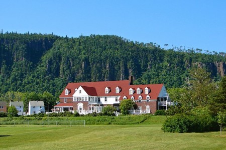
Red Rock Inn, Highway11.ca

The Red Rock Inn. (Credit: User P199 at Wiki Commons.)

Hurkett

As I went through the site to reformat and redo it after losing all of my content in early 2013 (thank you, wonderful internet!), I collapsed a number of tiny entries into single pages.  Mainly to save website space and to improve the viewer’s navigation experience – anything in the name of efficiency.

But there is one town whose page I refuse to combine with any other: Hurkett.

Because if I did, I might find a price on my head.  OK, more likely I’d get inundadted with nasty emails…but more on that later.

Hurkett is actually three kilometres south of Highway 11.  At first glace, I thought that there wasn’t much there.  I counted about three houses near the highway, and another three further in. In all it was a five minute detour.

So I posted these impressions online, and promptly started developing a really bad reputation with the local population.

Hurkett Ontario Highway 11 Yonge Street Thunder Bay

Is there more to Hurkett than this?

One resident sent an email incensed that I had gotten things so wrong about her community.

Another told me that some townsfolk were reporting that there was a website stating that there was nothing in Hurkett, and that, according to this emailer, “well, that just couldn’t be true..”

One particularly memorable email stated that us southerners (they assumed) just couldn’t give a crap about the north (they assumed), and that I wouldn’t know a nice town if it smacked me in the head and if I had any eyes, ears, or brains at all (did they assume I had any? Or that I didn’t have any? I will assume that they assumed the latter) well then I’d have seen this wonderful little community, but because I come from Toronto (they assumed), a place where people are shot on the street on a daily basis, then I must be another half-wit southerner (they assumed) who should just stay the heck out of the north. Wow.

However, there were also some much more reasonable emails from Hurkettians (sp?) informing that I had, indeed, misrepresented their community.

Dawn emailed me to tell me that I had, once again gotten things wrong. It turns out that Hurkett is community of approximately 100 households (not 6!) and 300 people just off the Highway. My apologies to the poeple of Hurkett for missing the essence of their community.

Dale emailed to tell me that Hurkett has a nice public dock on Black Bay where you can fish (there is a local fly fishing company in town.) There is a community centre, a fire station, an arena that was volunteer-built (like Iroquois Falls), and nearby is the Hurkett Cove Conservation Area.

Hurkett Ontario habour Lake Superior highway 11 yonge street thunder bay

There sure is! This is Hurkett’s little harbour on Lake Superior. (Photo Credit: Wiki Commons P199)

On my quick drive through, the things I noticed were a wetland, a strawberry farm, a tree nursery, and a “walk-in cooler for all your cold storage needs.” I’m hoping to add to this with more about Hurkett’s past and present, if I can.

Email me at info (at) highway11 (dot) ca. Thanks to Dale and Dawn for the info on Hurkett, and my apologies to the other Hurkettites (sp?) that I offended with my earlier profile of Hurkett.

Pearl / Dorion

Welcome to Ontario’s “Canyon Country…”

Dorion gas station mural canyon country pearl highway 11 yonge street thunder bay ontario

The mural at the now-abandoned gas station at Dorion, near Pearl on Highway 11

Situated between the Wolfe River and Coldwater Creek, Dorion is your typical Highway 11 dot-on-the-map.  There are some scattered houses and an abandoned motel, but nowhere really to turn off the highway, at least that I have seen in my drives for work along the road.

Dorion indian head ontario highway 11 thunder bay rock statue canyon country

Dorion’s Indian Head on Highway 11. I’m really not saying the human head or face here…

Dorion is home to Canada’s largest wildlife mural – but not in the local gallery, or the town hall, or the café, but ….drumroll… at the Esso station.  The station is painted on all three sides, with moose, fish, and wolf representing Dorion’s place in “Canyon Country”.

As well, the station features a recreation of an Aboriginal sculpture known as the Indian Head.  (Both are pictured here.)  This sculpture is a recreation of Indian Head, a rock formation found in nearby Ouimet Canyon Provincial Park.  This is pure Highway 11 – random things in a completely random place.

Highway 11 randomness #347b: random fake animals near Pearl, Ontario

Highway 11 randomness #347b: random fake animals near Pearl, Ontario

Dorion is in the middle of what is called “Canyon Country” as Ouimet Canyon Provincial Park is approximately 12 kilometres north of the ‘town’. Nearby Eagle Canyon is a private park that has built Canada’s longest suspension bridge over the Ouimet Canyon – 600 feet across and more than 200 in height.

Dorion is also home to a bottled water works, Ontario’s largest fish culture station, the Trillium Motel, a bait shop, and a bible camp.

Pearl wasn’t on the map.  In Pearl you can find the Rocksville Amethyst Shop, some animal statues (which are small by Highway 11 standards), and a few bush side-streets.


Pass Lake

When you take frequent road trips (or make a website about a street) you learn a few lessons very quickly:

  • Lesson #1 – Always keep your keys in your pocket – lest you get locked out in the middle of nowhere.
  • Lesson #2 – Always follow the map – lest you get lost in the middle of nowhere.
  • Lesson #3 – Maps always lie.

Although my provincial highway map seems to suggest others, once again Pass Lake isn’t on Highway 11.  It has a gas station and a few homes on the highway, but the town is five kilometres south of the highway, towards Sleeping Giant Provincial Park.

Pass Lake has two interesting aspects to its history.  First, the area was first populated by the Aqua-Plano Aboriginals 9000 years ago.  The Aqua-Plano built a society around the hunting of large game animals, building specialized tools to prolong their existence.

Second, the area was the site of a special settlement of Danish homesteaders during the Great Depression.  It was hard for Danes to own land at home, some they came to Canada, cleared the land, built a settlement, and in 1932 erected Salem Lutheran Church, which still stands today.  A quick scan of local mailboxes showed names like Hansen, Salem, Sorensen, and Riemer, showing that descendants of original settlers remain to this day.A local resident obviously wouldn’t let a bad acronym get in the way either her own name or the joys of alliteration – Kathy’s Karen’s Kountry Kitchen serves home cooked meals on what must be one of Ontario’s most serene patios.  There is a beach at the lake with some cottage and camping facilities.  Beyond that, the town was hard to find.  There was an arrow for a community centre, but it looked to be far into the bush on a red dirt road.  The houses are spaced out and there is no focus to the town.

Pass Lake hosts an annual fall fair and offers some great views of Sleeping Giant Provincial Park, which is approximately 25 kilometres further down the peninsula from the town.

Wild Goose

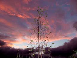
Sunset near Wild Goose, off Ontario Highway 11Wild Goose isn’t actually on Highway 11.  It’s about five minutes south of it on Lakeshore Drive in the Township of Shuniah, which was the first municipality founded in northwestern Ontario.  Shuniah is a local aboriginal word for silver, which was mined in the area.

I stayed in a great hostel here – the Thunder Bay International Hostel.  For $20 a night you get your own room.  Camping is even cheaper.  Hiking and the river are nearby.  Lloyd and Willa and great hosts, and Lloyd knows all the best spots for swimming.  I never went swimming.  I hope I didn’t disappoint.

Wild Goose has a nice park where you can swim across from the ever-present Sleeping Giant.  There is an LCBO outlet and a variety store.  Silver Harbour Conservation Area is a two minute drive from Lakeshore Road.

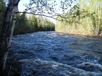
River near Wild Goose

River near Wild Goose (Credit this and the above photos:  Lloyd)

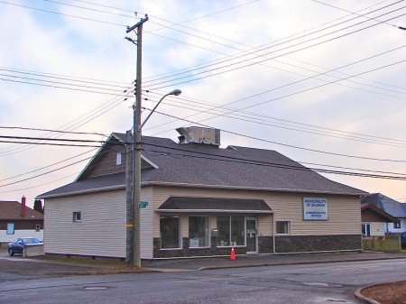
Wild Goose Shuniah, Highway 11 Ontario highway11.ca

Municipal building for Shuniah Townshoip, near Wild Goose Ontario (Credit: User P199 at Wiki Commons.)

Thunder Bay

Thunder Bay has a big random curling rock statue?  A massive four city-block-long woodpile?  Statues of polar bears, even though polar bears live nowhere nearby?  Yes honey, we're still in northern Ontario.

Thunder Bay has a big random curling rock statue?  A massive four city-block-long woodpile? Statues of arctic animals that live nowhere nearby?  Thunder Bay may be the big city but we’re still in northern Ontario.

I once heard a pretty prominent Canadian comedian joke something to the effect that there’s a reason that the Marathon of Hope ended in Thunder Bay.

I never really got the joke.  Maybe it’s because the city’s initials stand for a deadly disease, but I haven’t figured out what he was talking about. I like Thunder Bay.

TBay has a list of things going for it. TB has probably the best lookout on Highway 11 at the Terry Fox memorial.  It also has a majestic port bordered by rock formations on both sides.  There’s a pretty decent rap song about the city that was recently written up in the Toronto Star. It is the hometown of the most pro hockey players per capita. They have their own special foods that you can’t get anywhere else – superflat Finnish pancakes and their own type of doughnut. And I’m told that it has the largest Finnish population outside of Finland (more than 10 000…)
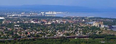
TB-16-TBay-SkylineThunder Bay:  A Tale of Two Cities

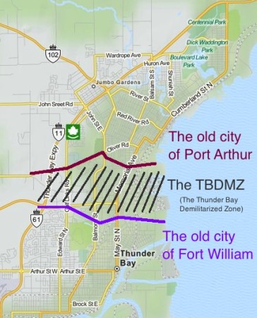
TB-16-TBay-Thunder Bay Demilitarized Zone

The TB DMZ. Keeping hostilities between Port Arthur and Fort William to a minimum since 1907.

Thunder Bay is actually two cities – Port Arthur and Fort William amalgamated in 1970.

Since then, they really haven’t come together in a physical manner.  There is a bit of a ‘no man’s land’ between north and south Thunder Bay, filled with a golf course, a hospital, an expressway, and some suburban-style office parks.  The street names change between north and south.

So how did they choose the name “Thunder Bay”? I have no idea if this is true, but I once read in a book that when Port Arthur and Fort William merged in 1970, they couldn’t decide on a common name. In order to solve the problem, they held a referendum. As always, the voters were split. Some thought it should be named “Lakehead.” While others preferred the more regal-sounding “The Lakehead.” When the final tallies were counted, the two Lakehead options combined had a majority of votes. However, with the two camps splitting most of the vote, plucky little “Thunder Bay” slipped up the middle to win a plurality. Is it true? I don’t know, but I wouldn’t be surprised.

It’s as if the two cities are still buffering against each other, or just don’t know what to do with the space between them. Is there animosity?  Bobby Curtola is from Port Arthur.  Paul Shaffer is from Fort William.  I don’t know if a rivalry exists, but there’s potential…

My first car had only AM radio.  Which means only oldies music.  Which means you hear a lot of Bobby Curtola to make up the CanCon requirements.

My first car had only AM radio. Which means only oldies music. Which means you hear a lot of Thunder Bay’s Bobby Curtola so the station can be in compliance with CanCon requirements.

Thunder Bay has a lot of variety in neighbourhoods.  Many parts are littered with old northern hotels and taverns (a la Timmins), while some residential areas have stately turn-of-the-century homes (a la Haileybury), while there are the 1960s suburbs (a la Etobicoke, but with bigger lawns), while Walsh Street is essentially a paved hydro corridor with homes on either side (a la Longlac.)  The whole situation means that, while Thunder Bay is a really nice city, it can be sprawly, confusing, and makes for horrible driving.
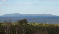
The Sleeping Giant, from Thunder Bay's waterfront

A not-so-great photo from yours truly of The Sleeping Giant, from Thunder Bay’s waterfront

Of course, nothing says ‘Thunder Bay’ to the history-conscious Canadian than grain elevators.  The prevalence of shipping means that the city is criss-crossed by train tracks, which pretty much cut off the city from most of its waterfront, save for a nice park in the north.  I think that the port in south Thunder Bay is bigger, but that the elevators in north Thunder Bay are near the waterfront park and therefore make for nicer photos.  There are beautiful views of Sleeping Giant (the big rock formation off the harbour) from both the waterfront marina park or from Hillcrest Park on High Street.

One of the coolest thing about Thunder Bay is the massive rock-bubble-things that border the south part of town.  You can’t miss them no matter where you look to the south.  They’re called the Nor’Westers (after the fur traders) and the largest (Mount McKay) is open for cars to drive up, for a small fee.  There’s something Rio de Janeiro-esque about it – they just need a statue on top, looking down over the city.

Maybe they can put a statue of a famous Thunder Bayer up there.  Again though, who to choose – Port Arthur’s Bobby Curtola or Fort William’s Paul Shaffer? I’ll pledge 50$ to that.

Thunder Bay has art grafitti. Yep it's big

Flashes of the cosmopolitan. (Photo credit: Lloyd from Wild Goose)

Thunder Bay:  The North’s New York City…?

Thunder Bay wins the north’s big city sweepstakes not only because it is the subject of a rap song (click here, the video is surprisingly good) or the presence of art graffiti but also because, compared to the rest of the north, Thunder Bay is practically a metropolis:

  • Thunder Bay has 110 000 people
  • Almost ten percent of them speak a language other than French or English (Finnish)
  • Thunder Bay has multiple occurrences of the same store or franchise
  • There are more stoplights than you can count on your hands and feet in Thunder Bay
  • Thunder Bay has satellite towns that resemble suburbs (real ones, not like the hamlets outside of Hearst or Geraldton)
  • Eight cities on four different continents around the world are twinned with Thunder Bay
  • Heck, Thunder Bay even has its own semi-pro soccer team that employs a handful of Brazilians for a few months every summer

But nothing shows off Thunder Bay’s cosmopolitan flair better than its International Friendship Garden.

The Thunder Bay Soroptimist International Friendship Garden - featuring installations from the Chinese, Dutch and Croatian communities.

The Thunder Bay Soroptimist International Friendship Garden – featuring installations from the Chinese, Dutch and Croatian communities.

The Garden was founded by various ethnic civic organizations to commemorate Canada’s centennial in 1967.  You can meet Croatia’s King Tomislav.  You can pose with the concrete geese representing Finland.  Italy, Scotland, Greece, India, the Philippines, and others are all there too.  It almost feels like a ‘mini-putt your way around the world’ exhibit that you’d find on Highway Six south of Hamilton.  Maybe it’s the Dutch windmill.  Or the random Italian villa surrounded by a chain-link fence.  Or maybe it’s the sawmill from Deutschland, which I thought was a garden shed until I spotted the faux waterwheel (sans water.)

However, you have to give TB some credit here.  It’s actually pretty cool and totally endearing. Most cities couldn’t have attempted this.  Fewer would have even considered it.

It’s more than a bit hokey, but that’s what makes it undeniably charming.  Sure, the Confucius statue and adjacent mini-pavilion looks like it could be beside Chinese restaurant in Markham, but who cares?  It’s a great park and apparently one of the ‘in’ spots for wedding photos in Thunder Bay.
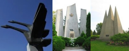
No, we're not on the set of Logan's Run, these are the Finnish, Italian and Slovakian monuments at the Thunder Bay International Friendship Garden

No, we’re not on the set of Logan’s Run, these are the Finnish, Italian and Slovakian monuments at the Thunder Bay International Friendship Garden

If you’re in Thunder Bay, you need to try a Persian. A Persian is a holeless doughnut rubbed with cinnamon and topped with a bright pink sugary raspberry glaze. They were …ahem…”invented” in Thunder Bay (in the 1930s), perfected in Thunder Bay, and only sold in Thunder Bay.
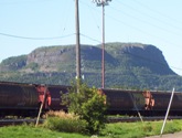
These look so much bigger in real life

The Norwesters.  These look so much bigger in real life

A Persian is like the oil-soaked goodness of a fresh farmer’s market doughnut and and the sugaryness of a Beavertail all rolled up into one bundle of super fatty northern Ontario goodness. As one of my co-workers has told me, she works with people in Thunder Bay and when she asks them about Persians, she could practically hear their mouths water through the phone. When she goes there for meetings, she buys two flats and brings them back from Thunder Bay on the plane, and only one flat makes it back alive. But if you’re gonna take the plunge – make sure you avoid the chocolate and go for the real thing – the one with the pink topping.
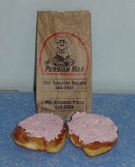
That being said, they're eerily similar to the Unique to TBay - except they look like the Paczkis of Cleveland or the doughnuts of pretty much anywhere else.

Persians – unique to TBay, tho eerily similar to the Paczkis of Cleveland or the doughnuts of pretty much anywhere else.

There are two locations that sell Persians (the doughnuts – not the ancient peoples) – one on Tungsten (out by the university), and one on Balmoral. Just look for The Persian Man.

For non-doughnut grub and shopping the major streets are Red River and Memorial in north Thunder Bay, and Arthur in south Thunder Bay.  There is a real mall, a movie complex, the only Swiss Chalet since North Bay, some other chain restaurants, but no Giant Tiger (disappointing.). At one time, TBay had the only East Side Mario’s since Timmins but Keith emailed me to deliver the bad news – it is closed.

To-Do in TB
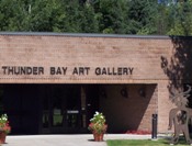
Thunder Bay - Art Gallery highway11.caAs far as culture, the Thunder Bay Art Gallery on the campus of Confederation College had a great Norval Morrisseau exhibition while I was there.  The gallery is small, but entrance is ridiculously cheap.  Thunder Bay also has a symphony, as well as a charity casino.  The corner of Algoma and Bay in north Thunder Bay is a bit of a hip spot, with some pubs, a hostel, and specialty shops nearby (a Finnish-language bookstore, and Finn-tastic Sauna and Gift Shop).  While I was there, an Italian festival had blocked off the intersection (beer tent + meatball & sausage stands + old nonnas telling you to eat more = my kind of thing!)  There’s also a really nice ballpark in Port Arthur that hosts The Thunder Bay Border Cats, a minor league team in one of the American independent leagues.

But as soon as you get start getting visions of grandeur, Thunder Bay returns to its northern roots.

There are all-you-can-eat cabbage rolls and pirogi every Friday from 12-1 at the Polish Hall on Algoma.  The Superior Bowladrome is one of four bowling alleys I counted in TB.

(Where I grew up we had double the population but only half the bowling alleys.)

There are the second- and third-tier franchises some common to the north – Robin’s Doughnuts gives Tim Horton’s a serious run for their money in northwestern Ontario, and especially in TB.  There is Tacotime, some sort of Mexican franchise that has placed its geometric cacti throughout the city. (This picture does not do those catci justice. And the food is pretty good too…)

highway11.ca TACO TIME - Thunder Bay, ON, Logan, UT, Toronto, ON

Taco Time! I’ve been obsessed with Taco Time ever since I visited the one in Thunder Bay (left photo) and came under the spell of its sort-of art deco cactus. I was overjoyed when I found one on my honeymoon in Logan, Utah, and when another opened in the Atrium on Bay in Toronto. Sadly, the Torontonians have no taste. 🙁

But for a real Thunder Bay meal, you need to go to the Hoito. It’s a diner serving traditional Finnish food, and in its heyday it was a focal point for the very politically-active Finnish community. There’s even been a book written on stories told in the diner. It’s located in the old Finnish Labour Temple, which the local community is working hard to restore.

There are also the totally random people.  I saw kids sitting unseatbelted (not even strapped in with a rope or duct-tape) on a flatbed truck, as well as roving from side-to-sid

e in the cargo hold of pickups. This wasn’t just in cottage areas, but on main drags like Arthur.  I learned that Vampiro, Canada’s top wrestler on the Mexican lucha libre circuit hails from TB.  In one of my strangest (?) memories, I witnessed a man smoking a cigar walk out of his home with his dog on a leash.  He walked across the street to a cemetery.  He let his dog poo in the cemetery, and he walked right back across the street to his home.  Gross, but funny. (Maybe this is the sort of thing that inspired White River‘s pet relief station.)

Finally, you know Thunder Bay is a true northern town as it obeys the two main laws of Highway 11 – that each city must have something big, and something in a pile.  Thunder Bay has both – its five-foot tall curling rock, and the ever-popular pile of wood.
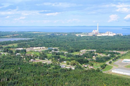
View from Fort William First Nation, near Thunder Bay, Highway 11.ca

I used to have these teeny-tiny 200 pixel square photos of the Thunder Bay waterfront on this site.  What would this website be like without User P199 at Wikimedia Commons saving everyone from my pitiful photography?  (The photo at the top of the post is also his.)
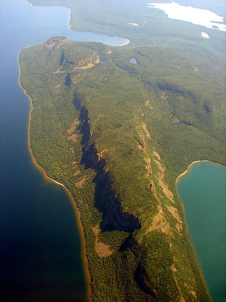
Thunder Bay - Sleeping Gia highway11.ca

An absolutely killer photo of The Sleeping Giant, thanks to Wiki Commons contributor P199
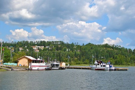
Old Fort William

Old Fort William is not a town – it is an historical site in the vein of Ste-Marie-Among-the-Huron, except that it focuses on the fur trade rather than a Jesuit mission.Old Fort William is a recreation of a North-West Company fur trading post that existed at Thunder Bay in the 1800s.  People there are costumed, play specific roles, and make minor attempts to speak in 1815 accents.  The level of commitment to their characters varies, but that’s what makes it most fun – some are really into it, while for others it’s quite simply a summer job.

During my visit, the committed outnumbered the uncommitted.  How did I find this out without talking to each and every staff member? Well, no word of a lie, each and every costumed staff member, save for one, approached me at some time in my two hours there. In full accent and character. And not just to ask me not to walk on the newly-sodded lawn. They were actually into it. From a bunch of 16 and 17 year-old’s, that’s what I call enthusiasm.

And as for the one historical interpreter who failed to approach me on his own, well, apparently he was pretty into it too. As I found out, when I asked him how far Rainy River was from Thunder Bay.

The teenage interpreter responded that “he had never heard of such places.

Having caught on to his character-induced ruse, I smiled and asked how long it would take me to get to Rainy River.

He responded that “he had not heard of such places, but that it took multiple days paddle to get to Rainy Lake, depending on the weather.

This time I flat out asked him how long. It would take. To drive. To Rainy. River.

He responded that “he did not understand drive.  To drive a plow to a Rainy Lake?  That would be impossible! What could I want with a plow at Rainy Lake. Was I going there to trade?

Knowing the only thing I had to trade was a nasty hand gesture, I walked away.

Evidently this was one guy who didn’t see the golf cart shuttle that ferried visitors between the gift shop and the fort. Nor had he questioned why I had a digital camera or just how the grass was kept so golf-course-like short.  Another slightly less dedicated fort guy (if you can call wearing hides and furs and skins in the searing summer heat as “less committed”) eventually helped me.

Entrance to Old Fort William is about 14$, 12$ if you’re a student, and takes about two hours.  There’s fair amount to see, especially in the summer with the canoe rides and the farm.  It’s well worth it.  Every year the fort used to host “Rock the Fort,” a musical festival hosting some of the biggest names on the small-to-medium summer music festival circuit in Canada (believe me, I know, my hometown has one every year as well) such as April Wine, Trooper, Burton Cummings, and others.

Rosslyn Village

We’ll get to Rosslyn Village’s agricultural background, it’s big weird things and its woodpile in a minute.

But what’s truly notable to someone blogging the world’s longest street is that Rosslyn Village is the first place that I almost locked my keys in the car.  (Yet.)

Having driven from Timmins to Thunder Bay and visiting each and every possible thing in between, I thought I had perfected the art of pulling a u-turn, dashing from the car, snapping a photo, and jumping back in.  I guess I was getting cocky.  Rosslyn was the first instance where I contemplated leaving my keys in the ignition.

After having paid homage to the cow-on-a-stick, I heard a creak.  Found at the old Canada feed station site on Highway 11, the white cow peers expressionless across the highway at a height of about 30 feet.

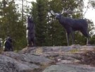
I paid no attention.  So I took some photos of the two big weird wooden moose hunter figures.  The wooden ‘statues’ of brothers Mike and André Allen stand against Highway 11.  Being on someone’s private property I didn’t venture further, so their meaning is thus unknown to me.  (Maybe they are northern Ontario’s version of a nutcracker?)

Rosslyn Village HuntersI had just finished taking a photo of André when I heard it.  A light thud.  A plasticky thud.  It was unmistakeable.  My car was a tiny city car.  It had the heft of a Pringles container.  That sounds couldn’t be anything else.

That was the sound of the wind closing the driver’s side door!

I returned to my car to find my door locked shut thanks to Thunder Bay’s crazy winds.  Relievingly, the keys were in my pocket.

Now, that might not sound like much.  But when you’re 12 hours from where you’ve been staying, and likely 24 hours from home, and your wallet is in the car, and your only other clothes are 65 km back, and off the main road to boot, that’s freakin’ scary.

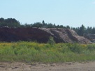
Rosslyn Village seems to be the concentration of what is a tiny little farm belt just west of Thunder Bay.  With 6000 people (combined with Kakabeka Falls), and corn and hay and dairy operations, the area is reminiscent of the towns of the Temiskaming claybelt (just replace Earlton’s giant buffalo with a miniature cow-on-a stick, of course.)  And of course, Rosslyn Village wouldn’t be northern Ontario without a woodpile, which is visible on the south side of the highway.

The town of Rosslyn Village itself is actually a few kilometres off Highway 11, and considering I had driven more than a 1000 kilometres in the past two days I decided that I’d had enough detours for the time being and continued back to Thunder Bay.

I shoulda made a website on woodpiles of northern Ontario...

Rosslyn Village’s woodpile, west of Thunder Bay.  I shoulda made a website on woodpiles of northern Ontario…

Kakabeka Falls

I had the idea to blog all of Highway 11 / Yonge Street when I was eight hours into a drive from Timmins to Thunder Bay.

I had been working up in the Timmins area and figured why not use the civic holiday weekend to drive out to Thunder Bay.  (I figured I’d never be so “close” by again.)  I had just left Geraldton when I saw a young hitchiker walking west in the middle of one of those storms where the rain falls at just the right diagonal angle that you wonder if it’ll take the paint off your house.  It was hitting him so hard that it was knocking his baseball cap around on his head.

Kakabeka Falls, the Niagara of Northern Ontario?“Boy,” I thought.  “I bet this guy had wished he’d read up about this stretch of highway.”  It’s a good 70 km to Beardmore.  And then I lightbulb went off.

After having a bit of a scare of my own – I would have left Iroquois Falls for Timmins via backroads in the winter with next to no gas, only to be dissuaded by a pleading co-worker.  “There’ll be a gas station”, I thought! – I’d been blogging about some of the towns in and around Timmins and northern Temiskaming.  They’re all around Highway 11.  And Highway 11 is Yonge Street.  Why not just turn this into a blog on the world’s longest street?

I had arrived in Thunder Bay feeling triumphant, happy to see the city lights as a signal – that I had done it. I felt like I had practically finished the Boston Marathon or something. Except in my car.

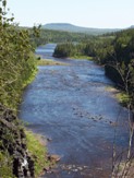
Downstream from the falls

Downstream from the falls

The problem with that thought, however, was again my lack of planning.  At that time, I had thought that Highway 11 ended in Thunder Bay. I wasn’t even truly aware that the Highway kept going.

But then I kept following Highway 11 further.  And further.  And then in Kakabeka Falls, I finally figured it out.  Highway 11 kept going.  All the way to Atikokan. To Fort Frances. To Rainy River. I hadn’t completed it by any means. I was more than 500 km short!

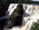
Sometimes called “Niagara of the North” (when Bracebridge isn’t calling their rather middling falls the same thing), the town of Kakabeka Falls is built around the waterfalls from which it derives its name.  Thirty kilometres west of Thunder Bay, Kakabeka Falls is one of Ontario’s natural wonders.

The majestic falls are well worth the parking charge (two dollars per hour at the time of my visit), even for a short stop.  There are three lookouts, each with educational displays, and there is a one-lane road which links the two sides of the provincial park and provides a fourth vantage point.  On the north side of the highway, there is a beach with beautiful dark blue water.  For an added twist, you can attend Kakabeka Bible Camp – just be advised that Kakabeka Falls is a bad spot to try walking on water.  (Sorry, so bad. Not funny.)

The Metropolitan Moose is a good bet for baked goods and coffee, and if you’re feeling adventurous, you can try to Chinese food available at the curling club just east of town, although I don’t know if it is quality Northern Ontario Chinese Food.

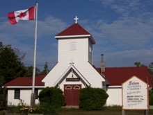
The town has a four to five motels, an LCBO outlet, gas stations, two amethyst shops (the amethyst signs are really getting old, they’re even on people’s front lawns out here.)  There are two churches in town, including St. Theresa’s which is pictured here.  Wednesday night is bingo night at the Legion.  There are about 6000 people in Kakabeka Falls and Rosslyn Village altogether.

Twenty-four kilometres south of town you can find the wonderfully-titled St. Urho’s Golf Club.  (Is that really pronounced “yer-ho’s”?)

Church on Highway 11 in Kakabeka Falls