Cobalt

Cobalt, OntarioIn my travels along Highway 11 I’ve noticed that some towns are:

And then there are some that are just plain cool.

Enter Cobalt.

Cobalt is just really neat.  Part of it is the history.  Part of it is the town’s independent streak.  But mostly, it’s just so old and, well, old, that it’s really interesting.

From “Yikes” to “Cool”

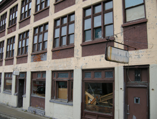
My first impression of Cobalt was “oh god.”  And not in a good way.  But boy was I wrong. Cobalt is the kind of town that would have five taverns but no grocery store. And that’s what makes it so interesting.Abandoned storefront in Cobalt, a reminder of its heydey
Cobalt headframe, hgihway 11 Ontario

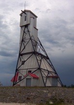
Preserved mine headframe in Cobalt – really cool

It was when I stopped to take a break from driving that I really saw my surroundings.  I realized that what looked old and run down was simply historic.  That was looked grotty and old really had a tonne of character. That instead of tearing down older buildings and erecting cheap, shoddy new ones in their place, Cobalt had preserved its history. A history they were proud of. This place wasn’t run down, it was preserved.  Cobalt was named Ontario’s most historic town for a reason.

Sure, there aren’t a tonne of stores or boutiques.  But at least there aren’t a tonne of places selling crap either.  There is no grocery store left in town (it closed in 1992 when the store owner cleared out the remaining products and held dance parties in the store to commemorate its closing), but what else is there is because it needs to be there – like museums, mine shafts, and bars.  More than a few of them.
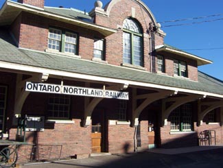
Cobalt Train Station, Highway 11

Cobalt ONTC station

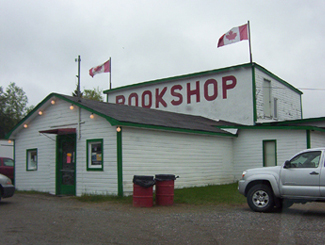
Highway 11 Book Shop, now closed. Cobalt, OntarioThe Highway Book Shop was a classic tourist destination that never feels like a tourist destination.  It was a family-run used bookshop on Highway 11 just outside of Cobalt and it is not only worth a visit, it is worth some time.  Maps, books, magazines, teaching materials, kid’s lit, old books, new books, big books, rare books – you wouldn’t have believed all the crap they have in there.  I think I spent an hour on two separate occasions perusing the cramped store. It might smell like your grandmother’s basement, but it’s really neat, and no visit to Temiskaming is complete without a stop, in my opinion. Sadly, the icon has closed.  Ready to retire for years, the owners couldn’t find anyone to take the store on and had to shut one of Highway 11’s best attractions down.

Cobalt Classic Theatre is the only remaining theatre from Cobalt’s heyday in 1920s.  While other towns were using economic development funds to build golf courses, Cobalt restored the old Classic Theatre in 1993 and now hosts students, playwrights, and actors from across Ontario. The theatre is restored to what it looked like in the 1920s and is a focal point for the community.
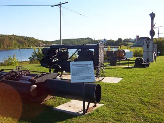
Cobalt, mining equipment, Highway 11

Antique mining equipment on display at the lakefront.  Other towns would have just thrown this stuff out.  Cobalt, refreshingly, doesn’t run from its roots.
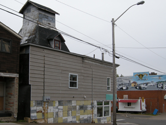
Mine headframe now a bar, Cobalt, Ontario

This headframe is now the world’s only bar in a mine headframe! That’s revitalization, northern Ontario style.

The Cobalt Mining Museum has the world’s largest display of silver and offers the only underground mine tour that I’ve seen outside of Timmins.  The Bunker Military Museum has a good collection of memorabilia, the Great Canadian Mine show displays mining technology, and there is also a firefighter museum in town.

Cobalt also has two separate self-guided walks.  The Cobalt Walking Tour brings you through town past historic buildings and historical places, while the Heritage Silver Trail is a self guided tour of many of the abandoned mine headframes in the area.

There’s more.  There is Fred’s Northern Picnic, an annual music festival that the local Member of Parliament usually plays at (he’s a musician by trade) and where you get three days of music and free camping for like $60.  The Silver Street Cafe has good food and decent prices, and they also cater local events with real food (forget hamburgers and hot dogs, think steak on a bun and pulled pork with onions.)  The Silverland Inn and Motel is a restored hotel from Cobalt’s mining heyday and also serves food.  There is a stained glass shop, a gem shop, and Iddy Biddy Petting Farm.  Cobalt also has more murals than Nipigon.
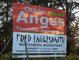
Fred's Northern Picnic, featuring MP Charlie Angus, Cobalt, ON

Not sure if they’re still running Fred’s Northern Picnic, but that’s where I saw Serena Ryder before she was big, and the local MP get up and do a set too
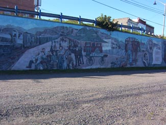
History of Cobalt Mural, Cobalt Highway 11Hockey, Streetcars, and Casa Loma

I read in the James Bay tourist brochure that there is a legend that Cobalt blacksmith Fred Larose threw his hammer at a fox, uncovering a rich vein of silver in the process.  Further silver and mineral deposits were found in 1903, triggering a mining rush like no other in northern Ontario.  The significance of the Cobalt finds supposedly led to riots over mining stocks in New York City.  Others say that Cobalt built Bay Street (Toronto’s Wall Street.)  A testament to the town’s wealth, the Cobalt Silver Kings played the 1909 season in the NHA, the NHL’s precursor. Another first in Cobalt include the Temiskaming Streetcar Line, which was installed between Cobalt and Haileybury, and was the first streetcar system north of Toronto.

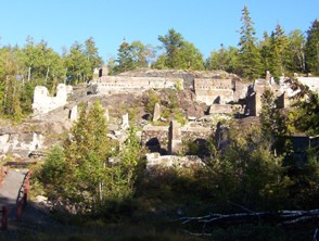
Mining ruins, Cobalt, Highway 11 Ontario

Mining ruins east of town

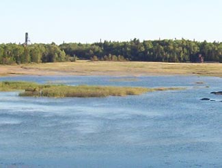
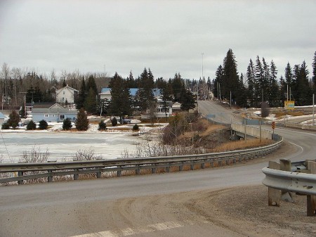
Cobalt Lake, Ontario

Cobalt Lake, once drained, then filled, now restored

In addition, the mines of Cobalt built Casa Loma, the famous “castle” built upon Spadina Heights in Toronto. Sir Henry Mill Pellatt was a wealthy Canadian mine owner (some say Canada’s richest man at the time.) It was his mining operations in Cobalt that allowed him to gather the immense wealth to build Casa Loma. Construction began in 1911 and took more than three years, 3.5$ million, and more than 300 full-time workers. With 98 rooms, it was the largest residence in Canada at the time. Pellat eventually lost his residence, as the Depression and the decline of mining in Cobalt led to his financial ruin. Casa Loma was essentially built with the revenues Sir Henry Mill Pellatt gained by draining Cobalt Lake for silver mining.

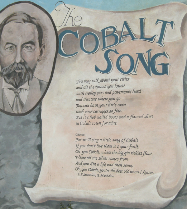
The Cobalt rush eventually produced more than $260 million worth of silver, countless myths and stories about how and where silver was found, who struck it rich, and who lost their pants in speculation. The Cobalt silver rush resulted in a whole little Cobalt culture developing – embodied by the Cobalt Song (click here to download the sheet music.) Cobalt led to the founding towns like North Cobalt (a bedroom town for miners) and Haileybury (a bedroom town for wealthy mine owners.) The mining boom in Cobalt also paved the way for exploration further north, which led to massive gold finds in Timmins and Kirkland Lake, both of which far exceeded the value of the mines of Cobalt in the long-run.
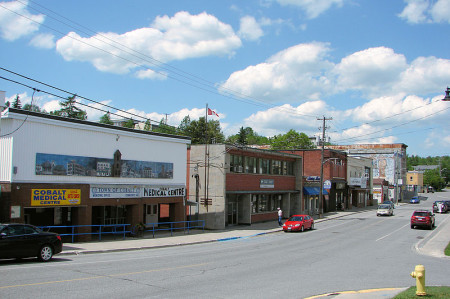
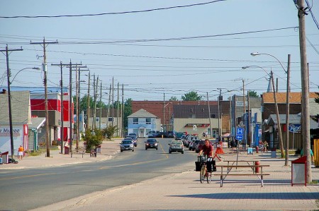
Cobalt, Ontario, downtown, highway11.ca Ontario Highway 11

I could move this photo of downtown Cobalt closer to the text that talks about downtown Cobalt but in wordpress moving photos around is a pain in the rear. (Credit: User P199 at Wiki Commons.)

Although Cobalt survived the usual northern Ontario disasters, including a typhoid outbreak in 1909, and Great Fire of 1922, it couldn’t survive the decline of mining.  Well, it survived, but it’s much smaller today and mining no longer exists.  There is some exploration for diamonds, but I don’t think they’ve been found.  I’ve heard that many of the old mines still have minerals in them, but that it’s just not economical to mine such old shafts for minerals at today’s prices. But, in the end, the history of Cobalt is one of a town that conbtinually gets kicked, but then manages to find its way back up.

Cobalt is considered the third part of the Tri Towns along with New Liskeard and Haileybury.  But for some reason it didn’t amalgamate into Temiskaming Shores in the late 1990s when the province forced municipalities to squish together.  Maybe it’s too far away.  Maybe old hostilities with North Cobalt scuppered a move.  Maybe the town is too independent.  Maybe there is still an old hockey rivalry between Cobalt and Haileybury from the one season both towns had a team in the NHA.  I’m sure someone in the town of 1200 put up a fight.  I don’t know.

I haven’t spent as much time as I would like in Cobalt, and, I must admit, haven’t visited any of the touristy things here other than the Highway Book Shop.  But I’m sure I’ll be back again.
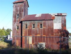
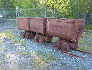
Old mining carts, Cobalt, Ontario

My grandfather worked in coal mines in Europe for a time.  Seeing these things, all I could think of was my disbelief that people actually went underground with these things…that’s ballsy

The Cobalt Song Mural, Cobalt, Highway 11 Ontario

Haileybury

Which northern Ontario town had its own street cars, was home to the guy who wrote the Hardy Boys, had the most millionaires in Canada, was the first home of the team that would become the Montréal Canadiens, and then promptly had its prosperity wiped out by a massive fire?

Streetcar Norhtern Ontario, Haileybury, Highway 11

Back off St. Clair Avenue West…Haileybury has had streetcars too!

The thing that makes Haileybury really northern is its history.  The rise and fall and apparent rebuilding is really interesting and, in my opinion, totally characteristic of northern Ontario.

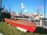
Lumber boat in Haileybury, ontario

After Longlac and Opasatika, let me guess this is a lumber boat?

Once known as Humphrey’s Depot, Haileybury was founded in the early 1900s by a former fur trader on the shores of Lake Temiskaming.  He named the town after the school he attended in England.  He tried to attract settlers with the usual propaganda leaflets, but as northern Ontarians know, there’s no better way to get the country settled than a gold rush.  And that’s what it took to get Haileybury off the ground.

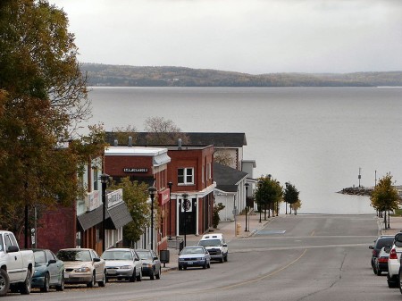
Haileybury, downtown, Highway 11 Ontario Lake

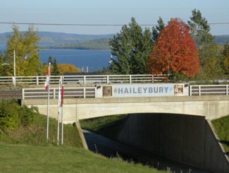
Haileybury road leading into Lake Temiskaming. (Credit; User P199 at Wiki Commons.)

Despite being named after a place in England where wealthy parents got rid of their kids, Haileybury is the start of francophone north-eastern/central Ontario.  (Or it is the end, depending on which way you’re traveling on Highway 11.)  Approximately 80 percent of Haileyburians are French-first, which is interesting given that their neighbours are primarily anglophone, particularly in New Liskeard (70 percent) and Cobalt (almost completely unilingual.)  As you go north after Haileybury, the towns almost alternate – anglo, franco, etc.

The discovery of silver in Cobalt in 1903 started a population explosion in Haileybury, as the town became a bedroom community for prospectors and mine owners.  So successful were some that a street in Haileybury was dubbed Millionaire’s Row for the wealthy people it housed.

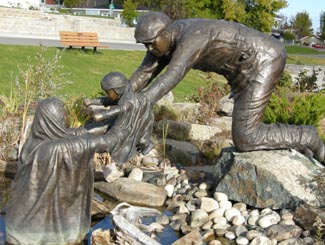
Haileybury, Ontario on Highway 11But of course, this all had to come to a tragic end with the fires of 1922, which killed 11, displaced 3500, and razed the town completely alongside New Liskeard, Dymond, and possibly Cobalt. In order to survive, many families had to hide in wells, lakes, and even down mine shafts. Many of those who escaped to the mines died when the fires, passing over the mines, sucked out the shaft’s oxygen, asphyxiating those who sought refuge underground. The town commorates the fire with a sculpture at its waterfront park, pictured below on the left.

Haileybury Today

With 4500 people, Haileybury (pronounced locally as Haileyberry) is the second largest part of the Tri-Towns and Haileybury is the seat of the Temiskaming Shores municipality, which includes New Liskeard and Dymond.  It is a quiet lakeshore community that is worth a stop if you’re not in a hurry.

Pioneer Monument, Great Fire, Haileybury, Highway 11

Monument to pioneers that survived the Great Fire by hiding in swamps, lakes, and wells

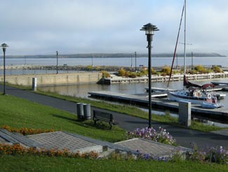
I really like the waterfront.  There is a nice little pavilion with the Pioneer’s Monument (pictured) honouring the fire of 1922.  There is a little beach and a modern marina as well.  The view is nice across the lake to Quebec and in the summer you’ll see a number of boats on the water as Lake Temiskaming is the end of the scenic Ottawa River route, which is popular with boaters.  The waterfront is worth a drive, if not a full stop.

Haileybury on the shores of Lake Temiskaming

Haileybury on the shores of Lake Temiskaming

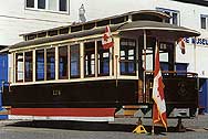
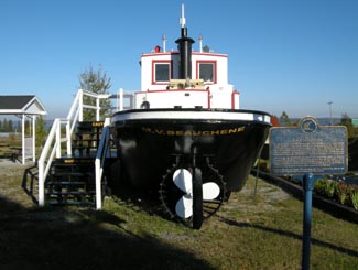
In terms of tourism, there is a fair amount to do.  The Haileybury Heritage Museum was built to chronicle the history of the town and tell the story of the fire.  The museum features a restored 1920s streetcar, as well as an old firepumper and a preserved tugboat that used to ply the waters of Lake Temiskaming.  You can also visit the “world famous” Haileybury School of Mines.  Haileybury is also home to the Temiskaming Art Gallery.  You can see different types of ores at the Rock Park Walk, while there is camping and golf in town as well.

I don’t remember a lot of places to eat, and I think the only Tri-Town Tim Horton’s are in New Liskeard and Dymond.  Accommodations include the Leisure Inn, Edgewater Motel and Cabins, the Haileybury Beach Motel, and the Les Suites des Presidents Suites, an upscale bed and breakfast.  New Liskeard has more places to stay and eat.  Personally I find that Haileybury, despite being very pretty and having stuff to do, is still something of a bedroom community.  It doesn’t have the same downtown nor the same ‘feel’ that New Liskeard does.  And it’s nothing like Cobalt.  At all.

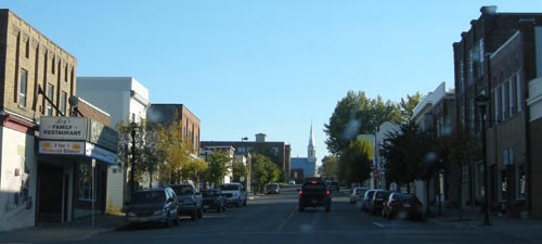
Downtown Haileybury

Back to History

Haileybury was also home to the team that would become the Montreal Canadiens.  The club played the 1909 NHA season and left for Montreal.  It would become the Canadiens only two years later.  I think that’s pretty neat.

Haileybury’s streetcars were part of the Nipissing Central Railway that connected the Tri Towns, which would definitely make it unique in the north.  Heck I’m sure it ran faster then than Timmins transit does today.  Toronto also donated 87 streetcars after the great fire to help shelter the homeless.  Today there is one restored streetcar left at the Haileybury Heritage Museum.

And, to finish, Haileybury was also home to Les Macfarlane, who wrote many of the Hardy Boys novels under the pen name Franklin Dixon.

Thanks to Johnny O for the info on the Tri Towns.

The Hardy Boys's Sleuth, in Haileybury on Highway 11

I never liked the Hardy Boys. Too All-American. Too serious. Too predictable. Sure, you knew that Encyclopedia Brown was always going to figure it out too but at least he had a sense of humour. But, anyway, this is a replica of the Hardy Boys’s boat, in Haileybury.

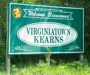
Virginiatown / Kearns

Continuing our detour off Highway 11, Virginiatown and Kearns are two villages (population approximately 800) northeast of Krugerdorf via Highway 624.  V-town is just a tad west of the Quebec border on the northeastern shore of Larder Lake.Virginiatown and Kearns, OntarioBuilt in the shadow of the great Mount Cheminis, the area known as Virginiatown is comprised of three different villages – Kearns, North Virginiatown, and Virginiatown proper. I would have done separate pages for all three but a) I don’t have a tonne of info, and b) I’m not sure where one village ends and the next one begins on a map. I think North Virginiatown is north of Highway 66, Virginiatown is south of it, and Kearns is just a kilometre or two east.

Virginiatown is actually much closer to Rouyn than Timmins or any other larger centres in Ontario. Therefore, (and I might be wrong, but) I’m pretty sure that V-town, as it is affectionately called, is a largely francophone community which had its heyday with the northeastern Ontario mining boom in the early half of the 20th century.  So, I checked this fact.  Statscan tells me that Virginiatown and area is largely francophone.  But emailers and posters (before I lost all the posts) tell me that nearly no one speaks French in V-town.  So, I don’t know.

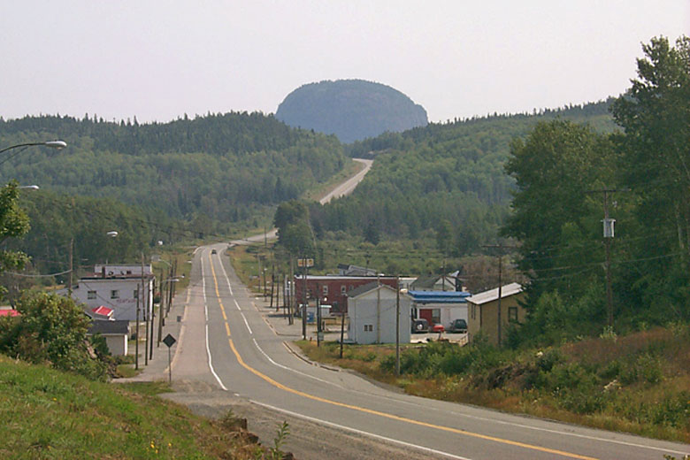
Virginiatown, Ontario

Highway 66 traveling east into Virginiatown, with Mount Cheminis in the background

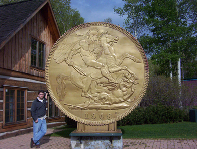
Virginiatown sprung up with the expansion of the mineral rush which began in Cobalt in the early 1900s and drove north founding towns like Kirkland Lake and Larder Lake. V-town was famous for the Kerr Addison Mine, which at one time was the richest gold deposit in North America. The gold from the first Canadian 5 ounce gold coin was mined from the Kerr Addison. Today, a coin monument stands to commemorate this Virginiatown achievement.

Like all boom towns, this had to come to an end eventually. The Kerr Addison Mine shut down in the 1990s, and while there is still exploration and some smaller gold ventures in the area, Virginiatown is pretty sleepy nowadays. Check out the link to Louie Palu’s photos below, it contains some fantastic shots of mining life in Larder Lake and Virginiatown mines.

Virginiatown coin, Ontario

Does V-town’s big weird coin outdo Larder Lake‘s flying fish?

There is a boat launch to Larder Lake, and you can access nearby Labyrinth Lake where you can catch northern pike, bass, and walleye. According to google, there is a ceramic shop in town as well. You can visit the Virginiatown Heritage House for a history of the town and its mining past, or hike the Heritage Gold Trail to view underground mining equipment.

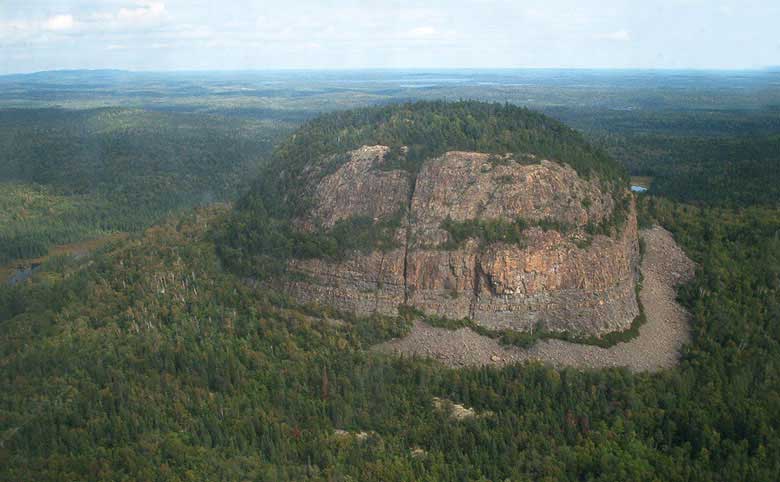
Mount Cheminis is, in my opinion, the coolest thing in the area. Shooting up from the trees like the bum of a thick marker, it rises majestically above V-town and is visible from Highway 66. You can hike up the summit from local trails. Check out some of the nice pictures in the links below. Andre emailed to let me know that Mount Cheminis (known as Mont Chaudron in French) is techhnically in Québec.

Mount Cheminis, Virginiatown, Ontario

Mount Cheminis. Awesome!

Services in town include gas (Guy’s Service Station), a small grocery store, and the usual small-town-northern-Ontario stuff like the Bear Creek Bait and Tackle shop and a curling club. Chez Lucie is a drug store, convenience store, and video rental in one, and Armando’s “Le Bar” is a local diner and watering hole. The Cheminis Lodge provides bed and breakfast facilities and lodging, as does the Hilltop Inn.

The only time I drove through Virginiatown was en route to Rouyn. I was on a schedule, so I stopped to take a picture with the big coin and that’s it. Please help me add to this page – send personal anecdotes, history, photos, and advice to info (at) highway11 (dot) ca.

For an archive of the 30 comments that were posted to Highway11.ca’s profile of Virigniatown/Kearns between 2008 and 2012, please click here.

Kirkland Lake

I almost moved to Kirkland Lake, and I’ve always kind of regretted that it didn’t work out.  Kirkland Lake is a neat little town that’s been described to me as the ‘wild west’ of northeastern Ontario.

Forty five kilometres east of the Québec border on Highway 66 (not Highway 11, we’re on a detour right now), Kirkland Lake is a largely anglophone town of about 10 000 8000, and is the largest town between North Bay and Thunder Bay on Highway 11.

Mines and Garbage

Kirkland Lake is extremely well known throughout Canada despite its small size and relatively remote location.  Since gold was struck in the early 1900s, KL has been one of Canada’s most famous mining towns, complete with gold mines, drinking hotels, and highgraders.  There’s a miner’s memorial as you come into town, which is actually quite classy and lists all the names of those who have died in mining accidents since the town began.

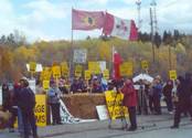
Kirkland Lake Adams Mine Protest

Adams Mine protests in Kirkland Lake in the 1990s

KL is also famous for Adams Mine – an abandoned open-pit mine that would have been the site for Toronto’s garbage, had the local community, First Nations, farmers and environmentalists not fought it so effectively.  They were in the media, they wrote thousands of letters, they united many groups that had not worked together before.

Kirkland Lake is a story across Canada showing that no matter how small you may be if you do it right and smart – you can win.  Adams Mine was seen as a huge story across Canada – so much so that the effort which started small eventually changed a lot of minds across southern Ontario.  The provincial government put the plan to rest in 2003.  The Grievous Angels, a band based in northern Ontario, wrote a song about it (the lyrics are here.)

Harry and Hockey and … other interesting stuff (that begins with the sound “wh”)

Kirkland Lake was named after Winifred Kirkland, a secretary at the old Ministry of Mines.  (Ah to be an early provincial bureaucrat – you might get a town named after you.) Kirkland Lake, arguably, has it’s own suburb – King Kirkland – which consists of about 20 houses and trailers about ten minutes east of town on the highway.

Sir Harry Oakes is probably Kirkland Lake’s most famous and most wealthy citizen. American-born, he was a prospector who finally struck it big in KL after stints in California, Australia, and the Klondike.  His mine in KL was the second largest gold mine in the Americas.  By the 1920s, Harry Oakes was Canada’s richest individual.  However in 1943, Oakes was allegedly murdered at his home in the Bahamas, and although fingers were pointed towards his son-in-law, no one was ever convicted of the crime.  Today his former house is home to the Northern Ontario Museum in KL.

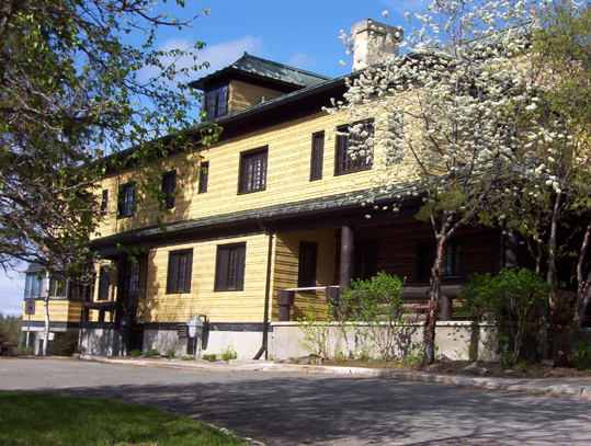
Kirkland Lake Mansion museum

Harry Oakes’s former mansion – now the Kirkland Lake museum

In terms of other famous KLers, Kirkland Lake was also once home to Growing Pains star Alan Thicke, figure skater Toller Cranston, and former NHL goalie Darren Puppa.

Hockey Heritage North, Kirkland Lake OntarioOn the subject of hockey, Kirkland Lake used to be known as a hockey hotbed.  CBC broadcaster Foster Hewitt used to call KL “the town that made the NHL famous” due to so many Kirkland Lakers filling the roasters of early NHL squads.  Today KL is home to Hockey Heritage North, a museum that celebrates hockey and northern Ontario’s role in the NHL.  Hockey Heritage North has a parkinglot that’s bigger than the museum itself – seemingly twice the size of the facility – and the parkinglot is probably a bigger draw for kids learning to ride bikes or for rollerblading and skateboarding.  In three visits I’ve come to believe that Hockey Heritage North’s parkinglot is the nicest smoothest stretch of pavement in all of northern Ontario.

Downtown Kirkland Lake

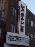
The place to see a show in Kirkland Lake. I mean a normal show. Don’t get any ideas. Those days are over.

Way back in the day, Kirkland Lake, however, was arguably almost as famous for its red house.  KL had a reputation for being a party town, thanks in part to the mining boom and the many bachelors who ventured north to prospect and work. I have been told that one of the highlights of Kirkland Lake’s heyday was its internationally-known brothel.  Soldiers from the area went to Europe to fight in World War One and regaled Europeans with tales of “the Red House of Kirkland Lake” or “5 Main Street” which was in fact a popular brothel well-known across the north.  Supposedly the tales were so tall or so enthralling that other soldiers and even Europeans have actually come back to the area to visit Kirkland Lake’s red whorehouse.  The house itself still standing but is no longer red.

Kirkland Lake: The Town

Kirkland Lake, to me at least, is a town of contrasts.  When you enter the downtown along Government Road, it looks a bit like Huntsville in cottage country – a windy street revealing the town turn by turn, forming the backbone of an old but not pretty interesting little downtown.  Actually, I like the downtown – it’s may not be “quaint” by some people’s standards but has character. With a decent downtown and as a town of 10 000, Kirkland Lake is big by Highway 11 standards.  You don’t have to worry about whether there is a gas station or a liquor store.  There are two hotels (HoJo and Comfort Inn), a Canadian Tire, a McDonald’s, a KFC, a Subway, a pizza shop, two Tim Hortonses (heck Timmins only has three!), a northern Ontario Chinese place, the Downtown Family Restaurant, and ‘The Zone’, which is a little club sort of thing in the basement of the local MP’s office.

Yet one could say that there is very little shopping.  Other than Giant Tiger and Hart, that’s about it.  No Zellers, no Walmart, one (and a half) grocery stores, a music shop, a pawn shop, and that’s it.  The Kirkland Lake Mall has maybe about 20 shops and services.  I guess you either go to Timmins, or to Rouyn-Noranda.

Kirkland Lake Ontario's mall

Kirkland Lake has a “mall”!

For a number of years, Kirkland Lake also had a significant Jewish community. As the mining boom spread northwards, Jewish families from Eastern Europe and even the United States moved up into the Englehart and Kirkland Lake area. Some settled as farmers in the area around Krugerdorf, while others formed the backbone of the commerce that fed Northeastern Ontario’s mining towns. A synagogue was built in 1927, with land donated by Sir Harry Oakes on Station Road. The community peaking in the late 1940s at a couple hundred members. Eventually, as the sons and daughters of the community moved southwards, and as fewer immigrants came north, the community shrank, and the synoguge was turned into apartments in 1980. Kirkland Lake’s original ‘Ark’ (I think that’s the wooden structure which holds the Torah) was eventually transported to the Beth Tikvah Synagogue in Toronto. While the community may have migrated, the history and the impact of Jewish immigrants lives long in the north, in places like Kirkland Lake, Iroquois Falls, Krugerdorf, and Timmins. Check out the virtual museum at the Kirkland Lake Jewish History link at the bottom of the page for first hand stories from community members.  (Check out KL’s Jewish history here or here.)

Kirkland Lake today still has a bit of a reputation as a hard-scrabble town. The cyclical ups and downs of the mining and logging industries make Kirkland Lake a boomtown one decade and an economic sponge the next. Just like many towns in both northern and southern Ontario, as life in Northern Ontario requires a little assistance to get by the booms and busts of the economy. Like all mining towns, Kirkland Lake is a little rough around the edges. But that’s what makes places like this interesting, and unique. Like someone posted below, KL is a mining town, past, present, and future.

Downtown Kirkland Lake

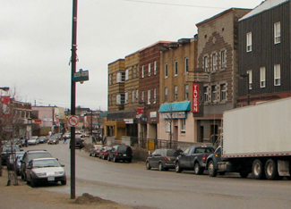
Forget the mall.  Kirkland Lake’s downtown is rough and old school and kindofabitof awesome

I have one beef with KL though, and I’ll get it off my chest now.  The signs outside the town blatantly lie.  They tell you it’s 15 kilometres to town and then 15 kilometres later you see a sign that says “Kirkland Lake 6 km” and then five minutes later you see another sign “Kirkland Lake 5 km.”  Now I’m sorry, first off you’re lying the first time, and then the second time I was driving 90 kilometres an hour and I did not manage to go only one kilometre in that span of five minutes.  It’s frustrating. Bad signage is one of my pet peeves in general.

I like Kirkland Lake.  It has a lot of potential if marketed correctly.  I’ll be back.

Gull Lake, near Kirkland Lake Ontario

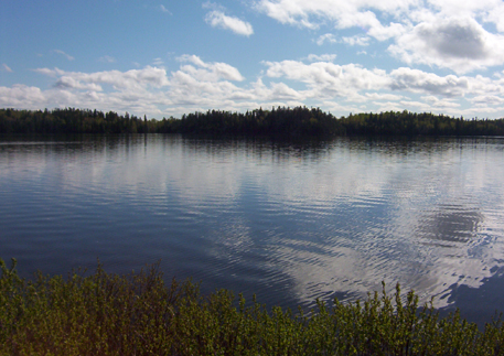
Gull Lake outside of Kirkland Lake


For an archive of the 40 comments that were posted to Highway11.ca’s profile of Kirkland Lake between 2008 and 2012, please click here.

Ramore

Ramore is a quiet community about one minute east of Highway 11 on road 572.  It is 15 kilometres south of Matheson and is made up of three streets (Fergus, Timmins, and one other street I forgot to write down.) Ramore, surprisingly, was the home of two air bases, part of the Mid-Canada and Pinetree Lines.

Ramore, Ontario church off Highway 11

Church at sunset in Ramore

Predominantly francophone, Ramore (and its cousin Holtyre) reminds me a bit of Val Gagné – small, quiet, clean, about 40 houses (probably more) – except with more agriculture.  The area is surrounded by farms – some fallow, others still producing – which gives the area a relaxed, summer feel and some pretty fields and old barns. (And for some reason, there’s a house with a Canada flag and a Barbados flag.)

Ramore was a railway town, forestry centre, and agricultural area, but in 1950, the Americans came to town and built a Pinetree Line radar station – not by accident. The mountain the radar site was located is a high-point in the region. The mountain next to it on the west side of the highway is called Kempis Mountain. Both are prehistoric volcanoes that are long dead. Near the Radar Base, is an airstrip – not widely known. Most still think that the military built it, but that is not so. The airfield was built in the 1930’s as a make-work program during the Great Depression. It was part of some sort of larger aerial mapping program. The strip was built, but WWII came along. Not sure how much use it really got, until the Air Base was built, nearby.

Ramore church shrine, Highway 11 Ontario

Shrine at the church in Ramore

The Air Base played a large role in the area, both socially and economically, from Kirkland Lake to Matheson. In 1962, the Americans turned the base over to the Canadians. It was part of a deal that resulted due to the cancellation of the famed Avro Arrow Program. Canada would “lease” 66 F-101 Voodoos and take over 12 Pinetree Radar Bases – this included Ramore. Supposedly due to budget cuts and changing technology, the Base was closed in 1974. A similar base at Lowther was dismantled in 1984.
Interestingly, up until the mid-60’s, Kempus Mountain had a small “air base detachment” separate from the Ramore base. This is because, Kempus Mountain was part of the Mid-Canada radar system. Kempus was a relay station for the Mid-Canada line (which was a different line of radar stations than the Pinetree line), which operated generally around the 60th parallel. This is one of the few places in Canada where the Mid-Canada Line and Pinetree Lines met. As the site of two former air bases, one can say, that Ramore had a very strong connection to the Cold War. Today, one of the bases lay abandoned and some people still explore it, however it is not recommended due to the physical hazards and the potential of running into harmful contaminants.  (Click here for photos of a visit to former base location in 2002.)

South of Ramore on Highway 11 is the Ramore Flea Market.  Albeit small, this is a real flea market, not like the North Cobalt Flea Market.  I haven’t had a chance to look around, but it’s worth a stop since it’s right on Highway 11.
Raymore also hosts a Country and Western Festival every September, complete with concerts, demonstrations, and competitions.  I don’t know if there is a midway.

Ramore Flea Market, Ontario Highway 11

Drove past at least 20 times. Always wished I had stopped by.

Ramore has a church, a baseball diamond, a small library, a caisse, and Bouchard’s Grocery and LCBO outlet, which is more like a convenience store with food.  Just south of the town is Rolly’s Motel and Home Cooked Meals, which has rooms and food but no gas.  There are blueberry stands both north and south of Ramore, as well as a family that sells vegetables from a stall.

Thanks to Dwight for the info and for pointing me towards the photos of the radar base.

For an archive of the 40 comments that were posted to Highway11.ca’s profile of Ramore between 2008 and 2012, please click here.

Holtyre

On the other side of the Black River, Holtyre is ten minutes east of Highway 11 on road 572.  Like its cousin Ramore, Holtyre is a tiny three-street (Euclid, Gleason, Pearl) francophone hamlet.

Holtyre, Ontario farm off highway 11

A farm in Holtyre

Dwight emailed me to tell me that Holtyre was built in the early 1930’s after gold was discovered. The town was named after 2 mines: Hollinger and Macintyre – hence the name Holtyre. The mine had high grade gold which was mined from 1935 to 1988 – over half a century.

Up until the late 70s there were 2 stores, a large hotel, bowling ally, 2 schools (English and French – K to 8) and gas station. There was (and is) a larger school bus business that first started by transporting miners to the Johns Mansville Asbestos mine site between Holtyre and Matheson after WWII – the business evolved from there.

Dwight also emailed to tell this story: supposedly in the mid-70’s the gold mine changed ownership and it was decided to save costs, close the smelter, and truck the raw ore to Timmins for smelting. Sounded logical, and for nearly 20 more years, this is what happened. In order to make room on the property, they decided to simply burn the old smelter building down – after all, it was over 40 years old and well used. The thing is, that inside of the structure had been in place since 1935 and was made of wood. Gold dust from the smelting process had been building in every crevice and crack in the old building. When they burned it down, there was enough pure gold that had melted into clumps on the ground, that when it was collected (as I understand in quite a surprising panic!), the new owners paid for the mine – that day. It was clear profit from then on. Who would have guessed – certainly not the previous owners !

Holtyre, Ontario

Does photography count? Uhm, probably…

I noticed some interesting houses with two level front balconies, kind of like in New Orleans, but less extravagant.  I wanted to take a photo, but Holtyre is so small that I felt oddly conspicuous and didn’t take any photos directly in town. (And hey, on my journeys I’ve been taking photos of everything and anything, so if I feel too out of place, then you know I felt weird!)  I think it was because the community was just so small and was also off the road.  I had no reason to be there, so it felt a bit weird.  So instead, I took some shots of a local farm. The tiny photo doesn’t do it justice…it was such a great summer evening the first time I was in Holtyre.

Holtyre has its own church, a playground, and an inordinate number of school buses.  I think there is a school bus operator in town, but there were also old buses in a few fields and yards, so I wonder what’s up.

I didn’t see any stores in town, but then again I skirted around and didn’t stop too long.  I’m sure there’s a variety store.  I don’t think there is a caisse or a gas station.  There is an abattoir outside of town, if you happen to have any animals that need butchering.

For more info, check out J. Charles Caty’s excellent history of Holtyre or the 25-minute documentary from 1971 on Holtyre that is online – you can watch it here, on Youtube.

Holtyre boys Highway 11

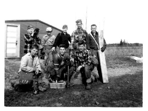
Photo of some cabin builders, maybe late 50s early 60s (posted at the request of a reader)

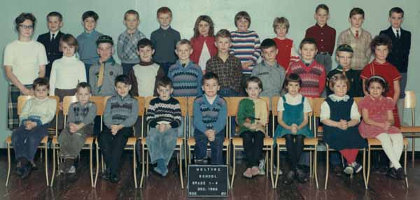
1966 Holtyre, Ontario public school photo 1-4

December 1966, Holtyre Public School Grades 1-4

HOltyre, Ontario public school photo 1996 5-8

December 1966, Holtyre Public School Grades 5-8


For an archive of the more than 450 comments (yes you read that correctly.  More than four-hundred and fifty!) that were posted to Highway11.ca’s profile of Holtyre between 2008 and 2012, please click here.

Matheson

“650 000 acres of paradise” read the signs coming into Black River-Matheson.  The towns in Black River-Matheson (Monteith, Val Gagne, Ramore, Holtyre, and Matheson) are quaint, clean, and definitely rural – marking the transition between Ontario’s true north and the farms of the Temiskaming claybelt.  Matheson serves as a crossroads between road 101 (which runs from Québec to Timmins) and Highway 11.

Matheson, Ontario on Highway 11

Still not sure who Thelma Miles is…

When first founded the town was named MacDougall’s Chute – ‘MacDougall’ being the name of a local First Nations trapper and ‘Chute’ pointing to its mining origins.  The government renamed it Matheson in 1906 as they built the railway through the region to transport timber, ore, and wheat back to southern Ontario.  Today, a hunk of gold ore sits at Queen’s Park in Toronto as a testament to the riches formerly found in the Matheson area.  High upon a hill overlooking Highway 11, the Thelma Miles Museum brings visitors back through Matheson’s history from 1900 onwards.

Matheson was the site of the famous Croesus mine discovery of 1914. The largest concentration of pure gold ever to be found was discovered – a pure gold nugget measuring 2” x 1.25” was removed (a model of it is at the museum in Matheson). Gold was so rich that it was mined at an unbelievable 5,945 ounces per ton. The vein was lost about 2 years later – the time of the Great Fire.

Matheson, Ontario, Highway 11, highway11.ca

Matheson, Ontario on Highway 11 (Credit: User P199 at Wiki Commons.)

Matheson used to be the agricultural centre of the northern half of notheastern Ontario. Up until 1995, it even had a Ministry of Agriculture office. One had to go back a few decades to understand why agriculture flourished here. Besides Government incentives in the earlier part of the 1900’s for ‘pioneers’ to settle, and fairly fertile land that far north, was another reason – forestry.

Black River in Matheson, Ontario

Black River boat launch

Dwight emailed to tell me that, up until the early 60’s, before mechanization came to the forestry industry in full force, trees were harvested using hundreds of horses – and these horses had to be fed. To this day forestry plays a large part in the area. The big plant in Iroquois Falls was in the area, but so were plants in Kenogami Lake, and even several small saw mills in the area. One existed for years (and may to this day) in Ramore. Therefore, there was a bit more to the agricultural industry then meets the eye in the area.

Saying that, once the 1960s ended and mechanization of forestry took hold, agriculture began a 25 year decline to near extinction in the area. Two big ‘hits occurred – the 1980-82 recession (that even wiped out nearly all farm manufacturers as they were known then, and only left one intact – John Deere). The final ‘hit’ was the recession of the early 90’s. Before the recession of the early 80’s, there were several larger beef cattle herds, that totaled approx 1000 animals or more, from as far north as Iroquois Falls, south to Ramore. Matheson even had a feedlot and abattoir, with Holtyre having an abattoir. Monteith had a veterinarian for large and small animals up until the mid-80’s. By the mid 90’s there were probably no more than 200 animals, with even fewer today.

The Matheson Fire

Matheson is the epicentre of the Matheson Fire.  Also known as the Great Fire of 1916, the fire was the largest forest fire at the time and still stands today as Ontario’s most deadly, killing more than 220 people and burning more than 500 000 acres.  The fire formed a whopping 64-kilometre front from Porquis Junction through to Ramore – completely destroying all the communities in its path.  (The fire is the main reason that ‘Driftwood City’ was rebuilt as Monteith.)  It’s been told that those who didn’t escape by train found safety hovering in lakes and rivers.  The Matheson Fire led to creation of Ontario’s fire protections branch of the Ministry of Natural Resources.

The town’s Rotary Park displays a replica of an old mining cart (pictured) as well as a hunk of ore and a large wooden carving in honour of Aboriginal traders that once made their home in the area.  Upon further inspection, the old mining cart has been used as a wastebin for the old election signs of a handily-defeated Liberal politician.  There’s also a boat launch and pavilion on the Black River.

Mining memorial in Matheson, Ontario on Highway 11

Ore comes up…

Liberal fortunes in northern Ontario go down the chute, literally

…and junk goes down!

What I didn’t know is that there was a mine near Matheson that used to be a large producer of asbestos. Apparently, the area has a number of asbestos mines that operated until the 1960s. Johns Mansville had a huge operation on the back highway to Quebec, about 15 km east of town. It closed in the 60’s when the demand for asbestos dropped once health issues became known. There are still large deposites of asbestos in the area (along with gold of course). The Hedman asbestos mine was still operating until recently as far as I know, making safer products they have patented: “Hedmanite” and “Lizardite”. There are still asbestos tailings sites in the area, one site being as high as the mountain at the old Ramore Air Base.

I used to be sort of related to someone from Matheson (long story!), so I’ve been ‘regaled’ with tales of the region’s former agricultural prowess, the size of the markets, the vibrancy of the community, and the bars.  Today, with most of the farms are abandoned, the town is a shell of its old self – note the old Stanley Hotel with its Da-Lor Lounge, both of which now sit empty and for sale – a relic of better days.

Statue in Matheson, Ontario

Yeah the sun wasn’t helping my photographic skills on this one

Today Matheson has a population of about a thousand, with the township’s total population just breaking the 2500 mark.  Downtown Matheson now has the Cozy Corner, a variety store, Northern Treasures Gifts, a Freshmart, a hardware store, a caisse, an LCBO, and oddly enough, a garden centre.  The Northern Delight Restaurant and the Bel Air Motel both provide other options on Highway 11 for food and lodging, respectively.  There are numerous gas stations off the highway for snacks, petrol, and pee stations.  Despite being in this part of Ontario, there is no Northern Ontario Chinese Food – a testament to Matheson’s Anglophone bent (as compared to its largely francophone neighbours.)

Matheson is the last stop on road 101 to Quebec, about an hour away, and is also about an hour and fifteen minutes from Timmins.
Thanks to Dwight for the info on Matheson.

For an archive of the 40 comments that were posted to Highway11.ca’s profile of Matheson between 2008 and 2012, please click here.

Geraldton

Compared to the many other spots on Highway 11’s mid-west corridor, Geraldton is a relatively bustling town of 2400, apparently with its own suburbs – Jonesville and Geraldton East.

Geraldton has two town mottos – ‘Spirit of the North’ and ‘The Friendly Town with a Heart of Gold’.  It’s obvious that the town has put its golden heart to good use, as it is one of the most actively and professionally marketed towns in northern Ontario.

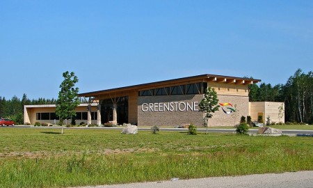
Geraldton, Ontario Highway 11 tourist centre

Geraldton’s fancy and new tourist center, visible from Highway 11

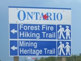
Thirty-eight kilometres west of Longlac, Geraldton has actively used a restored mine headspace in all its tourism literature.  The mine shaft is quire nicely restored. If you turn down Hardrock Drive (yes, it’s the best-named street in northern Ontario after Iroquois Falls’ Oil Tank Road) you’ll see a rocky landscape which I believe is the headframe’s parking lot and the starting point for the two hiking trails seen below.

The Geraldton Discovery Centre, on Highway 11 across from the mine shaft, is also really nicely done-up.  The Discovery Centre has exhibits on the area’s forestry and mining history, current practices in both industries, and also allows you to dress up in fireman gear and have your photo taken (handy if your wife or girlfriend is into that kind of thing and you’re not a firefighter like the most of us.)Geraldton's restored mine headframe on Highway 11Geraldon is on the shores of Kenogamisis Lake, which, by the way, offers some low-level cliff diving opportunities (I don’t endorse/condone/promote/suggest doing this, I just observed some people doing while I drove past. Do not jump off cliffs into the water, it’s really dangerous.)  Geraldton also has a nice golf course and some hiking trails.

Hiking trails in Geraldton, Ontario, highway 11

I think I’ll take a pass on the first one

I happened to be in town for their annual August long-weekend Jamboree.  I was planning to stop after I saw a Bristol board sign indicating that it was in nearby Macleod Provincial Park.  With my drive time approaching the six hour mark, and the valuable contents of my wallet becoming increasingly sparse with each stop for gas and coffee and doughnuts, and the rain beginning to pour, I declined my chance to jam with the locals.

Geraldton downtown, highway11.ca Ontario

Downtown Geraldton, Ontario north of Highway 11 (Credit: User P199 at Wiki Commons.)

I missed the town itself.  Geraldton is about five kilometres north of Highway 11.  (I was tired. I was trying to make it to Nipigon without getting gas. (Danger Will Robinson.  Red alert.  BAD IDEA!)  Plus. it was raining.  I had just passed a hitchhiker and felt really really guilty but not guilty enough to take my life into my own hands in the middle of nowhere in order to save the guy from the downpour.)  Therefore I continued along Highway 11, and missed out on mainstreet Geraldton.

If you continue up the road past Geraldton, you’ll eventually hit Nakina and Aroland, two of Ontario’s more isolated northern towns.

Greenstone municipal building in Geraldton, Ontario, north of Highway 11

Well this is pretty swish. (Credit: user P199 at Wiki Commons.)

Mine Centre

Mine Centre is on Highway 11 in between Fort Frances and Atikokan.

The regional tourist guide says that Mine Centre is “a small community…a great place to stop for a bite, get supplies, or talk to friendly locals.”  However, when you’re considered a small community in a place where every town is small, then you know Mine Centre truly must be another small Highway 11 hamlet.

Nearby, Bad Vermillion Lake is good for fishing – pike, bass, trout (supposedly “huge and tasty!” according to one site), walleye, and northern pike can all be found near Mine Centre.  There is the Turtle River wilderness area for those who wish to canoe or kayak.  I haven’t found many tourist listings on the internet but there seem to be a few cabin/camp operators near Mine Centre.

Keith emailed me to say that between Mine Centre and Fort Frances there is a place called Bears Passage, 7 km east of the intersection of Highway 11 and Highway 502. This area is mostly cabins and cottages but some people live year round. A nice lookout exists at the Bears Passage Bridge looking out on to Rainy River.