Churchill

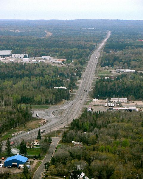
As you travel north on Yonge Street from Bradford, you’ll pass through two hamlets, both home to two churches sitting atop a hill.  One, is the very aplty named Churchill.

Churchill, Ontario, Curling Club, Highway 11

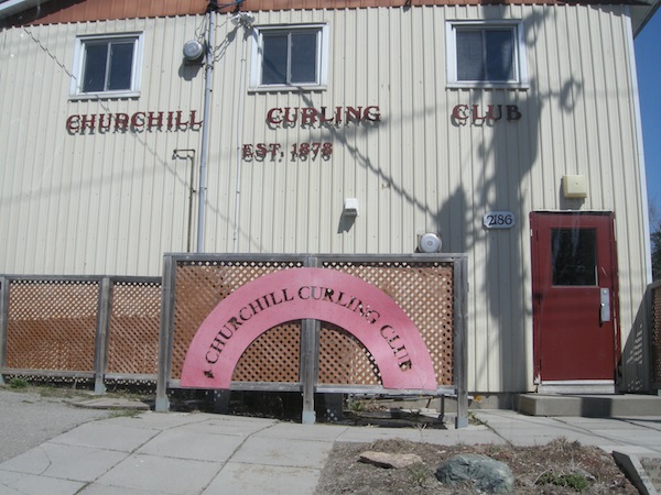
Who knew curling was even invented in 1878?

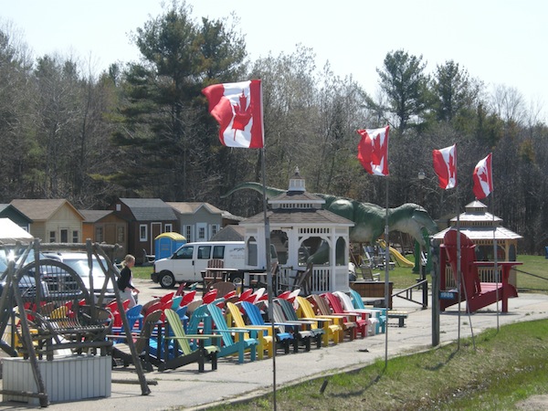
Churchill is pretty tiny.  There isn’t a gas station and there might have been a variety store, although I don’t recall one.  But with its two churches and a couple of old buildings, it’s kinda quaint.  There is a curling club, a store named Steeples that sells home decor, fudge, and pies, a garden centre (gotta love those multi-faceted Highway 11 stores), “Skydive Toronto” (isn’t that a bit misleading?), and, most importantly, a cowboy boot store.

Yes, you read that correctly – a place that sells western boots.  In a town that doesn’t even have a gas station.  If that doesn’t scream Highway 11, what does?

Churchill, Ontario, Wild Wild West Western Wear on Highway 11

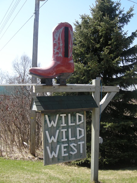
Does this medium-sized replica of a cowboy boot count as Churchill’s “big weird thing”?

I had to do a double-take.  I couldn’t believe my luck.  I pretty much pulled an immediate u-turn on Highway 11 – this is a big deal because there was traffic and when driving I’m cautious to the point of anal.  (You don’t know how many cool photos I’ve missed because I’m unwilling to slow down, pull over or pull a u-ey.  I missed going into Eagle Canyon in Dorion simply because I missed the turn and then didn’t feel comfy u-turning til I hit Thunder Bay, and by then I was too far away!)  I couldn’t believe that there would be two western boot stores in between Toronto and Barrie (the other is in Innisfil.)  I had dreams of finding a form-fitting pair of Tony Lama Regal Americanas in Antique Peanut or a pair of 11 EW Dan Post Justins in Cognac.  But sadly for me, I was driving on a Monday afternoon.  And in the off-season, Wild Wild West (which seems to run out of someone’s home) is only open on Saturdays from 11-5.

If you’re looking to venture off Highway 11, turn east onto Killarney Beach Road.  A ten minute drive will take you to Lefroy, a cute little beach town (with a great fish and chips shop) that reminds me some of the little shoreline towns on Lake Erie.

Highway11.ca my western boots

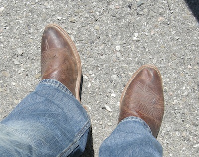
A few years back I needed to buy riding boots for a ranch vacation. They wouldn’t fit in my luggage so I had to wear them on the plane. Despite being the cheapest boots I could find they were the most comfortable shoes I’ve ever worn. Not to mention the coolest looking too. So I’m a convert. I even have a fancypants pair for work!

Farms near Churchill, Ontario, on Highway 11

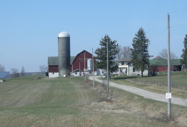
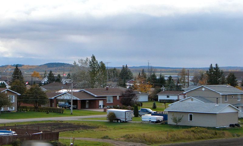
Although Churchill does have its modern subdivision just north of town at the crest of the hill, by and large it’s still an aggy community

Churchill, Ontario, St. Peter's Anglican Church on Highway 11

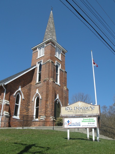
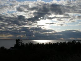
This is church #1 in Churchill when driving north up Highway 11. I did not get a photo of church #2.  It probably would have made more sense to put this photo up at the top where I refer to the churches.

Gravenhurst

If you’re coming up Yonge Street / Highway 11 from the south, Gravenhurst is the first real town north of Orillia.

And Gravenhurst is one of the first towns to truly straddle the northern-southern divide.Being in cottage country, Gravenhurst is home to all sorts of little things you’d not find in a northern town – a tea shop, two independent cafés, an upscale pub, a resort restaurant.  There is a small arts community – the downtown is littered with murals – and there is even the Gravenhurst Opera House, built in 1901.  The Muskoka Gallery By the Bay displays art near Gravenhurst’s cute waterfront.  The town hosts an annual Music on the Barge festival at Gull Lake Park, with many musicians playing in a picturesque setting.

But you can tell that there’s a bit of north in this town too.  It’s evident in the nature statues and the goofy motels and that one of its best-rated restaurants is a truck-stop.  It’s in the tacky miniputts and the ageing tourist traps and the way a community that essentially hugs a single main road tries to brand itself into two distinct districts (Downtown vs. Uptown).

And it is in the local restaurant rivalries that split long-time residents – the stone hearth knotty-pine rustic welcome of the China House versus the more run-down but all-day dim sum of the Rickshaw, and the Greek-Canadian combo at the Uptown Diner pitted against the Greek-Canadian-Italian of Rombo’s Family Restaurant.

Gravenhurst on Yonge St, Highway 11 Ontario

I’m a little bit country – Fish-and-bear statues, strange motel-restaurant combos, big weird cottage chairs (watch out Callander and Fort Frances), and more bear sculptures…Gravenhurst has touches of northern Ontario

It's not every Muskoka town that has an Opera House and a statue of a communist doctor

And I’m a little bit rock and roll – It’s not every Highway 11 town that has an Opera House and a statue of a communist doctor – Gravenhurst is still a bit southern, too.

Gravenhurst was named after a village in England which is mentioned in Washington Irving’s book Bracebridge Hall.  Between 1940 and 1943 it was known as “Little Norway” due to its proximity to the Norwegian Air Force’s temporary training base in Canada.  Today Gravenhurst is a retirement and cottage community.

With a permanent population of 10 000, Gravenhurst is the smallest of the towns that make up the cottage country triangle (Bracebridge and Huntsville being larger) but it is still big enough and touristy enough to have the main food and lodging franchises, as well as other tourist amenities.   Muskoka steamships operate three different ships that give tours of the many picturesque lakes in the area, with dinner and music cruises available.

But what struck me most about Gravenhurst was the pace.

Cars sauntering down the road, none hitting more than maybe 30 kilometres an hour.

Moms chatting along the main street, enjoying a sundrenched May weekday before their kids get released from school in six weeks.

A young family resting in the shadow of the statue of Dr. Norman Bethune, likely oblivious to the fact that he’s the only westerner to have a statue in China (and probably the only communist to have a statue on Yonge Street) taking in the fresh air whilst retrieving the shoes that their toddler had kicked off.

Local kids out for lunch, meandering in their flip flops having jumped at the chance to wear summer clothing in the decidedly spring weather, full of the listlessness of near-freedom in the face of limited opportunity brings after a tiring, cold winter.

Everyone enjoying the space that becomes so competed-for once the cottagers come in, yet likely all-too-aware that none of this would be possible without the annual invasion of busy and bustling out-of-towners that trample this vibe for twelve weeks each and every year.

Gravenhurst Ontario chinese food

Even after all of these years eating at northern Ontario Chinese food restaurants, I have never ordered the “Canadian” food

Downtown Gravenhurst on a warm and sunny May morning

Downtown Gravenhurst on a warm and sunny May morning

More AdirondackoopsImeanMuskoka chairs on Highway 11

More Adirondack oops I mean Muskoka chairs on Highway 11…and another inexplicable Yonge Street / Highway 11 dinosaur sighting.

North Bay

Although considered to be in northern Ontario, if you look at it North Bay really isn’t that far north.

“Just north enough to be perfect” according to its slogan, North Bay is the second city of Ontario’s near north (after Sudbury.)

Considering what southern Ontario considers to be ‘north’, maybe “just north enough to be perfect” should be Barrie’s slogan? Kidding…!North Bay, Ontario, Highway 11

Explored by Samuel de Champlain, North Bay wasn’t founded until 1891.  Primarily a railway town, North Bay once harboured massive ambitions of being Canada’s Panama – there were plans for a canal stretching from the Ottawa River through the town to Lake Nipissing, which would have essentially been a massive shortcut for boats en route from Thunder Bay.  This never materialized.  North Bay did however play an important role during the silver rushes in Cobalt as it was the hub of both the CPR and the ONTC line up to northeastern Ontario. Today, North Bay is largely a university, military, and (most importantly) a transportation town.

Highway 11 ontario north bay highway11.ca

Highway 11 heading out of North Bay (Credit: P199 from Wiki Commons)

I’ve driven through North Bay five times, and stopped in a couple of other times for visits of a few hours.  It has all the amenities a trveller could need – from motels to real hotels, from diners to chain restaurants, from no name doughnut stops to Tim Horton’s.

North Bay is essentially the last place to get a full range of big city shops, services, and franchises before Timmins, or if you plan to stay solely on Highway 11, the last place before Thunder Bay.. I was once told by a facetious friend that North Bay is Cree for “a place on the lake where the gas is cheaper.”  While that’s obviously a joke, the general point about gas prices is true – sometimes as much as 15 cents cheaper than its more northern counterparts.

Lake Nipplesing, North Bay, highway 11

Lake Nippissing under clouds.

North Bay is home to a really nice restored theatre – the Capitol Centre – that hosts plays and concerts. (I got dragged to an Anne of Green Gables play while we were there…and I can’t believe I’m admitting this but it was actually kind of good.  The island, the island, we’re from Prince Edward Island…we’re island, we’re island throughandthrough…)  Although the theatre doesn’t immediately catch the eye (it’s on Main St, or Oak St, I can’t remember) the inside is really quite nice. There truly isn’t a bad seat in the house.

North Bay was home to Mike Harris, a two-term Ontario Premier during the late 1990s in Ontario whose name pretty much became a curse-word if you were a public school student at the time.  He’s famous for the coining the phrase “common sense revolution.” Oh, and the Dionne Quintuplets were born in nearby Corbeil Callander.  Their exploitation brought a fair amount of money to North Bay during the depression.  Kids in the Hall comedian Scott Thompson was born in North Bay (I think he grew up in Scarborough though), as is weatherperson Susan Hay and a pretty not so great band called High Holy Days.

Plan in North Bay, highway 11, Ontario

North Bay’s “some big weird thing” is a bit more refined than some other northern Ontario towns

North Bay is also famous for being the hometown of Roy Thomson, the founder of the Thomson media empire and the namesake of Toronto’s Roy Thomson Hall, one of Canada’s premiere music venues. Roy Thomson started out selling radios door-to-door in North Bay. This interest in radio led to him taking over the local radio station, taking over or establishing more radio stations, then expeanding into newspapers – eventually making him one of Canada’s most successful businessmen.

North Bay cruise tour highway 11

I once chuckled at an acquaintance who recounted their engagement story, which occurred under a Tuscan sunset.  I shouldn’t have laughed – I almost proposed on a boat tour of Lake Nipissing

Tourist activities include the Commanda boat tours on Lake Nipissing, and the beach, walkways, and mini train ride at the city’s waterfront.  There are plays (Nipissing Stage Company) and festivals (The Heritage Festival every August Civic holiday.)  The Dream Catcher Express used to run a day-trip train to Temagami to view the leaves in the fall – but that’s been cancelled since the government shut down the ONTC. There is also the original Dionne House, where to Dionne quints were born (the house pictured second from top on the left), which has been moved into town and turned into a little museum. The museum is open from Spring to late October, and entrance is about 3$ each, and is worth a visit if you’re in town.

Dionne House Museum, Ontario, Highway 11

I never cease to amaze myself with how crap my photos can get. This is the Dionne Quints Museum house.

What else can I say about North Bay?  You know, this site is kinda focused on the more northern towns, like Timmins, so I guess I’m not always putting as much content up about places like Barrie or North Bay, etc. I guess since North Bay is a bit bigger than the average town on this site, there is less I have to tell you. North Bay is pretty nice, it seems like a good place to live and a great place to grow up – but this site is a bit more about the smaller, more remote towns to its north. (I got flack from a poster on the Huntsville page for this site’s north-centric focus, I’m waiting for same flack to be posted on behalf of North Bay too…)

Fun in North Bay, Highway 11

For a while I had no photos of North Bay, and this was the first that came up in google

Marten River

Marten River is a hamlet of about 100 people 45 kilometres south of Temagami.  On the south end of Lake Temagami, the town is largely dependent on forestry and tourism, and is home to a number of lodges and outfitters.

Marten Falls, big fish, Highway 11 Ontario

Highway 11’s largest fish? That’s what Marten Falls claims

Marten River Provincial Park has camping, hiking, and a replica 19th century logging camp.  Every July there is the annual Logging Days Festival.  It is also home to the obligatory “some big weird thing” that each town in northern Ontario seems to have – in this case, it is what they claim is Highway 11’s biggest fish, though Nipigon might have something to say about that.  (Sorry, Larder Lake, you’re disqualified.  You’re not on Highway 11 at all.)

There is a gas station in town, Marten River Outfitters, and a few little places to eat, including the Rock Pine Motel and Restaurant.

There are three lakes near Marten River – Marten Lake, Ingall Lake, and Jumping Caribou Lake.  The lake is stocked with fish and there is also hiking at the local crown game preserve.

Latchford

With the town motto of “The Best Little Town By a Dam Site”, Latchford signals the end of Temagami and the beginning of Temiskaming. (Scroll down to the bottom of the page for more photos.)

Like Smooth Rock Falls, another tourist guide I saw advises that Latchford is “the perfect stopover place for food, fuel, and tourist information” however I couldn’t really attest on my first visit – I was in a rush, Latchford was small, and you can’t stop everywhere each time you take a roadtrip. I’ve since visited and can confirm that, while tiny, Latchford is clean, quiet, and has some nice river access and good hiking nearby.

Aubrey Cosens Bridge, Latchford Ontario, Highway 11

Like a mini Skyway Bridge made of big mechano

Latchford was founded in 1902 as a logging town on the Montréal River.  Steamboats used Latchford as a home base to pick up passengers on their way up the Montreal River to Elk Lake. Today the river is crossed by the newly restored Sergeant Aubrey Cosens Bridge. (And this is the second thing named after this guy – there’s also a heritage plaque near Iroquois Falls.) The bridge buckled in the winter of 2003 after it rusted to an unsafe state.  It was closed for months, cutting off all of northeastern Ontario from he Highway 11 artery it so relied upon. Trucks were forced to detour east through Témiscamingue, Québec, up and over Lake Temiskaming and into the Tri-Towns, or west through Sudbury, Gogama, and through Timmins – until a temporary bridge was built. Thankfully, it has now been fixed.

More interestingly, Latchford used to be the home of a big casino during the Cobalt mining boom.  Many miners and prospectors would come to Latchford to party and increase their fortunes, and of course to visit the dancers and prostitutes that called the casino home.  I think the town has quieted down sufficiently since then.

Latchford, Shortest Covered Bridge in the World, Highway 11

Latchford’s “some small weird thing” – The World’s Shortest Covered Bridge!

In Latchford there are tours along the Montréal River.  There is a little town museum (called the Latchford House of Memories) which opens in the spring and closes the second week of October. Latchford is also home to the Ontario Logging Hall of Fame, which has an old blacksmith shop, an icehouse, some old logging equipment, and a restored turn-of-the-century sawmill.  I’m surprised some environmentalists haven’t defaced the logging museum. Latchford is also known for having the world’s shortest covered bridge.  Every August they have their annual canoe and kayak races on the river. If you’re into hunting, the area around Latchford is good for bear, and is located in two prime moose areas. The whole of Highway 11 from North Bay to beyond Latchford is postered with “watch out for moose” signs everywhere.

Latchford is pretty small, but it has a decent spate of amenities. The town has its own tourist info centre (located in the municipal office) however it was closed in October when I was there last. There are many lodges, campsites, and RV sites nearby for accommodation, as well as a diner, a Chip Stand (LA Fries – it is for sale), a variety store, and a gas station in town. Latchford is home to an LCBO agency outlet which stays open until 8 or 9 PM. Wilks Restaurant (also called the Café Log Cabin Café) is housed in a trailer just north of the tourist information centre, and serves homemade food at reasonable prices. Wilks Restaurant has been highly recommended to me by people who live in the area.

Highway 11 Ontario backcountry near Latchford

An ode to Fergus. My trusty, gas-sipping steed is now longer

I’ve stayed at Bay Lee Mac Camp, which is within Latchford’s southern limits, about halfway between Latchford and Temagami. While rustic (no electricity – all lights, the stove and fridge ran on propane) the cottage was clean, quiet, and serene – I don’t think I’ve ever been in a quieter place in my life. Located right on Rib Lake, Bay Lee Mac has water access for swimming, boating, and canoeing, provide organized hikes and hunts, and is located close to the Ottawa-Temiskaming Highland Trail.

Additional outdoors activities include the fishing derby in July – check it out here if you’re interested – and WJB Greenwood Provincial Park.

Dymond

One tourist guide I saw promotes Dymond as “the jewel of Temiskaming”.  While I think Earlton gives them a serious run for their money in the “jewel” department, Dymond is a nice little township of farms, big box stores, and fast food restaurants, where English and French are both spoken approximately equally.

Ms. Holstein, Queen of Dymond on Highway 11

Ms. Holstein, Queen of Dymond

Despite its southern Ontario feel, Dymond is a northern Ontario town and therefore has to have “some big weird thing”.  That would be Ms. Claybelt the Oversize Holstein, as well as the model Mack Truck at Gilli’s Truckstop, both on the main Highway 11.  (That is not me in the photo – my camera conked out in North Bay and didn’t get charged until Kirkland Lake so I had to steal this photo from the town’s website.)

I thought that Dymond was in the Tri Towns but really it’s not, as the name refers to Haileybury, New Liskeard, and Cobalt.  Dymond was forced to merge with New Liskeard and Haileybury in the 1990s to form the municipality of Temiskaming Shores.  It is technically the oldest of the three townships, as it was founded in 1901.  Dymond has relied on its agricultural base to withstand the boom-bust economic of northern Ontario, and to this day retains a distinctly agricultural feel…that is, once you get past the strip malls.

Dymond has recently become a big-box-store, fast food, and motel haven.  Dymond is essentially the last spot to do any real shopping on Highway 11 between North Bay and Thunder Bay without taking a fairly major detour off Highway 11 into Timmins.  (I hope this doesn’t draw business away from New Liskeard’s fairly quaint downtown.)  There’s a Walmart, a Zellers, a fairly big Canadian Tire, a new steak restaurant, and a number of different fast food outlets including McDonald’s and the last Harvey’s on the whole of Highway 11.

This is important so let me re-ierate this – if you’re travelling west toward Thunder Bay, Dymond has the last Harvey’s on the whole of Highway 11.
There isn’t a tonne to do in Dymond – most visitors would be likely to skip it for New Liskeard or Haileybury.  However there is a golf course and some hiking available – stop at the tourist building on Highway 11b for more info.  There is also the Little Claybelt Homesteaders Museum, chronicling the rise of agriculture and the founding of the Tri-Town.  On main Highway 11 (west of New Liskeard) there is a little lookout with a nice view of the Tri-Town.

Earlton

You can tell you’re in farm country in Earlton – 1) it has a John Deere dealership, and 2) the Earlton Country Store isn’t a craft outlet, it’s a real country store complete with seed, fertilizers, and farm tools.

Earlton hosted the International Plowing Match in 2009

Earlton hosted the International Plowing Match in 2009.  (Photo credit: Highgrader Magazine)

Earlton is a francophone farm hamlet of about 800 on Highway 11.  I love Earlton.  It reminds me of southern Ontario.  Upon driving in to Earlton you see the grain, corn, and dairy farms (I think they also grow some potatoes and berries up here too.)  Depending on the direction of the wind, the town sometimes smells like a barn.  But that’s why it is so neat.  Heck, there are cows practically right in the town itself.  Earlton is so cute – I love it.

Cow traffic jam!  Cattle graze near homes in Earlton, Ontario on highway 11

Honestly, these were right in the middle of town

Earlton is kind of the half-way point between North Bay and Cochrane, being about 200 kilometres in between both.  Earlton is about 30 kilometres north of New Liskeard. Earlton is the home of hockey’s true number 99, former Maple Leafs player Wilf Paiement, who recently appeared in a pretty-cheesy-but-not-unfunny Leon’s commercial (“You can make three easy paiements…”)

Earlton used to be well known for the Earlton Zoo – the only place in Ontario north of Toronto to have zebras and other African animals.  However that morphed into the Temiskaming Wildlife Centre, which took care or orphaned or rescued animals from across the north.  Apparently, according to posters below, the Centre is now shut down.

Earlton, Ontario on Highway 11 highway11.ca

(Credit: User P199 at wiki Commons.)

There is also Manitou, the famous bison statue that is (if I am correct) the world’s largest sculpture of a bison or buffalo.  If you get up close, you’ll see that it is made of everything from sheet metal to fibreglass to nuts and bolts (as hair.)  It is even anatomically correct, which I’m sure leads to many rude photos and pranks.

Earlton, Ontario Highway 11 Bison statue

Earlton’s anatomically correct bison

Earlton hosts a number of festivals.  As a farming town, Earlton hosts a farm fair the weekend after Labour Day.  Every July 15 and 16 Earlton hosts its annual Steam Days, where old steam powered machines are resurrected and displayed.  There is also the yearly Temiskaming Drag n’ Fly drag racing event held at the airport. Earlton was also the home to the 2009 International Plowing Match – the furthest north the IPM has ever been held. (Scroll down for a few IPM photos – thanks to Highgrader Magazine for the International Plowing Match photos.)

Earlton, Ontario 2006 protest

Local businesses and residents fought the closure of the Thornloe Cheese Factory, and won

In terms of services, Earlton has a caisse, a Scotiabank and Chartrand’s Grocery.  Hotel LaSalle (“the friendly place”) has takeout and dine-in food.  There are also two chip stands, a little bowling alley (it is northern Ontario still!) and a motel.  There is a baseball diamond and recreation centre at the west end of town.  There is gas just off Highway 11, and Real’s Barbershop is in town should you need a haircut on your roadtrip.

Earlton is definitely worth a stop, especially on a summer evening to watch the sun set over the local farms.  You’ll swear you’re in Perth County or Essex County, not Temiskaming.

Earlton, Ontario rural airport, highway11.ca

Earlton’s little airport, surrounded by countryside. (Credit: User P199 at Wiki Commons.)

Earlton, Ontario 2009 IPM Highway 11

2009 International Plowing Match. (Photo credit: Highgrader Magazine.)

Virginiatown / Kearns

Continuing our detour off Highway 11, Virginiatown and Kearns are two villages (population approximately 800) northeast of Krugerdorf via Highway 624.  V-town is just a tad west of the Quebec border on the northeastern shore of Larder Lake.Virginiatown and Kearns, OntarioBuilt in the shadow of the great Mount Cheminis, the area known as Virginiatown is comprised of three different villages – Kearns, North Virginiatown, and Virginiatown proper. I would have done separate pages for all three but a) I don’t have a tonne of info, and b) I’m not sure where one village ends and the next one begins on a map. I think North Virginiatown is north of Highway 66, Virginiatown is south of it, and Kearns is just a kilometre or two east.

Virginiatown is actually much closer to Rouyn than Timmins or any other larger centres in Ontario. Therefore, (and I might be wrong, but) I’m pretty sure that V-town, as it is affectionately called, is a largely francophone community which had its heyday with the northeastern Ontario mining boom in the early half of the 20th century.  So, I checked this fact.  Statscan tells me that Virginiatown and area is largely francophone.  But emailers and posters (before I lost all the posts) tell me that nearly no one speaks French in V-town.  So, I don’t know.

Virginiatown, Ontario

Highway 66 traveling east into Virginiatown, with Mount Cheminis in the background

Virginiatown sprung up with the expansion of the mineral rush which began in Cobalt in the early 1900s and drove north founding towns like Kirkland Lake and Larder Lake. V-town was famous for the Kerr Addison Mine, which at one time was the richest gold deposit in North America. The gold from the first Canadian 5 ounce gold coin was mined from the Kerr Addison. Today, a coin monument stands to commemorate this Virginiatown achievement.

Like all boom towns, this had to come to an end eventually. The Kerr Addison Mine shut down in the 1990s, and while there is still exploration and some smaller gold ventures in the area, Virginiatown is pretty sleepy nowadays. Check out the link to Louie Palu’s photos below, it contains some fantastic shots of mining life in Larder Lake and Virginiatown mines.

Virginiatown coin, Ontario

Does V-town’s big weird coin outdo Larder Lake‘s flying fish?

There is a boat launch to Larder Lake, and you can access nearby Labyrinth Lake where you can catch northern pike, bass, and walleye. According to google, there is a ceramic shop in town as well. You can visit the Virginiatown Heritage House for a history of the town and its mining past, or hike the Heritage Gold Trail to view underground mining equipment.

Mount Cheminis is, in my opinion, the coolest thing in the area. Shooting up from the trees like the bum of a thick marker, it rises majestically above V-town and is visible from Highway 66. You can hike up the summit from local trails. Check out some of the nice pictures in the links below. Andre emailed to let me know that Mount Cheminis (known as Mont Chaudron in French) is techhnically in Québec.

Mount Cheminis, Virginiatown, Ontario

Mount Cheminis. Awesome!

Services in town include gas (Guy’s Service Station), a small grocery store, and the usual small-town-northern-Ontario stuff like the Bear Creek Bait and Tackle shop and a curling club. Chez Lucie is a drug store, convenience store, and video rental in one, and Armando’s “Le Bar” is a local diner and watering hole. The Cheminis Lodge provides bed and breakfast facilities and lodging, as does the Hilltop Inn.

The only time I drove through Virginiatown was en route to Rouyn. I was on a schedule, so I stopped to take a picture with the big coin and that’s it. Please help me add to this page – send personal anecdotes, history, photos, and advice to info (at) highway11 (dot) ca.

For an archive of the 30 comments that were posted to Highway11.ca’s profile of Virigniatown/Kearns between 2008 and 2012, please click here.

Larder Lake

Unlike Kirkland Lake, there is actually a Larder Lake in Larder Lake. Larder Lake is a former mining town about 10 kilometres west of Virginiatown on Highway 66 (not Highway 11 – detour still in effect), and 20 kilometres from the Québec border.

Larder Lake was first settled in 1906 after the silver boom in Cobalt pushed people further north in search of more mineral deposits. Gold was found in the Larder Lake area, creating a boomtown in the bush.

Larder Lake Ontario fish

Larder Lake’s entry in the “some big weird thing” contest: a big fish

I’ve been to Larder twice but never really gathered much intel. There are some camping and picnic areas, a beach, and a 30 slip marina. Larder Lake also has an LCBO, a service station, a public library, a post office, a motel, and a restaurant.  Unlike its largely anglophone neighbour Kirkland Lake, approximately 40 percent of Larder Lake residents are francophone.

Ashley emailed to let me know that there is the Raven Beach Campground run by the town, and the most northerly skill hill in Ontario (along with Timmins‘ Kamiskotia.) He also advised that, on the way to Larder Lake from Kirkland lake there is Fork Lake Resort, that has a campground, cabins and a beach strop. But here’s the most important part: apparently, there is a really good restaurant where they serve the most excellent pie in the area – just make sure to call ahead to make sure they’re open

Help add to this page – email at info (at) highway11 (dot) ca, or post your thoughts below.

Cochrane

Chimo the Polar Bear in Cochrane, ON

Travel blog lesson #31 – always take a second, empty, non-person photo.  Or else you may end up with a blog full of photos of previous girlfriends.

Most towns would make a big deal of the fact that a former hockey player and doughnut baron hailed from their community.

Instead, Cochrane advertises Nanook, Aurora, and Nakita as its three most famous citizens.

Yep, we’re talking about animals.

If you have a fear of polar bears, steer well clear of Cochrane. I’m just teasing – they’re well contained. Cochrane has adopted the polar bear as their town symbol, even though true polar bear habitat is more than 300 kilometres away.  There are even fake igloos in town.

Chimo, the town mascot, is honoured with a big polar bear statue just as you enter town.  There’s also the Polar Bear Conservatory, where Nanook, Aurora, and Nakita spend their time.  There you can watch feedings, see interpretive displays, and “swim with the polar bears.” Ok, so if you’re more than 4 feet tall it is more of a wade than a swim but don’t let my teasing dissuade you – the Polar Bear Conservatory is interesting. Kids love the wading with the polar bears part. There’s also an adjacent ‘old style’ village with gas pumps, farm implements, and a collection of really awesome vintage skidoos.

Polar bear conservancy in Cochrane, Ontario

This was pretty cool, to be honest

Old Tyme Village ski-doo collection, Cochrane, Ontario

Definitely the most northern Ontario museum in northern Ontario

Cochrane is a very pretty little community of 4500 (slightly more anglophone than francophone) on Highway 11.  No matter what language you’re in, Cochrane is pronounced like cock-ran.  This might seem pretty intuitive but once in a gas station with a bunch of tourists from Belgium who kept asking how to get to a place that sounded like Cosh-rahnne and no-one, not the anglos nor the francos knew what the heck they were talking about.  I only figured it out about a year later.  Hopefully it didn’t take them that long.

Old locomotive on display in Cochrane, Ontario

(Credit: Patrick)

It has a growing tourist industry built on the Polar Bear Express, which runs north to Moosonee twice a day in the summer.  Or at least it did, until the government stopped supporting the railway and now no-one knows what’s happening to the ONR.

Fishing and ATV expeditions often start here.  Greenwater Provincial Park is about an hour west of the town, providing fishing, swimming, and hiking around a series of kettle lakes.  Greenwater is pretty, and quiet. Also notable is the Tim Horton arena, home to the Tim Horton museum, that I didn’t have a chance to visit.

One of the coolest things about Cochrane, in my books at least, is Lake Commando. One –  that’s a sweet name.  Lake Commando. Sure, it’s more like a pond, but the words ‘Lake Commando’ just sounds so cool.  That’s awesome.  That’s even cooler than Geraldton’s Hardrock Drive, or Iroquois Falls’ Oil Tank Road. Two – it’s pretty.  It has parkland around it, a walking trail, and a quaint little bridge.  There’s also a bed and breakfast bordering the lake.

Cochrane, Ontario train station leads to James Bay

Cochrane train station.  (I do not know how to effectively use my camera in any lighting – dark or bright.)

As for amenities, since Cochrane has about 4500 people it’s fairly well served.  If you’re looking to bring out your fancy-pants you may be out of luck, but otherwise there’s everything you need.  Cochrane has a Tim Horton’s (which pays homage to the town’s most famous son with plaques on the walls, memorabilia all around), a KFC, and some other diner-style restaurants.  There’s also a rib/wing place and the Station Inn if you want a real sit-down meal, and, of course, a place serving Authentic Northern Ontario Chinese Food.

Cochrane, Ontario on Highway 11

Can you milk a polar bear? Well, Cochrane sure does. (Photo credit: Patrick)

There’s a small farmer’s market at the north end of town every Saturday, and a country store you’ll see across from the polar bear statue that sells cottagy-type stuff that you see in Muksoka.  Also, Cochrane has the last Giant Tiger on Highway 11 after Kirkland Lake.

Cochrane is also notable for receiving Ontario’s first ever permit to serve liquor on a Sunday, for a winter carnival held in the mid 1960s. Despite the devastating fires of 1910, 1911, 1916, and Cochrane still exists to this day.

Thanks to Paul for some of the Cochrane.

Lake Commando, Cochrane, Ontario

Lake Commando.  Still looking for Rambo River. (Come to think of it, there was a Rambo Creek near to where I grew up…800 km away)

Cochrane, Ontario off highway 11 highway11.ca

(Credit: User P199 at Wiki Commons.)

Cochrane, Ontario street

Streetscape in Cochrane

Cochrane, Ontario municipal building highway 11

A nicer Cochrane streetscape. (Credit: User P199 at Wiki Commons.)