Innisfil

Innisfil is the town in Ontario.  Innisfail is its namesake out in Alberta.  I’m going to get that out of the way and try my best not to make any typos and avoid any negative emails.  For this site, typing Innisfail would be an epic fail.

Highway 11 Ontairo, Innisfil, highway11.ca

For years, David Wilcox was never invited to play my hometown’s summer festival because the organizers thought that his crowd (baby boomer dads?) was “too rowdy”

Innisfil is pretty well-known throughout southern and central Ontario for its beach on Lake Simcoe and its outlet malls on Highway 400 near Cookstown.   After driving down Highway 11 south of Barrie, however, I gotta say that I’m a little confused.

I knew that, administratively, Innisfil encompassed a collection of villages and hamlets south of Barrie and along the western shore of Lake Simcoe.  But, I always thought that there was a specific settlement named Innisfil on Yonge Street / Highway 11.  That may be the case, but it wasn’t apparent during my recent trip on Highway 11.  My map reads: St. Paul’s, Stroud, Barclay, Churchill, Fennell, Coulson’s Hill, and then Bradford.  No Innisfil in sight, other than in block letters over the region.

Innisfil has changed a lot since its first settlement in the late 1800s.  After more than a half-century as a farming region, Innisfil has slowly become more commuter-focused.  At one time, almost every house on Lake Simcoe was a recreational property.  Today, more than 90 percent are year-round permanent residences.

Though the Ontario Stock Yards moved here from Toronto in 1993, Innisfil has gradually become less agricultural.  It lost land to Barrie in 1967, 1982, 1993, and 2010 despite pressure to facilitate development for commuter residents bound for Barrie or Toronto.  Book-ended by Barrie’s 135 000 people and Newmarket’s 80 000, Innisfil’s 32 000 (spread over over seven or eight communities) are facing the squeeze of urbanization.  Contrast this to the depopulation problems faced by communities an hour or two further north and you’ll have a good sense of how Ontario’s diversity can be a challenge in creating political and societal consensus province-wide.

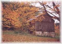
Innisfil, Ontario on Highway 11 farming highway11.ca

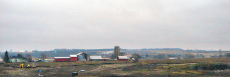
Farms outside Innisfil, Ontario on Highway 11 (Credit: User P199 at Wiki Commons.)

I don’t often advocate leaving Highway 11 for 400-series highways, but in the case of Innisfil you have my blessing.  Not only if you’re going to the beach, but also if you’re looking for antiques.  The Roadshow 400 Antique Mall is located right on Highway 400.  And it is really fantastic, open during the week and weekends, with some of the best selection of antiques available day-in-day-out in Ontario.  (It gives Southworks in Cambridge a run for its money.)  And the yellow-and-black chip truck in the parking lot has a pretty decent poutine.

Antiques in Innisfil, highway11.ca Ontario

Don’t get distracted by the neighbouring flea market, focus on the antique mall at the east end of the complex.

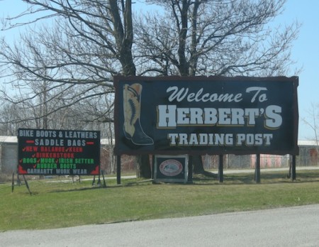
The other reason to head off Highway 11 in Innisfil is Herbert’s Western Boots and Western Wear.  One of two cowboy boots stores on Highway 11, Herbert’s has the best selection in western boots in the area, and I can attest that staff are helpful and low-pressure – willing to help you for hours if need-be, even if you can’t find the pair for you.  (Keleher’s Western Boots and Tack, also in Cambridge, has a slightly larger selection.)
Innisfil, Ontario, Cowbow Boots Herbert's Western Wear, Highway11.ca

Uhh, yup we’re not in Toronto anymore.

North Shore

Aha!  So you thought that Barrie and Orillia were close by.  Think again!  It’s about 40 kilometres from Barrie to Orillia.

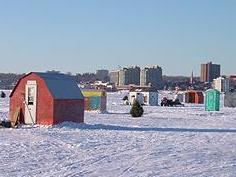
Ice fishing, Lake Simcoe, Highway 11

Ice fishing on Lake Simcoe, just watch out for global warming

As an ignorant southern Ontarian I always grew up associating the two, sort of Barrie is to Orillia what Hamilton is to Burlington.   Well, it’s a mistake that I made countless times – thinking that once you hit Barrie, you’ll hit Orillia about 10 minutes later.  Well no, you won’t.  It takes a while, especially if you think past the distance between the town boundaries and actually are driving from Barrie town centre to Orillia town centre.

This is where the transition begins, southern Ontario slowly blending northward into a no man’s land of cottage country temporariness.  It’s evident in the mix of permanent and seasonal businesses that dot the highway – the junk stores disguised as antique shops, the candy stores for the kids, a Napoleon barbecue outlet, the cottage furniture stores, the old-school huntin’ and finshin’ sporting goods and outfitters, the portable sawmilling service, the ads for timber framing, the cycle of independent burger joints constantly opening and closing juxtaposes against the opening of a new Oliver & Bonacini restaurant to serve the cottage crowd.

Highway 11 near Hawkestone

There are a few towns in between Barrie and Orillia along the north shore of Lake Simcoe but I haven’t profiled them because this section of Highway 11 is more like a real highway – it has four lanes, it has exits, and it completely by passes the area’s small towns in the name of faster travelling.  So I’m sorry, Crown Hill, Guthrie, Oro, and Forest Home, I haven’t visited and considering that this is the last stretch of real highway on Highway 11, I’m unlikely to stop anytime soon.

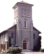
Additionally, many of the towns are a bit of a detour off the highway, sometimes all the way to the shores of Lake Simcoe.  If it was in northern Ontario I’d probably take the detour, but up north towns are few and far between.  They’re a luxury.  In southern Ontario and especially in cottage country towns are a dime a dozen.  So I’m sorry Shanty Bay, Oro Station, and Hawkestone, I haven’t visited.Church, north shore lake simcoe near Barrie, Highway 11

I’ve always found this bit of a difficult drive.  You go from the 400 series Highways, averaging 120 kilometres an hour over three lanes to a highway littered with fast food restaurants on the side, cars merging and exiting at speeds way too high for the two-lane divided highway that is this part of Highway 11.

So now that you know there is some space between Barrie and Orillia, you may continue your journey to either of those two cities.

Muskoka Falls

Muskoka Falls is a village southeast of Bracebridge just a couple of minutes east off Highway 11.

If you need a break from the Raffi and the kids need a chance to do more than just shake shake shake their sillies out, the small beach strip is a good spot – there is swimming, sand, a couple of picnic tables, and the dull roar of the falls in the air – all in an area small enough to be able to keep an eye on the kids while still relaxing.

Muskoka Falls, Ontario on Highway 11 / Yonge Street

If you’re driving from the north, take the second Muskoka Falls/Bracebridge exit (first if you’re driving from the south), turn right, and then take your first left.  Don’t be tempted by the signs pointing to a Subway, a McDonald’s and a Harvey’s just a few kilometres away – that’s the sneaky back route that Bracebridge uses to get you on a long, winding trip that often plunks you down not in the fast food drive-through of your choosing, but right into its downtown instead.

Muskoka Falls was one of the first stops on the Ferguson Road, an old gravel precursor to Highway 11 that was built section by section between 1858 and 1927.  The site of free government land grants to encourage settlement of the Ontario backcountry, Muskoka Falls was intended to be an important agricultural spot but crap soils meant that it never became one.  Lumbering and hydro followed – particularly as sections of Highway 11 were connected and paved – but by and large the area become reforested and overgrown.

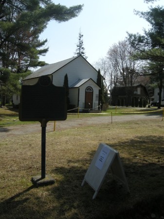
Today it’s a tiny village with an elementary school, a boat launch and a small public beach facing Muskoka Falls. The village has a church, Muskoka Falls United Church, and there is a cemetery with some burials from as far back as the 1800s.  There’s a Lafarge Cement plant, the Skyway Motel, and small private airfield just west of the village site, off Highway 11.

If you have photos of or info on Muskoka Falls let me know, post below or email me at info (at) highway11 (dot) ca.

Ontario historical plaque for the Ferguson Road outside the old church in Muskoka Falls, just off Highway 11

Random graffiti at the Muskoka Falls public beach
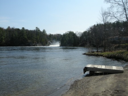
The falls, from the public boat launch in Muskoka Falls

The falls, from the public boat launch in Muskoka Falls