Holland Marsh

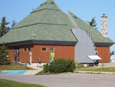
Holland Marsh, Canal Road farmer's market, Highway 11

The Canal Road farmers market has a direct exit from the 400

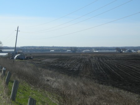
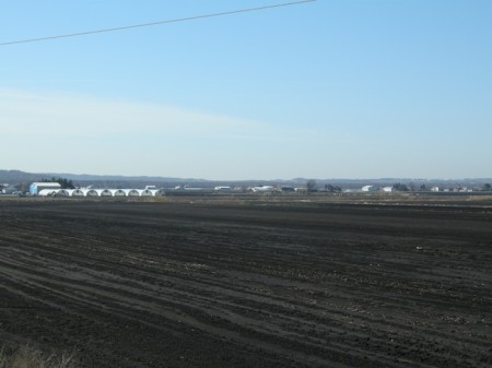
Although it’s not immediately apparent when you’re driving on Highway 11, you can’t miss the wet, black fields and the plasticky, arching growtunnels of the Holland Marsh when you’re on the 400.

Stretching from Highway 400 to the outskirts of Holland Landing in the east and Innisfil in the north – with Bradford right in the middle – the Holland Marsh is one of central Ontario’s most productive agricultural areas.

The area was first settled in the 1880s when local mattress companies set up shop in order to harvest marsh reeds for stuffing and bedding.  By the mid 1920s the marshes had largely been drained, leading to the founding of a small Dutch settlement of 15 families in 1935.

Today the Holland Marsh is a mix of corporate farms, veg processors and family farmers that largely grow market garden crops for local consumption, particularly onions, carrots, and lettuces.  During the summer months, there is a farmer’s market open on Canal Road, just off the 400 as you get ready to drive up the big hill.

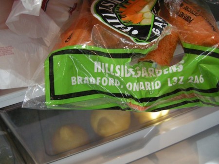
Carrots from Bradford, Ontario, Holland Marsh, highway11.ca

Holland Marsh veggies, in my fridge!

Holland Marsh, highway11.ca Ontario Holland Marsh, Ontario, highway11.ca

Krugerdorf

We’re detouring from Highway 11 a bit to visit Krugerdorf, and some towns on Highway 66.

Krugerdorf was founded as a farming homestead in Chamberlain Township in the early 1900s, about 25 kilometres south of Kirkland Lake. Not officially named Krugerdorf until 1949, the area was largely settled by a number of German families. The town was given the name “The German Settlement” until it became to be called Krugerdorf.

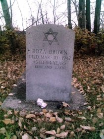
Krugerdorf, Ontairo Jewsih cemetary off Highway 11One of the first settlers was August Kruger, a farmer and blacksmith from Germany. Having migrated to Renfrew County in 1879 (northwest of Ottawa), August and his son Frank left for the Krugerdorf area in 1905, where he was given deed to 800 acres of land. Kruger established a farm, and a blacksmith shop, and helped provide ties and spikes to the railway. Word of his success attracted other German-speaking families from Renfrew County in 1910, along with English and Scottish settlers. Later a sawmill and threshing mill were established on the Blanche River.

The area also had a noticeable Jewish homesteading community. With the help of the Baron de Hirsch Institute of Montreal, an organization that helped Jewish immigrants to move to Canada, a small Jewish farming community was set up in the area. Free land was offered to settlers along the railroad between 1905 and 1915, atttracting Jewish settlers from Russia and Romania, where they couldn’t legally own land. According the the Canada virtual museum website, among the colony were such names as Henerofsky, Gurevitch, Feldman, Levy, Goldstein, Abraham, Frumpkin, Verlieb and others. There were about fifty families in all. Eventually, the town developed, with a school, a Lutheran church, and a synagoge.

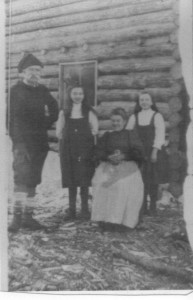
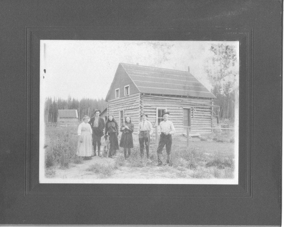
The Forrester Family Krugerdorf Highway 11 1910

The Forrester Family outside their Krugerdorf homestead in the early 1900s

The Northern Chevra Kadesha Cemetery was established in 1906 when some Jewish pioneers died in a canoeing accident. Morris Perkus and his son Ben were returning from Englehart station with three new immigrants from Europe when their boat was caught in a surprise current and took them over the fall. A small, hockey-rink sized piece of land on the land of local farmer Simon Henerofsky was devoted to bury the dead pioneers and deeded to the Jewish community in nearby Englehart. The Krugerdorf cemetery would eventually serve the Jewish populations of Temiskaming, mainly centered in Kirkland Lake, Englehart, and Cobalt. Today, Krugerdorf cemetery is maintained by Jewish communities in northeastern Ontario and northwestern Quebec.

The community began to decline in the late 1920s. Despite high quality soil, frosts killed crops and markets for beef and grain were distant. After the Second World War, the farming community really began to wind down as children left the farm for work in local towns. All that is left today is the cemetery, a testament to the settlers of a bygone era.  See some photos here and here.

If you’d like to know more about Krugerdorf and the history of Chamberlain Township, you can read The Last Jewish Family in Ansonville, or A Place Called Krugerdorf, by Herb Kruger in the Englehart Library.

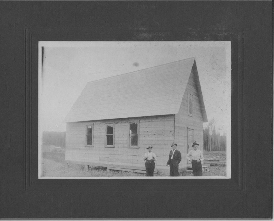
And a big thank you to Jim Atkinson for the homesteading photos.

If you can add to this page, or provide some photos, please let me know by emailing info (at) highway11 (dot) ca.

(The headstone photo is copyright of the Canada Virtual Museum – the Kirkland Lake Jewish Cemetery.)

Krugerdorf homestead, highway 11 ontario

Krugerdorf homestead

Early Krugerdorf church Highway 11 Ontario

Krugerdorf church – notice the sawn boards, no logs


Opasatika

Opasatika is a former mill town with about 300 residents set on the Opasatika River.

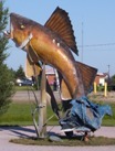
Opasatika, Ontario, Highway 11 fish

This is actually pretty cool in person. Well done, Opaz.

Opaz (as it is commonly called along northern Highway 11) used to have its own mill (and supposedly, from what I was told, its own dance club), but changes to the forestry industry in northern Ontario have meant that a lot of the smaller mills are being closed.  This means that communities like Opasatika, Smooth Rock, and Longlac are losing their mills, and fighting for their lives in the process. I was told that it used to be that there was a little mill in each little town from Hearst through to Smooth Rock.

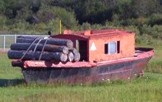
Of course, Opasatika has its “some weird big thing” as you enter the town.  There’s a random fish statue . There’s also a mini logging boat sitting in the field.  Normally there are plaques for these kinds of things but not here – I guess everyone around here is just in-the-know. A resident emailed me to tell me that the fish was supposed to have a commemorative plaque, and be the start of a historical site. However, progress was delayed when the town mill was closed – and subsequently, all civic efforts have gone into finding a solution for the mill. That’s understandable, and unfortunate.

Lumber boat, Opasatika, Ontario Highway 11

Take note Longlac – it is obvious what this boat’s purpose is

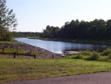
Opasatika (pronounced locally as Opa-set-ticka) also has a nice little waterfront park with a boat launch to the river, and two marshes – du Village and des Lambert.  Sixty kilometres south of Opasatika you can find Christopher Waterfall which leads into Rufus Lake.

Opasatika River launch, Highway 11

NO SWIMMING. Okay Opaz, you made it clear.

As for businesses, Magazin Martel is a depanneur with a little LCBO outlet.  Mandy’s Beanerie serves coffee and meals as well.  There might be more for food and services, but I’m not sure. I haven’t been back in a while.

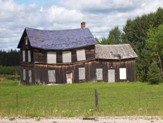
There used to be a mushroom farm in Opasatika.  I’m not sure if it is still running. I don’t know if it gives tours, but you could enquire – I’ve always found visiting any kind of factory/workplace type thing to actually pretty interesting. The farmhouse you see on the right is actually in Val Rita, and has some personal significance to its owner, a testament to the agriculture that used to occur in this area.Lonely farm, Opasatika, Highway 11On a personal note, Opasatika is the first place where my car was chased by a dog on the journey.  Imagine, if you live on Highway 11 and you have a dog that chases cars or trucks?  Boy are you in trouble…

Thanks to Anick for help with Opaz.

Reesor

Reesor is the site of one of northern Ontario’s many former agricultural colonies – in this case, one founded by Mennonites.

Thomas Reesor, an Old Order Mennonite Minister from Markham, Ontario who was employed by the railway, helped settle a number of Russian Memnonite refugees in Northern Ontario. In July 1924, many families decided to travel north and establish a settlement in northern Ontario on land offered by the Canadian Government. The group, accompanied by Thomas Reesor, made the train journey north to their new settlement in the wilderness west of Kapuskasing. The settlement was officially named “Reesor” in recognition of Thomas Reesor, it’s benefactor and founder.
The Reesor United Mennonite congregation began services about 1926, and formally organized in May 1927. Jacob H. Janzen is considered the founding leader of the group.

The settlement was situated along the Trans-Canada highway west of Cochrane, Ontario. It was organized in a traditional Russian Mennonite manne. The settlement initially prospered, reaching a membership of 75 in 1932, but declined rapidly during the Depression. The congregation dissolved on January 5, 1948.

In 2007, the hardships faced by the colonists at Reesor were made into a play, named Reesor, that featured at Fringe Festivals across Canada.

Hearst

There’s something really interesting about Hearst.

Hearst is the frontier of northern Ontario – you either live in Hearst, east of Hearst, or you live waaaaaaaaaaaaaay west of it.  It even has a Northern Store (how’s that for remote.)
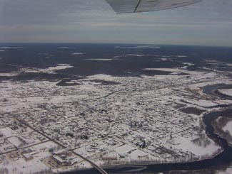
Hearst, Ontario on Highway 11

Hearst from the air

Where else would a town of 6000 have so many bars, the “northern ballet”, and yet still have four or five churches?

What other place keeps you in their town by telling you just how far away everywhere else is?  I mean, Longlac is 210 kilometres west, with nothing in between.  Hearst has the last McDonald’s for 500 kilometres – I know it because I checked, in person. There isn’t another McD’s until Thunder Bay

The tourist office in Hearst. Highway 11

The tourist office in Hearst. So awesome.

I once applied for a government job in Hearst, but never got an interview.  To be fair, I realize now that I was woefully underqualified.  I swear that the ad had listed French as “an asset”.  Well, no French isn’t an asset – in Hearst, it’s a requirement.

One of the most interesting things about Hearst, however, is that it is the most francophone community in Ontario – something like 85-90 percent.  Hearst even has residents that only speak French, and no English.  Rue George is the downtown drag and it’s really cute, with small shops, a library, a diner, and a movie theatre showing French-language movies.  It’s reminds me of Penetanguishene, but more with more French.
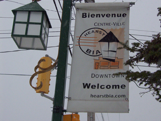
Hearst, OntarioI (h)EART (h)EARST

Erst (as it is pronounced locally) is a pretty special town.  It has:

•    The motto: “The Moose capital of Canada” (or so they boast)
•    The only tin man on Highway 11 (he keeps watch over an appliance store)
•    The most millionaires per capita (or so someone emailed, apparently it’s due to the local forestry?)
•    The largest moose sculpture on Highway 11 (Believe me, I’ve seen them all)
•    The most suburbs (two) of any small town Highway 11 town (take that, King Kirkland or Geraldton East)
•    The most truckstops per capita (or so I’ve calculated, roughly)
•    The biggest woodpile on Highway 11 (I’ve seen them all too)
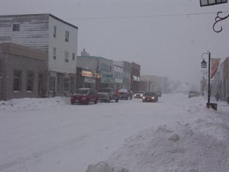
Trust me.  When it's not getting snowbombed, Hearst's downtown is super cute

Trust me. When it’s not getting snowbombed, Hearst’s downtown is super cute.  The problem is that it gets hammered all the time.

Heck, I’ve been to Hearst three times.  Most of the photos here are from the first time that I hadn’t been snowed in (because it was August.)  Both other times, I was stuck for three days in storms even that locals found nasty.

Set on the Mattawishkwia River, Hearst is a forestry town (hence the massive woodpile.)  It also has a tourism industry set around hunting, outfitters, and its proximity to three Provincial Parks:  Fushimi Lake, Missinaibi and Nagagamisis.  It is also the end of the Algoma Line, which runs fall colours rail tours from Sault Ste. Marie to Hearst.

Despite its francophone heritage, Hearst was once the site of a Slovak settlement.  Bradlo, nestled 11 kilometres south of Hearst, the community persisted until the 1950s when the residents realized that the land was agriculturally marginal, and wouldn’t support farming in a modern economy.
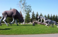
Sculpture jsut outside of Hearst

Hearst is so cool, this wolf vs. moose sculpture doesn’t even count as their “some big weird thing”…
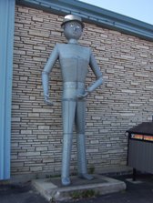
Hearst tin man, Highway 11

…instead, this does!

Food and Fun in a Frontier Town

Hearst is a center for most of the little communities west of Kapsukasing, and is the largest town between Thunder Bay and Kapsukasing on Highway 11.  And probably for Hornepayne on Highway 631, about an hour and a half south.  (Head off-route and take a trip along 631 here.)
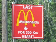
No McDonald's for 500 km in Hearst, Highway 11

I’ve used this photo about a twenty-two times on this website and it never gets old

Therefore, Hearst has an abundance of services.  It has the only McDonald’s and Tim Horton’s that you’ll see until Thunder Bay.  In addition to the 24-hour garage and towing company that is advertised throughout northern Ontario, there are shops downtown and food everywhere.  Hearst also has an overabundance of places that serve Northern Ontario Chinese Food.

Hearst has something for everyone – the northern ‘hotel’ scene (the Waverly or the Windsor), cafés (although Café Duo doesn’t serve coffee, go figure), fast food (McDonald’s, KFC, Subway, and the only Pizza Pizza west of Timmins), authentic chip stands (Micko’s is great), sit down restaurants (Mom’s, John’s, Pizza Place has ok pasta), fine dining (you can find filet mignon, steak, and Cuban cigars at Ailleurs), and even a little night club (OK, fine, it’s the bar at the Companion.)
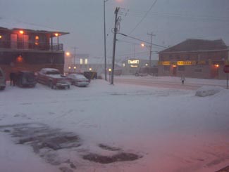
Snowstorm, Hearst, Highway 11

Highway 11 in Hearst, getting walloped, again

There are motels aplenty in Hearst so you should have no trouble finding a place to stay.  (A note to those staying at the Queens Motel, keep your kids away from the funny channels at the end of the TV dial there!)  There is also hockey in the winter – in fact, Hearst is the hometown of Claude Giroux, Philadelphia Flyers superstar, as well as Pierre LeBrun, a hockey commentator who has appearanced on TSN, ESPN, and Hockey Night in Canada. Hearst is home to the local team les Elans de Hearst. And, there is bowling.

Come on, it’s northern Ontario. Of course there is bowling!
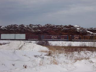
Super awesome Hearst woodpile, Highway 11

Hearst – simply the best woodpile of any Highway 11 community

Hearst, Ontario highway11.ca

And this is what happens to a woodpile on Highway 11, in Hearst (Credit: Wiki Commons contributor P199)
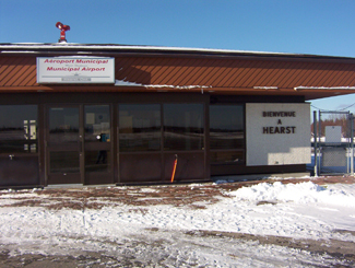
 

Hearst, Ontario airport

Not sure why I took a photo of Hearst’s airport
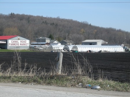
Pass Lake

When you take frequent road trips (or make a website about a street) you learn a few lessons very quickly:

  • Lesson #1 – Always keep your keys in your pocket – lest you get locked out in the middle of nowhere.
  • Lesson #2 – Always follow the map – lest you get lost in the middle of nowhere.
  • Lesson #3 – Maps always lie.

Although my provincial highway map seems to suggest others, once again Pass Lake isn’t on Highway 11.  It has a gas station and a few homes on the highway, but the town is five kilometres south of the highway, towards Sleeping Giant Provincial Park.

Pass Lake has two interesting aspects to its history.  First, the area was first populated by the Aqua-Plano Aboriginals 9000 years ago.  The Aqua-Plano built a society around the hunting of large game animals, building specialized tools to prolong their existence.

Second, the area was the site of a special settlement of Danish homesteaders during the Great Depression.  It was hard for Danes to own land at home, some they came to Canada, cleared the land, built a settlement, and in 1932 erected Salem Lutheran Church, which still stands today.  A quick scan of local mailboxes showed names like Hansen, Salem, Sorensen, and Riemer, showing that descendants of original settlers remain to this day.A local resident obviously wouldn’t let a bad acronym get in the way either her own name or the joys of alliteration – Kathy’s Karen’s Kountry Kitchen serves home cooked meals on what must be one of Ontario’s most serene patios.  There is a beach at the lake with some cottage and camping facilities.  Beyond that, the town was hard to find.  There was an arrow for a community centre, but it looked to be far into the bush on a red dirt road.  The houses are spaced out and there is no focus to the town.

Pass Lake hosts an annual fall fair and offers some great views of Sleeping Giant Provincial Park, which is approximately 25 kilometres further down the peninsula from the town.