We’re detouring from Highway 11 a bit to visit Krugerdorf, and some towns on Highway 66.
Krugerdorf was founded as a farming homestead in Chamberlain Township in the early 1900s, about 25 kilometres south of Kirkland Lake. Not officially named Krugerdorf until 1949, the area was largely settled by a number of German families. The town was given the name “The German Settlement” until it became to be called Krugerdorf.
 One of the first settlers was August Kruger, a farmer and blacksmith from Germany. Having migrated to Renfrew County in 1879 (northwest of Ottawa), August and his son Frank left for the Krugerdorf area in 1905, where he was given deed to 800 acres of land. Kruger established a farm, and a blacksmith shop, and helped provide ties and spikes to the railway. Word of his success attracted other German-speaking families from Renfrew County in 1910, along with English and Scottish settlers. Later a sawmill and threshing mill were established on the Blanche River.
The area also had a noticeable Jewish homesteading community. With the help of the Baron de Hirsch Institute of Montreal, an organization that helped Jewish immigrants to move to Canada, a small Jewish farming community was set up in the area. Free land was offered to settlers along the railroad between 1905 and 1915, atttracting Jewish settlers from Russia and Romania, where they couldn’t legally own land. According the the Canada virtual museum website, among the colony were such names as Henerofsky, Gurevitch, Feldman, Levy, Goldstein, Abraham, Frumpkin, Verlieb and others. There were about fifty families in all. Eventually, the town developed, with a school, a Lutheran church, and a synagoge.

The Forrester Family outside their Krugerdorf homestead in the early 1900s
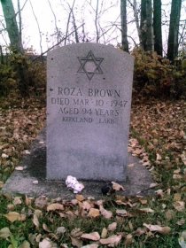
The Northern Chevra Kadesha Cemetery was established in 1906 when some Jewish pioneers died in a canoeing accident. Morris Perkus and his son Ben were returning from Englehart station with three new immigrants from Europe when their boat was caught in a surprise current and took them over the fall. A small, hockey-rink sized piece of land on the land of local farmer Simon Henerofsky was devoted to bury the dead pioneers and deeded to the Jewish community in nearby Englehart. The Krugerdorf cemetery would eventually serve the Jewish populations of Temiskaming, mainly centered in Kirkland Lake, Englehart, and Cobalt. Today, Krugerdorf cemetery is maintained by Jewish communities in northeastern Ontario and northwestern Quebec.
The community began to decline in the late 1920s. Despite high quality soil, frosts killed crops and markets for beef and grain were distant. After the Second World War, the farming community really began to wind down as children left the farm for work in local towns. All that is left today is the cemetery, a testament to the settlers of a bygone era. See some photos here and here.
If you’d like to know more about Krugerdorf and the history of Chamberlain Township, you can read The Last Jewish Family in Ansonville, or A Place Called Krugerdorf, by Herb Kruger in the Englehart Library.
And a big thank you to Jim Atkinson for the homesteading photos.
If you can add to this page, or provide some photos, please let me know by emailing info (at) highway11 (dot) ca.
(The headstone photo is copyright of the Canada Virtual Museum – the Kirkland Lake Jewish Cemetery.)
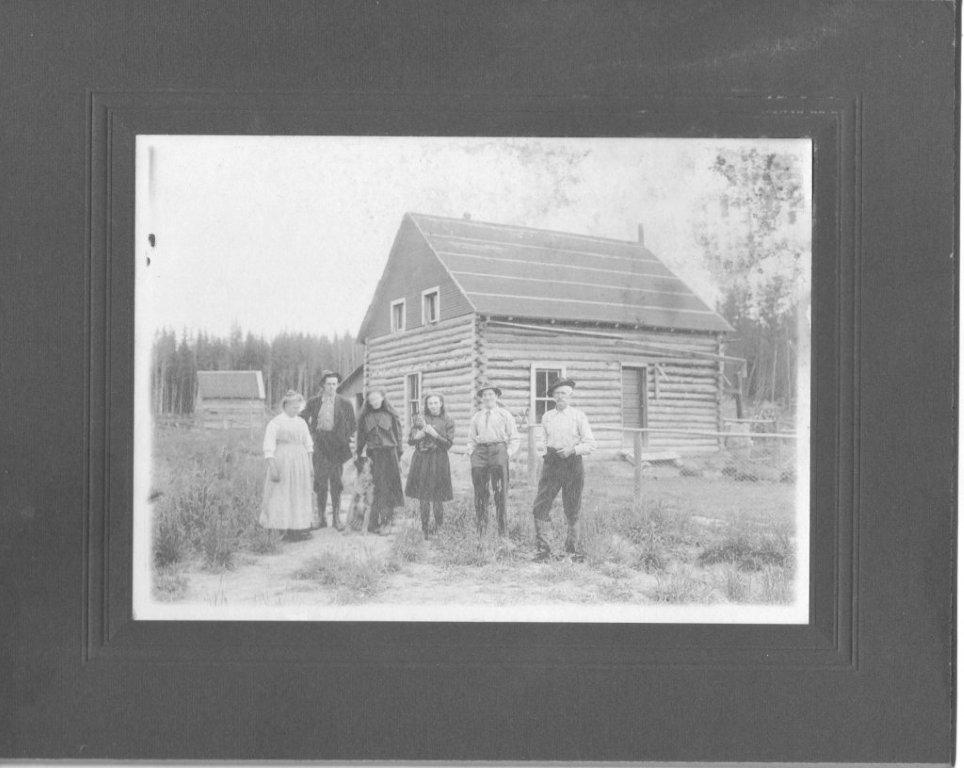
Krugerdorf homestead
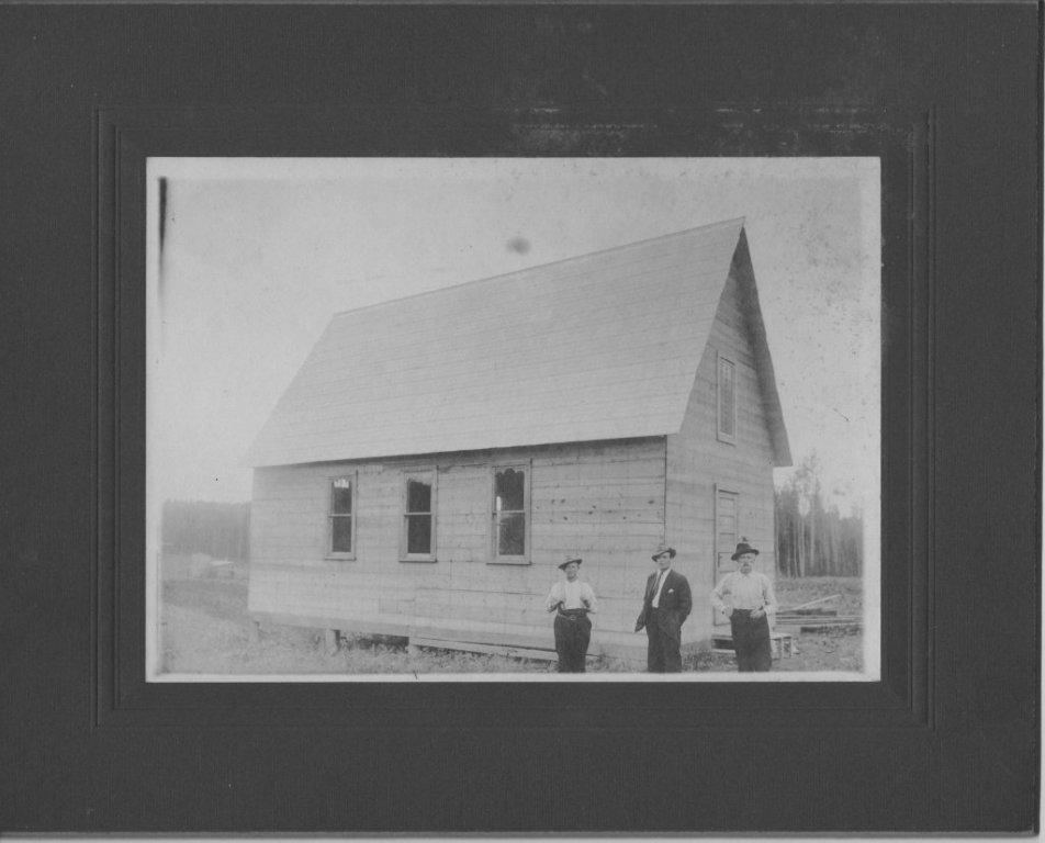
Krugerdorf church – notice the sawn boards, no logs