Kahshe Lake / Severn Bridge

MK-05-KahsheLake-SignKashshe Lake is a small cottage community a bit to the east of Highway 11 south of Muskoka Falls about 25 minutes north of Orillia.

Kahshe Lake began as a series of logging camps in the 1860s.  A guy named James Grant soon built a sawmill near the lake and others followed, eventually building a hotel and a general store.  However James Grant died and the rest fell into disrepair.  Kahshe Lake was then abandoned and eventually become a cottage community.

There two ideas of what “Kahshe” means.  Some think it came from an Aboriginal word Kah-she-she-bog-a-mog, which, according to one source, means Lake of Many Ducks and Birds.

This is cooler in person - a solar-heated seedling-starting operation in Kahshe Lake, on Highway 11

This is cooler in person – a solar-heated seedling-starting operation in Kahshe Lake, on Highway 11

Others think that Kahshe means healings waters.  The lake itself is “Tea Coloured”, due to a high level of dissolved organics and is said to have healing properties.

Kahshe Lake Barrens Conservation Reserve is home to numerous provincially and nationally rare plant and animal species. It is ecologically significant because of its large size and lack of habitat fragmentation.

I’ve always just passed it by when driving Highway 11 but one spring I took a mid-day drive up to explore.

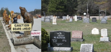
Who buys these things?  I'm talking about the bear statues for sale along Highway 11, not the family plots at the Symington cemetery in Kahshe Lake

Who buys these things? I’m talking about the bear statues for sale along Highway 11, not the family plots at the Symington cemetery in Kahshe Lake

There wasn’t much beyond the usual-yet-random highway-facing stores of a cottage country thoroughfare, like an RV dealer, an inflatables repair service, and a store that sells Muskoka chairs and carved wooden bears.  Most notable was the Symington Township pioneer cemetery and the really cool solar nursery setup that one of the local greenhouses has on the east side of Highway 11.

North Kahshe Lake road passes through some year-round houses, ending at a small private marina.  South Kahshe Lake road leads to a small cottage community whose main road peters out into a single-lane gravel path adorned with beware of flood signs.  I didn’t go past that point, though I did stop to enjoy the absolute silence – bullfrogs, bulrushes, leaves, the wind – just five minutes from a bustling, 120-kilometre per hour highway.

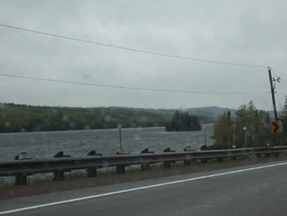
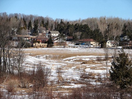
Kahshe Lake, at the end of South Kahshe Lake Road, just east of Highway 11 / Yonge Street

Kahshe Lake, at the end of South Kahshe Lake Road, just east of Highway 11 / Yonge Street

Severn Bridge

Severn Bridge, Ontario on Highway 11 / Yonge Street - the town sign, the community hall and the church

Severn Bridge, Ontario on Highway 11 / Yonge Street – the town sign, the community hall and the church

Severn Bridge was named after the Severn River, which divides England and Wales and is criss-crossed by many bridges.  It is on the Severn-Trent Waterway that connects the Trent River to Georgian Bay via the Severn.

Severn Bridge was founded in the mid 1800s as a logging camp.  From there it developed: the post office came in 1861, the railway in the 1870s, and Highway 11 in 1927.  Today it is a town of about 300 half way between Orillia and Gravenhurst.  There is a small hydroelectric dam and otherwise it’s all about cottage country tourism.  And bird breeding.

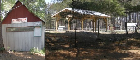
Severn Bridge - still a southern Ontario town with the agricultural society and permanent fairgrounds

Severn Bridge – still a southern Ontario town with the agricultural society and permanent fairgrounds

Cute but tiny Severn Bridge is one of the first highway-side towns you north of the Lake Simcoe strip of Highway 11 just outside of Orillia.  Severn Bridge straddles Highway 11, with the Rowing Club and the boat dock and the Shamrock Bay Marina east of the highway and the town proper, including a local potter, an independent gas station, two auto repair shops, an old community centre, a really nice elementary school, and an agricultural society on the east side.

Close by there is the Muskoka Wildlife Centre which offers education programs for kids.  Severn Bridge has two bed and breakfasts (Sparrow’s Nest and Severn Shores) and hosts an annual fall fair at the agricultural society grounds.

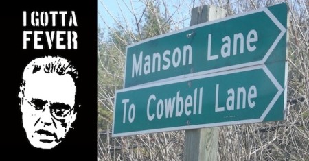
I can only wonder how many times this street sign has been stolen

I can only wonder how many times this street sign has been stolen from just outside Severn Bridge

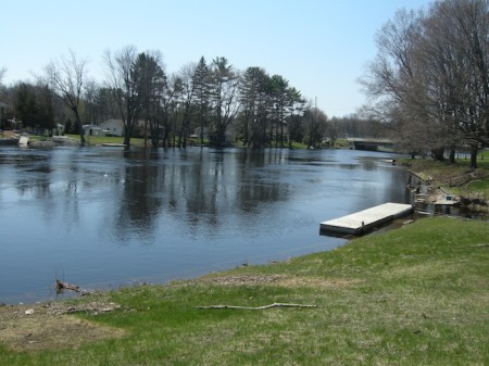
Severn Bridge boat launch on the Severn River, right by the rowing club.  If I recall correctly, the dock is not public

Severn Bridge boat launch on the Severn River, right by the rowing club. If I recall correctly, the dock is not public

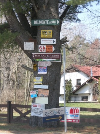
Severn Bridge's tree of signs

Severn Bridge’s tree of signs

Trout Creek

Trout Creek, ontario, powassan, community centre, highway 11,

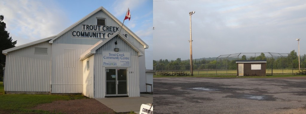
Community Centre and ball diamonds, Trout Creek, Ontario on Highway 11

Trout Creek is a small hydro town of less than a 1000.  My time in Trout Creek has always been brief – usually passing through on an early morning drive up or down Highway 11.  And each time I’ve been through, no matter what hour or what weather, there are always a few people milling about outside the general store.  Small town life always surprises you.

Settlers came up in 1880s when railroad was being built.  With the creation of a rail station and a few other amenities, settlers came in to log nearby Algonquin Provincial Park, and with the discovery of a waterfall, tap the rivers for a sawmill and for electricity.  A hotel was eventually built but unfortunately, everything was destroyed in 1892 by fire.

Today Trout Creek still has logging and still has a sawmill.  There is a little library in town, as well as a few shops and stores.  The Trout Creek Hotel and TJ’s Restaurant and Motel have room and board both, while the Princess Motel and Tracy’s Fresh Abundance Restaurant have room and board, respectively.  Trout Creek hosts a winter carnival every February and a fishing derby in July.

Trout Creek is the home of former Boston marathon winner James Corkery.

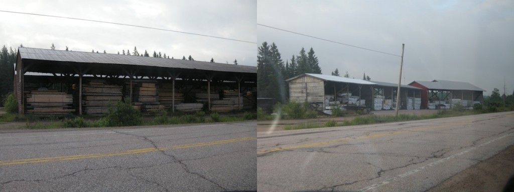
Trout Creek, Ontario, HIghway 11, lumber, mill, yonge street, powassan

Trout Creek, Ontario lumber yard or lumber mill? I’m not sure. But at six am on a Monday, I wasn’t going to get out and ask.

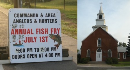
Trout Creek, Ontario, Highway 11, Church, fishing derby, yonge street

Evidence of creeping northernOntarioness in the upper-south: a fishing derby, and an our lady of sacred something, in Trout Creek, just south of North Bay.

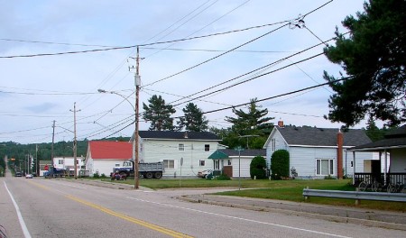
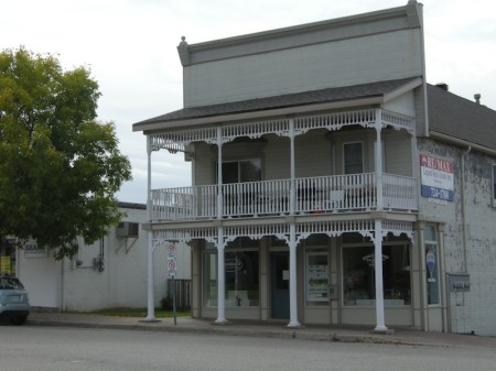
Trout Creek, Ontario, on Highway 11

I wanted to get a shot of the general store on Main Street, but as is my luck a bunch of guys were sitting outside having a smoke at six in the morning.  So, instead, I give you Trout Creek, Ontario, on Highway 11 (Photo: User P199 at Wiki Commons.)

Powassan

20-MK-Powassan-powPowassan is kind of funny because if it was north of North Bay it’d be considered a freakin metropolis fairly large town.  When I first wrote up most of this website, I was in my northern traveller mode.  When you’re used to places like Latchford or Jellicoe, Powassan seems pretty big.

We had been staying at Piebird Farmstay B&B, just west of Powassan in Nipissing Village.  But five-plus years removed from my northern Ontario adventures, just having finished a short hike in Restoule Provincial Park and promising the ravenous wife a reasonable diner meal, I headed 40 minutes east to Powassan based on hazy comparisons of Powassan to places that truly were dots on a map.  It must have a place we can get a sandwich.  A Tim Horton’s maybe, even.

I distinctly remembered a two story building in the downtown.  So it had to be pretty “big”, right?

Downtown Powassan, ON

Downtown Powassan, Ontario on Highway 11 / Yonge Street

There was the China Garden, and the Hawk n’ Eye Pub and …well…that’s it.  Strange for a Saturday, for this urbanite at least, the café was closed.  There wasn’t much else.  Jugding by the packed parking lot, everyone, it seems, was spending their Saturday lunch at the arena.  Despite being the largest town between Huntsville and North Bay, Powassan is really just one of many small towns found along Highway 11.  (If you can, arrange a dinner at Piebird.  You won’t be disappointed.)

Powassan is a First Nations word that means “bend.”  I’m assuming that’s not a command but a description of a place on the river.  I’m not sure exactly how it is pronounced, but I sure hope it is old-school Adam West Batman-style.

Anthony was kind enough to send in some info about Powassan. First, yes, the name Powassan means “bend in the river”. Second, that river is Genesese Creek, which flows into the South River, eventually making it to Lake Nipissing. And third, Powassan is the only place in the world named Powassan.

Founded in 1905, Powassan soon became the site of a lumber and grist mill.  Today it is focused on power generation, lumber, maple syrup and some small scale agriculture.  It is also the unfortunate namesake of Powassan Encephalitis – a tick-spread virus I used to joke about on here until I found out that it could kill you.  It’s killed 40 people in the US alone since 2008.

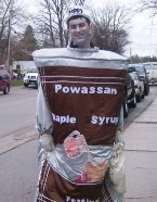
Can you believe this?  "Sappy" at the syrup festival in Powassan, highway 11

I can’t get over this. This is so awesome. Awesome name (“Sappy”). Awesome costume (syrup can). This kid is my hero. I WANT TO BE THIS KID.

I adore small towns.  Each time I’ve been here Powassan has had that feel.  There are some nicely restored buildings on Main Street.  In the summer there’s a small farmer’s market.  There are two seasonal fairs – the Agricultural Society Fair on Labour Day Weekend and the Maple Syrup Festival (with ‘Sappy’ the mascot) in the fall.

Powassan is also home to a lookout on Powassan Mountain, (which I’m sure is a “mountain” in the same spirit of Hamilton’s “mountain”.)   A space conservatory is in the planning stages for Powassan. I have to be honest, I’m not sure what a space conservatory is. A planetarium maybe? I dunno.  Maybe they can pick up the Dunlap Observatory, drive it 307 kilometres north, and plunk it down in Powassan?

Powassan, Ontario, highway11.ca

I don’t see Powassan Mountain.  (Photo credit: User P199 at Wiki Commons)

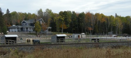
Horse farms and stables, just north of Powassan's downtown drag

Knowlton Ridge horse farm and stables, just north of Powassan’s main drag

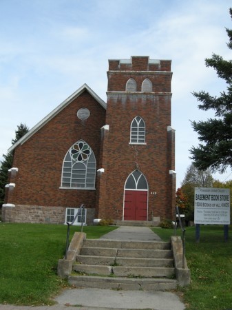
I used to get dragged to my Mom's work at a preschool in a church basement every PD Day.  I wish it was Powassan's church basement - there's a bookstore down there!

As a kid, I used to get dragged to my Mom’s work at a preschool in a church basement every PD Day. I wish it was Powassan’s church basement – there’s a bookstore down there!

Backroads just northeast of Powassan, Ontario near Highway 11

Backroads just northeast of Powassan, Ontario near Highway 11

Temagami

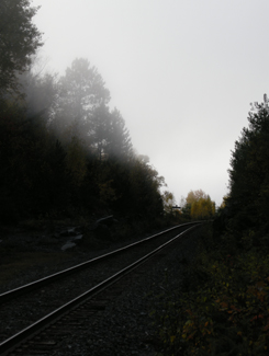
ONTC line near Temagami, Highway 11 Ontario

Nothing captures the loneliness of northern Ontario than the railway heading off into nowhere

Sure, after Huntsville the towns become sporadic, a bit less refined, and really small – but those areas are still within relatively short driving distance to either Barrie and/or North Bay.

But it is after North Bay where Ontario changes.

Towns of 10 000 become cities.

Villages of 2000 become towns.

Hamlets that wouldn’t warrant a sign in southern Ontario make it into maps, travel guides and guidebooks about the north.

Temagami is the perfect example.  Not only do you not realize just how far away it is from North Bay (more than an hour), but it’s also really small.  The dots-on-the-map before Temagami aren’t really true towns at all, they’re much closer to being dots-on-the-map. And when you get into Latchford, you realize that it is much the same as Temagami.

If you don’t have some decent cassettes for the car by now, you’re in trouble from here on in.  You’ll start seeing more transport trucks than cars. Of the few cars on the road, they’ll practically all be domestic, and will likely have an ATV in tow. The distances are only going to get larger and the roads will only get lonelier.

Temagami from Highway 11

Temagami from Highway 11

OK, so a bit about Temagami

Temagami is a town of about 1000 an hour-plus from North Bay.  The town was first settled in 1850 when the Hudson Bay Company set up a trading post on Lake Temagami.  The ONTC railways came through in 1904 as silver was found in Cobalt to the north, and Temagami became a town of trappers, traders, and prospectors.
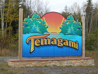
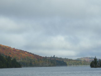
Temagami, Ontario Highway 11From Highway 11, Temagami is a land of contrasts.  Some spots can be boring as heck.  Rocks and trees, rocks and trees.  Others, however, can be surprisingly beautiful. On a recent trip to the area we didn’t take many photos of Temagami, mainly because the scenery was so majestic, it was nearly impossible to discern what was photo-worthy and what wasn’t, without taking photos practically every ten minutes. We actually experienced scenic fatigue, and by the end of our trip we were turning our noses up at lakes, forest scenes, and vistas we would have stopped for has we been in southern Ontario. And we didn’t even go into the interior, or explore Lake Temagami, which is reportedly more scenic than the area directly off Highway 11.Lake near Temagami, OntarioOne of the many reasons for Temagami’s beauty is that it is one of the last parts of accessible Ontario with old growth forest, and was the subject of intense protests against logging in the 1980s.  Temagami is Ojibway for ‘deep water by the shore.’  It is also where Englishman Archie Belaney found fame as Grey Owl, an Aboriginal devoted to environmentalism.
Today Temagami is largely dependent on forestry and tourism. There are two provincial parks nearby, Finlayson and Lady Evelyn-Smoothwater.  Temagami is a starting point for a number of all season activities, including boating, dogsledding, canoeing, cross country skiing, swimming, fishing, camping, houseboating, hunting, and guided tours.  There are also a nature interpretive centre, some craft shops, and an art gallery.
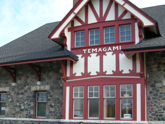
Temagami Train Station, Highway 11

Train station in Temagami

Temagami has a few tourist amenities.  There’s a gas station, the aformentioned grocery store, two outfitters (one of which was closed and for sale during our trip), two outdoors stores, two restaurants (one Chinese, and the Busy Bee) and a couple of shops.  There are numerous camps, lodges, and other places to stay, including Inn The Woods Motel and Bed and Breakfast, Leisure Island Houseboats, Linda’s Wigwams, Smoothwater Resort, and Temagami On-Ice Bungalows. There is a bit of a residential area on either side of Highway 11, and another a bit further north in what is called “Temagami North.”

Being on “Temagami Time”

You hear a lot about Temagami in the news and from friends who have cottages and cabins.  Yet I was surprised just how tiny the town is considering the tourism business up here.  There is a lot to do in Temagami if you like the outdoors.  But if you like the indoors, or just aren’t that woodsy, well, don’t expect much of a town or any indoor or evening attractions, because the town itself is miniscule, and what is available keeps weird hours – what I call “Temagami Time.”Panorama from hiking trails of HIghway 11, Temagami, Ontario

The Co-op grocery store isn’t open on Wednesdays. Many offices or stores are only open half-days. The scenic rail route from North Bay, called the Dream Catcher Express, runs a meagre six days a year. One of the town’s two restaurants closes at 6 PM on some days. The Temagami tourism welcome centre, the Caribou Mountain fire tower info centre and shop, and the train station interpretive centre and gift-shop all close after the first weekend in October.

Most surprisingly for Northern Ontario, the LCBO closes at 5 PM (go to Latchford for an agency store that stays open ’til 8 or 9.) If you’re visiting Temagami after September, you better have electricity in your cabin or be prepared to go to sleep early, because nothing will be open and it’ll be dark – during our recent trip we experienced pitch black night during the second week of October at the late hour of 7.25 PM. So if you’re heading to Temagami, especially in the fall, be prepared to live according to Temagami Time. While I’m half joking, this is actually something to think about – I only became acclimatized to being on a late fall ‘vacation’ in Temagami – going to bed early, timing trips to stores and eating supper early – by the time my mini vacation was over!

Temagami, Ontario, Highway 11

Nestled in the woods like a fairy tale is Temagami’s town site

Hiking

Temagai beavers ruin boardwalk, Highway 11

Sabotage! Wilderness 1 Hikers 0

The area used to be littered with forest fire towers that were up to 1000 metres high – one of which has been maintained as an attraction that you can climb.  My partner and I attempted a climb on a windy, wet day in October. We’re not embarassed to admit we didn’t make it all the way up. She was a bit iffy to begin with, but considering we were the only ones there, the cold, biting winds, some slippery stairs, and the requisite creaking of the structure with each gust, we abandoned our climb 3/4 of the way through. It didn’t help that it was cloudy and that the lookouts built around the tower gave us the nice views we wanted without needing to climb. (No shame in excuses for me!)  I don’t think the tower is as tall as it seems, but considering it’s on the highest point in the area, it seemed very, very tall. The tower is one kilometre from Highway 11, east on O’Connor Drive up Caribou Mountain, but isn’t really visible from the highway, unless you’re looking for it.
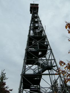
Climb Temagami's restored fire tower, Highway 11

I’ll admit it. I bailed when the tower sighed under my weight and shifted with the wind

I enjoy hiking and Temagami has a lot of opportunities to get into the forest. The one problem is that many of the hiking trails are accessible only by boat. For example, there is a renowned stand of old growth pine on Bear Island, but that’s only accessible by an hour’s canoe, or by water taxi from the marina at the end of the Lake Temagami Access Road, 25 kilometres drive south and west of the town. Others are further in the bush, such as Lady Evelyn Smoothwater Provincial Park, which are accessible only if you’re willing to paddle and portage, or willing to pay for a float plane flight. Even the White Bear Trails that are right in town require a canoe trip (or a significant hike of three hours) to reach the best old growth forests.
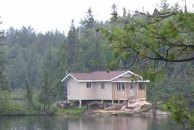
Temagami cottage, Highway 11

Raised cottage in the bush

The trails that you can reach by car tend to be at the end of long, winding, unpaved logging roads that are no longer maintained, such as those at Grand Campment Bay, 40 kilometres east of town, anything off of the two Roosevelt Roads, or at Lake Anima Nipissing, just south-west of Latchford. Many are poorly marked, and do not directly indicate their skill level. We hiked one trail that turned out to not be the paths were throught we were on, another we considered following turned out to be an ATV route, and a third we never found at all despite following directions to a T. A fourth was a great hike, but was a bit beyond our capability. (Well, maybe not beyond our actual capability, but beyond our willingness.)

Anyway, I just want to say that hiking in Temagami isn’t as easy as driving up and looking for a trail sign. It’s not onerous, but it takes some planning – you have to do a bit of homework.
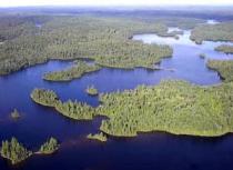
Temagai, aerial view, Highway 11

Obviously not my photo

Temagami, Ontario, Highway 11

October storm whips the waters near Temagami
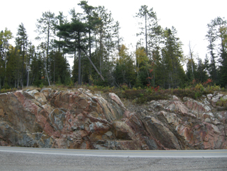
Temagami Highway 11

Rocks and trees, rocks and trees

Temagami, Highway 11

The limitless possibilities of the open road beckon in “real” northern Ontario
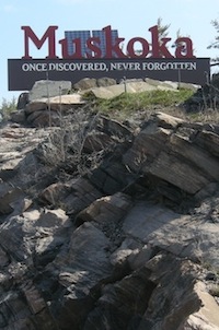
Elk Lake

Elk Lake is a community of about 800 people at the junction of Highways 65 and 560, on the banks of the Montreal River.  Equally anglophone and francophone, Elk Lake sits at the western edge of the Temiskaming Clay Belt and is primarily a forestry town. (Scroll down to the bottom of the page for more photos.)

Elk Lake, Highway 66, Ontario

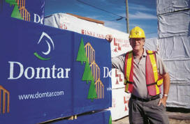
Random photo at the Domtar mill in Elk Lake, with random worker from a random website

According to Museums North, remnants of pictographs on rocks show that the Elk Lake area was along trade routes used by the Cree and Anishnabai people. These routes were already well established prior to the establishment of the Fur Trade of the mid 1600s. Remnants of an Aboriginal graveyard that can be seen on the south side of town indicate that Elk Lake was settled long before Europeans arrived. The local Ojibway peoples named the lake after the huge herds of elk that roamed the area at this time.

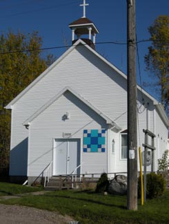
Elk Lake church

Church in Elk Lake

Although forestry had been going on in the area since the mid 1800s, Elk Lake didn’t become settled by Europeans until silver was discovered in the area in 1906. The town was set up in 1909, road connections to Elk Lake were built (previously, you could only get there by steamboats on the Montreal River, from Latchford) and eventually there were 30 active mines in the area, and the town peaked with a population of 10 000. A line of the Temiskaming and Northern Ontario Railway was built to the town in 1913.

Elk Lake Today

Today, Elk Lake is home to about 400 people. The town straddles the shore of the Montreal River, which makes for some beautiful views, especially when the sun shines off the shimmering water. I was pretty impressed with how clean and tidy Elk Lake was – the village could make for a nice getaway if you’re willing to go off the beaten path in search of quiet, solitude, and relaxation. It’s also not too far from Long Lake, which has even more hunting, fishing, boating, and swimming opportunities.

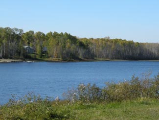
Elk Lake River

Elk Lake River

Elk Lake’s major employer is the Elk Lake Planing Mill, owned by forest industry giant Domtar. You can call 678-2210 to go for tours in the plant. Mining has all but disappeared, although high metals prices have re-ignited exploration in the area. Being at the western edge of the Temiskaming Claybelt, there is also some agriculture in and around Elk Lake, largely beef and horse farms.
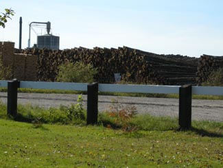
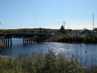
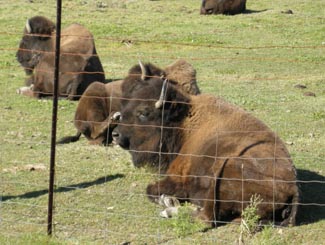
Bison farm, Elk Lake

The fence doesn’t inspire…

Elk Lake, surprising to some, has gotten a bit of a reputation for being a community with a green outlook. The town is known as a proponent of sustainable forestry. It is also the site of the Elk Lake Eco Resource Centre, a conference/banquet/retreat/hotel facility which was built with local economic and environmental sustainability in mind. Citizens of Elk Lake were also instrumental in the fight against Adams Mine, when the Ontario government was proposing to use the former Kirkland Lake mine site as a dumping ground for Toronto’s garbage.Farm country, Elk Lake, northern Ontario

As for services, I’ve only been to Elk Lake once so I can’t comment too much. In addition to the Eco Centre, there’s a chip stand (year-round!), an LCBO, gas, some motels, a small grocery store and an outfitters. I know there are a number of tourist camps, lodges, and cabin rental places in the area that offer outdoor activities such as hunting, fishing, snowshoeing, canoeing, and camping. Elk Lake is also home to a cross-country ski club that maintains about 15 kilometres of trails. The municipal campground has a boat launch, a beach, and hiking along the Bear Creek Rapids. The town is also close to the northernmost point of Makobe-Greys River Provincial Park.
In 2009, the Township of James (in which Elk Lake is situated) will celebrate their 100th Anniversary.

WOODPiLE! Elk Lake

Finally! It’s been so long since I’ve seen a woodpile!

Hayden – Elk Lake Serenade

Elk Lake, I think, is also the inspiration for the title of Hayden’s CD Elk Lake Serenade, which I can say (and can many others) is probably one of his best albums. (Hayden is a Toronto-based folk-rock musician, who was heralded as the next Beatles in the mid 1990s when he released a home-made tape recorded in his bedroom. Evidently, that level of fame never panned out, however, he is still a fantastic musician nonetheless.)Elk Lake River

Email me to add to this page at info (at) highway11 (dot) ca, or comment below

Englehart

Englehart is an anglophone town of 1500 on Highway 11.  Right at the north end of the Temiskaming claybelt, you can tell that it’s near the end of farm country as there are farms all around yet the major employer is the Grant Forest Products Mill, which dominates the town from Highway 11.  Englehart is about 30 minutes from Kirkland Lake.

Englehart Grant Mill, highway 11 ontario

I had my own photo of the mill but User P199’s at Wiki commons is so much better.  This view is facing south on Ontario Highway 11.

The town was founded in 1908 and named after Jake Englehart, an American who moved to Canada at age 19 in 1860s to setup oil refineries in southern Ontario.  After achieving success in the Petrolia area, he was appointed by the Province to run the ONTC rail line in 1905.  His management brought stability and expansion to the provincial agency.  But most importantly, Englehart helped rebuild the region after the devastating fires of 1911.  He even spent his own money to feed those left homeless by the fires – he posted a sign at one of his rail stations saying that no-one need pass the station feeling hungry. In its heyday, Englehart even had a small Jewish population which helped settle immigrants into farming communities like Krugerdorf, and later provide work when these homesteads were abandoned.

Englehart has a cute, quiet downtown.  It is a town of well kept houses, manicured lawns, and cute little parkettes.  The old Temiskaming Locomotive 701 has been restored and displayed downtown – it was the last steam engine to prowl the ONTC tracks.Small-town American 1950s downtown  right in Englehart, Ontario(A note to travellers – on my first trip to Englehart we stopped at the local library to use the washroom.  That was an uncomfy decision.  It was completely awkward – don’t forget that in a town like that, everyone knows you’re a stranger and it was completely conspicuous to walk in, pee, and walk out without so much as lifting a Chatelaine off the shelves.  I mean, don’t get me wrong, no one said anything, but I just felt so conspicuous. Go at one of the gas stations on Highway 11 instead.)

Englehart has a really nice little music store called Musical Strings n’ Things that recently moved into a larger location across form the town hall.  It’s worth a visit, especially if you want to try your hand at the banjitar.  Service is great.  I’ve stopped in three times, and received better service than in any music shop I’ve ever dropped into – and I’ve never purchased a thing. And they know I’m not going to buy anything.  I’m obviously from away, and it’s unlikely that I’m going stop in Englehart for a pee, a pop, and a mandolin.  But each time, the shopkeeper tells me they’re just filling in for the owner who has just stepped out, but I’m welcome to play, try, or ogle at anything in the store.

Music store, Englehart, Ontario Highway 11

The North’s Best Music Store, as decided by … me.

A former housemate named Tara had family from the region, and she informed me of the local specialty – the Island Burger. Apparently, the hamburger is served at a Cousin’s Restaurant and is named the “Island Burger” as the hamburger is essentially an island in a sea of hot gravy and cheese curds. Sounds fantastic.

For food and drink there is the Olde Town Inn and Restaurant, a Subway, and a Coffee Time (all on Highway 11.)  In town, there is Cousin’s for burgers or pizza (although I’m not totally sure if it is still open), Kim’s Pizza Plus, and a local diner, the Sister’s Cafe, which serves breakfast, lunch, and supper platters. My partner and I stopped in at Sister’s for a weekday lunch. Being not from Englehart, and more importantly being under the age of 65, we got some pretty surprised looks from the existing patrons and even the staff, but we survived, everyone was friendly, service was great and so was lunch.

There’s a new drop-in café catering to teens on 8th Avenue, the Oasis Teen Café.  There is gas on Highway 11 and a reasonable-sized Valumart in town for those who need groceries.  Englehart also has a full blown LCBO. In terms of shopping there is Memory Lane Antiques or Treasure Chest Antiques on Highway 11, as well as Marion’s Emporium and Christmas store in town.  There’s also a little home-run spa in town.

Englehart train, highway 11

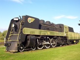
First Cochrane, next Iroquois Falls, now Englehart’s turn with the old locos

Englehart has a few tourist activities – most notably the historical museum.  There are also walking trails, one of which goes to nearby Kap-Kig-Iwan Provincial Park and its picture perfect waterfalls.  Every June the town hosts the annual Black Fly Festival, and the weekend after Labour Day means it’s fall fair time.

Of course, with Grant Forest Products in town, Englehart also has a fairly substantial woodpile.

Thanks to Justin and Tara for the Englehart info.  Check out some more photos here, here and here.

Larder Lake

Unlike Kirkland Lake, there is actually a Larder Lake in Larder Lake. Larder Lake is a former mining town about 10 kilometres west of Virginiatown on Highway 66 (not Highway 11 – detour still in effect), and 20 kilometres from the Québec border.

Larder Lake was first settled in 1906 after the silver boom in Cobalt pushed people further north in search of more mineral deposits. Gold was found in the Larder Lake area, creating a boomtown in the bush.

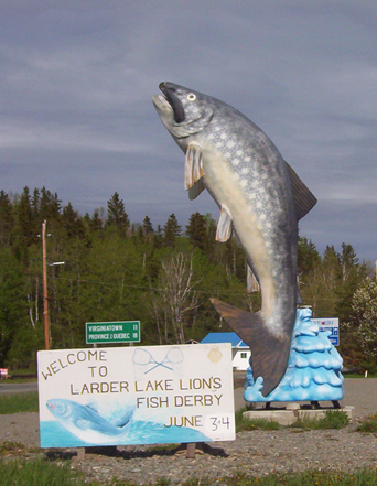
Larder Lake Ontario fish

Larder Lake’s entry in the “some big weird thing” contest: a big fish

I’ve been to Larder twice but never really gathered much intel. There are some camping and picnic areas, a beach, and a 30 slip marina. Larder Lake also has an LCBO, a service station, a public library, a post office, a motel, and a restaurant.  Unlike its largely anglophone neighbour Kirkland Lake, approximately 40 percent of Larder Lake residents are francophone.

Ashley emailed to let me know that there is the Raven Beach Campground run by the town, and the most northerly skill hill in Ontario (along with Timmins‘ Kamiskotia.) He also advised that, on the way to Larder Lake from Kirkland lake there is Fork Lake Resort, that has a campground, cabins and a beach strop. But here’s the most important part: apparently, there is a really good restaurant where they serve the most excellent pie in the area – just make sure to call ahead to make sure they’re open

Help add to this page – email at info (at) highway11 (dot) ca, or post your thoughts below.

Matheson

“650 000 acres of paradise” read the signs coming into Black River-Matheson.  The towns in Black River-Matheson (Monteith, Val Gagne, Ramore, Holtyre, and Matheson) are quaint, clean, and definitely rural – marking the transition between Ontario’s true north and the farms of the Temiskaming claybelt.  Matheson serves as a crossroads between road 101 (which runs from Québec to Timmins) and Highway 11.

Matheson, Ontario on Highway 11

Still not sure who Thelma Miles is…

When first founded the town was named MacDougall’s Chute – ‘MacDougall’ being the name of a local First Nations trapper and ‘Chute’ pointing to its mining origins.  The government renamed it Matheson in 1906 as they built the railway through the region to transport timber, ore, and wheat back to southern Ontario.  Today, a hunk of gold ore sits at Queen’s Park in Toronto as a testament to the riches formerly found in the Matheson area.  High upon a hill overlooking Highway 11, the Thelma Miles Museum brings visitors back through Matheson’s history from 1900 onwards.

Matheson was the site of the famous Croesus mine discovery of 1914. The largest concentration of pure gold ever to be found was discovered – a pure gold nugget measuring 2” x 1.25” was removed (a model of it is at the museum in Matheson). Gold was so rich that it was mined at an unbelievable 5,945 ounces per ton. The vein was lost about 2 years later – the time of the Great Fire.

Matheson, Ontario, Highway 11, highway11.ca

Matheson, Ontario on Highway 11 (Credit: User P199 at Wiki Commons.)

Matheson used to be the agricultural centre of the northern half of notheastern Ontario. Up until 1995, it even had a Ministry of Agriculture office. One had to go back a few decades to understand why agriculture flourished here. Besides Government incentives in the earlier part of the 1900’s for ‘pioneers’ to settle, and fairly fertile land that far north, was another reason – forestry.

Black River in Matheson, Ontario

Black River boat launch

Dwight emailed to tell me that, up until the early 60’s, before mechanization came to the forestry industry in full force, trees were harvested using hundreds of horses – and these horses had to be fed. To this day forestry plays a large part in the area. The big plant in Iroquois Falls was in the area, but so were plants in Kenogami Lake, and even several small saw mills in the area. One existed for years (and may to this day) in Ramore. Therefore, there was a bit more to the agricultural industry then meets the eye in the area.

Saying that, once the 1960s ended and mechanization of forestry took hold, agriculture began a 25 year decline to near extinction in the area. Two big ‘hits occurred – the 1980-82 recession (that even wiped out nearly all farm manufacturers as they were known then, and only left one intact – John Deere). The final ‘hit’ was the recession of the early 90’s. Before the recession of the early 80’s, there were several larger beef cattle herds, that totaled approx 1000 animals or more, from as far north as Iroquois Falls, south to Ramore. Matheson even had a feedlot and abattoir, with Holtyre having an abattoir. Monteith had a veterinarian for large and small animals up until the mid-80’s. By the mid 90’s there were probably no more than 200 animals, with even fewer today.

The Matheson Fire

Matheson is the epicentre of the Matheson Fire.  Also known as the Great Fire of 1916, the fire was the largest forest fire at the time and still stands today as Ontario’s most deadly, killing more than 220 people and burning more than 500 000 acres.  The fire formed a whopping 64-kilometre front from Porquis Junction through to Ramore – completely destroying all the communities in its path.  (The fire is the main reason that ‘Driftwood City’ was rebuilt as Monteith.)  It’s been told that those who didn’t escape by train found safety hovering in lakes and rivers.  The Matheson Fire led to creation of Ontario’s fire protections branch of the Ministry of Natural Resources.

The town’s Rotary Park displays a replica of an old mining cart (pictured) as well as a hunk of ore and a large wooden carving in honour of Aboriginal traders that once made their home in the area.  Upon further inspection, the old mining cart has been used as a wastebin for the old election signs of a handily-defeated Liberal politician.  There’s also a boat launch and pavilion on the Black River.

Mining memorial in Matheson, Ontario on Highway 11

Ore comes up…

Liberal fortunes in northern Ontario go down the chute, literally

…and junk goes down!

What I didn’t know is that there was a mine near Matheson that used to be a large producer of asbestos. Apparently, the area has a number of asbestos mines that operated until the 1960s. Johns Mansville had a huge operation on the back highway to Quebec, about 15 km east of town. It closed in the 60’s when the demand for asbestos dropped once health issues became known. There are still large deposites of asbestos in the area (along with gold of course). The Hedman asbestos mine was still operating until recently as far as I know, making safer products they have patented: “Hedmanite” and “Lizardite”. There are still asbestos tailings sites in the area, one site being as high as the mountain at the old Ramore Air Base.

I used to be sort of related to someone from Matheson (long story!), so I’ve been ‘regaled’ with tales of the region’s former agricultural prowess, the size of the markets, the vibrancy of the community, and the bars.  Today, with most of the farms are abandoned, the town is a shell of its old self – note the old Stanley Hotel with its Da-Lor Lounge, both of which now sit empty and for sale – a relic of better days.

Statue in Matheson, Ontario

Yeah the sun wasn’t helping my photographic skills on this one

Today Matheson has a population of about a thousand, with the township’s total population just breaking the 2500 mark.  Downtown Matheson now has the Cozy Corner, a variety store, Northern Treasures Gifts, a Freshmart, a hardware store, a caisse, an LCBO, and oddly enough, a garden centre.  The Northern Delight Restaurant and the Bel Air Motel both provide other options on Highway 11 for food and lodging, respectively.  There are numerous gas stations off the highway for snacks, petrol, and pee stations.  Despite being in this part of Ontario, there is no Northern Ontario Chinese Food – a testament to Matheson’s Anglophone bent (as compared to its largely francophone neighbours.)

Matheson is the last stop on road 101 to Quebec, about an hour away, and is also about an hour and fifteen minutes from Timmins.
Thanks to Dwight for the info on Matheson.

For an archive of the 40 comments that were posted to Highway11.ca’s profile of Matheson between 2008 and 2012, please click here.

Iroquois Falls

Iroquois Falls isn’t right on Highway 11 – it’s about 15 kilometres away at the end of road 67.  Founded more than 90 years ago, Iroquois Falls is home to a big pulp/paper mill and three electricity dams — all of which together used to be the world’s largest pulp and paper operation.

Iroquois Falls, OntarioIroquois Falls (pronounced locally as Urr-roquois, not Ear-roquois) is about half anglophone and half francophone.  The town is split in two by the railroad, and crisscrossed by the tracks at an innumerable amount of locations.  (I wonder if Iroquois Falls has the highest number of railroad crossings per capita in Ontario.)

Interestingly, the west half of the town seems to have English street names, while the east side’s streets are in French.  There is even rue Synagogue – a testimonial to the Jewish population that once settled in northeastern Ontario.  And while we’re on street names, there’s also Oil Tank Road, which is just begging to be the name of a country album.

Iroquois Falls was comprised of at least three communities – Iroquois Fall, Ansonville and Montrock. Amalgamation has put them all together under one municipal roof.

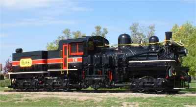
The Shay in Iroquois Falls

The Shay, Iroquois Falls’s old locomotive

The Abitibi Arena in Iroquois Falls was built entirely by community labour in 1955. Actually, at the time it was billed as the largest community labour project in North America. A large contributor to the project was personnel employed by the paper mill. If a part or piece of equipment was needed somewhere during the construction apparently it was readily made by a millwright over in the paper mill.

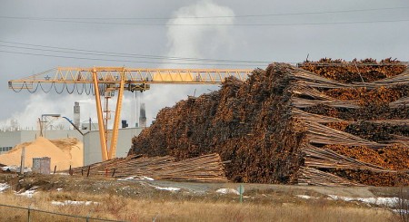
Iroquois Falls woodpile at the mill, Highway 11

Sometimes this travel blog feels like a tour of northern Ontario woodpiles (Credit: User P199 at Wiki Commons.)

Known as “The Garden Town of the North”, Iroquois Falls is home to The Shay, an old restored locomotive that used to work the Abitibi line.  The town is also home to the Abitibi Eskimos, a junior hockey team that draws record numbers in the Northern Ontario Junior Hockey League.  I’ve heard that people come from as far as Kirkland Lake to watch the Eskies.  Iroquois Falls celebrates Paperfest in August and the Moby Pike fishing Derby in July.  There is also a Pioneer Museum in town chronicling the rise of the forestry industry and settlement of the town.Iroquois Falls Eskis logo

Iroquois Falls used to be the home of a large, wooden hotel that was served by an fantastic dining room. Unfortunately, it is no more, either being torn down or burned down at some point before I had a chance to have a meal. Randy’s Rec Room is a pub serving surprisingly good food and the service is top notch.  For food there is also the Main Street Café, the Bus Stop Chip Stand, DJ’s pizza, a diner, and a Tim Horton’s.  There’s a motel when you’re coming into town, but I don’t think the adjoining steakhouse has been in operation for years.  There are some bank branches and a caisse.  Esso (west of the tracks) and PetroCanada (east of the tracks) are in town as well. And the Silver Grill is a Chinese place serving 100 percent northern Ontario Chinese food.

Iroquois Falls is a pretty nice town.  There are nice old houses, a few parks, and a marina at Twin Falls that provides access to the massive Lake Abitibi.

Thanks to Paul for the info on Iroquois Falls.

Cochrane

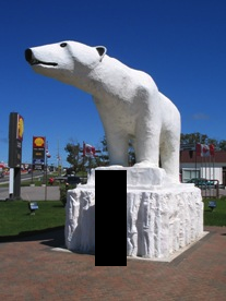
Chimo the Polar Bear in Cochrane, ON

Travel blog lesson #31 – always take a second, empty, non-person photo.  Or else you may end up with a blog full of photos of previous girlfriends.

Most towns would make a big deal of the fact that a former hockey player and doughnut baron hailed from their community.

Instead, Cochrane advertises Nanook, Aurora, and Nakita as its three most famous citizens.

Yep, we’re talking about animals.

If you have a fear of polar bears, steer well clear of Cochrane. I’m just teasing – they’re well contained. Cochrane has adopted the polar bear as their town symbol, even though true polar bear habitat is more than 300 kilometres away.  There are even fake igloos in town.

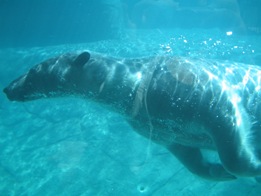
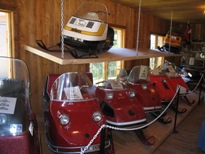
Chimo, the town mascot, is honoured with a big polar bear statue just as you enter town.  There’s also the Polar Bear Conservatory, where Nanook, Aurora, and Nakita spend their time.  There you can watch feedings, see interpretive displays, and “swim with the polar bears.” Ok, so if you’re more than 4 feet tall it is more of a wade than a swim but don’t let my teasing dissuade you – the Polar Bear Conservatory is interesting. Kids love the wading with the polar bears part. There’s also an adjacent ‘old style’ village with gas pumps, farm implements, and a collection of really awesome vintage skidoos.

Polar bear conservancy in Cochrane, Ontario

This was pretty cool, to be honest

Old Tyme Village ski-doo collection, Cochrane, Ontario

Definitely the most northern Ontario museum in northern Ontario

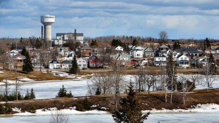
Cochrane is a very pretty little community of 4500 (slightly more anglophone than francophone) on Highway 11.  No matter what language you’re in, Cochrane is pronounced like cock-ran.  This might seem pretty intuitive but once in a gas station with a bunch of tourists from Belgium who kept asking how to get to a place that sounded like Cosh-rahnne and no-one, not the anglos nor the francos knew what the heck they were talking about.  I only figured it out about a year later.  Hopefully it didn’t take them that long.

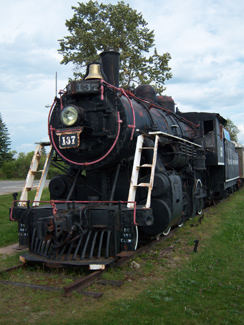
Old locomotive on display in Cochrane, Ontario

(Credit: Patrick)

It has a growing tourist industry built on the Polar Bear Express, which runs north to Moosonee twice a day in the summer.  Or at least it did, until the government stopped supporting the railway and now no-one knows what’s happening to the ONR.

Fishing and ATV expeditions often start here.  Greenwater Provincial Park is about an hour west of the town, providing fishing, swimming, and hiking around a series of kettle lakes.  Greenwater is pretty, and quiet. Also notable is the Tim Horton arena, home to the Tim Horton museum, that I didn’t have a chance to visit.

One of the coolest things about Cochrane, in my books at least, is Lake Commando. One –  that’s a sweet name.  Lake Commando. Sure, it’s more like a pond, but the words ‘Lake Commando’ just sounds so cool.  That’s awesome.  That’s even cooler than Geraldton’s Hardrock Drive, or Iroquois Falls’ Oil Tank Road. Two – it’s pretty.  It has parkland around it, a walking trail, and a quaint little bridge.  There’s also a bed and breakfast bordering the lake.

Cochrane, Ontario train station leads to James Bay

Cochrane train station.  (I do not know how to effectively use my camera in any lighting – dark or bright.)

As for amenities, since Cochrane has about 4500 people it’s fairly well served.  If you’re looking to bring out your fancy-pants you may be out of luck, but otherwise there’s everything you need.  Cochrane has a Tim Horton’s (which pays homage to the town’s most famous son with plaques on the walls, memorabilia all around), a KFC, and some other diner-style restaurants.  There’s also a rib/wing place and the Station Inn if you want a real sit-down meal, and, of course, a place serving Authentic Northern Ontario Chinese Food.

Cochrane, Ontario on Highway 11

Can you milk a polar bear? Well, Cochrane sure does. (Photo credit: Patrick)

There’s a small farmer’s market at the north end of town every Saturday, and a country store you’ll see across from the polar bear statue that sells cottagy-type stuff that you see in Muksoka.  Also, Cochrane has the last Giant Tiger on Highway 11 after Kirkland Lake.

Cochrane is also notable for receiving Ontario’s first ever permit to serve liquor on a Sunday, for a winter carnival held in the mid 1960s. Despite the devastating fires of 1910, 1911, 1916, and Cochrane still exists to this day.

Thanks to Paul for some of the Cochrane.

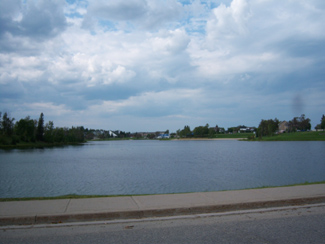
Lake Commando, Cochrane, Ontario

Lake Commando.  Still looking for Rambo River. (Come to think of it, there was a Rambo Creek near to where I grew up…800 km away)

Cochrane, Ontario off highway 11 highway11.ca

(Credit: User P199 at Wiki Commons.)

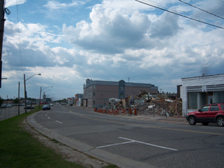
Cochrane, Ontario street

Streetscape in Cochrane

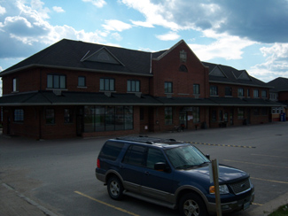
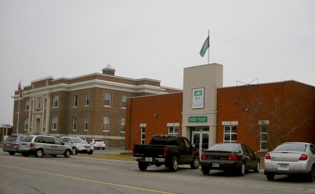
Cochrane, Ontario municipal building highway 11

A nicer Cochrane streetscape. (Credit: User P199 at Wiki Commons.)