Haileybury

Which northern Ontario town had its own street cars, was home to the guy who wrote the Hardy Boys, had the most millionaires in Canada, was the first home of the team that would become the Montréal Canadiens, and then promptly had its prosperity wiped out by a massive fire?

Streetcar Norhtern Ontario, Haileybury, Highway 11

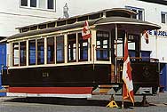
Back off St. Clair Avenue West…Haileybury has had streetcars too!

The thing that makes Haileybury really northern is its history.  The rise and fall and apparent rebuilding is really interesting and, in my opinion, totally characteristic of northern Ontario.

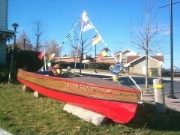
Lumber boat in Haileybury, ontario

After Longlac and Opasatika, let me guess this is a lumber boat?

Once known as Humphrey’s Depot, Haileybury was founded in the early 1900s by a former fur trader on the shores of Lake Temiskaming.  He named the town after the school he attended in England.  He tried to attract settlers with the usual propaganda leaflets, but as northern Ontarians know, there’s no better way to get the country settled than a gold rush.  And that’s what it took to get Haileybury off the ground.

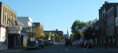
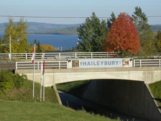
Haileybury, downtown, Highway 11 Ontario Lake

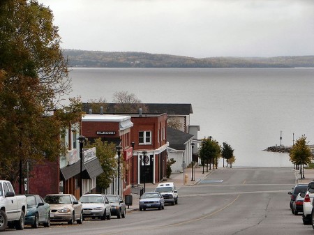
Haileybury road leading into Lake Temiskaming. (Credit; User P199 at Wiki Commons.)

Despite being named after a place in England where wealthy parents got rid of their kids, Haileybury is the start of francophone north-eastern/central Ontario.  (Or it is the end, depending on which way you’re traveling on Highway 11.)  Approximately 80 percent of Haileyburians are French-first, which is interesting given that their neighbours are primarily anglophone, particularly in New Liskeard (70 percent) and Cobalt (almost completely unilingual.)  As you go north after Haileybury, the towns almost alternate – anglo, franco, etc.

The discovery of silver in Cobalt in 1903 started a population explosion in Haileybury, as the town became a bedroom community for prospectors and mine owners.  So successful were some that a street in Haileybury was dubbed Millionaire’s Row for the wealthy people it housed.
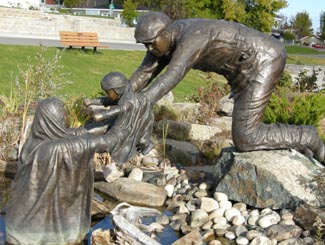
Haileybury, Ontario on Highway 11But of course, this all had to come to a tragic end with the fires of 1922, which killed 11, displaced 3500, and razed the town completely alongside New Liskeard, Dymond, and possibly Cobalt. In order to survive, many families had to hide in wells, lakes, and even down mine shafts. Many of those who escaped to the mines died when the fires, passing over the mines, sucked out the shaft’s oxygen, asphyxiating those who sought refuge underground. The town commorates the fire with a sculpture at its waterfront park, pictured below on the left.

Haileybury Today

With 4500 people, Haileybury (pronounced locally as Haileyberry) is the second largest part of the Tri-Towns and Haileybury is the seat of the Temiskaming Shores municipality, which includes New Liskeard and Dymond.  It is a quiet lakeshore community that is worth a stop if you’re not in a hurry.

Pioneer Monument, Great Fire, Haileybury, Highway 11

Monument to pioneers that survived the Great Fire by hiding in swamps, lakes, and wells

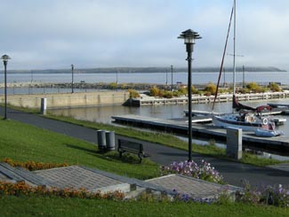
I really like the waterfront.  There is a nice little pavilion with the Pioneer’s Monument (pictured) honouring the fire of 1922.  There is a little beach and a modern marina as well.  The view is nice across the lake to Quebec and in the summer you’ll see a number of boats on the water as Lake Temiskaming is the end of the scenic Ottawa River route, which is popular with boaters.  The waterfront is worth a drive, if not a full stop.

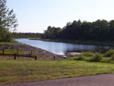
Haileybury on the shores of Lake Temiskaming

Haileybury on the shores of Lake Temiskaming

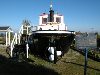
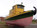
In terms of tourism, there is a fair amount to do.  The Haileybury Heritage Museum was built to chronicle the history of the town and tell the story of the fire.  The museum features a restored 1920s streetcar, as well as an old firepumper and a preserved tugboat that used to ply the waters of Lake Temiskaming.  You can also visit the “world famous” Haileybury School of Mines.  Haileybury is also home to the Temiskaming Art Gallery.  You can see different types of ores at the Rock Park Walk, while there is camping and golf in town as well.

I don’t remember a lot of places to eat, and I think the only Tri-Town Tim Horton’s are in New Liskeard and Dymond.  Accommodations include the Leisure Inn, Edgewater Motel and Cabins, the Haileybury Beach Motel, and the Les Suites des Presidents Suites, an upscale bed and breakfast.  New Liskeard has more places to stay and eat.  Personally I find that Haileybury, despite being very pretty and having stuff to do, is still something of a bedroom community.  It doesn’t have the same downtown nor the same ‘feel’ that New Liskeard does.  And it’s nothing like Cobalt.  At all.

Downtown Haileybury

Back to History

Haileybury was also home to the team that would become the Montreal Canadiens.  The club played the 1909 NHA season and left for Montreal.  It would become the Canadiens only two years later.  I think that’s pretty neat.

Haileybury’s streetcars were part of the Nipissing Central Railway that connected the Tri Towns, which would definitely make it unique in the north.  Heck I’m sure it ran faster then than Timmins transit does today.  Toronto also donated 87 streetcars after the great fire to help shelter the homeless.  Today there is one restored streetcar left at the Haileybury Heritage Museum.

And, to finish, Haileybury was also home to Les Macfarlane, who wrote many of the Hardy Boys novels under the pen name Franklin Dixon.

Thanks to Johnny O for the info on the Tri Towns.
The Hardy Boys's Sleuth, in Haileybury on Highway 11

I never liked the Hardy Boys. Too All-American. Too serious. Too predictable. Sure, you knew that Encyclopedia Brown was always going to figure it out too but at least he had a sense of humour. But, anyway, this is a replica of the Hardy Boys’s boat, in Haileybury.

Larder Lake

Unlike Kirkland Lake, there is actually a Larder Lake in Larder Lake. Larder Lake is a former mining town about 10 kilometres west of Virginiatown on Highway 66 (not Highway 11 – detour still in effect), and 20 kilometres from the Québec border.

Larder Lake was first settled in 1906 after the silver boom in Cobalt pushed people further north in search of more mineral deposits. Gold was found in the Larder Lake area, creating a boomtown in the bush.

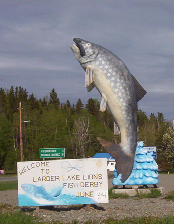
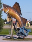
Larder Lake Ontario fish

Larder Lake’s entry in the “some big weird thing” contest: a big fish

I’ve been to Larder twice but never really gathered much intel. There are some camping and picnic areas, a beach, and a 30 slip marina. Larder Lake also has an LCBO, a service station, a public library, a post office, a motel, and a restaurant.  Unlike its largely anglophone neighbour Kirkland Lake, approximately 40 percent of Larder Lake residents are francophone.

Ashley emailed to let me know that there is the Raven Beach Campground run by the town, and the most northerly skill hill in Ontario (along with Timmins‘ Kamiskotia.) He also advised that, on the way to Larder Lake from Kirkland lake there is Fork Lake Resort, that has a campground, cabins and a beach strop. But here’s the most important part: apparently, there is a really good restaurant where they serve the most excellent pie in the area – just make sure to call ahead to make sure they’re open

Help add to this page – email at info (at) highway11 (dot) ca, or post your thoughts below.

Kenogami Lake

Kenogami Lake – where Kirkland Lake goes to find a lake.

Kenogami Lake, Ontario Highway 11Ok, that’s not the town motto.  Kenogami, which means “long lake” in Montagnais or “long water” in Cree, (or neither, according to a comment below), is a river about 15 kilometres north of Kirkland Lake on Highway 11.  Kenogami used to have a little sawmill, I didn’t see any homes in Kenogami Lake, per se, but there were lots of cottages along the beautiful river with numerous little piers and boat docks along the shore.  The river crossing is a nice little break from the forests and truckstops of the highway, and makes a nice stop if you’ve been travelling far and don’t plan on stopping in Kirkland Lake.

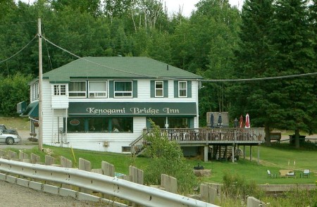
Kenogami Lake Inn on Highway 11, with a waterfront patio

Waterfront patio? Torontonian heads would explode for this (Credit: User P199 at Wiki Commons.)

The Kenogami Bridge Inn has wing nights every Monday and Tuesday.  I was there on a Monday night and there were eleven cars while I was there.  I didn’t venture in but things sure smelled good, and the patio would be absolutely serene were it not for the traffic on Highway 11.

Kenogami Lake, Ontario Highway 11There’s a marine shop across highway and I’ve seen ads on the highway for Kenogami Trash n’ Treasures, which sells some old cast iron cookstoves among other things.  South of the bridge over the Kenogami River there’s Delean’s Restaurant, a gas station, and an old chocolate factory that I’m told went bust when its owners, a married couple, unfortunately split up.  Further south there is MacPherson’s General Store, which sells munchies, liquor, and gas.

There’s also – get this – a gun shop in Kenogami.  Yes, a gun shop.  Maybe my existence up until then was too sheltered, but this is only the third gun shop I’ve ever seen in my life (the others being Fred’s Gun Repair and Buy-Sell-Trade in Delhi, and Giovanni’s Gun Shop on Wilson in Toronto, those two I remember passing in the car as a kid.)  We’ve all seen the rifles locked away in Canadian Tire, but when I read ‘gun shop’ my mind went ‘huh?’ until I realized that we’re in the middle of hunting country.

Pretty and calm, Kenogami Lake is a nice spot to stop and admire the handsome beauty of northern Ontario, before hitting the washrooms and hitting the road.

Tunis / Nellie Lake

One my drives up Highway 11 after Iroquois Falls, I didn’t see much in Tunis, at least not much that was directly on the highway itself.

Dutch from Kitigan emailed me to tell me that Tunis, was the home of a huge church that was used as a vacation retreat for Catholic priests and nuns. About 25 years ago, the church sold everything, and left. New owners tried to run a motel out of the complex, but it soon went under, and burnt down five years later.

About 15 years ago, a large power plant was built not far south of Tunis, financed by the Ontario Teachers Retirement fund.

As far as I could tell, Nellie Lake consists of a gas station, a few houses, and an an abandoned motel/gas bar complex along Highway 11.

However, according to some helpful emails from Sarah, I seem to have missed all the fun. Nellie Lake requires that you leave Highway 11 to truly find it.

Nellie Lake (the town) is largely a small cottage hamlet off the highway. Worth checking out is the lake itself, which has beach facilities and apparently picturesque and transquil surroundings. Cameron’s Beach and Trailer Park borders Big Nellie Lake and offers camping and trailer services alongside the water.

Opasatika

Opasatika is a former mill town with about 300 residents set on the Opasatika River.

Opasatika, Ontario, Highway 11 fish

This is actually pretty cool in person. Well done, Opaz.

Opaz (as it is commonly called along northern Highway 11) used to have its own mill (and supposedly, from what I was told, its own dance club), but changes to the forestry industry in northern Ontario have meant that a lot of the smaller mills are being closed.  This means that communities like Opasatika, Smooth Rock, and Longlac are losing their mills, and fighting for their lives in the process. I was told that it used to be that there was a little mill in each little town from Hearst through to Smooth Rock.

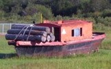
Of course, Opasatika has its “some weird big thing” as you enter the town.  There’s a random fish statue . There’s also a mini logging boat sitting in the field.  Normally there are plaques for these kinds of things but not here – I guess everyone around here is just in-the-know. A resident emailed me to tell me that the fish was supposed to have a commemorative plaque, and be the start of a historical site. However, progress was delayed when the town mill was closed – and subsequently, all civic efforts have gone into finding a solution for the mill. That’s understandable, and unfortunate.

Lumber boat, Opasatika, Ontario Highway 11

Take note Longlac – it is obvious what this boat’s purpose is

Opasatika (pronounced locally as Opa-set-ticka) also has a nice little waterfront park with a boat launch to the river, and two marshes – du Village and des Lambert.  Sixty kilometres south of Opasatika you can find Christopher Waterfall which leads into Rufus Lake.

Opasatika River launch, Highway 11

NO SWIMMING. Okay Opaz, you made it clear.

As for businesses, Magazin Martel is a depanneur with a little LCBO outlet.  Mandy’s Beanerie serves coffee and meals as well.  There might be more for food and services, but I’m not sure. I haven’t been back in a while.

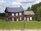
There used to be a mushroom farm in Opasatika.  I’m not sure if it is still running. I don’t know if it gives tours, but you could enquire – I’ve always found visiting any kind of factory/workplace type thing to actually pretty interesting. The farmhouse you see on the right is actually in Val Rita, and has some personal significance to its owner, a testament to the agriculture that used to occur in this area.Lonely farm, Opasatika, Highway 11On a personal note, Opasatika is the first place where my car was chased by a dog on the journey.  Imagine, if you live on Highway 11 and you have a dog that chases cars or trucks?  Boy are you in trouble…

Thanks to Anick for help with Opaz.

Mattice

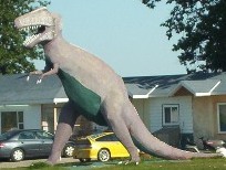
When you enter Mattice from the east, you’ll be greeted by a dinosaur.

T-Rex has no cultural significance to the town.  There isn’t a museum around.  He’s not the town mascot. To my knowledge no dinosaur bones have been found in the area. It’s just decoration on someone’s front lawn.  Think of it as an especially eccentric garden gnome.

T-Rex in Mattice, Northern Ontario, Highway 11

Mattice does its bit to continue Highway 11’s many “WTF? moments.

I’ve been told by a Mattice resident that the T-Rex was built by the owner of the Mattice Motel to attract tourists.  There used to be a stegosaurus in town, as well.  It turns out that the stegosaurus was destroyed by a new owner when the previous owner left to pursue his dinosaur dreams elsewhere.  Seriously.  It turns out he left to build a concrete Jurassic park in the Ottawa region.

A francophone town in the heart of French-speaking Ontario, Mattice (rhymes with ice) is one of these small northern towns (population approximately 500) on Highway 11 that has a little bar, an a full-blown LCBO, and a skidoo repair shop … but only the tiniest of grocery stores that would barely qualify as a fruit stand in more urban areas in southern Ontario.

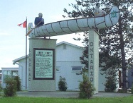
Fur trading monument, Mattice, Highway 11 Ontario

Mattice used to be the launchpad for old fur trading expeditions

Set on the Missinaibi River, Mattice used to be a starting point for Voyageurs heading downstream for the fur trade.  There’s a historical plaque and one of Highway 11’s classier statues to commemorate its history.  About two kilometres upstream, there’s a traditional Aboriginal burial ground.

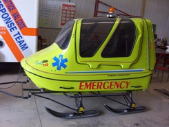
Mattice emergency service skidoo, Highway 11

Ambulance northern Ontario style

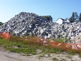
If you go north on one of Mattice’s side street you’ll find the nice riverfront park.  It’s actually quite a nice park, with a boat launch, a picnic area, and an inexplicable pile of rocks (that, it turns out, were used in the refurbishment of the Missinaibi Bridge.  And then left there for posterity’s sake.)

Rock pile, Mattice, Highway 11

Lacking a woodpile, this pile of rocks will have to do

Longlac

Longlac is approximately half way between Toronto and Winnipeg, and is 320 kilometres from Thunder Bay. So for me, on one particularly longish trip, making it to Longlac was kindofabigdeal.

There is nothing between Hearst and Longlac save for maybe a gas station (and I mean maybe) and the Klotz Lake washroom/swimming combo rest station on the side of the road.  The drive seems. to. take. for. ever. (ok I think I got my point across, it’s probably not that bad.)

Longlac welcome sign, Highway 11

Longlac’s fur trader welcome statue was somehow both cheesier and cooler in person

So, for me at least, the oncoming arrival of Longlac was a big deal – finally, the end of this 200 kilometre stretch of nothingness…! It’s no surprise that the town’s Protestant church is named St. John-in-the-Wilderness.  And it wasn’t founded in the fur trading days either – this was founded ‘in the wilderness’ in, wait for it, 1943.

Today, Longlac is a former paper and forestry town trying to reinvent itself in a difficult economy and represents the westernmost edge of northern Ontario’s francophone belt – just under half its residents are French-speakers.  Hence the local  caisse.

Not immediately evident that this guy is supposed to pull logs

Not immediately evident that this guy is supposed to pull logs

When you get into the town you’re immediately greeted by a horse statue and two beached boats.  The horse is pulling logs (which you can’t see unless you climb up the little hill to the statue itself.)  I think the boats are supposed to carry logs too. They seem to be the remains of a former miniputt course.  It’s too bad it can be a bit confusing to the visitor.

Loggin boat, Longlac, Ontario Highway 11

Also not immediately evident that this is supposed to pull logs too

Longlac has a long history.  Prior to 1800 the town was a North West Company trading post.  In 1814, the Hudson Bay Company set up a rival post, and in the spirit of modern commercialism the two merged in 1821. There is a historical plaque with a statue of two guys in a canoe, representing the role of Aboriginal peoples and fur traders in building Longlac.  There’s also a town history board back at the tourist office/former mini putt site.

Longlac used to be a mill town but today, no mills operate in Longlac.  All three have shut down in the last few years. “Founded on fur, sustained by the forest” is Longlac’s motto, and considering that the forestry industry is contracting in northern Ontario, you have to wonder what a town of 1200ish will find to sustain itself. What other jobs can there be in the area? How long before parents have to start working in Alberta? It is communities like Longlac that you really feel for – they’ve survived this long.

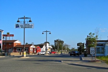
Longlac, Ontarios main drag...don't hit the light posts!  (Credit: User P199 at Wiki Commons)

Forestry Road – Longlac, Ontario’s main drag…don’t hit the light posts! (Credit: User P199 at Wiki Commons)

Longlac’s main strip is Forestry Road, which runs perpendicular to Highway 11.  It has a row of streetlights right in the middle of the road, which practically invites you to play a game of bumper cars with your vehicle.  What happens if you have to swerve for a dog?

Longlac has the requisite truck stops and third tier franchises of a Highway 11 town, with places like Robin’s Doughnuts and 2 for 1 Pizza.  There’s an LCBO outlet, a bed and breakfast (Lily’s), and what seems like the newest Rexall pharmacy in Canada.  (It is so shiny and suburban that it looks a bit out of place.)

Abandoned mini putt in Longlac, Highway 11

Abandoned mini putt in Longlac, Highway 11.  I thought the horse and boat belonged to the mini putt!

Apartments in Longlac, highway 11

Seriously? This is northern Ontario after all.

I hope to visit again. Maybe someone can send me an email and let more know a bit more so I can add it here.

Lake Nipigon

My map indicated that there were three communities on Highway 11 between Geraldton and Nipigon – Rocky Bay, Macdiarmid, and Orient Bay.  This may or may not be true.

Rocky Bay is home to the Rocky Bay First Nation.  It is actually off Highway 11 and I didn’t venture in as time and gas were becoming an issue.  (Note to readers, fill up in Beardmore.)

The only thing I saw named Macdiarmid was a dirt road.

I couldn’t find Orient Bay either, although truth be told I was getting weary of driving on this particular trip and didn’t really give it a good look.  It might be the name of a lodge or an outfitters station, but I didn’t see it.

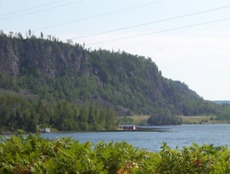
Beautiful cliffs of Lake Nipigon

Beautiful cliffs of Lake Nipigon

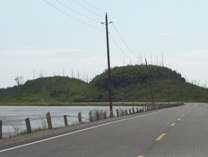
But what is great about this part of Highway 11 is the drive itself.  The scenery is absolutely fantastic.  Stunning cliffs are the result of geological processes that have left the Pijitawabik Palisades as some of the most awe-inspiring views on Highway 11 .  The highway is bordered by countless lakes which are nestled between beautiful rocky outcroppings that jut from the landscape like bumps on a log.

Weird bumpy rock formations follow Highway 11 in the Lake Nipigon area

Weird bumpy rock formations follow Highway 11 in the Lake Nipigon area

This drive is sincerely one of northern Ontario’s most scenic drives.  So if you’re already out this way, don’t rush through – it is worth stopping and enjoying.

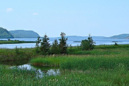
Lake Nipigon marshes off highway 11 ontario highway11.ca

Lake Nipigon Wetlands with cliffs in the background. I love Ontario. (Credit: User P199 at Wiki Commons.)

Barwick

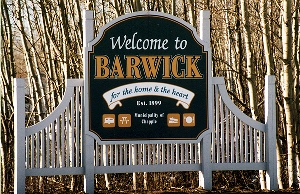
Barwick, Ontario, on Highway 11 highway11.caBarwick is a village of around 900 people just west of Emo.

Barwick has Riverfront Park which provides nice views of the Rainy River.  There is a boat launch and some picnic pavilions. Apparently, the area provides some nice birdwatching.  There is also St. Paul’s Heritage Church in town.  I assume it’s old.

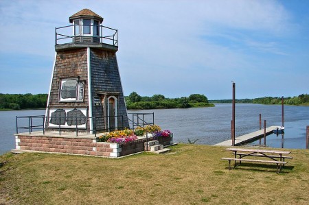
Barwick is also home to a lighthouse, not an old one but one built in 2003.  There is some talk that there were lighthouses on Lake of the Woods in the past, but no confirmation of one being in Barwick.

Barwick, Ontario's lighthouse, highway11.ca

AHOY MATEY…I see a miniature lighthouse. (Photo: User P199 at Wiki Commons.)

That’s what’s cool about so many towns on Highway 11 – when someone gets inspired, the community tends to get something done.The Chapple Museum is home to Barwick’s history.  It is located at a former trading post, and now displays material from local farms, the old Hudson’s Bay Company post, local artists, and is home to a war memorial.

There is a gas station, a RV/campground, a garage, a Christian school, four churches and an oriented-strandboard plant.  You can take tours of the Voyageur Panel OSB plant by calling 807-274-2000 in the summer.

And like all the surrounding villages, Barwick tries to lay claim to the Native historical centre as a local attraction, but it is in Stratton, one town west.

Stratton

Stratton is the seat of Morley Township and is two towns east of Rainy River.

RR-14-Stratton-LogoThe Township of Morley has the coolest city logo I think I’ve seen while compiling this site (see left).  It looks like it was drawn in Microsoft Paint (much like this website), and features a sun, some waves, a maple leaf, what I think is a lunchpail (oops! it’s a silo!), and a curling rock.  If this isn’t the logo of a Canadian retirement town, then what is?

East of town is the Kay-Nah-Chi-Wah-Nung Historical Centre (imagine having to spell that website address over the phone!).  Located by the Manitou Mounds, it’s an ancient First Nations burial site that’s been commemorated with a historical centre.

There’s the annual curling bonspiel in late February.  And there’s another one in mid-March.  And another one in late-March. And another one for truckers in April.  There’s a fishing derby in July, and then another curling bonspiel in December.

The area was first settled in the 1870s when settlers first travelled to Rat Portage (I bet Kenora sure is happy about changing their name from Rat Portage…) and then travelled by steamboat through Lake of the Woods.  Fires wiped out the early town, but things were rebuilt and in 1903 Stratton became the seat of the township. Today, Stratton is a bedroom community for Fort Frances and an agricultural area, with the only cattle auction/sales centre in north-western Ontario.

Add to this page by emailing me at info (at) highway11 (dot) ca and make Stratton come alive (ok not really.)

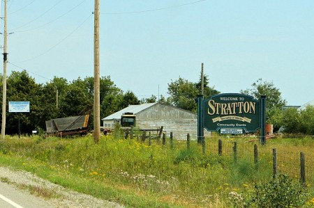
Stratton, Ontario, northwest on Highway 11 highway11.ca

(Photo: User P199 at Wiki Commons.)

RR-14-Stratton-Launch