Larder Lake

Unlike Kirkland Lake, there is actually a Larder Lake in Larder Lake. Larder Lake is a former mining town about 10 kilometres west of Virginiatown on Highway 66 (not Highway 11 – detour still in effect), and 20 kilometres from the Québec border.

Larder Lake was first settled in 1906 after the silver boom in Cobalt pushed people further north in search of more mineral deposits. Gold was found in the Larder Lake area, creating a boomtown in the bush.

Larder Lake Ontario fish

Larder Lake’s entry in the “some big weird thing” contest: a big fish

I’ve been to Larder twice but never really gathered much intel. There are some camping and picnic areas, a beach, and a 30 slip marina. Larder Lake also has an LCBO, a service station, a public library, a post office, a motel, and a restaurant.  Unlike its largely anglophone neighbour Kirkland Lake, approximately 40 percent of Larder Lake residents are francophone.

Ashley emailed to let me know that there is the Raven Beach Campground run by the town, and the most northerly skill hill in Ontario (along with Timmins‘ Kamiskotia.) He also advised that, on the way to Larder Lake from Kirkland lake there is Fork Lake Resort, that has a campground, cabins and a beach strop. But here’s the most important part: apparently, there is a really good restaurant where they serve the most excellent pie in the area – just make sure to call ahead to make sure they’re open

Help add to this page – email at info (at) highway11 (dot) ca, or post your thoughts below.

Kirkland Lake

I almost moved to Kirkland Lake, and I’ve always kind of regretted that it didn’t work out.  Kirkland Lake is a neat little town that’s been described to me as the ‘wild west’ of northeastern Ontario.

Forty five kilometres east of the Québec border on Highway 66 (not Highway 11, we’re on a detour right now), Kirkland Lake is a largely anglophone town of about 10 000 8000, and is the largest town between North Bay and Thunder Bay on Highway 11.

Mines and Garbage

Kirkland Lake is extremely well known throughout Canada despite its small size and relatively remote location.  Since gold was struck in the early 1900s, KL has been one of Canada’s most famous mining towns, complete with gold mines, drinking hotels, and highgraders.  There’s a miner’s memorial as you come into town, which is actually quite classy and lists all the names of those who have died in mining accidents since the town began.

Kirkland Lake Adams Mine Protest

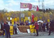
Adams Mine protests in Kirkland Lake in the 1990s

KL is also famous for Adams Mine – an abandoned open-pit mine that would have been the site for Toronto’s garbage, had the local community, First Nations, farmers and environmentalists not fought it so effectively.  They were in the media, they wrote thousands of letters, they united many groups that had not worked together before.

Kirkland Lake is a story across Canada showing that no matter how small you may be if you do it right and smart – you can win.  Adams Mine was seen as a huge story across Canada – so much so that the effort which started small eventually changed a lot of minds across southern Ontario.  The provincial government put the plan to rest in 2003.  The Grievous Angels, a band based in northern Ontario, wrote a song about it (the lyrics are here.)

Harry and Hockey and … other interesting stuff (that begins with the sound “wh”)

Kirkland Lake was named after Winifred Kirkland, a secretary at the old Ministry of Mines.  (Ah to be an early provincial bureaucrat – you might get a town named after you.) Kirkland Lake, arguably, has it’s own suburb – King Kirkland – which consists of about 20 houses and trailers about ten minutes east of town on the highway.

Sir Harry Oakes is probably Kirkland Lake’s most famous and most wealthy citizen. American-born, he was a prospector who finally struck it big in KL after stints in California, Australia, and the Klondike.  His mine in KL was the second largest gold mine in the Americas.  By the 1920s, Harry Oakes was Canada’s richest individual.  However in 1943, Oakes was allegedly murdered at his home in the Bahamas, and although fingers were pointed towards his son-in-law, no one was ever convicted of the crime.  Today his former house is home to the Northern Ontario Museum in KL.

Kirkland Lake Mansion museum

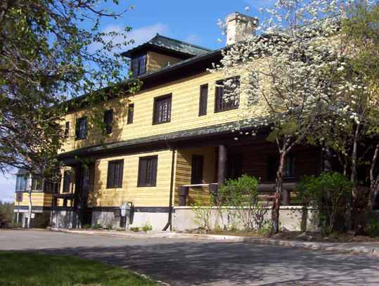
Harry Oakes’s former mansion – now the Kirkland Lake museum

In terms of other famous KLers, Kirkland Lake was also once home to Growing Pains star Alan Thicke, figure skater Toller Cranston, and former NHL goalie Darren Puppa.

Hockey Heritage North, Kirkland Lake Ontario
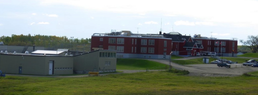
On the subject of hockey, Kirkland Lake used to be known as a hockey hotbed.  CBC broadcaster Foster Hewitt used to call KL “the town that made the NHL famous” due to so many Kirkland Lakers filling the roasters of early NHL squads.  Today KL is home to Hockey Heritage North, a museum that celebrates hockey and northern Ontario’s role in the NHL.  Hockey Heritage North has a parkinglot that’s bigger than the museum itself – seemingly twice the size of the facility – and the parkinglot is probably a bigger draw for kids learning to ride bikes or for rollerblading and skateboarding.  In three visits I’ve come to believe that Hockey Heritage North’s parkinglot is the nicest smoothest stretch of pavement in all of northern Ontario.

Downtown Kirkland Lake

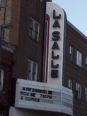
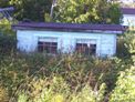
The place to see a show in Kirkland Lake. I mean a normal show. Don’t get any ideas. Those days are over.

Way back in the day, Kirkland Lake, however, was arguably almost as famous for its red house.  KL had a reputation for being a party town, thanks in part to the mining boom and the many bachelors who ventured north to prospect and work. I have been told that one of the highlights of Kirkland Lake’s heyday was its internationally-known brothel.  Soldiers from the area went to Europe to fight in World War One and regaled Europeans with tales of “the Red House of Kirkland Lake” or “5 Main Street” which was in fact a popular brothel well-known across the north.  Supposedly the tales were so tall or so enthralling that other soldiers and even Europeans have actually come back to the area to visit Kirkland Lake’s red whorehouse.  The house itself still standing but is no longer red.

Kirkland Lake: The Town

Kirkland Lake, to me at least, is a town of contrasts.  When you enter the downtown along Government Road, it looks a bit like Huntsville in cottage country – a windy street revealing the town turn by turn, forming the backbone of an old but not pretty interesting little downtown.  Actually, I like the downtown – it’s may not be “quaint” by some people’s standards but has character. With a decent downtown and as a town of 10 000, Kirkland Lake is big by Highway 11 standards.  You don’t have to worry about whether there is a gas station or a liquor store.  There are two hotels (HoJo and Comfort Inn), a Canadian Tire, a McDonald’s, a KFC, a Subway, a pizza shop, two Tim Hortonses (heck Timmins only has three!), a northern Ontario Chinese place, the Downtown Family Restaurant, and ‘The Zone’, which is a little club sort of thing in the basement of the local MP’s office.

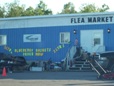
Yet one could say that there is very little shopping.  Other than Giant Tiger and Hart, that’s about it.  No Zellers, no Walmart, one (and a half) grocery stores, a music shop, a pawn shop, and that’s it.  The Kirkland Lake Mall has maybe about 20 shops and services.  I guess you either go to Timmins, or to Rouyn-Noranda.

Kirkland Lake Ontario's mall

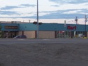
Kirkland Lake has a “mall”!

For a number of years, Kirkland Lake also had a significant Jewish community. As the mining boom spread northwards, Jewish families from Eastern Europe and even the United States moved up into the Englehart and Kirkland Lake area. Some settled as farmers in the area around Krugerdorf, while others formed the backbone of the commerce that fed Northeastern Ontario’s mining towns. A synagogue was built in 1927, with land donated by Sir Harry Oakes on Station Road. The community peaking in the late 1940s at a couple hundred members. Eventually, as the sons and daughters of the community moved southwards, and as fewer immigrants came north, the community shrank, and the synoguge was turned into apartments in 1980. Kirkland Lake’s original ‘Ark’ (I think that’s the wooden structure which holds the Torah) was eventually transported to the Beth Tikvah Synagogue in Toronto. While the community may have migrated, the history and the impact of Jewish immigrants lives long in the north, in places like Kirkland Lake, Iroquois Falls, Krugerdorf, and Timmins. Check out the virtual museum at the Kirkland Lake Jewish History link at the bottom of the page for first hand stories from community members.  (Check out KL’s Jewish history here or here.)

Kirkland Lake today still has a bit of a reputation as a hard-scrabble town. The cyclical ups and downs of the mining and logging industries make Kirkland Lake a boomtown one decade and an economic sponge the next. Just like many towns in both northern and southern Ontario, as life in Northern Ontario requires a little assistance to get by the booms and busts of the economy. Like all mining towns, Kirkland Lake is a little rough around the edges. But that’s what makes places like this interesting, and unique. Like someone posted below, KL is a mining town, past, present, and future.

Downtown Kirkland Lake

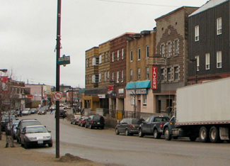
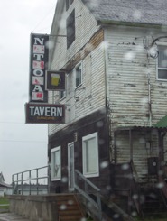
Forget the mall.  Kirkland Lake’s downtown is rough and old school and kindofabitof awesome

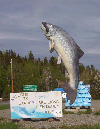
I have one beef with KL though, and I’ll get it off my chest now.  The signs outside the town blatantly lie.  They tell you it’s 15 kilometres to town and then 15 kilometres later you see a sign that says “Kirkland Lake 6 km” and then five minutes later you see another sign “Kirkland Lake 5 km.”  Now I’m sorry, first off you’re lying the first time, and then the second time I was driving 90 kilometres an hour and I did not manage to go only one kilometre in that span of five minutes.  It’s frustrating. Bad signage is one of my pet peeves in general.

I like Kirkland Lake.  It has a lot of potential if marketed correctly.  I’ll be back.

Gull Lake, near Kirkland Lake Ontario

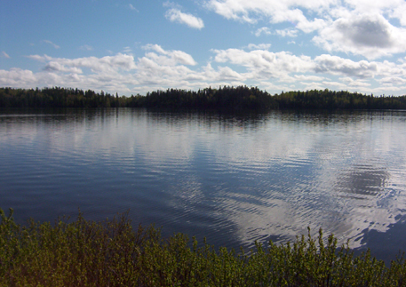
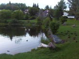
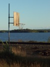
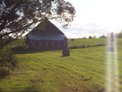
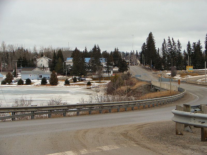
Gull Lake outside of Kirkland Lake


For an archive of the 40 comments that were posted to Highway11.ca’s profile of Kirkland Lake between 2008 and 2012, please click here.

Swastika

Swastika, Ontario highway11.ca

(Photo: P199 at Wiki Commons.)

Unlike Chaput Hughes, which is on the map but is essentially a part of Kirkland Lake (hence why I don’t profile it on this website), to my eyes Swastika was a bit more separate – it seemed to have the makings of being its own little hamlet (at one point in history.)

Once again, I had to be set straight. Swastika is technically a part of Kirkland Lake. On the other side of KL, King Kirkland (which I had erroneously identified as part of the town), however, is not. I stand corrected.

Swastika is a former railroad town on Highway 66 (not Highway 11) founded in 1906.  It is here that the main ONTC line branches off to Rouyn in Quebec.  Swastika was also home to the Swastika Mining Company, which found gold in 1908 but soon went under soon after.

During the Second World War the Province asked Swastika to change its name to Winston, in honour of Churchill.  The town refused.  Someone even put up a sign stating “To hell with Hitler.  We had Swastika first.

Swastika, OntarioWhen driving through a few years back, I counted three churches and estimated about 60 houses in Swastika. Evidently, as per the posting below, there are more than 60 hourses in Swastika.  The Swastika Fireman’s Park has a nice little waterfront along the Blanche River, featuring an historical plaque, a bunch of ducks, and a peaceful spot to stop.

I’m not sure how many services or shops in there are in Swastika.  Corner Link Variety is one – it serves ice cream as well as normal variety store stuff.  It’s off the main road, a bit north at the base of the church pictured here. I didn’t spend a lot of time in the town, I was eating ice cream at the Fireman’s Park.Swastika, Ontario church

Swastika also has a train station – I was surprised to learn that the ONTC passenger service doesn’t go into Kirkland Lake, but lets you off in Swastika where you then take a bus to KL.

Kenogami Lake

Kenogami Lake – where Kirkland Lake goes to find a lake.

Kenogami Lake, Ontario Highway 11Ok, that’s not the town motto.  Kenogami, which means “long lake” in Montagnais or “long water” in Cree, (or neither, according to a comment below), is a river about 15 kilometres north of Kirkland Lake on Highway 11.  Kenogami used to have a little sawmill, I didn’t see any homes in Kenogami Lake, per se, but there were lots of cottages along the beautiful river with numerous little piers and boat docks along the shore.  The river crossing is a nice little break from the forests and truckstops of the highway, and makes a nice stop if you’ve been travelling far and don’t plan on stopping in Kirkland Lake.

Kenogami Lake Inn on Highway 11, with a waterfront patio

Waterfront patio? Torontonian heads would explode for this (Credit: User P199 at Wiki Commons.)

The Kenogami Bridge Inn has wing nights every Monday and Tuesday.  I was there on a Monday night and there were eleven cars while I was there.  I didn’t venture in but things sure smelled good, and the patio would be absolutely serene were it not for the traffic on Highway 11.

Kenogami Lake, Ontario Highway 11There’s a marine shop across highway and I’ve seen ads on the highway for Kenogami Trash n’ Treasures, which sells some old cast iron cookstoves among other things.  South of the bridge over the Kenogami River there’s Delean’s Restaurant, a gas station, and an old chocolate factory that I’m told went bust when its owners, a married couple, unfortunately split up.  Further south there is MacPherson’s General Store, which sells munchies, liquor, and gas.

There’s also – get this – a gun shop in Kenogami.  Yes, a gun shop.  Maybe my existence up until then was too sheltered, but this is only the third gun shop I’ve ever seen in my life (the others being Fred’s Gun Repair and Buy-Sell-Trade in Delhi, and Giovanni’s Gun Shop on Wilson in Toronto, those two I remember passing in the car as a kid.)  We’ve all seen the rifles locked away in Canadian Tire, but when I read ‘gun shop’ my mind went ‘huh?’ until I realized that we’re in the middle of hunting country.

Pretty and calm, Kenogami Lake is a nice spot to stop and admire the handsome beauty of northern Ontario, before hitting the washrooms and hitting the road.

Sesekinika

Sesekinika is a small line of about a dozen houses and cottages on road 570, five minutes east of Highway 11.  I would call it a hamlet, but it’s probably more of a cottage or camp area.

Sesekinika borders the lake of the same name, giving it some quite pretty views – for which my photos definitely do not do justice.Basketball by the lake in Sesekinika, Ontario

Sesekinika Resort offers some lake-front accommodation and activities just south of town on Highway 11.  Sesekinika was also home to Circle Square Ranch of 1980’s mid-morning Canadian children’s television fame (I see now that there are multiple Circle Square ranches in Canada, which makes its location in Sesekinika a lot less cool than I originally thought) but according to a comment below, the ranch has since closed.

Similar to Sapawe in the far northwest, Sesekinika is the official divide between the Atlantic and Arctic watersheds (Sesekinika falls into the former.)

Small camp in SesekinikaI drove as far as the road was paved and then promptly turned around.  Just as I finished my u-turn I found a massive Dodge Durango staring me down through my rear view mirror. My heart started beating. I briefly wondered if I was about to be run out of town for snooping around with a digital camera…and then…the couple in the car…waved and smiled.

I guess I gotta get out of the city. 😉

For an archive of the 40 comments that were posted to Highway11.ca’s profile of Sesekinika between 2008 and 2012, please click here.

Wavell

Dwight emailed me to tell me about Wavell, which like Krugerdorf, Jackfish, and Lowther, is one of the many towns that time forgot along Highway 11.

Wavell was a railway town complete with a school and a post office. Forestry was the big industry then, as was prospecting the wider region. This was especially true for the area after the Great Fire, as it still had trees, and the rail line to that point which hadn’t been damaged by the fire. Buildings in Wavell that were built in WWI eerily still stand today.

The area was populated by Russian and Polish immigrants after WWI. Over time Wavell literally died off, with only a couple houses on Highway 11, and only a couple more in the general area of the old town site.

Getting to the old Wavell town site, one turns east off Highway 11 (just within ear-shot of Kempus Mountain) on the Wavell Road. The well kept gravel road splits in 2: if you take the left prong, it crosses the Black River, and ends in a clearing near 2 homes which are still occupied today. To get to the old town site, take the right prong – and bring and bring a camera.  Wavell is neat – beautiful and peaceful.

Ramore

Ramore is a quiet community about one minute east of Highway 11 on road 572.  It is 15 kilometres south of Matheson and is made up of three streets (Fergus, Timmins, and one other street I forgot to write down.) Ramore, surprisingly, was the home of two air bases, part of the Mid-Canada and Pinetree Lines.

Ramore, Ontario church off Highway 11

Church at sunset in Ramore

Predominantly francophone, Ramore (and its cousin Holtyre) reminds me a bit of Val Gagné – small, quiet, clean, about 40 houses (probably more) – except with more agriculture.  The area is surrounded by farms – some fallow, others still producing – which gives the area a relaxed, summer feel and some pretty fields and old barns. (And for some reason, there’s a house with a Canada flag and a Barbados flag.)

Ramore was a railway town, forestry centre, and agricultural area, but in 1950, the Americans came to town and built a Pinetree Line radar station – not by accident. The mountain the radar site was located is a high-point in the region. The mountain next to it on the west side of the highway is called Kempis Mountain. Both are prehistoric volcanoes that are long dead. Near the Radar Base, is an airstrip – not widely known. Most still think that the military built it, but that is not so. The airfield was built in the 1930’s as a make-work program during the Great Depression. It was part of some sort of larger aerial mapping program. The strip was built, but WWII came along. Not sure how much use it really got, until the Air Base was built, nearby.

Ramore church shrine, Highway 11 Ontario

Shrine at the church in Ramore

The Air Base played a large role in the area, both socially and economically, from Kirkland Lake to Matheson. In 1962, the Americans turned the base over to the Canadians. It was part of a deal that resulted due to the cancellation of the famed Avro Arrow Program. Canada would “lease” 66 F-101 Voodoos and take over 12 Pinetree Radar Bases – this included Ramore. Supposedly due to budget cuts and changing technology, the Base was closed in 1974. A similar base at Lowther was dismantled in 1984.
Interestingly, up until the mid-60’s, Kempus Mountain had a small “air base detachment” separate from the Ramore base. This is because, Kempus Mountain was part of the Mid-Canada radar system. Kempus was a relay station for the Mid-Canada line (which was a different line of radar stations than the Pinetree line), which operated generally around the 60th parallel. This is one of the few places in Canada where the Mid-Canada Line and Pinetree Lines met. As the site of two former air bases, one can say, that Ramore had a very strong connection to the Cold War. Today, one of the bases lay abandoned and some people still explore it, however it is not recommended due to the physical hazards and the potential of running into harmful contaminants.  (Click here for photos of a visit to former base location in 2002.)

South of Ramore on Highway 11 is the Ramore Flea Market.  Albeit small, this is a real flea market, not like the North Cobalt Flea Market.  I haven’t had a chance to look around, but it’s worth a stop since it’s right on Highway 11.
Raymore also hosts a Country and Western Festival every September, complete with concerts, demonstrations, and competitions.  I don’t know if there is a midway.

Ramore Flea Market, Ontario Highway 11

Drove past at least 20 times. Always wished I had stopped by.

Ramore has a church, a baseball diamond, a small library, a caisse, and Bouchard’s Grocery and LCBO outlet, which is more like a convenience store with food.  Just south of the town is Rolly’s Motel and Home Cooked Meals, which has rooms and food but no gas.  There are blueberry stands both north and south of Ramore, as well as a family that sells vegetables from a stall.

Thanks to Dwight for the info and for pointing me towards the photos of the radar base.

For an archive of the 40 comments that were posted to Highway11.ca’s profile of Ramore between 2008 and 2012, please click here.

Holtyre

On the other side of the Black River, Holtyre is ten minutes east of Highway 11 on road 572.  Like its cousin Ramore, Holtyre is a tiny three-street (Euclid, Gleason, Pearl) francophone hamlet.

Holtyre, Ontario farm off highway 11

A farm in Holtyre

Dwight emailed me to tell me that Holtyre was built in the early 1930’s after gold was discovered. The town was named after 2 mines: Hollinger and Macintyre – hence the name Holtyre. The mine had high grade gold which was mined from 1935 to 1988 – over half a century.

Up until the late 70s there were 2 stores, a large hotel, bowling ally, 2 schools (English and French – K to 8) and gas station. There was (and is) a larger school bus business that first started by transporting miners to the Johns Mansville Asbestos mine site between Holtyre and Matheson after WWII – the business evolved from there.

Dwight also emailed to tell this story: supposedly in the mid-70’s the gold mine changed ownership and it was decided to save costs, close the smelter, and truck the raw ore to Timmins for smelting. Sounded logical, and for nearly 20 more years, this is what happened. In order to make room on the property, they decided to simply burn the old smelter building down – after all, it was over 40 years old and well used. The thing is, that inside of the structure had been in place since 1935 and was made of wood. Gold dust from the smelting process had been building in every crevice and crack in the old building. When they burned it down, there was enough pure gold that had melted into clumps on the ground, that when it was collected (as I understand in quite a surprising panic!), the new owners paid for the mine – that day. It was clear profit from then on. Who would have guessed – certainly not the previous owners !

Holtyre, Ontario

Does photography count? Uhm, probably…

I noticed some interesting houses with two level front balconies, kind of like in New Orleans, but less extravagant.  I wanted to take a photo, but Holtyre is so small that I felt oddly conspicuous and didn’t take any photos directly in town. (And hey, on my journeys I’ve been taking photos of everything and anything, so if I feel too out of place, then you know I felt weird!)  I think it was because the community was just so small and was also off the road.  I had no reason to be there, so it felt a bit weird.  So instead, I took some shots of a local farm. The tiny photo doesn’t do it justice…it was such a great summer evening the first time I was in Holtyre.

Holtyre has its own church, a playground, and an inordinate number of school buses.  I think there is a school bus operator in town, but there were also old buses in a few fields and yards, so I wonder what’s up.

I didn’t see any stores in town, but then again I skirted around and didn’t stop too long.  I’m sure there’s a variety store.  I don’t think there is a caisse or a gas station.  There is an abattoir outside of town, if you happen to have any animals that need butchering.

For more info, check out J. Charles Caty’s excellent history of Holtyre or the 25-minute documentary from 1971 on Holtyre that is online – you can watch it here, on Youtube.

Holtyre boys Highway 11

Photo of some cabin builders, maybe late 50s early 60s (posted at the request of a reader)

1966 Holtyre, Ontario public school photo 1-4

December 1966, Holtyre Public School Grades 1-4

HOltyre, Ontario public school photo 1996 5-8

December 1966, Holtyre Public School Grades 5-8


For an archive of the more than 450 comments (yes you read that correctly.  More than four-hundred and fifty!) that were posted to Highway11.ca’s profile of Holtyre between 2008 and 2012, please click here.

Matheson

“650 000 acres of paradise” read the signs coming into Black River-Matheson.  The towns in Black River-Matheson (Monteith, Val Gagne, Ramore, Holtyre, and Matheson) are quaint, clean, and definitely rural – marking the transition between Ontario’s true north and the farms of the Temiskaming claybelt.  Matheson serves as a crossroads between road 101 (which runs from Québec to Timmins) and Highway 11.

Matheson, Ontario on Highway 11

Still not sure who Thelma Miles is…

When first founded the town was named MacDougall’s Chute – ‘MacDougall’ being the name of a local First Nations trapper and ‘Chute’ pointing to its mining origins.  The government renamed it Matheson in 1906 as they built the railway through the region to transport timber, ore, and wheat back to southern Ontario.  Today, a hunk of gold ore sits at Queen’s Park in Toronto as a testament to the riches formerly found in the Matheson area.  High upon a hill overlooking Highway 11, the Thelma Miles Museum brings visitors back through Matheson’s history from 1900 onwards.

Matheson was the site of the famous Croesus mine discovery of 1914. The largest concentration of pure gold ever to be found was discovered – a pure gold nugget measuring 2” x 1.25” was removed (a model of it is at the museum in Matheson). Gold was so rich that it was mined at an unbelievable 5,945 ounces per ton. The vein was lost about 2 years later – the time of the Great Fire.

Matheson, Ontario, Highway 11, highway11.ca

Matheson, Ontario on Highway 11 (Credit: User P199 at Wiki Commons.)

Matheson used to be the agricultural centre of the northern half of notheastern Ontario. Up until 1995, it even had a Ministry of Agriculture office. One had to go back a few decades to understand why agriculture flourished here. Besides Government incentives in the earlier part of the 1900’s for ‘pioneers’ to settle, and fairly fertile land that far north, was another reason – forestry.

Black River in Matheson, Ontario

Black River boat launch

Dwight emailed to tell me that, up until the early 60’s, before mechanization came to the forestry industry in full force, trees were harvested using hundreds of horses – and these horses had to be fed. To this day forestry plays a large part in the area. The big plant in Iroquois Falls was in the area, but so were plants in Kenogami Lake, and even several small saw mills in the area. One existed for years (and may to this day) in Ramore. Therefore, there was a bit more to the agricultural industry then meets the eye in the area.

Saying that, once the 1960s ended and mechanization of forestry took hold, agriculture began a 25 year decline to near extinction in the area. Two big ‘hits occurred – the 1980-82 recession (that even wiped out nearly all farm manufacturers as they were known then, and only left one intact – John Deere). The final ‘hit’ was the recession of the early 90’s. Before the recession of the early 80’s, there were several larger beef cattle herds, that totaled approx 1000 animals or more, from as far north as Iroquois Falls, south to Ramore. Matheson even had a feedlot and abattoir, with Holtyre having an abattoir. Monteith had a veterinarian for large and small animals up until the mid-80’s. By the mid 90’s there were probably no more than 200 animals, with even fewer today.

The Matheson Fire

Matheson is the epicentre of the Matheson Fire.  Also known as the Great Fire of 1916, the fire was the largest forest fire at the time and still stands today as Ontario’s most deadly, killing more than 220 people and burning more than 500 000 acres.  The fire formed a whopping 64-kilometre front from Porquis Junction through to Ramore – completely destroying all the communities in its path.  (The fire is the main reason that ‘Driftwood City’ was rebuilt as Monteith.)  It’s been told that those who didn’t escape by train found safety hovering in lakes and rivers.  The Matheson Fire led to creation of Ontario’s fire protections branch of the Ministry of Natural Resources.

The town’s Rotary Park displays a replica of an old mining cart (pictured) as well as a hunk of ore and a large wooden carving in honour of Aboriginal traders that once made their home in the area.  Upon further inspection, the old mining cart has been used as a wastebin for the old election signs of a handily-defeated Liberal politician.  There’s also a boat launch and pavilion on the Black River.

Mining memorial in Matheson, Ontario on Highway 11

Ore comes up…

Liberal fortunes in northern Ontario go down the chute, literally

…and junk goes down!

What I didn’t know is that there was a mine near Matheson that used to be a large producer of asbestos. Apparently, the area has a number of asbestos mines that operated until the 1960s. Johns Mansville had a huge operation on the back highway to Quebec, about 15 km east of town. It closed in the 60’s when the demand for asbestos dropped once health issues became known. There are still large deposites of asbestos in the area (along with gold of course). The Hedman asbestos mine was still operating until recently as far as I know, making safer products they have patented: “Hedmanite” and “Lizardite”. There are still asbestos tailings sites in the area, one site being as high as the mountain at the old Ramore Air Base.

I used to be sort of related to someone from Matheson (long story!), so I’ve been ‘regaled’ with tales of the region’s former agricultural prowess, the size of the markets, the vibrancy of the community, and the bars.  Today, with most of the farms are abandoned, the town is a shell of its old self – note the old Stanley Hotel with its Da-Lor Lounge, both of which now sit empty and for sale – a relic of better days.

Statue in Matheson, Ontario

Yeah the sun wasn’t helping my photographic skills on this one

Today Matheson has a population of about a thousand, with the township’s total population just breaking the 2500 mark.  Downtown Matheson now has the Cozy Corner, a variety store, Northern Treasures Gifts, a Freshmart, a hardware store, a caisse, an LCBO, and oddly enough, a garden centre.  The Northern Delight Restaurant and the Bel Air Motel both provide other options on Highway 11 for food and lodging, respectively.  There are numerous gas stations off the highway for snacks, petrol, and pee stations.  Despite being in this part of Ontario, there is no Northern Ontario Chinese Food – a testament to Matheson’s Anglophone bent (as compared to its largely francophone neighbours.)

Matheson is the last stop on road 101 to Quebec, about an hour away, and is also about an hour and fifteen minutes from Timmins.
Thanks to Dwight for the info on Matheson.

For an archive of the 40 comments that were posted to Highway11.ca’s profile of Matheson between 2008 and 2012, please click here.

Monteith / Val Gagné

I suspect that Monteith Correction Facility used to be a source of ..."interesting" comments on this page before I upgraded the comment system.

Given the number of crazy posts I had on the old Monteith page, I suspect that Monteith Correction Facility used to be a source of …”interesting” comments before I upgraded the comment system.

Monteith is about 20 kilometres northwest of Matheson (on Highway 11), and 11 kilometres south of Iroquois Falls. Most people see places like Monteith as dots-on-the-map, but if you look behind the map you’ll find that places like these often have some pretty neat histories.

Monteith was founded in 1916 as Driftwood City (the ‘city’ part obviously debatable to some ) but was destroyed by fire soon after.  The town (‘town’ less debateable) was then rebuilt as the home of a demonstration farm.  I’ve been told that the town was named Monteith after a former Provincial Minister of Agriculture.Val Gagné is a largely francophone hamlet of about 50 houses 30 minutes south of Iroquois Falls.

Monteith's church.

Monteith’s church.

The demonstration farm was eventually converted into a military training centre, which was then used as a boarding school, which was then turned into an abandoned boarding school, which then turned into a jail, which then turned into a World War II Prisoner-of-War camp, which then turned back into a jail.

Today Monteith is known for being the home of Monteith Correctional Centre, a medium security prison that bears an eerie resemblance to my old high school.  The facility is pictured here (Monteith, not my old highschool.)

Paul emailed in to tell me that during the summer of ’64 or ’65 there was an iron ore discovery north of Timmins. This was quite a rich find, and was followed by a huge smelter being built just outside of Timmins. The find of iron ore sparked speculators and claim staking in an area of approx. 40 – 50 miles all around Timmins. There were literally hundreds and hundreds of claims staked.

Apparently, a Toronto Star reporter with a vivid imagination described the exploration boom with the following headline: “Startled guards at the Monteith Correctional Centre discovered miners tunnelling underneath the jail in search of iron ore”.

  Of course it wasn’t true. Apparently somebody must have fed that reporter quite a line, but it was good for a few laughs. (I guess they didn’t check sources in those days).

I’ve only been to Monteith once, so I haven’t done a tonne of exploring. I counted maybe 20 houses (there are probably more, I always seem to under-count and get emails later) there is the Mary Magdalene Church (pictured), an old playground, a pop machine, and oddly enough a totally random garden centre. There;s probably more I just didn’t get to see it that day.

Val Gagné

Val Gagne isn’t directly on Highway 11 – it’s about a 10 minute drive east of the main highway.  Val Gagné is one of many tiny little farming communities that typifies northern Temiskaming.

National Tavern, Val Gagné, Ontario

The National, Val Gagné’s watering hole

In town, Sunshine Café and Variety on rue Principale serves cold beer and also has an LCBO outlet.  Last time I was there the store was for sale (I know a lot of people who would love to own their own liquor store, just maybe not in Val Gagné.)  There are a few other businesses, including Guay’s Garage, a caisse, a foodmart, and of course, a church.

I took a photo of the old National Tavern as a tribute to the town’s past.  I thought it was shut down and boarded up, but in fact I’ve been told that it’s still open.

Val Gagné apparently has one of the nicest baseball fields in all of Ontario and hosts an annual baseball tournament on the August long weekend named Val Gagné Days.  There is also an annual corn roast that attracts 10 000 people from across the north.  If you explore the cemetery there is a statue to be found commemorating the people who died in the Great Fire of 1916.

A former Val Gagné resident emailed me regarding the website and alerted me to the fact that I’m making their hometown (and many others) seem like a “ramshackle collection of abandoned huts”. While that’s definitely not the case, nor the intent (at least not on purpose) there may be more to the town than met my eye that rainy afternoon in August.

(Photo are “pour” to incessant rain.)