Constance Lake

Constance Lake off Highway 11

Turn north just west of Hearst to get to Constance Lake

Constance Lake is about six kilometres north of Highway 11. Constance Lake First Nation is a fairly nice community of about 700 people.  I’ve visited a few times but never thought to take photos before this trip, however I was anxious to make it past Hearst before lunch and therefore didn’t stop in on this journey.

There are advertisements for an Ojibway-Cree Heritage Centre on Highway 11 just west of Constance Lake.  However I think it is still under construction, even though it planned to open in June 2006.  This will likely be a worthwhile attraction for anyone driving between Hearst and Longlac.

Constance Lake First Nation, highway11.ca

I almost ended up playing Friday night BINGO in Constance Lake and have always regretted that I didn’t get to have the experience.  Or a shot at winning a truck!Credit: User P199 at Wiki Commons.)

You can get gas in town at Norm’s Gas Bar, and for food there’s Kendra’s Diner on the outskirts of Constance Lake.  Other services include the Sutherland General Store, an outfitters, and a shop called Crafts and Things.  There’s also a post office and the Lecours Lumber operation.

Constance Lake is also home to a power project that uses discarded wood fibre to make energy.  It is visible from Highway 11, about 10 kilometres before you turn off to Constance Lake.

Calstock Mill, constance lake, ontario highway 11 highway11.ca

The mill at Calstock, just south of Constance Lake. (Credit: User P199 at Wiki Commons.)

Empty Highway

Highway 11 distance, Longlac

It’s feels like 399 km from Constance Lake to Longlac

The 200 kilometres between Constance Lake and Longlac is one of the most annoying drives I have faced.

Not because the roads are bad, or the scenery stinks, or it’s a hard drive – not at all.  It’s not even really that long or that boring.  But there are two problems.

One —  there is almost nothing there.  And I really mean almost nothing.  I counted five houses between Hearst and Longlac.  Three of those were associated with wilderness businesses.  There were a few derelict truck stops and out-of-business motels which serve as reminders of past attempts at economic development and the larger retreat of business from northern Ontario.  There was a moose crossing roadsign that someone had defaced by adding an exuberant silhouette of moose genitalia (but there was a truck racing behind me so I couldn’t stop for a photo.)  There is literally nothing for 200 maybe 250 kilometres, and that’s weird when you’re from southern Ontario.  Get gas in either Hearst or Longlac, as may be only one stop on the way, if at all.Abandoned gas station, Highway 11

Two — the drive is a pain because signs keep reminding you every 20 kilometres that, in what seemed like at least an hour, you’ve actually only travelled 20 kilometres.  I don’t need to know that often that the drive is long, I know it already!  How about updating me every 50 kilometres, that’ll feel like progress.

There is however one nice rest station with running water, picnic tables, and washrooms (but no shops or gas.)  It’s at Klotz Lake where, if you really want a break, you can even go swimming.

Klotz Lake rest station, Highway 11

I am super awesome at photography, non?

Longlac

Longlac is approximately half way between Toronto and Winnipeg, and is 320 kilometres from Thunder Bay. So for me, on one particularly longish trip, making it to Longlac was kindofabigdeal.

There is nothing between Hearst and Longlac save for maybe a gas station (and I mean maybe) and the Klotz Lake washroom/swimming combo rest station on the side of the road.  The drive seems. to. take. for. ever. (ok I think I got my point across, it’s probably not that bad.)

Longlac welcome sign, Highway 11

Longlac’s fur trader welcome statue was somehow both cheesier and cooler in person

So, for me at least, the oncoming arrival of Longlac was a big deal – finally, the end of this 200 kilometre stretch of nothingness…! It’s no surprise that the town’s Protestant church is named St. John-in-the-Wilderness.  And it wasn’t founded in the fur trading days either – this was founded ‘in the wilderness’ in, wait for it, 1943.

Today, Longlac is a former paper and forestry town trying to reinvent itself in a difficult economy and represents the westernmost edge of northern Ontario’s francophone belt – just under half its residents are French-speakers.  Hence the local  caisse.

Not immediately evident that this guy is supposed to pull logs

Not immediately evident that this guy is supposed to pull logs

When you get into the town you’re immediately greeted by a horse statue and two beached boats.  The horse is pulling logs (which you can’t see unless you climb up the little hill to the statue itself.)  I think the boats are supposed to carry logs too. They seem to be the remains of a former miniputt course.  It’s too bad it can be a bit confusing to the visitor.

Loggin boat, Longlac, Ontario Highway 11

Also not immediately evident that this is supposed to pull logs too

Longlac has a long history.  Prior to 1800 the town was a North West Company trading post.  In 1814, the Hudson Bay Company set up a rival post, and in the spirit of modern commercialism the two merged in 1821. There is a historical plaque with a statue of two guys in a canoe, representing the role of Aboriginal peoples and fur traders in building Longlac.  There’s also a town history board back at the tourist office/former mini putt site.

Longlac used to be a mill town but today, no mills operate in Longlac.  All three have shut down in the last few years. “Founded on fur, sustained by the forest” is Longlac’s motto, and considering that the forestry industry is contracting in northern Ontario, you have to wonder what a town of 1200ish will find to sustain itself. What other jobs can there be in the area? How long before parents have to start working in Alberta? It is communities like Longlac that you really feel for – they’ve survived this long.

Longlac, Ontarios main drag...don't hit the light posts!  (Credit: User P199 at Wiki Commons)

Forestry Road – Longlac, Ontario’s main drag…don’t hit the light posts! (Credit: User P199 at Wiki Commons)

Longlac’s main strip is Forestry Road, which runs perpendicular to Highway 11.  It has a row of streetlights right in the middle of the road, which practically invites you to play a game of bumper cars with your vehicle.  What happens if you have to swerve for a dog?

Longlac has the requisite truck stops and third tier franchises of a Highway 11 town, with places like Robin’s Doughnuts and 2 for 1 Pizza.  There’s an LCBO outlet, a bed and breakfast (Lily’s), and what seems like the newest Rexall pharmacy in Canada.  (It is so shiny and suburban that it looks a bit out of place.)

Abandoned mini putt in Longlac, Highway 11

Abandoned mini putt in Longlac, Highway 11.  I thought the horse and boat belonged to the mini putt!

Apartments in Longlac, highway 11

Seriously? This is northern Ontario after all.

I hope to visit again. Maybe someone can send me an email and let more know a bit more so I can add it here.

Long Lake

Situated at the choppy headwaters of Long Lake, Long Lake First Nation is just across the bridge from Longlac.

The first thing you notice is the old church.  Sitting majestically on a peninsula that juts into the water, the church looks like the subject of horror movies and scary stories.  You can see that the roof is falling in.  Some windows are missing and the church needs repair.  It’s old but has lots of character, and looks great sitting against the water.  It looks perfect for movies or random exploring, however access from Highway 11 is blocked by a large no trespassing sign.

Long Lake church on Highway 11

The old church at the tip of Long Lake

The town is surrounded by some marsh land to the east.  The Long Lake First Nation General Store offered gas and snacks.  I didn’t go into town, however it seemed that there were about 50 homes and other buildings.

Geraldton

Compared to the many other spots on Highway 11’s mid-west corridor, Geraldton is a relatively bustling town of 2400, apparently with its own suburbs – Jonesville and Geraldton East.

Geraldton has two town mottos – ‘Spirit of the North’ and ‘The Friendly Town with a Heart of Gold’.  It’s obvious that the town has put its golden heart to good use, as it is one of the most actively and professionally marketed towns in northern Ontario.

Geraldton, Ontario Highway 11 tourist centre

Geraldton’s fancy and new tourist center, visible from Highway 11

Thirty-eight kilometres west of Longlac, Geraldton has actively used a restored mine headspace in all its tourism literature.  The mine shaft is quire nicely restored. If you turn down Hardrock Drive (yes, it’s the best-named street in northern Ontario after Iroquois Falls’ Oil Tank Road) you’ll see a rocky landscape which I believe is the headframe’s parking lot and the starting point for the two hiking trails seen below.

The Geraldton Discovery Centre, on Highway 11 across from the mine shaft, is also really nicely done-up.  The Discovery Centre has exhibits on the area’s forestry and mining history, current practices in both industries, and also allows you to dress up in fireman gear and have your photo taken (handy if your wife or girlfriend is into that kind of thing and you’re not a firefighter like the most of us.)Geraldton's restored mine headframe on Highway 11Geraldon is on the shores of Kenogamisis Lake, which, by the way, offers some low-level cliff diving opportunities (I don’t endorse/condone/promote/suggest doing this, I just observed some people doing while I drove past. Do not jump off cliffs into the water, it’s really dangerous.)  Geraldton also has a nice golf course and some hiking trails.

Hiking trails in Geraldton, Ontario, highway 11

I think I’ll take a pass on the first one

I happened to be in town for their annual August long-weekend Jamboree.  I was planning to stop after I saw a Bristol board sign indicating that it was in nearby Macleod Provincial Park.  With my drive time approaching the six hour mark, and the valuable contents of my wallet becoming increasingly sparse with each stop for gas and coffee and doughnuts, and the rain beginning to pour, I declined my chance to jam with the locals.

Geraldton downtown, highway11.ca Ontario

Downtown Geraldton, Ontario north of Highway 11 (Credit: User P199 at Wiki Commons.)

I missed the town itself.  Geraldton is about five kilometres north of Highway 11.  (I was tired. I was trying to make it to Nipigon without getting gas. (Danger Will Robinson.  Red alert.  BAD IDEA!)  Plus. it was raining.  I had just passed a hitchhiker and felt really really guilty but not guilty enough to take my life into my own hands in the middle of nowhere in order to save the guy from the downpour.)  Therefore I continued along Highway 11, and missed out on mainstreet Geraldton.

If you continue up the road past Geraldton, you’ll eventually hit Nakina and Aroland, two of Ontario’s more isolated northern towns.

Greenstone municipal building in Geraldton, Ontario, north of Highway 11

Well this is pretty swish. (Credit: user P199 at Wiki Commons.)

Nakina / Aroland

North of Geraldton you’ll find two towns on opposite ends of Highway 548 – Nakina, and Aroland.

Nakina is village of approximately 500 people on Highway 584. The village is situated approximately 60 kilometres north of Geraldton – making Nakina one of Ontario’s more remote towns on the road network.

Nakina highway ending, Ontario highway11.ca

At the end of one of the most northerly stretches of road in Ontario are Nakina and Aroland

With 500 people today, Nakina is essentially the remnants of an old railway town. The town was founded in 1913 due to the junction of the railway – after Nakina the rail lines branch southwards towards Toronto or east towards Quebec. This made Nakina an ideal spot for a railway centre. In its heyday, Nakina has a fully functioning roundhouse, with fuel, servicing, and train-turning facilities.

The 1940s saw Nakina get a radar base. Built in World War Two, the base was designed to protect the important locks between Lakes Huron and Superior at Sault Ste. Marie. Like many of Canada’s old radar bases, it was operated by the United States, but dismantled soon after the Second World War.

Nakina, Ontairo way up north a fair bit off Highway 11

Nakina, harkening back to the old days of northern Ontario railway towns (Photo: User P199 at Wiki Commons.)

Nakina hit a boom in the 1970s when, in addition to its railway functions, the town was home to a large paper mill. This boosted the population to nearly double what it is today. Currently, however, minerals exploration and tourism are the largest industries today. Nakina is a starting point for many northern fly-in lodges. You can fly to lakes such as Makokibatan, part of the Albany River system. Fish for walleye, northern pike as well as brook trout.With both the pulp and railway industries definitely on the wane, it may be hard for Nakina to stem out-migration and beat the odds of being such a remote, northern town.

Train station in Nakina, Ontario Highway 11 Homepage

Nakina’s train station

Nakina advertizes along Highway 11 with its mascot, the “Nakina Mosquita”… I wish I had taken a photo of one of those signs. Thanks to Keith for sending in the photos of the rail station and of the end of Highway 584.

Aroland is an Oji-Cree First Nations town about 20 kilometres northwest of Nakina off Highway 584 on Highway 643. Approximately 300 people live in the community.

The surrounding area was a traditional camping ground in the late 18th and early 19th centuries due to good hunting, fishing and trapping. The Hudson Bay Company set up a trading post at nearby Kawpaskagami Lake in the early 1900s. The railway expanded to the area in 1911. According to the Chiefs of Ontario website, the Arrow Land and Logging Company, which operated in the area from 1933 to 1941, employed many Band members and contributed to the establishment of a permanent community.

The community is made up of members from many First Nations across the north, including former members from Long Lake, Fort Hope, Marten Falls, and Fort William Bands. The Aroland settlement is within the boundaries of the Robinson-Superior Treaty of 1850 and the James Bay Treaty of 1905 (known across the north as Treaty 9.)

Jellicoe (and Nezan and/or Nezah, and Tansleyville)

Jellicoe, Ontario, west of Geraldton on Highway 11 (Photo credit: Wiki Commons User P199)

Jellicoe, Ontario, west of Geraldton on Highway 11 (Photo credit: Wiki Commons User P199)

Depending on the map you’re using, one, two, or all of three of Nezan, Nezah, and Tansleyville exist as dots on the map west of Jellicoe.

Although they exist on my map, they didn’t exist on the road as I drove it – I saw one house that might be Tansleyville, while I found an intersection that might qualify as Nezan, or possibly Nezah.  And that’s it.

Jellicoe is the kind of place that makes the francophone hamlets like Mattice and Moonbeam on Highway 11 look big.  There are about a dozen houses and cottages in Jellicoe, many of which are on the shores of a small lake that had beautiful emerald-green water the day that I visited.  (Too bad it didn’t turn out in my photo.)

This photo doesn't show it, but the lake was serene and green (in a good way)

This photo doesn’t show it, but the lake was serene and green (in a good way)

The town is pretty small. It was really quiet the day I was there. The church was closed, there were some other buildings – some cottages, a few boarded up – and some old election signs up on a few trees. It was really really quiet.

As for services, there’s a hunting store and gas station, and that’s all I noticed on that day.  When going to Geraldton (50 kilometres away) is considered a trip to the city, you know you’re remote.

TB-04-Jellicoe-Church

Jellicoe also features Colimar Lodges and Chalets about five minutes west of town. I’ve only been through once so please fill in anything I missed below.

Beardmore

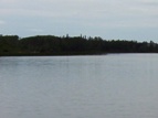
Eighty kilometres west of Geraldton is Beardmore, the “Gateway to Lake Nipigon.”

Welcome to Beardmore, Ontario

Not a pride parade float, it’s the welcome to Beardmore sign!

Beardmore started out as a flag station on the CNR before finding itself in the middle of the Lake Nipigon gold ‘rush’ in the 1930s.  The town faced ‘rapid expansion’ after gold was found on the Sturgeon River, as evidenced by the Timmins-style hotels that unfortunately no longer serve as watering holes for the community.

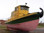
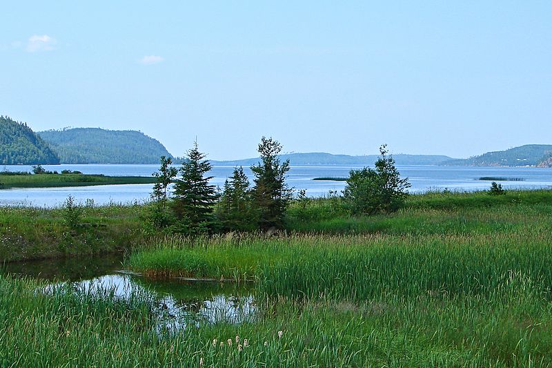
Today, it’s a town of about 200 people focusing on forestry and serving as a take-off point for camping and boating near Lake Nipigon.  So it’s pretty small, and pretty quiet.  But what Beardmore lacks in amenities it makes up in uniqueness. I liked Beardmore.

Beardmore church

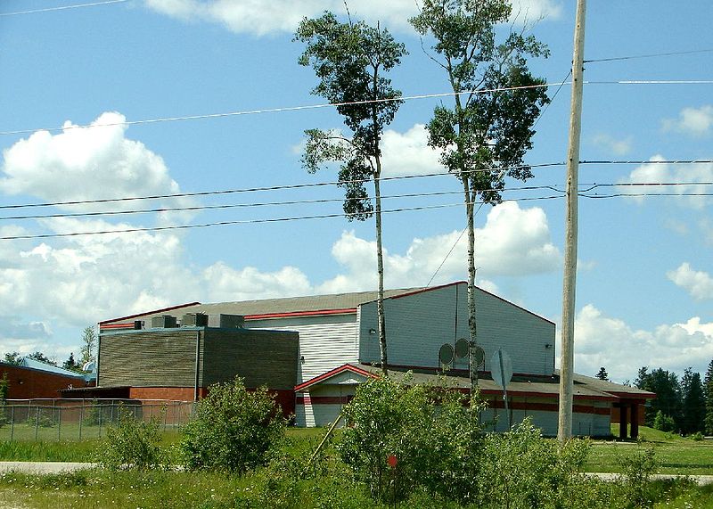
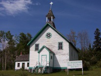
A church in Beardmore – completely unrelated to the text that appears above or below this photo

Beardmore is known for Vikings.

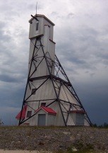
The Beardmore Relics, which were purported to be a cache of Viking artifacts, were found near the town in the early 1930s.

The relics – including an old sword, and axe, and a piece of a shield – were supposedly found while a prospector was panning for gold, and for a time were claimed as evidence that Vikings explored much further than Vinland, Markland, and Helluland while they were in North America, and that they explored parts of northern Ontario and maybe even Minnesota.

The Royal Ontario Museum purchased the relics and displayed them for about twenty years until they were forced to hold a public enquiry as to whether the relics were actually found in Beardmore, or imported by Scandinavian settlers desperate for a historic taste of home and passed off as a discovery in an elobarate hoax.

Beardmore, Ontario on Highway 11 Ontario highway11.ca

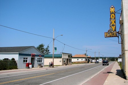
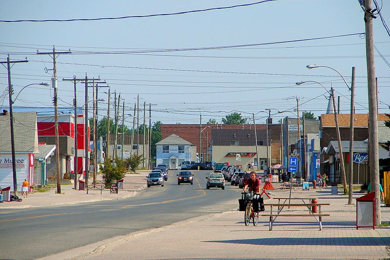
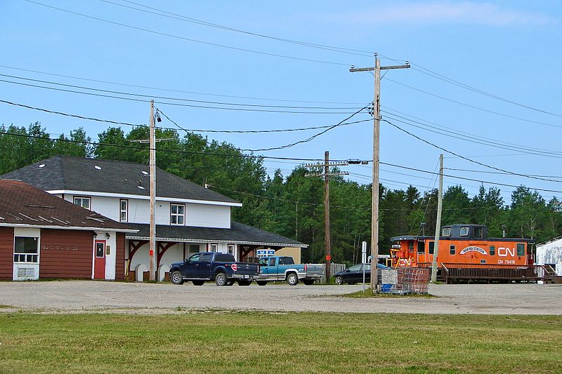
Highway 11 as it runs through Beardmore, Ontario.  Note the lounge-hotel at right, once a fixture of every town in northern Ontario.  (Photo: User P199 at Wiki Commons.)

In the “some big weird thing” sweepstakes Beardmore doesn’t disappoint.  Beardmore is also home to what it claims is the world’s largest snowman.  Does the title still count even though he’s not made of snow?  During the summer, the apparently nameless snowman sports sunglasses and fishing rod to signify that anything you can do, a snowman can do way cooler.

Beardmore, Highway 11's snowman capital, with the world's largest " snowman "

Neither rain, nor sleet, nor heat, nor hail will keep Beardmore’s snowman from standing watch over the community

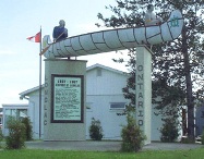
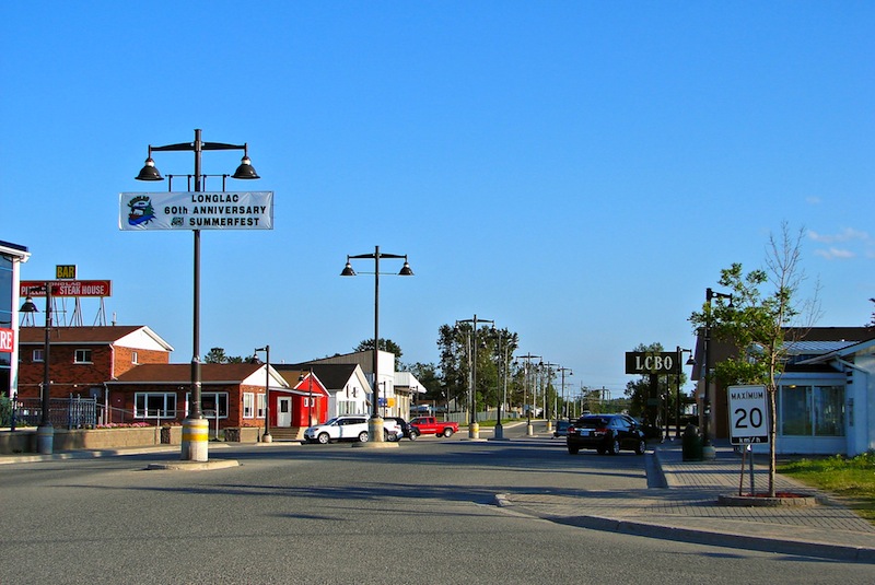
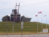
The town sign isn’t just a normal wooden sign.  They’ve spelled out Beardmore on railroad ties in rainbow-coloured letters that you can’t miss. The town also has these nice new ‘Welcome to Beardmore’ pennants hanging from the lampposts.

This is what I love about Highway 11 communities.  They have pride. They have spunk. They have a sense of community. And this sense of community means that they’re not afraid to try.

Sometimes when you’re from a larger place you forget that, no matter where you’re from or where you live, everyone has some sense of pride in their hometown.  Beardmore is a place that reminds you of this.

Beardmore, Ontario war memorial - Highway 11
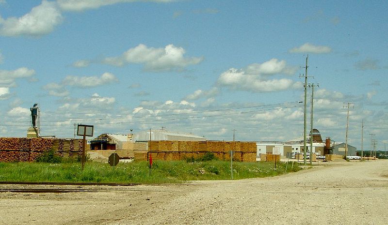
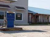
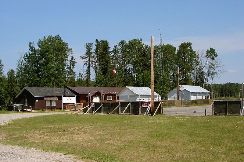
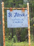
Today Beardmore is a forestry and outfitting town, with a baseball field, a church, some gas stations and about 40 or 50 houses.  There is a Legion in town too.  Beardmore is the only real stop between Geraldton and Lake Nipigon, a 170 kilometre journey.

Beardmore is also where renowned artist Norval Morrisseau first showed his work to a Toronto exhibitor.

Lake Nipigon

My map indicated that there were three communities on Highway 11 between Geraldton and Nipigon – Rocky Bay, Macdiarmid, and Orient Bay.  This may or may not be true.

Rocky Bay is home to the Rocky Bay First Nation.  It is actually off Highway 11 and I didn’t venture in as time and gas were becoming an issue.  (Note to readers, fill up in Beardmore.)

The only thing I saw named Macdiarmid was a dirt road.

I couldn’t find Orient Bay either, although truth be told I was getting weary of driving on this particular trip and didn’t really give it a good look.  It might be the name of a lodge or an outfitters station, but I didn’t see it.

Beautiful cliffs of Lake Nipigon

Beautiful cliffs of Lake Nipigon

But what is great about this part of Highway 11 is the drive itself.  The scenery is absolutely fantastic.  Stunning cliffs are the result of geological processes that have left the Pijitawabik Palisades as some of the most awe-inspiring views on Highway 11 .  The highway is bordered by countless lakes which are nestled between beautiful rocky outcroppings that jut from the landscape like bumps on a log.

Weird bumpy rock formations follow Highway 11 in the Lake Nipigon area

Weird bumpy rock formations follow Highway 11 in the Lake Nipigon area

This drive is sincerely one of northern Ontario’s most scenic drives.  So if you’re already out this way, don’t rush through – it is worth stopping and enjoying.

Lake Nipigon marshes off highway 11 ontario highway11.ca

Lake Nipigon Wetlands with cliffs in the background. I love Ontario. (Credit: User P199 at Wiki Commons.)

Lake Helen

A town of about 250 people, Lake Helen is home to the Red Rock First Nation, which hosts its annual traditional gathering from July 14 through to the 16th.
Lake Helen

Lake Helen has a nice beach and some beautiful views out onto the local lake, which is part of Lake Nipigon Provincial Park.

The town is also home to St. Sylvesters Roman Catholic Church.  Built in 1877, the Jesuit mission is clearly historic and is marked by an on-site plaque, and some traditional scared ground on the other side of Highway 11.