Kitigan

At first I thought that there wasn’t much in Kitigan other than a rail crossing and two houses, one of which is always for sale.

Since then I’ve been reliably informed that Kitigan is much more than that. I guess it’s always been out of my own haste that I missed it.

Not only does the town make up more than one or two houses, but at one time it was larger than Kapuskasing!

Kitigan was an active point for loading pulp wood. A resident informed me by email that the hamlet was originally named Poquetteville when it was founded as a railway whistlestop and section station. Today, 30 families make Kitigan their home. Located eight kilometres east of Kapuskasing, Kitigan is an Aboriginal word meaning garden or open fields.

Thanks to Dutch for the Kitigan info. If you have more, please email me. My address is info (at) highway11 (dot) ca

Kapuskasing

Kapuskaing, Cold Weather Test Centre, GM, Highway 11 Ontario

Nothing says “welcome, why don’t you stay a while?” like seeing the Cold Weather test centre from your car window

Which Highway 11 town has 9000 people, more than 50 shops and services and was the hometown of the director of movies like Terminator, Aliens, True Lies, Titanic and Avatar?

Yep, Kapuskasing is kindofabigdeal in Highway 11 terms.

Kap has some neat sites.  The old Ontario Northland train station has been recently fixed up and has a little area for art exhibitions from the area.  There’s an old locomotive adjacent to the station that houses train memorabilia and neat facts about the CNR’s history.

Highway 11 Ontario, Kapuskasing, bear

Kap’s entry into the “some big weird thing” – a bear

Originally named Macpherson, the ‘model town of the North’ was built around the pulp mill that originally supplied paper to the New York Times.  When they built the mill, they decided to build a company town, and since it was a company town they planned it as the ‘model town of the north’ complete with planned parks (quite nice), its own power supply (which used to serve the town and mill exclusively), and an English-style traffic circle, which residents and visitors alike find confusing to this day.

MOdel Town of the North, Kapuskasing's roundabout

You know roundabouts are confusing when they are a pain even in a town this small

With about 9000 people, Kapuskasing is the largest town on Highway 11 between Kirkland Lake and Thunder Bay.  It’s even has its own spot on the North American professional lumberjackery circuit.  Every July the Kapuskasing Lumberjack Festival is broadcast live on television across Canada, and maybe even into the States. (Heck, Canada doesn’t even have a soccer league, but it has a lumberjack circuit?  And is sustainable with stops in towns like Kap?  Who would have guessed it…)

POWs

Kapuskasing POW memorial, Highway 11I was surprised to find, by accident, two little memorials just west of Kap.  There’s one for Ukrainian-Canadian detainees tha

t were interred near Kap during the First World War (the photo of the guy with the hat.)  Further in off the highway there’s one for German/Austrian/Turkish Prisoners Of War (the photo with the little crosses) that died while being imprisoned.

I found out from some locals at the site that during the First World War Kap was the site of a POW camp.  It was decided that

Kapuskasing POW camp memorial, Highway 11 Ontario

Kapuskasing POW camp memorial

Kapuskasing was perfect because at the time the only way in and out of town, at that time, was by train.  In other words, everyone detained there was stuck – there was no way to escape and nowhere to go if you did.  They used their labour to clear land for Kapuskasing’s experimental farm, which is right beside the 24 graves of the POWs.

In addition, Paul emailed me to tell me about Kapuskasing’s former life as a station on the ONR rail line. Every time a train derailed, the local foreman of the track maintenance crew at Kapuskasing was required to file a report with the head office of ONR in Toronto. His reports were apparently quite lengthy and detailed. After receiving many of these “eloquent” and “descriptive” reports, about train derailments the foreman (named Flanigan) was advised by the head office people to write reports that weren’t so lengthy. So, after the next derailment, the following telegram was received in the head office, as follows:

Re: ONR train derailment at Kapuskasing:
”Off again – on again – gone again” (Signed) FLANIGAN.

Farm near Kapuskasing. Highway 11

Still farm country this far north

Kapuskasing Today

Like all the francophone towns (it’s about 30/70 anglo/franco) of the north, Kapuskasing is really quite nice.  Although a James Bay tourism brochure bogusly claims that Kap is a town of “street dances” (who wrote that thing?), there is a fair amount to do for a city of its size.

Kapuskasing train station

Kap’s train station is pretty magnifique, with a museum and gallery

There is a farmer’s market in the summer.  If you can make it past the downtown traffic circle in the direction of your desire, you’ll find a really nice lakefront park and some good walking paths.

Kap has a bunch of services that are too long to go into detail here.  What’s important is that there is a Tim Horton’s.  There’s a McDonald’s too.  There are some honest-to-goodness northern Ontario Chinese food restaurants.  There is a Walmart but no Giant Tiger.  Apparently Kapuskasing also has the most productive Casey’s restaurant in all of Ontario.  Take that, Front and University (the downtown Toronto location.)

Pub Max, right on Highway 11, also has good food, especially the chicken salad sandwich.  There are two touristy stores on Highway 11 in Kap, namely Marbleworks and the Moonbeam Country Store.

Agrium Mine, Kapuskasing

Aerial view of a mine, near Kapuskasing

Harty / Val Rita

Harty, Ontario, Highway 11Harty and Val Rita are two more clean, quaint, and cute francophone hamlets in the heart of French-speaking Highway 11.  There’s not a tonne of stuff in Harty – St. Stanislas Church (founded in 1932), maybe 30 houses, and a playground.

Harty’s town sign is nifty as you can see it from both directions on Highway 11 – there are letters on both sides of the pillars. The photo does not do this justice as it is hard to see the town letters carved into the concrete.

Val Rita, Ontario, Highway 11

Bienvenue a Val Rita (Both photos c/o user P199 at Wiki Commons.)

As for Val Rita, well it’s a bit larger but unless you want to eat, get gas, wash your car, or go to church…yep those are your options.

Val Rita chip stand, Highway 11, Ontario

I shoulda made a website on HIghway 11 chip-stands…

In terms of food, there’s a small Foodmart, as well as the Val Rita Chip Stand.  The 24-hour The Auberge Inn (Auberge means ‘inn’ in French, no? So effectively the place is named The Inn Inn? That’s almost like “The La Trattoria” from the movie Mickey Blue Eyes) offers rooms, breakfast, and gas.  There’s also a car wash and a caisse.

Help me add more to this page, send an email to info (at) highway11 (dot) ca, or post below.

Churhc, Val Rita Ontario, Highway 11

Val Rita’s church

Opasatika

Opasatika is a former mill town with about 300 residents set on the Opasatika River.

Opasatika, Ontario, Highway 11 fish

This is actually pretty cool in person. Well done, Opaz.

Opaz (as it is commonly called along northern Highway 11) used to have its own mill (and supposedly, from what I was told, its own dance club), but changes to the forestry industry in northern Ontario have meant that a lot of the smaller mills are being closed.  This means that communities like Opasatika, Smooth Rock, and Longlac are losing their mills, and fighting for their lives in the process. I was told that it used to be that there was a little mill in each little town from Hearst through to Smooth Rock.

Of course, Opasatika has its “some weird big thing” as you enter the town.  There’s a random fish statue . There’s also a mini logging boat sitting in the field.  Normally there are plaques for these kinds of things but not here – I guess everyone around here is just in-the-know. A resident emailed me to tell me that the fish was supposed to have a commemorative plaque, and be the start of a historical site. However, progress was delayed when the town mill was closed – and subsequently, all civic efforts have gone into finding a solution for the mill. That’s understandable, and unfortunate.

Lumber boat, Opasatika, Ontario Highway 11

Take note Longlac – it is obvious what this boat’s purpose is

Opasatika (pronounced locally as Opa-set-ticka) also has a nice little waterfront park with a boat launch to the river, and two marshes – du Village and des Lambert.  Sixty kilometres south of Opasatika you can find Christopher Waterfall which leads into Rufus Lake.

Opasatika River launch, Highway 11

NO SWIMMING. Okay Opaz, you made it clear.

As for businesses, Magazin Martel is a depanneur with a little LCBO outlet.  Mandy’s Beanerie serves coffee and meals as well.  There might be more for food and services, but I’m not sure. I haven’t been back in a while.

There used to be a mushroom farm in Opasatika.  I’m not sure if it is still running. I don’t know if it gives tours, but you could enquire – I’ve always found visiting any kind of factory/workplace type thing to actually pretty interesting. The farmhouse you see on the right is actually in Val Rita, and has some personal significance to its owner, a testament to the agriculture that used to occur in this area.Lonely farm, Opasatika, Highway 11On a personal note, Opasatika is the first place where my car was chased by a dog on the journey.  Imagine, if you live on Highway 11 and you have a dog that chases cars or trucks?  Boy are you in trouble…

Thanks to Anick for help with Opaz.

Reesor

Reesor is the site of one of northern Ontario’s many former agricultural colonies – in this case, one founded by Mennonites.

Thomas Reesor, an Old Order Mennonite Minister from Markham, Ontario who was employed by the railway, helped settle a number of Russian Memnonite refugees in Northern Ontario. In July 1924, many families decided to travel north and establish a settlement in northern Ontario on land offered by the Canadian Government. The group, accompanied by Thomas Reesor, made the train journey north to their new settlement in the wilderness west of Kapuskasing. The settlement was officially named “Reesor” in recognition of Thomas Reesor, it’s benefactor and founder.
The Reesor United Mennonite congregation began services about 1926, and formally organized in May 1927. Jacob H. Janzen is considered the founding leader of the group.

The settlement was situated along the Trans-Canada highway west of Cochrane, Ontario. It was organized in a traditional Russian Mennonite manne. The settlement initially prospered, reaching a membership of 75 in 1932, but declined rapidly during the Depression. The congregation dissolved on January 5, 1948.

In 2007, the hardships faced by the colonists at Reesor were made into a play, named Reesor, that featured at Fringe Festivals across Canada.

Reesor Siding

Reesor Siding, three kilometres west of Reesor proper, is the site of one of Canada’s bloodiest labour conflicts and the inspiration behind a really good Stompin’ Tom song.

On Highway 11 there is a memorial to the Reesor Siding Strike of 1963, a defining moment in Canadian labour history whose division still exists to this day.

From what I’ve read and been told, it all began when a local lumber union walked off the job.  They were supplying wood to the pulp mill in Kapuskasing.

Some local farmers decided to break picket lines and supply the Kapuskasing mill with wood.  This angered the local union.

This led to a stalemate where the union sabotaged the farmers’ efforts to supply wood, and the farmers refused to support the strike.  When some union members went to disrupt a secret midnight shipment of wood, an altercation broke out.  Three strikers were shot, 11 others were wounded. In the end, something like 20 individual farmers were charged with murder for the one resulting death, which was a record as the largest murder trial in Canada. More than 150 strikers were arrested for rioting, and were held for two weeks at the correctional centre at Monteith.


Reesor Siding monument, Highway 11

Monument commemorating the strikers killed at Reesor Siding

The memorial on Highway 11 was erected by the local union, to the dismay of some locals.  The Reesor incident remained a sore point for some time.  Supposedly, the first time Stompin’ Tom sang his song “The Reesor Crossing Tragedy” at a concert in Kapuskasing, he was run out of town…

Reesor Siding, at its height, had about 100 residents, after a number of Mennonite and fraco-Ontarian families took homesteads after the ONR railway moved in in 1915. A store was opened in 1924, and a sawmill, Mennonite church, cemetery, and tennis court. A school came in 1927. However, with the hardships of the Depression, families generally left the area, and farming families struggled.

By the time the Reesor Siding incident happened, only a few farm families were left in the area.

“Just a little bit west of Kapuskasing,
Reesor Crossing, that’s the name.
Farmers hauled, from out of the bushland,
pulpwood for the mill-bound train.
Twenty farmers met that night,
to guard their pulp from a union strike,
unaware this night would see a tragedy,
the Reesor Crossing Tragedy.
“You’ll never load that pile of lumber”,
said the Union men, when they came.
Though they numbered about 500,
the twenty farmers took rifle aim.

“We’ve got to get our pulpwood out,
before the muskeg frost comes out”.
“And may God help us all to see,
no Reesor Crossing Tragedy”.

“You’ll never touch this pile of lumber”,
but they came, and tragically,
three men died, that february,
in the year of ’63.
Eight more wounded, some beat up
tires slashed on the lumber trucks.
A night of death, and destiny -
the Reesor Crossing Tragedy.
“You’ll never touch this pile of lumber”,
seven words that spelled out pain.
For the widows and their children,
and their men who died in vain.
How can anyone forget,
the bloodiest labour battle yet,
in all Canadian history?
The Reesor Crossing tragedy.

Just a little bit west of Kapuskasing,
they erected a sculpture beside the tracks.
Of the bushman and his family,
who live their lives behind the axe.

It reminds us in the North,
not to bring out tempers forth
That there may never elsewhere be
 no Reesor Crossing Tragedy.”

Lyrics from “The Reesor Crossing Tragedy” by Stompin’ Tom Connors (1968).

Lowther

Lowther is dead.  Long live Lowther.

I’ve been told by a Mattice resident that Lowther is on the map since it used to be the home of a NORAD base until the mid-1980s. Dwight confirmed this.
Much like the radar base around Ramore, the Lowther baseclosed in 1987. However, unlike Ramore, when they closed the place absolutely everything was removed within a couple years. The first photo below shows the Lowther base from Highway 11, in 1984. The second is an aerial shot of the base, with Highway 11 running diagonally in the background.

Today, Lowther is just an empty area where the radar base and all buildings existed. While Lowther is on the map, it no longer exists.

Thanks to Dwight for the info, and for pointing me to the photos linked below, care of Marg and Ren l’Ecuyer’s Pinetree Line website (www.pinetreeline.org)
Photo Links: Pinetree Line – View of Lowther Base from Highway 11, 1984, Pinetree Line – Aerial View of Lowther Base from Highway 11, Pinetree Line – Dismantling of Lowther Base, 1989, Pinetree Line – View of Lowther Base from Highway 11, 1998

Mattice

When you enter Mattice from the east, you’ll be greeted by a dinosaur.

T-Rex has no cultural significance to the town.  There isn’t a museum around.  He’s not the town mascot. To my knowledge no dinosaur bones have been found in the area. It’s just decoration on someone’s front lawn.  Think of it as an especially eccentric garden gnome.

T-Rex in Mattice, Northern Ontario, Highway 11

Mattice does its bit to continue Highway 11’s many “WTF? moments.

I’ve been told by a Mattice resident that the T-Rex was built by the owner of the Mattice Motel to attract tourists.  There used to be a stegosaurus in town, as well.  It turns out that the stegosaurus was destroyed by a new owner when the previous owner left to pursue his dinosaur dreams elsewhere.  Seriously.  It turns out he left to build a concrete Jurassic park in the Ottawa region.

A francophone town in the heart of French-speaking Ontario, Mattice (rhymes with ice) is one of these small northern towns (population approximately 500) on Highway 11 that has a little bar, an a full-blown LCBO, and a skidoo repair shop … but only the tiniest of grocery stores that would barely qualify as a fruit stand in more urban areas in southern Ontario.

Fur trading monument, Mattice, Highway 11 Ontario

Mattice used to be the launchpad for old fur trading expeditions

Set on the Missinaibi River, Mattice used to be a starting point for Voyageurs heading downstream for the fur trade.  There’s a historical plaque and one of Highway 11’s classier statues to commemorate its history.  About two kilometres upstream, there’s a traditional Aboriginal burial ground.

Mattice emergency service skidoo, Highway 11

Ambulance northern Ontario style

If you go north on one of Mattice’s side street you’ll find the nice riverfront park.  It’s actually quite a nice park, with a boat launch, a picnic area, and an inexplicable pile of rocks (that, it turns out, were used in the refurbishment of the Missinaibi Bridge.  And then left there for posterity’s sake.)

Rock pile, Mattice, Highway 11

Lacking a woodpile, this pile of rocks will have to do

Hallébourg / Val Coté

Hallébourg – a cluster of approximately 20 homes east of Hearst on Highway 11 – is one of the smallest of the francophone hamlets on Highway 11.  I think only Strickland or Harty are smaller.

Hallebourg, Ontario, highway11.ca on Highway 11

(This and the next photo both c/o user P199 at Wiki Commons)

Just east of Hallébourg, Val Coté used to be a tiny farming hamlet, but as farming became less profitable in agriculturally minor areas of Ontario like up here, it soon lost its economic raison d’etre.Val-Cote, Ontario Highway 11, highway11.ca

There are about 15 houses in Val Coté along with an old barn or two, a church, and a tiny caisse.  In the church parking lot there’s a sign advertising the Val Cote Musée Des Pierres, a rock museum.

Church in Val Coté, Ontario, Highway 11

Val Coté’s church

Val Coté, Ontario's Rock Museum, Highway 11

Sadly not open at 8.45 AM on a long-weekend Friday.


Hearst

There’s something really interesting about Hearst.

Hearst is the frontier of northern Ontario – you either live in Hearst, east of Hearst, or you live waaaaaaaaaaaaaay west of it.  It even has a Northern Store (how’s that for remote.)
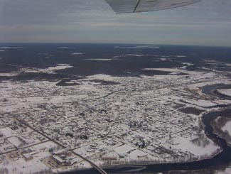
Hearst, Ontario on Highway 11

Hearst from the air

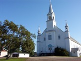
Where else would a town of 6000 have so many bars, the “northern ballet”, and yet still have four or five churches?

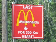
What other place keeps you in their town by telling you just how far away everywhere else is?  I mean, Longlac is 210 kilometres west, with nothing in between.  Hearst has the last McDonald’s for 500 kilometres – I know it because I checked, in person. There isn’t another McD’s until Thunder Bay

The tourist office in Hearst. Highway 11

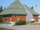
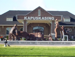
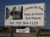
The tourist office in Hearst. So awesome.

I once applied for a government job in Hearst, but never got an interview.  To be fair, I realize now that I was woefully underqualified.  I swear that the ad had listed French as “an asset”.  Well, no French isn’t an asset – in Hearst, it’s a requirement.

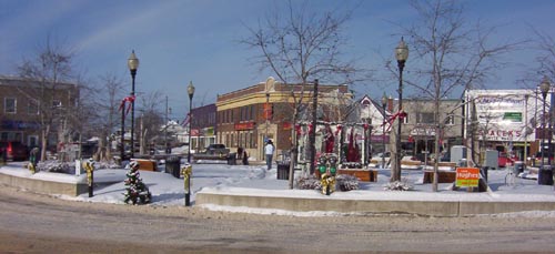
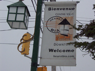
One of the most interesting things about Hearst, however, is that it is the most francophone community in Ontario – something like 85-90 percent.  Hearst even has residents that only speak French, and no English.  Rue George is the downtown drag and it’s really cute, with small shops, a library, a diner, and a movie theatre showing French-language movies.  It’s reminds me of Penetanguishene, but more with more French.

Hearst, OntarioI (h)EART (h)EARST

Erst (as it is pronounced locally) is a pretty special town.  It has:

•    The motto: “The Moose capital of Canada” (or so they boast)
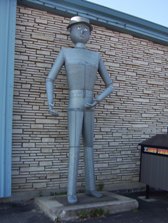
•    The only tin man on Highway 11 (he keeps watch over an appliance store)
•    The most millionaires per capita (or so someone emailed, apparently it’s due to the local forestry?)
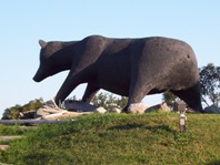
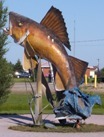
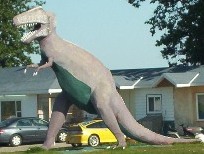
•    The largest moose sculpture on Highway 11 (Believe me, I’ve seen them all)
•    The most suburbs (two) of any small town Highway 11 town (take that, King Kirkland or Geraldton East)
•    The most truckstops per capita (or so I’ve calculated, roughly)
•    The biggest woodpile on Highway 11 (I’ve seen them all too)

Trust me.  When it's not getting snowbombed, Hearst's downtown is super cute

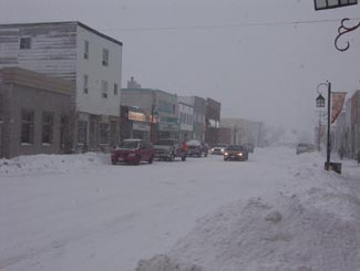
Trust me. When it’s not getting snowbombed, Hearst’s downtown is super cute.  The problem is that it gets hammered all the time.

Heck, I’ve been to Hearst three times.  Most of the photos here are from the first time that I hadn’t been snowed in (because it was August.)  Both other times, I was stuck for three days in storms even that locals found nasty.

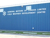
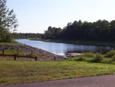
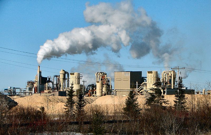
Set on the Mattawishkwia River, Hearst is a forestry town (hence the massive woodpile.)  It also has a tourism industry set around hunting, outfitters, and its proximity to three Provincial Parks:  Fushimi Lake, Missinaibi and Nagagamisis.  It is also the end of the Algoma Line, which runs fall colours rail tours from Sault Ste. Marie to Hearst.

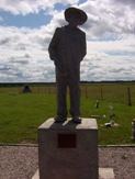
Despite its francophone heritage, Hearst was once the site of a Slovak settlement.  Bradlo, nestled 11 kilometres south of Hearst, the community persisted until the 1950s when the residents realized that the land was agriculturally marginal, and wouldn’t support farming in a modern economy.

Sculpture jsut outside of Hearst

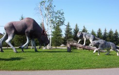
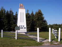
Hearst is so cool, this wolf vs. moose sculpture doesn’t even count as their “some big weird thing”…

Hearst tin man, Highway 11

…instead, this does!

Food and Fun in a Frontier Town

Hearst is a center for most of the little communities west of Kapsukasing, and is the largest town between Thunder Bay and Kapsukasing on Highway 11.  And probably for Hornepayne on Highway 631, about an hour and a half south.  (Head off-route and take a trip along 631 here.)

No McDonald's for 500 km in Hearst, Highway 11

I’ve used this photo about a twenty-two times on this website and it never gets old

Therefore, Hearst has an abundance of services.  It has the only McDonald’s and Tim Horton’s that you’ll see until Thunder Bay.  In addition to the 24-hour garage and towing company that is advertised throughout northern Ontario, there are shops downtown and food everywhere.  Hearst also has an overabundance of places that serve Northern Ontario Chinese Food.

Hearst has something for everyone – the northern ‘hotel’ scene (the Waverly or the Windsor), cafés (although Café Duo doesn’t serve coffee, go figure), fast food (McDonald’s, KFC, Subway, and the only Pizza Pizza west of Timmins), authentic chip stands (Micko’s is great), sit down restaurants (Mom’s, John’s, Pizza Place has ok pasta), fine dining (you can find filet mignon, steak, and Cuban cigars at Ailleurs), and even a little night club (OK, fine, it’s the bar at the Companion.)

Snowstorm, Hearst, Highway 11

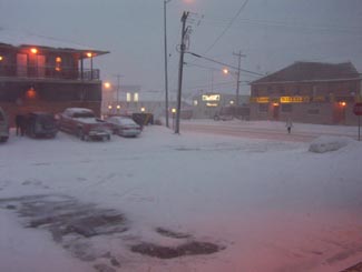
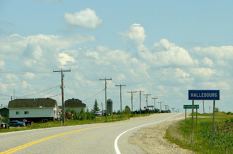
Highway 11 in Hearst, getting walloped, again

There are motels aplenty in Hearst so you should have no trouble finding a place to stay.  (A note to those staying at the Queens Motel, keep your kids away from the funny channels at the end of the TV dial there!)  There is also hockey in the winter – in fact, Hearst is the hometown of Claude Giroux, Philadelphia Flyers superstar, as well as Pierre LeBrun, a hockey commentator who has appearanced on TSN, ESPN, and Hockey Night in Canada. Hearst is home to the local team les Elans de Hearst. And, there is bowling.

Come on, it’s northern Ontario. Of course there is bowling!

Super awesome Hearst woodpile, Highway 11

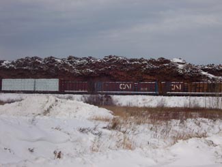
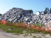
Hearst – simply the best woodpile of any Highway 11 community

Hearst, Ontario highway11.ca

And this is what happens to a woodpile on Highway 11, in Hearst (Credit: Wiki Commons contributor P199)


Hearst, Ontario airport

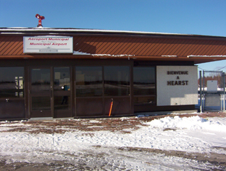
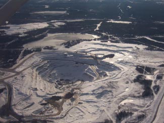
Not sure why I took a photo of Hearst’s airport