Marten River

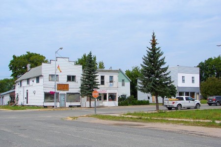
Marten River is a hamlet of about 100 people 45 kilometres south of Temagami.  On the south end of Lake Temagami, the town is largely dependent on forestry and tourism, and is home to a number of lodges and outfitters.

Marten Falls, big fish, Highway 11 Ontario

Highway 11’s largest fish? That’s what Marten Falls claims

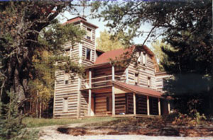
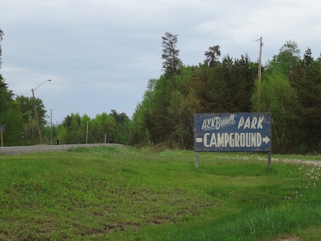
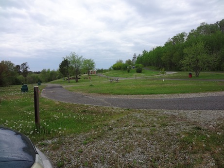
Marten River Provincial Park has camping, hiking, and a replica 19th century logging camp.  Every July there is the annual Logging Days Festival.  It is also home to the obligatory “some big weird thing” that each town in northern Ontario seems to have – in this case, it is what they claim is Highway 11’s biggest fish, though Nipigon might have something to say about that.  (Sorry, Larder Lake, you’re disqualified.  You’re not on Highway 11 at all.)

There is a gas station in town, Marten River Outfitters, and a few little places to eat, including the Rock Pine Motel and Restaurant.

There are three lakes near Marten River – Marten Lake, Ingall Lake, and Jumping Caribou Lake.  The lake is stocked with fish and there is also hiking at the local crown game preserve.

Temagami

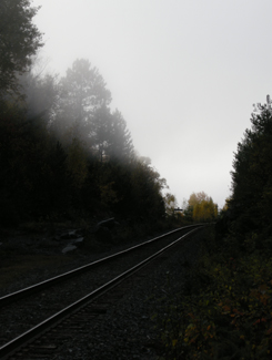
ONTC line near Temagami, Highway 11 Ontario

Nothing captures the loneliness of northern Ontario than the railway heading off into nowhere

Sure, after Huntsville the towns become sporadic, a bit less refined, and really small – but those areas are still within relatively short driving distance to either Barrie and/or North Bay.

But it is after North Bay where Ontario changes.

Towns of 10 000 become cities.

Villages of 2000 become towns.

Hamlets that wouldn’t warrant a sign in southern Ontario make it into maps, travel guides and guidebooks about the north.

Temagami is the perfect example.  Not only do you not realize just how far away it is from North Bay (more than an hour), but it’s also really small.  The dots-on-the-map before Temagami aren’t really true towns at all, they’re much closer to being dots-on-the-map. And when you get into Latchford, you realize that it is much the same as Temagami.

If you don’t have some decent cassettes for the car by now, you’re in trouble from here on in.  You’ll start seeing more transport trucks than cars. Of the few cars on the road, they’ll practically all be domestic, and will likely have an ATV in tow. The distances are only going to get larger and the roads will only get lonelier.

Temagami from Highway 11

Temagami from Highway 11

OK, so a bit about Temagami

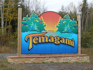
Temagami is a town of about 1000 an hour-plus from North Bay.  The town was first settled in 1850 when the Hudson Bay Company set up a trading post on Lake Temagami.  The ONTC railways came through in 1904 as silver was found in Cobalt to the north, and Temagami became a town of trappers, traders, and prospectors.
Temagami, Ontario Highway 11From Highway 11, Temagami is a land of contrasts.  Some spots can be boring as heck.  Rocks and trees, rocks and trees.  Others, however, can be surprisingly beautiful. On a recent trip to the area we didn’t take many photos of Temagami, mainly because the scenery was so majestic, it was nearly impossible to discern what was photo-worthy and what wasn’t, without taking photos practically every ten minutes. We actually experienced scenic fatigue, and by the end of our trip we were turning our noses up at lakes, forest scenes, and vistas we would have stopped for has we been in southern Ontario. And we didn’t even go into the interior, or explore Lake Temagami, which is reportedly more scenic than the area directly off Highway 11.Lake near Temagami, OntarioOne of the many reasons for Temagami’s beauty is that it is one of the last parts of accessible Ontario with old growth forest, and was the subject of intense protests against logging in the 1980s.  Temagami is Ojibway for ‘deep water by the shore.’  It is also where Englishman Archie Belaney found fame as Grey Owl, an Aboriginal devoted to environmentalism.
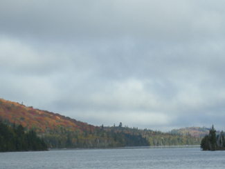
Today Temagami is largely dependent on forestry and tourism. There are two provincial parks nearby, Finlayson and Lady Evelyn-Smoothwater.  Temagami is a starting point for a number of all season activities, including boating, dogsledding, canoeing, cross country skiing, swimming, fishing, camping, houseboating, hunting, and guided tours.  There are also a nature interpretive centre, some craft shops, and an art gallery.
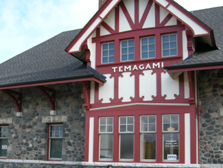
Temagami Train Station, Highway 11

Train station in Temagami

Temagami has a few tourist amenities.  There’s a gas station, the aformentioned grocery store, two outfitters (one of which was closed and for sale during our trip), two outdoors stores, two restaurants (one Chinese, and the Busy Bee) and a couple of shops.  There are numerous camps, lodges, and other places to stay, including Inn The Woods Motel and Bed and Breakfast, Leisure Island Houseboats, Linda’s Wigwams, Smoothwater Resort, and Temagami On-Ice Bungalows. There is a bit of a residential area on either side of Highway 11, and another a bit further north in what is called “Temagami North.”

Being on “Temagami Time”

You hear a lot about Temagami in the news and from friends who have cottages and cabins.  Yet I was surprised just how tiny the town is considering the tourism business up here.  There is a lot to do in Temagami if you like the outdoors.  But if you like the indoors, or just aren’t that woodsy, well, don’t expect much of a town or any indoor or evening attractions, because the town itself is miniscule, and what is available keeps weird hours – what I call “Temagami Time.”Panorama from hiking trails of HIghway 11, Temagami, Ontario

The Co-op grocery store isn’t open on Wednesdays. Many offices or stores are only open half-days. The scenic rail route from North Bay, called the Dream Catcher Express, runs a meagre six days a year. One of the town’s two restaurants closes at 6 PM on some days. The Temagami tourism welcome centre, the Caribou Mountain fire tower info centre and shop, and the train station interpretive centre and gift-shop all close after the first weekend in October.

Most surprisingly for Northern Ontario, the LCBO closes at 5 PM (go to Latchford for an agency store that stays open ’til 8 or 9.) If you’re visiting Temagami after September, you better have electricity in your cabin or be prepared to go to sleep early, because nothing will be open and it’ll be dark – during our recent trip we experienced pitch black night during the second week of October at the late hour of 7.25 PM. So if you’re heading to Temagami, especially in the fall, be prepared to live according to Temagami Time. While I’m half joking, this is actually something to think about – I only became acclimatized to being on a late fall ‘vacation’ in Temagami – going to bed early, timing trips to stores and eating supper early – by the time my mini vacation was over!

Temagami, Ontario, Highway 11

Nestled in the woods like a fairy tale is Temagami’s town site

Hiking

Temagai beavers ruin boardwalk, Highway 11

Sabotage! Wilderness 1 Hikers 0

The area used to be littered with forest fire towers that were up to 1000 metres high – one of which has been maintained as an attraction that you can climb.  My partner and I attempted a climb on a windy, wet day in October. We’re not embarassed to admit we didn’t make it all the way up. She was a bit iffy to begin with, but considering we were the only ones there, the cold, biting winds, some slippery stairs, and the requisite creaking of the structure with each gust, we abandoned our climb 3/4 of the way through. It didn’t help that it was cloudy and that the lookouts built around the tower gave us the nice views we wanted without needing to climb. (No shame in excuses for me!)  I don’t think the tower is as tall as it seems, but considering it’s on the highest point in the area, it seemed very, very tall. The tower is one kilometre from Highway 11, east on O’Connor Drive up Caribou Mountain, but isn’t really visible from the highway, unless you’re looking for it.
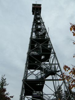
Climb Temagami's restored fire tower, Highway 11

I’ll admit it. I bailed when the tower sighed under my weight and shifted with the wind

I enjoy hiking and Temagami has a lot of opportunities to get into the forest. The one problem is that many of the hiking trails are accessible only by boat. For example, there is a renowned stand of old growth pine on Bear Island, but that’s only accessible by an hour’s canoe, or by water taxi from the marina at the end of the Lake Temagami Access Road, 25 kilometres drive south and west of the town. Others are further in the bush, such as Lady Evelyn Smoothwater Provincial Park, which are accessible only if you’re willing to paddle and portage, or willing to pay for a float plane flight. Even the White Bear Trails that are right in town require a canoe trip (or a significant hike of three hours) to reach the best old growth forests.
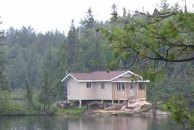
Temagami cottage, Highway 11

Raised cottage in the bush

The trails that you can reach by car tend to be at the end of long, winding, unpaved logging roads that are no longer maintained, such as those at Grand Campment Bay, 40 kilometres east of town, anything off of the two Roosevelt Roads, or at Lake Anima Nipissing, just south-west of Latchford. Many are poorly marked, and do not directly indicate their skill level. We hiked one trail that turned out to not be the paths were throught we were on, another we considered following turned out to be an ATV route, and a third we never found at all despite following directions to a T. A fourth was a great hike, but was a bit beyond our capability. (Well, maybe not beyond our actual capability, but beyond our willingness.)

Anyway, I just want to say that hiking in Temagami isn’t as easy as driving up and looking for a trail sign. It’s not onerous, but it takes some planning – you have to do a bit of homework.
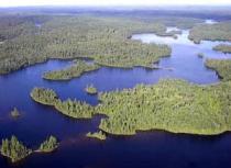
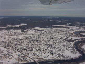
Temagai, aerial view, Highway 11

Obviously not my photo

Temagami, Ontario, Highway 11

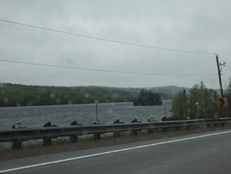
October storm whips the waters near Temagami
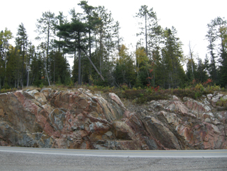
Temagami Highway 11

Rocks and trees, rocks and trees

Temagami, Highway 11

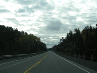
The limitless possibilities of the open road beckon in “real” northern Ontario

Larder Lake

Unlike Kirkland Lake, there is actually a Larder Lake in Larder Lake. Larder Lake is a former mining town about 10 kilometres west of Virginiatown on Highway 66 (not Highway 11 – detour still in effect), and 20 kilometres from the Québec border.

Larder Lake was first settled in 1906 after the silver boom in Cobalt pushed people further north in search of more mineral deposits. Gold was found in the Larder Lake area, creating a boomtown in the bush.

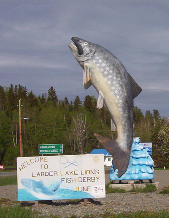
Larder Lake Ontario fish

Larder Lake’s entry in the “some big weird thing” contest: a big fish

I’ve been to Larder twice but never really gathered much intel. There are some camping and picnic areas, a beach, and a 30 slip marina. Larder Lake also has an LCBO, a service station, a public library, a post office, a motel, and a restaurant.  Unlike its largely anglophone neighbour Kirkland Lake, approximately 40 percent of Larder Lake residents are francophone.

Ashley emailed to let me know that there is the Raven Beach Campground run by the town, and the most northerly skill hill in Ontario (along with Timmins‘ Kamiskotia.) He also advised that, on the way to Larder Lake from Kirkland lake there is Fork Lake Resort, that has a campground, cabins and a beach strop. But here’s the most important part: apparently, there is a really good restaurant where they serve the most excellent pie in the area – just make sure to call ahead to make sure they’re open

Help add to this page – email at info (at) highway11 (dot) ca, or post your thoughts below.

Hearst

There’s something really interesting about Hearst.

Hearst is the frontier of northern Ontario – you either live in Hearst, east of Hearst, or you live waaaaaaaaaaaaaay west of it.  It even has a Northern Store (how’s that for remote.)
Hearst, Ontario on Highway 11

Hearst from the air

Where else would a town of 6000 have so many bars, the “northern ballet”, and yet still have four or five churches?

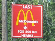
What other place keeps you in their town by telling you just how far away everywhere else is?  I mean, Longlac is 210 kilometres west, with nothing in between.  Hearst has the last McDonald’s for 500 kilometres – I know it because I checked, in person. There isn’t another McD’s until Thunder Bay

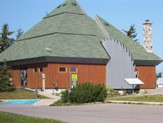
The tourist office in Hearst. Highway 11

The tourist office in Hearst. So awesome.

I once applied for a government job in Hearst, but never got an interview.  To be fair, I realize now that I was woefully underqualified.  I swear that the ad had listed French as “an asset”.  Well, no French isn’t an asset – in Hearst, it’s a requirement.

One of the most interesting things about Hearst, however, is that it is the most francophone community in Ontario – something like 85-90 percent.  Hearst even has residents that only speak French, and no English.  Rue George is the downtown drag and it’s really cute, with small shops, a library, a diner, and a movie theatre showing French-language movies.  It’s reminds me of Penetanguishene, but more with more French.

Hearst, OntarioI (h)EART (h)EARST

Erst (as it is pronounced locally) is a pretty special town.  It has:

•    The motto: “The Moose capital of Canada” (or so they boast)
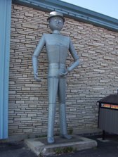
•    The only tin man on Highway 11 (he keeps watch over an appliance store)
•    The most millionaires per capita (or so someone emailed, apparently it’s due to the local forestry?)
•    The largest moose sculpture on Highway 11 (Believe me, I’ve seen them all)
•    The most suburbs (two) of any small town Highway 11 town (take that, King Kirkland or Geraldton East)
•    The most truckstops per capita (or so I’ve calculated, roughly)
•    The biggest woodpile on Highway 11 (I’ve seen them all too)

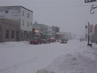
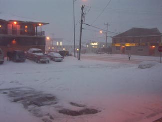
Trust me.  When it's not getting snowbombed, Hearst's downtown is super cute

Trust me. When it’s not getting snowbombed, Hearst’s downtown is super cute.  The problem is that it gets hammered all the time.

Heck, I’ve been to Hearst three times.  Most of the photos here are from the first time that I hadn’t been snowed in (because it was August.)  Both other times, I was stuck for three days in storms even that locals found nasty.

Set on the Mattawishkwia River, Hearst is a forestry town (hence the massive woodpile.)  It also has a tourism industry set around hunting, outfitters, and its proximity to three Provincial Parks:  Fushimi Lake, Missinaibi and Nagagamisis.  It is also the end of the Algoma Line, which runs fall colours rail tours from Sault Ste. Marie to Hearst.

Despite its francophone heritage, Hearst was once the site of a Slovak settlement.  Bradlo, nestled 11 kilometres south of Hearst, the community persisted until the 1950s when the residents realized that the land was agriculturally marginal, and wouldn’t support farming in a modern economy.

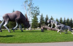
Sculpture jsut outside of Hearst

Hearst is so cool, this wolf vs. moose sculpture doesn’t even count as their “some big weird thing”…

Hearst tin man, Highway 11

…instead, this does!

Food and Fun in a Frontier Town

Hearst is a center for most of the little communities west of Kapsukasing, and is the largest town between Thunder Bay and Kapsukasing on Highway 11.  And probably for Hornepayne on Highway 631, about an hour and a half south.  (Head off-route and take a trip along 631 here.)

No McDonald's for 500 km in Hearst, Highway 11

I’ve used this photo about a twenty-two times on this website and it never gets old

Therefore, Hearst has an abundance of services.  It has the only McDonald’s and Tim Horton’s that you’ll see until Thunder Bay.  In addition to the 24-hour garage and towing company that is advertised throughout northern Ontario, there are shops downtown and food everywhere.  Hearst also has an overabundance of places that serve Northern Ontario Chinese Food.

Hearst has something for everyone – the northern ‘hotel’ scene (the Waverly or the Windsor), cafés (although Café Duo doesn’t serve coffee, go figure), fast food (McDonald’s, KFC, Subway, and the only Pizza Pizza west of Timmins), authentic chip stands (Micko’s is great), sit down restaurants (Mom’s, John’s, Pizza Place has ok pasta), fine dining (you can find filet mignon, steak, and Cuban cigars at Ailleurs), and even a little night club (OK, fine, it’s the bar at the Companion.)

Snowstorm, Hearst, Highway 11

Highway 11 in Hearst, getting walloped, again

There are motels aplenty in Hearst so you should have no trouble finding a place to stay.  (A note to those staying at the Queens Motel, keep your kids away from the funny channels at the end of the TV dial there!)  There is also hockey in the winter – in fact, Hearst is the hometown of Claude Giroux, Philadelphia Flyers superstar, as well as Pierre LeBrun, a hockey commentator who has appearanced on TSN, ESPN, and Hockey Night in Canada. Hearst is home to the local team les Elans de Hearst. And, there is bowling.

Come on, it’s northern Ontario. Of course there is bowling!

Super awesome Hearst woodpile, Highway 11

Hearst – simply the best woodpile of any Highway 11 community

Hearst, Ontario highway11.ca

And this is what happens to a woodpile on Highway 11, in Hearst (Credit: Wiki Commons contributor P199)


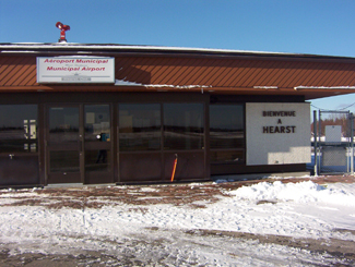
Hearst, Ontario airport

Not sure why I took a photo of Hearst’s airport

Beardmore

Eighty kilometres west of Geraldton is Beardmore, the “Gateway to Lake Nipigon.”

Welcome to Beardmore, Ontario

Not a pride parade float, it’s the welcome to Beardmore sign!

Beardmore started out as a flag station on the CNR before finding itself in the middle of the Lake Nipigon gold ‘rush’ in the 1930s.  The town faced ‘rapid expansion’ after gold was found on the Sturgeon River, as evidenced by the Timmins-style hotels that unfortunately no longer serve as watering holes for the community.

Today, it’s a town of about 200 people focusing on forestry and serving as a take-off point for camping and boating near Lake Nipigon.  So it’s pretty small, and pretty quiet.  But what Beardmore lacks in amenities it makes up in uniqueness. I liked Beardmore.

Beardmore church

A church in Beardmore – completely unrelated to the text that appears above or below this photo

Beardmore is known for Vikings.

The Beardmore Relics, which were purported to be a cache of Viking artifacts, were found near the town in the early 1930s.

The relics – including an old sword, and axe, and a piece of a shield – were supposedly found while a prospector was panning for gold, and for a time were claimed as evidence that Vikings explored much further than Vinland, Markland, and Helluland while they were in North America, and that they explored parts of northern Ontario and maybe even Minnesota.
The Royal Ontario Museum purchased the relics and displayed them for about twenty years until they were forced to hold a public enquiry as to whether the relics were actually found in Beardmore, or imported by Scandinavian settlers desperate for a historic taste of home and passed off as a discovery in an elobarate hoax.

Beardmore, Ontario on Highway 11 Ontario highway11.ca

Highway 11 as it runs through Beardmore, Ontario.  Note the lounge-hotel at right, once a fixture of every town in northern Ontario.  (Photo: User P199 at Wiki Commons.)

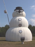
In the “some big weird thing” sweepstakes Beardmore doesn’t disappoint.  Beardmore is also home to what it claims is the world’s largest snowman.  Does the title still count even though he’s not made of snow?  During the summer, the apparently nameless snowman sports sunglasses and fishing rod to signify that anything you can do, a snowman can do way cooler.

Beardmore, Highway 11's snowman capital, with the world's largest " snowman "

Neither rain, nor sleet, nor heat, nor hail will keep Beardmore’s snowman from standing watch over the community

The town sign isn’t just a normal wooden sign.  They’ve spelled out Beardmore on railroad ties in rainbow-coloured letters that you can’t miss. The town also has these nice new ‘Welcome to Beardmore’ pennants hanging from the lampposts.

This is what I love about Highway 11 communities.  They have pride. They have spunk. They have a sense of community. And this sense of community means that they’re not afraid to try.

Sometimes when you’re from a larger place you forget that, no matter where you’re from or where you live, everyone has some sense of pride in their hometown.  Beardmore is a place that reminds you of this.

Beardmore, Ontario war memorial - Highway 11Today Beardmore is a forestry and outfitting town, with a baseball field, a church, some gas stations and about 40 or 50 houses.  There is a Legion in town too.  Beardmore is the only real stop between Geraldton and Lake Nipigon, a 170 kilometre journey.

Beardmore is also where renowned artist Norval Morrisseau first showed his work to a Toronto exhibitor.

Atikokan

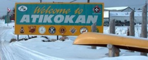
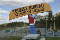
Welcome to Atikokan, Ontario, highway11.caYou might think that any town whose website lists its public library as a tourist attraction would be in need of some excitement. However, Atikokan actually has a fair amount to do.

Atikokan started off as a mining town when ore was discovered nearby in 1938.  After diverting ten kilometres of river, damming the water flow, and draining a lake, workers had shifted twice the amount of earth moved to build the Panama Canal in half the time it took to build the world famous waterway.  For even more history, check out Charles Dobie’s site.

Atikokan subsisted on two mines until 1980 when both closed.  Today, Atikokan is known for forestry, hunting, canoeing, hiking, lodges, and a coal-fired power plant that is constantly giving the area’s local MPP a kink in his party’s anti-coal platform.  The town is now home to 3400 citizens.

(Thirty-four hundred seems a bit high – I’m sure there is some sort of “Ontario small-town population formula” used to make it seem like there are more than 2000 people in any small town in southern or northern Ontario. Maybe they count population during the annual fair or something.)

I can barely portage let alone do it whilst smoking a pipe, Atikokan highway11.ca

I can barely lift a canoe let alone do it whilst smoking a pipe

Atikokan is a good spot for fishing, camping, or starting a wilderness journey – it’s not called the “Canoe Capital of Canada” for nothing.  Atikokan has great access to Quetico Provincial Park, a wilderness park often recognized as one of the most beautiful places in Ontario, if not in Canada.  As well, there is the White Otter / Turtle River Wilderness Area just north of town and public swimming at the beach on Crystal Lake.

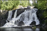
Other tourist attractions include tours of the local walleye hatchery, Scenic Little Falls, the Atikokan Centennial Museum, the Mining Attraction, and the Scenic Little Falls Golf Club. And, according to Wikipedia, Atikokan is Ojibway for “caribou bones”. Atikokan - highway11.ca water falls

However, the neatest thing in Atikokan (remember, in northern Ontario something can be “in” a town and still be 40 minutes away – or in this case, 64 kilometres away by boat or snowmobile) is White Otter Castle.  Started in 1905 by a strange local bachelor named Jimmy McQuat, the three story log cabin was built over ten years on the shores of White Otter Lake.  Jimmy single-handedly built his home out of red pine logs.  The castle has been restored by the local community and prints by a local artist are on sale for 100$.
As for services in town, I don’t have much info.  There are some lodges, a motel, a Foodland, and I’m sure a few diners in town.  Patrick reports that there is a great little campsite just outside of town.

Atikokan - White Otter Castle, highway11.ca

Okay, Jimmy McQuat’s White Otter Castle is a ‘castle’ in the sense that Hamilton, Ontario’s escarpment is a ‘mountain’, but it’s still really freakin’ neat.

Atikokan camp site, highway 11

Camp site in Atikokan

Atikokan camp site

The camp site runs on the honour system for travellers heading in at any time of day or night.  (Camp photos: Patrick.)

If you have, please email me to add to this page. My address is info (at) highway11 (dot) ca

Rainy River

Rainy River is closer to Winnipeg than Thunder Bay – and considering it’s in the same province as places as far away as Windsor, Ottawa, and Welland, you can tell why some people in the north may feel a bit disaffected. I mean, technically, it is faster to drive from Toronto to Rainy River via the US, passing through Michigan, Wisconsin and Minnesota, rather than taking Highway 17 and/or Highway 11 the whole way.

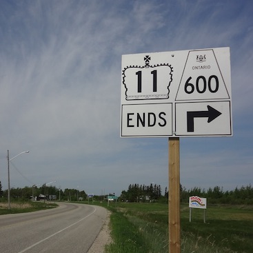
Depending on the direction you’re travelling, Rainy River is either the start or the end of Highway 11.  Atwood Street in Rainy River is the terminus of Toronto’s Yonge Street – all 1600 kilometres of it.

Highway 11 Rainy River terminus end

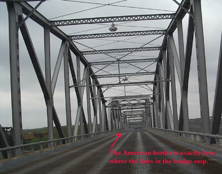
Although this website sort of starts in Rainy River, If you came from the south, Rainy River is the end of Highway 11, meaning you have two options: you can take Highway 600 up through Lake of The Woods, or…

Rainy River International Bridge Higway 11

…or you can take the International Bridge across Rainy River to Minnesota (This photo and the above c/o Patrick.)

International Bridge in Rainy River

(Photo: Keith)

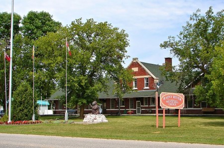
Rainy River is the gateway to northwestern Ontario – well, if you’re coming from the west, that is.  Rainy River is about 100 kilometres west of Fort Frances on Highway 11, and about 450 kilometres west of Thunder Bay.Rainy River began with a lumber mill in 1895 and by 1901 the CNR had a stop there.  By 1904 the town was established.  Today, its importance as a railway and logging town diminished, Rainy River is home to about 1000 people.  It’s an important border crossing, with access to Minnesota, and has plenty of outdoor activities.
Rainy River Locomotive, highway11.caRainy River is home to the 4008, a restored steam locomotive that used to run the CNR route to the town.  Much like the Shay in Iroquois Falls, the train is a testament to the old logging and railway industries which once dominated northern Ontario.  There is a railway heritage museum in town detailing Rainy River’s history with the railway.

Rainy River also has a marina, sports facilities, and both a buffalo and an elk farm.  There is a lot of hunting, fishing, boating, and swimming. Rainy River is one of the towns closest to the beautiful Lake of the Woods.

Rainy River hosts a few festivals including the mid-summer Railroad Daze, the Walleye Fishing Derby, and the Rainy River Giant Pumpkin Festival.  (Doesn’t some town in Nova Scotia have a giant pumpkin festival too? Where they row the carved pumpins like boats?  I don’t know.)

Post below, or email me at info (at) highway11 (dot) ca

Rainy River, Ontario, highway 11

Rainy River is small, but is a starting point for outfitting and anything to do with Lake of the Woods. (Photo: User P199 at Wiki Commons.)

Rainy River municipal building, highway11.ca

(Photo credit: User P199 at Wiki Commons.)