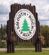
Smooth Rock Falls

Smooth Rock Falls on Highway 11 in OntarioWhen you come into Smooth Rock from the east, don’t be fooled, what you’re seeing is not a one-story IKEA.  It’s the local hospital.

One tourist guide I picked up said that Smooth Rock was the “perfect stop over and supply center.”  Man, those guys really know how to write a tourist brochure.  Talk about underselling…Smooth Rock deserves more than that!

Jeff Buttle, the pride of Smooth Rock Falls, on Highway 11

Jeffrey Buttle, Canadian and World Champion figure skater is from Smooth Rock

Nestled along the picturesque Mattagami River, Smooth Rock is more than just a town that sounds like a radio station.  It was home to Jeffrey Buttle, a recently retired Olympic silver medalist and world champion figure skater; Louise Pitre, a singer who has appeared on Broadway; and JP Parise, a former NHLer who played in the ’72 Summit Series, has coached at the famous Minnesota Shattuck-St Mary’s hockey program, and who is also the father of New Jersey Devils’ forward Zach Parise.  Those are three people that should have their own “Welcome to Smooth Rock, the home of…” signs on the way into town. I’ll pledge 50$ toward that.

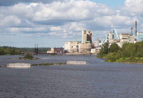
Smooth Rock is a largely francophone community of 1800 centered on the pulp and paper mill.  The problem is that “the North’s biggest little town” (their motto, I think) is about to get smaller as the mill shut down indefinitely in July 2006.  Smooth Rock is facing an uncertain future after the loss of their major employer. Which is really sad, since it’s a cute town and probably a great place to grow up and to retire. I’ve heard that the town and its residents are trying to start up a community-based venture to restart the now shuttered mill, but I don’t know if they’ve been successful.

The mill, now shutdown, at Smooth Rock Falls

The mill, now shut since 2006

Smooth Rock doesn’t have a tonne of touristy-type stuff.  There’s the Forget Me Not BnB west of the river.  There’s also a nine-hole golf course, a nice park on the east side of the river, and there are some fishing opportunities as well. Smooth Rock is good place to stop on the way to Kapuskasing and a place to get gas if you’re heading up to Fraserdale.

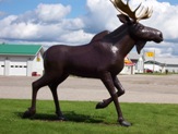
Smooth Rock Falls's highway 11 moose

Moose sculpture #234 on Highway 11

Northway Restaurant claims they have the “best poutine in the north”, although I’m sure that Poutineland in Timmins gives them a run for their money.  Audrey’s has good breakfast in a spartan setting.  There’s also Coco’s Chip Stand off the highway.  Rue Sixth is the main business section for Smooth Rock.  There’s a full-blown LCBO, an Esso, and a Tim-Br Mart.  The Moose Motel provides accommodations and SRF’s entry into the “some big weird thing” motif that is all the rage on Highway 11: a statue of a moose.  There is no Tim Horton’s or chain stores as far as I have seen.  I don’t know if there is a Chinese restaurant, but it’s northern Ontario so there must be one somewhere.Also, don’t be fooled.  There are signs advertising the “SRF Centre” on Highway 11 in both directions.  It’s not a mall – the “SRF Centre” is a truckstop with some slightly self-aggrandizing tendencies.
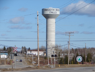
On an anecdotal bent, the town of Smooth Rock Falls used to plow each resident’s driveway in the winter.  I don’t know why that service ended.

Fauquier

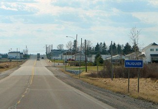
Fauquier, on Highway 11 in OntarioFauquier is a quiet, clean, and quaint hamlet of about 600 on the Groundhog River, which is crossed by both a rail and road bridge.

Much bigger than its cousins Strickland or Harty, Fauquier (roughly pronounced Folk-yay) once supported a mill.  Today the community has a few businesses, but I’m told that most residents commute to Kapuskasing.
Fauquier bridges

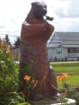
There’s a statue of a particuarly conniving-looking groundhog just off the highway, as well as a nice gazebo, soldier’s memorial, and a little parkette.  There’s another park just south of the highway, which borders the river and has a little boat launch.

Fauquier's creepy giant smoking groundhog on Highway 11

In northern Ontario, even the groundhogs are smokers

Just east of town, there’s a house with a rather eccentric yard, sporting the Olympic rings (?), some wooden sculptures (??), and a family of inukshuks (???). I didn’t get to take a photo, as the truck behind me was following too closely to safely stop and admire the uniqueness.

Like all the francophone communities on northeastern Highway 11, it is extremely well kept with a church, a dépanneur (convenience store), an LCBO outlet, and a small food store.  There is no gas station, however.

The Den, right on Highway 11, is a good place to stop for breakfast.  I’ve been there a number of times and it’s pretty decent.

Thanks to Patrick for most of the photos.

Fauquier, Ontario on Highway 11

Fauquier sunrise over the tracks

Moonbeam

Ah, Moonbeam.  It’s so cute.  And so goofy.  That’s why it’s so neat.  I like Moonbeam.

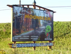
Moonbeam, Ontario welcome alien sign on Highway 11

I want to say that the alien’s name is Youpi, but I think that’s the name of the Montréal Expos’s mascot

Moonbeam is a small francophone town of about 1000 (which is big compared to places like Mattice, let alone Harty!)  It is so clean, so well kept, and, well, so spunky.

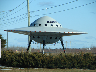
From what I’ve been told, the town got its name from railway workers who insisted that a beam of light from the moon hit the tracks one night.  And thus Moonbeam was named.  And with the help of hippies and a few dedicated locals, the name stuck.Moonbeam, Ontario's flying saucer on highway 11Moonbeam loves its space theme.  The flying saucer is one of Highway 11’s most famous monuments and is known throughout Ontario.  There is the Blue Moon Motel and Chip Stand (motel + chip truck = awesome combo) which features space stuff on its signs.  Moonbeam has its own mascot which is a little green alien whose name I can’t remember.  He’s on all their signs which are all over Highway 11’s eastern portion. I think I even have him on a shirt pin.
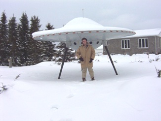
Alien ship stuck in Moonbeam, Ontario because of the cold

It was so cold I had to wear my gorilla gloves. I can’t believe we posed outside without a hat

But it’s not all rockets and asteroids with Moonbeam.  They have a vision and they’re realizing it.  There’s the Centre Culturel and the Leonard Art Gallery.  The town has some of the best hiking, cycling, and walking trails in northeastern Ontario.  Moonbeam has its own snowmobile club with trails that are groomed in the winter (it’s the first place I’ve ever seen a snowmobile trail groomer.)  Just north of town there is Remi Lake and René Brunelle Provincial Park, which I’m told has a waterslide.  There is also fishing, swimming, and canoeing/kayaking.

Moonbeam’s most famous son would be sculptor Maurice Gaudreault.  Gaudreault is well-known within Canadian ceramic circles for his work depicting life in northern Ontario through clay.

Gaudreault sculptureMoonbeam's famous Gaudreault

Gaudreault sculpture

There’s also a short film called Leaving Moonbeam about a young girl trying to hitch a ride out of Moonbeam.

Moonbeam actually has a fair amount to do and is totally worth a stop, or even more so, an actual visit.

Opasatika

Opasatika is a former mill town with about 300 residents set on the Opasatika River.

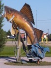
Opasatika, Ontario, Highway 11 fish

This is actually pretty cool in person. Well done, Opaz.

Opaz (as it is commonly called along northern Highway 11) used to have its own mill (and supposedly, from what I was told, its own dance club), but changes to the forestry industry in northern Ontario have meant that a lot of the smaller mills are being closed.  This means that communities like Opasatika, Smooth Rock, and Longlac are losing their mills, and fighting for their lives in the process. I was told that it used to be that there was a little mill in each little town from Hearst through to Smooth Rock.
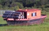
Of course, Opasatika has its “some weird big thing” as you enter the town.  There’s a random fish statue . There’s also a mini logging boat sitting in the field.  Normally there are plaques for these kinds of things but not here – I guess everyone around here is just in-the-know. A resident emailed me to tell me that the fish was supposed to have a commemorative plaque, and be the start of a historical site. However, progress was delayed when the town mill was closed – and subsequently, all civic efforts have gone into finding a solution for the mill. That’s understandable, and unfortunate.

Lumber boat, Opasatika, Ontario Highway 11

Take note Longlac – it is obvious what this boat’s purpose is

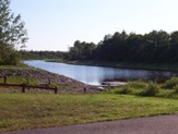
Opasatika (pronounced locally as Opa-set-ticka) also has a nice little waterfront park with a boat launch to the river, and two marshes – du Village and des Lambert.  Sixty kilometres south of Opasatika you can find Christopher Waterfall which leads into Rufus Lake.

Opasatika River launch, Highway 11

NO SWIMMING. Okay Opaz, you made it clear.

As for businesses, Magazin Martel is a depanneur with a little LCBO outlet.  Mandy’s Beanerie serves coffee and meals as well.  There might be more for food and services, but I’m not sure. I haven’t been back in a while.

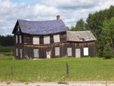
There used to be a mushroom farm in Opasatika.  I’m not sure if it is still running. I don’t know if it gives tours, but you could enquire – I’ve always found visiting any kind of factory/workplace type thing to actually pretty interesting. The farmhouse you see on the right is actually in Val Rita, and has some personal significance to its owner, a testament to the agriculture that used to occur in this area.Lonely farm, Opasatika, Highway 11On a personal note, Opasatika is the first place where my car was chased by a dog on the journey.  Imagine, if you live on Highway 11 and you have a dog that chases cars or trucks?  Boy are you in trouble…

Thanks to Anick for help with Opaz.

Mattice

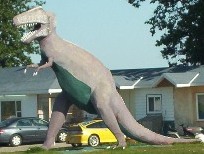
When you enter Mattice from the east, you’ll be greeted by a dinosaur.

T-Rex has no cultural significance to the town.  There isn’t a museum around.  He’s not the town mascot. To my knowledge no dinosaur bones have been found in the area. It’s just decoration on someone’s front lawn.  Think of it as an especially eccentric garden gnome.

T-Rex in Mattice, Northern Ontario, Highway 11

Mattice does its bit to continue Highway 11’s many “WTF? moments.

I’ve been told by a Mattice resident that the T-Rex was built by the owner of the Mattice Motel to attract tourists.  There used to be a stegosaurus in town, as well.  It turns out that the stegosaurus was destroyed by a new owner when the previous owner left to pursue his dinosaur dreams elsewhere.  Seriously.  It turns out he left to build a concrete Jurassic park in the Ottawa region.

A francophone town in the heart of French-speaking Ontario, Mattice (rhymes with ice) is one of these small northern towns (population approximately 500) on Highway 11 that has a little bar, an a full-blown LCBO, and a skidoo repair shop … but only the tiniest of grocery stores that would barely qualify as a fruit stand in more urban areas in southern Ontario.

Fur trading monument, Mattice, Highway 11 Ontario

Mattice used to be the launchpad for old fur trading expeditions

Set on the Missinaibi River, Mattice used to be a starting point for Voyageurs heading downstream for the fur trade.  There’s a historical plaque and one of Highway 11’s classier statues to commemorate its history.  About two kilometres upstream, there’s a traditional Aboriginal burial ground.

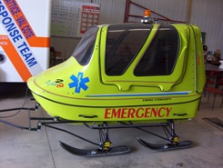
Mattice emergency service skidoo, Highway 11

Ambulance northern Ontario style

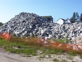
If you go north on one of Mattice’s side street you’ll find the nice riverfront park.  It’s actually quite a nice park, with a boat launch, a picnic area, and an inexplicable pile of rocks (that, it turns out, were used in the refurbishment of the Missinaibi Bridge.  And then left there for posterity’s sake.)

Rock pile, Mattice, Highway 11

Lacking a woodpile, this pile of rocks will have to do

Hearst

There’s something really interesting about Hearst.

Hearst is the frontier of northern Ontario – you either live in Hearst, east of Hearst, or you live waaaaaaaaaaaaaay west of it.  It even has a Northern Store (how’s that for remote.)

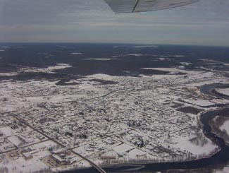
Hearst, Ontario on Highway 11

Hearst from the air

Where else would a town of 6000 have so many bars, the “northern ballet”, and yet still have four or five churches?

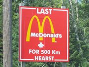
What other place keeps you in their town by telling you just how far away everywhere else is?  I mean, Longlac is 210 kilometres west, with nothing in between.  Hearst has the last McDonald’s for 500 kilometres – I know it because I checked, in person. There isn’t another McD’s until Thunder Bay

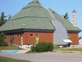
The tourist office in Hearst. Highway 11

The tourist office in Hearst. So awesome.

I once applied for a government job in Hearst, but never got an interview.  To be fair, I realize now that I was woefully underqualified.  I swear that the ad had listed French as “an asset”.  Well, no French isn’t an asset – in Hearst, it’s a requirement.

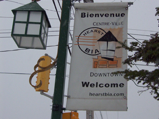
One of the most interesting things about Hearst, however, is that it is the most francophone community in Ontario – something like 85-90 percent.  Hearst even has residents that only speak French, and no English.  Rue George is the downtown drag and it’s really cute, with small shops, a library, a diner, and a movie theatre showing French-language movies.  It’s reminds me of Penetanguishene, but more with more French.

Hearst, OntarioI (h)EART (h)EARST

Erst (as it is pronounced locally) is a pretty special town.  It has:

•    The motto: “The Moose capital of Canada” (or so they boast)
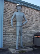
•    The only tin man on Highway 11 (he keeps watch over an appliance store)
•    The most millionaires per capita (or so someone emailed, apparently it’s due to the local forestry?)
•    The largest moose sculpture on Highway 11 (Believe me, I’ve seen them all)
•    The most suburbs (two) of any small town Highway 11 town (take that, King Kirkland or Geraldton East)
•    The most truckstops per capita (or so I’ve calculated, roughly)
•    The biggest woodpile on Highway 11 (I’ve seen them all too)

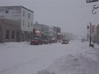
Trust me.  When it's not getting snowbombed, Hearst's downtown is super cute

Trust me. When it’s not getting snowbombed, Hearst’s downtown is super cute.  The problem is that it gets hammered all the time.

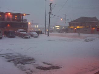
Heck, I’ve been to Hearst three times.  Most of the photos here are from the first time that I hadn’t been snowed in (because it was August.)  Both other times, I was stuck for three days in storms even that locals found nasty.

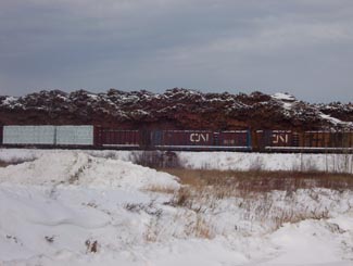
Set on the Mattawishkwia River, Hearst is a forestry town (hence the massive woodpile.)  It also has a tourism industry set around hunting, outfitters, and its proximity to three Provincial Parks:  Fushimi Lake, Missinaibi and Nagagamisis.  It is also the end of the Algoma Line, which runs fall colours rail tours from Sault Ste. Marie to Hearst.

Despite its francophone heritage, Hearst was once the site of a Slovak settlement.  Bradlo, nestled 11 kilometres south of Hearst, the community persisted until the 1950s when the residents realized that the land was agriculturally marginal, and wouldn’t support farming in a modern economy.

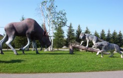
Sculpture jsut outside of Hearst

Hearst is so cool, this wolf vs. moose sculpture doesn’t even count as their “some big weird thing”…

Hearst tin man, Highway 11

…instead, this does!

Food and Fun in a Frontier Town

Hearst is a center for most of the little communities west of Kapsukasing, and is the largest town between Thunder Bay and Kapsukasing on Highway 11.  And probably for Hornepayne on Highway 631, about an hour and a half south.  (Head off-route and take a trip along 631 here.)

No McDonald's for 500 km in Hearst, Highway 11

I’ve used this photo about a twenty-two times on this website and it never gets old

Therefore, Hearst has an abundance of services.  It has the only McDonald’s and Tim Horton’s that you’ll see until Thunder Bay.  In addition to the 24-hour garage and towing company that is advertised throughout northern Ontario, there are shops downtown and food everywhere.  Hearst also has an overabundance of places that serve Northern Ontario Chinese Food.

Hearst has something for everyone – the northern ‘hotel’ scene (the Waverly or the Windsor), cafés (although Café Duo doesn’t serve coffee, go figure), fast food (McDonald’s, KFC, Subway, and the only Pizza Pizza west of Timmins), authentic chip stands (Micko’s is great), sit down restaurants (Mom’s, John’s, Pizza Place has ok pasta), fine dining (you can find filet mignon, steak, and Cuban cigars at Ailleurs), and even a little night club (OK, fine, it’s the bar at the Companion.)

Snowstorm, Hearst, Highway 11

Highway 11 in Hearst, getting walloped, again

There are motels aplenty in Hearst so you should have no trouble finding a place to stay.  (A note to those staying at the Queens Motel, keep your kids away from the funny channels at the end of the TV dial there!)  There is also hockey in the winter – in fact, Hearst is the hometown of Claude Giroux, Philadelphia Flyers superstar, as well as Pierre LeBrun, a hockey commentator who has appearanced on TSN, ESPN, and Hockey Night in Canada. Hearst is home to the local team les Elans de Hearst. And, there is bowling.

Come on, it’s northern Ontario. Of course there is bowling!

Super awesome Hearst woodpile, Highway 11

Hearst – simply the best woodpile of any Highway 11 community

Hearst, Ontario highway11.ca

And this is what happens to a woodpile on Highway 11, in Hearst (Credit: Wiki Commons contributor P199)


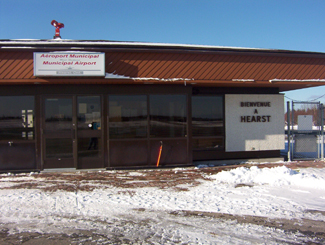
Hearst, Ontario airport

Not sure why I took a photo of Hearst’s airport

Longlac

Longlac is approximately half way between Toronto and Winnipeg, and is 320 kilometres from Thunder Bay. So for me, on one particularly longish trip, making it to Longlac was kindofabigdeal.

There is nothing between Hearst and Longlac save for maybe a gas station (and I mean maybe) and the Klotz Lake washroom/swimming combo rest station on the side of the road.  The drive seems. to. take. for. ever. (ok I think I got my point across, it’s probably not that bad.)

Longlac welcome sign, Highway 11

Longlac’s fur trader welcome statue was somehow both cheesier and cooler in person

So, for me at least, the oncoming arrival of Longlac was a big deal – finally, the end of this 200 kilometre stretch of nothingness…! It’s no surprise that the town’s Protestant church is named St. John-in-the-Wilderness.  And it wasn’t founded in the fur trading days either – this was founded ‘in the wilderness’ in, wait for it, 1943.

Today, Longlac is a former paper and forestry town trying to reinvent itself in a difficult economy and represents the westernmost edge of northern Ontario’s francophone belt – just under half its residents are French-speakers.  Hence the local  caisse.

Not immediately evident that this guy is supposed to pull logs

Not immediately evident that this guy is supposed to pull logs

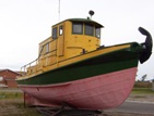
When you get into the town you’re immediately greeted by a horse statue and two beached boats.  The horse is pulling logs (which you can’t see unless you climb up the little hill to the statue itself.)  I think the boats are supposed to carry logs too. They seem to be the remains of a former miniputt course.  It’s too bad it can be a bit confusing to the visitor.

Loggin boat, Longlac, Ontario Highway 11

Also not immediately evident that this is supposed to pull logs too

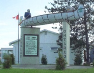
Longlac has a long history.  Prior to 1800 the town was a North West Company trading post.  In 1814, the Hudson Bay Company set up a rival post, and in the spirit of modern commercialism the two merged in 1821. There is a historical plaque with a statue of two guys in a canoe, representing the role of Aboriginal peoples and fur traders in building Longlac.  There’s also a town history board back at the tourist office/former mini putt site.

Longlac used to be a mill town but today, no mills operate in Longlac.  All three have shut down in the last few years. “Founded on fur, sustained by the forest” is Longlac’s motto, and considering that the forestry industry is contracting in northern Ontario, you have to wonder what a town of 1200ish will find to sustain itself. What other jobs can there be in the area? How long before parents have to start working in Alberta? It is communities like Longlac that you really feel for – they’ve survived this long.

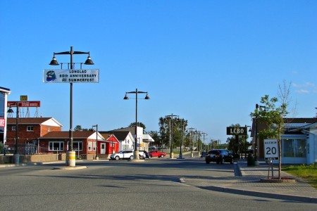
Longlac, Ontarios main drag...don't hit the light posts!  (Credit: User P199 at Wiki Commons)

Forestry Road – Longlac, Ontario’s main drag…don’t hit the light posts! (Credit: User P199 at Wiki Commons)

Longlac’s main strip is Forestry Road, which runs perpendicular to Highway 11.  It has a row of streetlights right in the middle of the road, which practically invites you to play a game of bumper cars with your vehicle.  What happens if you have to swerve for a dog?

Longlac has the requisite truck stops and third tier franchises of a Highway 11 town, with places like Robin’s Doughnuts and 2 for 1 Pizza.  There’s an LCBO outlet, a bed and breakfast (Lily’s), and what seems like the newest Rexall pharmacy in Canada.  (It is so shiny and suburban that it looks a bit out of place.)

Abandoned mini putt in Longlac, Highway 11

Abandoned mini putt in Longlac, Highway 11.  I thought the horse and boat belonged to the mini putt!

Apartments in Longlac, highway 11

Seriously? This is northern Ontario after all.

I hope to visit again. Maybe someone can send me an email and let more know a bit more so I can add it here.

Beardmore

Eighty kilometres west of Geraldton is Beardmore, the “Gateway to Lake Nipigon.”

Welcome to Beardmore, Ontario

Not a pride parade float, it’s the welcome to Beardmore sign!

Beardmore started out as a flag station on the CNR before finding itself in the middle of the Lake Nipigon gold ‘rush’ in the 1930s.  The town faced ‘rapid expansion’ after gold was found on the Sturgeon River, as evidenced by the Timmins-style hotels that unfortunately no longer serve as watering holes for the community.

Today, it’s a town of about 200 people focusing on forestry and serving as a take-off point for camping and boating near Lake Nipigon.  So it’s pretty small, and pretty quiet.  But what Beardmore lacks in amenities it makes up in uniqueness. I liked Beardmore.

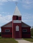
Beardmore church

A church in Beardmore – completely unrelated to the text that appears above or below this photo

Beardmore is known for Vikings.

The Beardmore Relics, which were purported to be a cache of Viking artifacts, were found near the town in the early 1930s.

The relics – including an old sword, and axe, and a piece of a shield – were supposedly found while a prospector was panning for gold, and for a time were claimed as evidence that Vikings explored much further than Vinland, Markland, and Helluland while they were in North America, and that they explored parts of northern Ontario and maybe even Minnesota.

The Royal Ontario Museum purchased the relics and displayed them for about twenty years until they were forced to hold a public enquiry as to whether the relics were actually found in Beardmore, or imported by Scandinavian settlers desperate for a historic taste of home and passed off as a discovery in an elobarate hoax.

Beardmore, Ontario on Highway 11 Ontario highway11.ca

Highway 11 as it runs through Beardmore, Ontario.  Note the lounge-hotel at right, once a fixture of every town in northern Ontario.  (Photo: User P199 at Wiki Commons.)

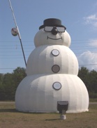
In the “some big weird thing” sweepstakes Beardmore doesn’t disappoint.  Beardmore is also home to what it claims is the world’s largest snowman.  Does the title still count even though he’s not made of snow?  During the summer, the apparently nameless snowman sports sunglasses and fishing rod to signify that anything you can do, a snowman can do way cooler.

Beardmore, Highway 11's snowman capital, with the world's largest " snowman "

Neither rain, nor sleet, nor heat, nor hail will keep Beardmore’s snowman from standing watch over the community

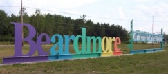
The town sign isn’t just a normal wooden sign.  They’ve spelled out Beardmore on railroad ties in rainbow-coloured letters that you can’t miss. The town also has these nice new ‘Welcome to Beardmore’ pennants hanging from the lampposts.

This is what I love about Highway 11 communities.  They have pride. They have spunk. They have a sense of community. And this sense of community means that they’re not afraid to try.

Sometimes when you’re from a larger place you forget that, no matter where you’re from or where you live, everyone has some sense of pride in their hometown.  Beardmore is a place that reminds you of this.

Beardmore, Ontario war memorial - Highway 11Today Beardmore is a forestry and outfitting town, with a baseball field, a church, some gas stations and about 40 or 50 houses.  There is a Legion in town too.  Beardmore is the only real stop between Geraldton and Lake Nipigon, a 170 kilometre journey.

Beardmore is also where renowned artist Norval Morrisseau first showed his work to a Toronto exhibitor.

Nipigon

Located on the most northern point of Lake Superior, Nipigon is pretty much the only true town between Geraldton and Thunder Bay.

You know what this means.

Out of the way Tim-Br Mart.

Move over Home Hardware.

Nipigon has a Canadian Tire…!

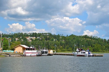
Nipigon, Ontario, highway11.ca marina lake superior

Even Nipigon’s little port is cute!  The lookout is up at the top of that hill in the back of the photo. (Photo: User P199 at Wiki Commons.)

When you drive into many northern towns, there’s usually a sign telling you that they’re the home of a semi-famous Canadian celebrity.

Well, fooling around on the internet one day I found out that a crater on Mars was named after Nipigon.

Why isn’t this on a sign beside the highway?  You could put “Nipigon – we’re so out of this world they named a crater on Mars after us!” or something like that.  Moonbeam would kill for this! I’d pledge 50$ toward that…

Nipigon shrine Ontario Highway 11Instead, you’re greeted by a sign that tells you that churches are open Sundays and are directed to a ‘scenic lookout’ which looks out over a cemetery.  Is this considered a God’s-eye view?  Nipigon does have an abundance of churches, and the town’s Catholic Church even has a little shrine beside its virgin Mary statue.

Hydroelectricity, fishing, forestry, tourism are the mainstays of Nipigon’s 2000 people. (I wonder if they did the census in the summer, and how that would impact the head-count – there seem to be some cottages in the area.) Nipigon is blessed with a scenic little harbour, complete with a waterfront park, a boat launch, and hiking trails.  It even has a nice kid’s bookshop, and a stained glass store to boot.  This is not your average Highway 11 town.

Paintings and Big Things

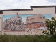
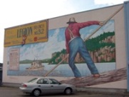
Nigion is full of murals Highway 11 OntarioWell, I take that last statement back.  Nipigon is your average Highway 11 town because, of course, it has to have its share of weirdness.  Of course, there is the mandatory “big weird thing in town”, but also in this case, it is public art.

Nipigon seems to love murals.  I counted four, plus the town museum which has paintings on it as well.  The one on the Legion celebrates forestry.  Another recognizes the history of the railroad.  A third shows the town’s first general store.  A fourth celebrates ‘northern Ontario time’ – encouraging workers to call in sick in order to go fishing.  It’s a great idea. I’m a sucker for any kind of public art.

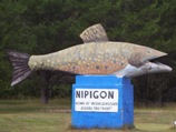
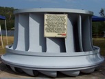
Nigion is full of murals Highway 11 OntarioLike most northern Ontario towns, Nipigon has a festival and a some big weird thing displayed in town.  Every August long weekend the town celebrates the Blueberry Blast festival, although I was there on the long weekend and didn’t see any blueberries raining down anywhere in the town.  In the “some big weird thing” category, Nipigon has two entries, 1) a historic turbine taken from the electrical plant up the river, and 2) a big trout on the highway.

Big weird thing #2 - Nipigon's trout, on Highway 11

Nipigon’s big weird thing #1 – Nipigon’s trout, on Highway 11

Nipigon is the best stop to eat or refuel before you hit Thunder Bay or Geraldton.  There is a foodmart, a Robin’s Doughnuts, multiple gas bars, a Beer Store, a Mac’s Milk, a few motels, a bank or two, a Subway where I waited 70 minutes to get a sub (beware of people coming in from camps and ordering 12 subs each), and a Pizza Pizza/KFC outlet.  Out on the highway there’s Gus’ Broasted Chicken, for those wanting a non-fast food meal.

Lots of people end up leaving Highway 11 for Highway 17 after Nipigon.  If you’re interested, check out the towns that run along Lake Superior’s shore by going off-route here.

Other random stuff

Nipigon Ontario - big weird thing #1 - hydro turbine

…and Nipigon’s big weird thing #2, an old hydro turbine

Oddly, east of Nipigon past Highway 11 there is an ad for construction company in based in Hearst.  That’s past Highway 11.  In the opposite direction of Hearst.  Really, it’s nowhere at all near the town.  Do the owners know where they’re being advertised?

Nipigon is also the town that got me in trouble in Grade Four.  Whilst playing Cross-Country Canada in computer class, Mme. Bennedsen caught me and three other kids giggling at the computer screen.

Now, this long before the advent of the internet, so in hindsight there wasn’t much risk we were up to anything particularly nefarious.  But maybe she was having a bad day, or maybe she was practicing her walk-stare-scold combo for use in future computer classes once the internet became a fixture of public education – whatever the reason, she rushed up toward us, eyes glaring, finger pointing, heels clicking ominously.

We looked at each other.  Once of us would have to come clean.  After multiple protestations from us that we were up to nothing, she finally flushed it from us.  And I took the hit for the four of us.  I was forced to stand before the class, head bowed, and admit out loud that there was, in fact, no town in Ontario named Nipplegone.

Pearl / Dorion

Welcome to Ontario’s “Canyon Country…”

Dorion gas station mural canyon country pearl highway 11 yonge street thunder bay ontario

The mural at the now-abandoned gas station at Dorion, near Pearl on Highway 11

Situated between the Wolfe River and Coldwater Creek, Dorion is your typical Highway 11 dot-on-the-map.  There are some scattered houses and an abandoned motel, but nowhere really to turn off the highway, at least that I have seen in my drives for work along the road.

Dorion indian head ontario highway 11 thunder bay rock statue canyon country

Dorion’s Indian Head on Highway 11. I’m really not saying the human head or face here…

Dorion is home to Canada’s largest wildlife mural – but not in the local gallery, or the town hall, or the café, but ….drumroll… at the Esso station.  The station is painted on all three sides, with moose, fish, and wolf representing Dorion’s place in “Canyon Country”.

As well, the station features a recreation of an Aboriginal sculpture known as the Indian Head.  (Both are pictured here.)  This sculpture is a recreation of Indian Head, a rock formation found in nearby Ouimet Canyon Provincial Park.  This is pure Highway 11 – random things in a completely random place.

Highway 11 randomness #347b: random fake animals near Pearl, Ontario

Highway 11 randomness #347b: random fake animals near Pearl, Ontario

Dorion is in the middle of what is called “Canyon Country” as Ouimet Canyon Provincial Park is approximately 12 kilometres north of the ‘town’. Nearby Eagle Canyon is a private park that has built Canada’s longest suspension bridge over the Ouimet Canyon – 600 feet across and more than 200 in height.

Dorion is also home to a bottled water works, Ontario’s largest fish culture station, the Trillium Motel, a bait shop, and a bible camp.

Pearl wasn’t on the map.  In Pearl you can find the Rocksville Amethyst Shop, some animal statues (which are small by Highway 11 standards), and a few bush side-streets.