Kakabeka Falls

I had the idea to blog all of Highway 11 / Yonge Street when I was eight hours into a drive from Timmins to Thunder Bay.

I had been working up in the Timmins area and figured why not use the civic holiday weekend to drive out to Thunder Bay.  (I figured I’d never be so “close” by again.)  I had just left Geraldton when I saw a young hitchiker walking west in the middle of one of those storms where the rain falls at just the right diagonal angle that you wonder if it’ll take the paint off your house.  It was hitting him so hard that it was knocking his baseball cap around on his head.
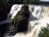
Kakabeka Falls, the Niagara of Northern Ontario?“Boy,” I thought.  “I bet this guy had wished he’d read up about this stretch of highway.”  It’s a good 70 km to Beardmore.  And then I lightbulb went off.

After having a bit of a scare of my own – I would have left Iroquois Falls for Timmins via backroads in the winter with next to no gas, only to be dissuaded by a pleading co-worker.  “There’ll be a gas station”, I thought! – I’d been blogging about some of the towns in and around Timmins and northern Temiskaming.  They’re all around Highway 11.  And Highway 11 is Yonge Street.  Why not just turn this into a blog on the world’s longest street?

I had arrived in Thunder Bay feeling triumphant, happy to see the city lights as a signal – that I had done it. I felt like I had practically finished the Boston Marathon or something. Except in my car.

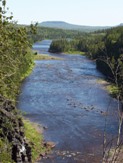
Downstream from the falls

Downstream from the falls

The problem with that thought, however, was again my lack of planning.  At that time, I had thought that Highway 11 ended in Thunder Bay. I wasn’t even truly aware that the Highway kept going.

But then I kept following Highway 11 further.  And further.  And then in Kakabeka Falls, I finally figured it out.  Highway 11 kept going.  All the way to Atikokan. To Fort Frances. To Rainy River. I hadn’t completed it by any means. I was more than 500 km short!

Sometimes called “Niagara of the North” (when Bracebridge isn’t calling their rather middling falls the same thing), the town of Kakabeka Falls is built around the waterfalls from which it derives its name.  Thirty kilometres west of Thunder Bay, Kakabeka Falls is one of Ontario’s natural wonders.

The majestic falls are well worth the parking charge (two dollars per hour at the time of my visit), even for a short stop.  There are three lookouts, each with educational displays, and there is a one-lane road which links the two sides of the provincial park and provides a fourth vantage point.  On the north side of the highway, there is a beach with beautiful dark blue water.  For an added twist, you can attend Kakabeka Bible Camp – just be advised that Kakabeka Falls is a bad spot to try walking on water.  (Sorry, so bad. Not funny.)

The Metropolitan Moose is a good bet for baked goods and coffee, and if you’re feeling adventurous, you can try to Chinese food available at the curling club just east of town, although I don’t know if it is quality Northern Ontario Chinese Food.

The town has a four to five motels, an LCBO outlet, gas stations, two amethyst shops (the amethyst signs are really getting old, they’re even on people’s front lawns out here.)  There are two churches in town, including St. Theresa’s which is pictured here.  Wednesday night is bingo night at the Legion.  There are about 6000 people in Kakabeka Falls and Rosslyn Village altogether.

Twenty-four kilometres south of town you can find the wonderfully-titled St. Urho’s Golf Club.  (Is that really pronounced “yer-ho’s”?)
Church on Highway 11 in Kakabeka Falls

Atikokan

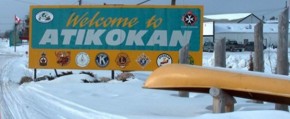
Welcome to Atikokan, Ontario, highway11.caYou might think that any town whose website lists its public library as a tourist attraction would be in need of some excitement. However, Atikokan actually has a fair amount to do.

Atikokan started off as a mining town when ore was discovered nearby in 1938.  After diverting ten kilometres of river, damming the water flow, and draining a lake, workers had shifted twice the amount of earth moved to build the Panama Canal in half the time it took to build the world famous waterway.  For even more history, check out Charles Dobie’s site.

Atikokan subsisted on two mines until 1980 when both closed.  Today, Atikokan is known for forestry, hunting, canoeing, hiking, lodges, and a coal-fired power plant that is constantly giving the area’s local MPP a kink in his party’s anti-coal platform.  The town is now home to 3400 citizens.

(Thirty-four hundred seems a bit high – I’m sure there is some sort of “Ontario small-town population formula” used to make it seem like there are more than 2000 people in any small town in southern or northern Ontario. Maybe they count population during the annual fair or something.)

I can barely portage let alone do it whilst smoking a pipe, Atikokan highway11.ca

I can barely lift a canoe let alone do it whilst smoking a pipe

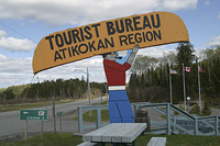
Atikokan is a good spot for fishing, camping, or starting a wilderness journey – it’s not called the “Canoe Capital of Canada” for nothing.  Atikokan has great access to Quetico Provincial Park, a wilderness park often recognized as one of the most beautiful places in Ontario, if not in Canada.  As well, there is the White Otter / Turtle River Wilderness Area just north of town and public swimming at the beach on Crystal Lake.

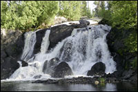
Other tourist attractions include tours of the local walleye hatchery, Scenic Little Falls, the Atikokan Centennial Museum, the Mining Attraction, and the Scenic Little Falls Golf Club. And, according to Wikipedia, Atikokan is Ojibway for “caribou bones”. Atikokan - highway11.ca water falls

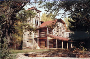
However, the neatest thing in Atikokan (remember, in northern Ontario something can be “in” a town and still be 40 minutes away – or in this case, 64 kilometres away by boat or snowmobile) is White Otter Castle.  Started in 1905 by a strange local bachelor named Jimmy McQuat, the three story log cabin was built over ten years on the shores of White Otter Lake.  Jimmy single-handedly built his home out of red pine logs.  The castle has been restored by the local community and prints by a local artist are on sale for 100$.

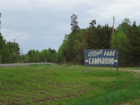
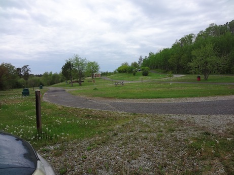
As for services in town, I don’t have much info.  There are some lodges, a motel, a Foodland, and I’m sure a few diners in town.  Patrick reports that there is a great little campsite just outside of town.

Atikokan - White Otter Castle, highway11.ca

Okay, Jimmy McQuat’s White Otter Castle is a ‘castle’ in the sense that Hamilton, Ontario’s escarpment is a ‘mountain’, but it’s still really freakin’ neat.

Atikokan camp site, highway 11

Camp site in Atikokan

Atikokan camp site

The camp site runs on the honour system for travellers heading in at any time of day or night.  (Camp photos: Patrick.)

If you have, please email me to add to this page. My address is info (at) highway11 (dot) ca

Stratton

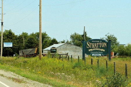
Stratton is the seat of Morley Township and is two towns east of Rainy River.

RR-14-Stratton-LogoThe Township of Morley has the coolest city logo I think I’ve seen while compiling this site (see left).  It looks like it was drawn in Microsoft Paint (much like this website), and features a sun, some waves, a maple leaf, what I think is a lunchpail (oops! it’s a silo!), and a curling rock.  If this isn’t the logo of a Canadian retirement town, then what is?

East of town is the Kay-Nah-Chi-Wah-Nung Historical Centre (imagine having to spell that website address over the phone!).  Located by the Manitou Mounds, it’s an ancient First Nations burial site that’s been commemorated with a historical centre.

There’s the annual curling bonspiel in late February.  And there’s another one in mid-March.  And another one in late-March. And another one for truckers in April.  There’s a fishing derby in July, and then another curling bonspiel in December.

The area was first settled in the 1870s when settlers first travelled to Rat Portage (I bet Kenora sure is happy about changing their name from Rat Portage…) and then travelled by steamboat through Lake of the Woods.  Fires wiped out the early town, but things were rebuilt and in 1903 Stratton became the seat of the township. Today, Stratton is a bedroom community for Fort Frances and an agricultural area, with the only cattle auction/sales centre in north-western Ontario.

Add to this page by emailing me at info (at) highway11 (dot) ca and make Stratton come alive (ok not really.)

Stratton, Ontario, northwest on Highway 11 highway11.ca

(Photo: User P199 at Wiki Commons.)

RR-14-Stratton-Launch