Hornepayne

Horneypayne three bears highway11.ca

Hornepayne is home to three bears, as compared to White River‘s one

Hornepayne was founded in 1928.  The town sign doesn’t announce the population.  I don’t think it can be more than 500, although everything I’ve read since my visit says that it is closer to 1000.  It is about an hour and a half southwest of Hearst on Highway 631.

“Home of the three bears”, Hornepayne is a railway town that’s seems to be in a bit of decline now that the railway isn’t so important.  Hornepayne proudly boasts having one of the last indoor roundhouses in the world.  Via trains still stop here.

For food, there is the Packsack Deli in an old barn across from the train tracks (turn left at the three bears), as well as Virginia’s Diner which opens at 6 AM for breakfast.  There’s also what they call a mall with an LCBO, a Northern Store, Craig’s Bar, and a sign advertising “Bars, Rooms, Food” so I assume there is some kind of motel inside.  For shopping, there’s Cindy’s This and That and the Passtime General Store.

Hornepayne highway 631 highway11.ca

Hornepayne used to have a little mall, but it closed in 2011 after 29 years.  Sad.  (Photo credit: P199 from Wiki Commons)


Hornepayne, Ontario mural highway11.ca

In the wilderness for the wilderness; Hornepayne, Ontario mural

I don’t know how much there is to do, although there is a snowmobiling club in the winter, and, of course hunting and fishing nearby.

And I can’t comment much more than that. Hornepayne is pretty out of the way, so I’ve only been through it once. And that time was at 7AM on a stat holiday so it was pretty quiet.  It is one of those visits where, in hindsight, I can’t believe I was willing to be so conspicuous as to take random photos of random things in a town so small and out of the way.  I guess I was gutsy in the summer of 2006.

If you’re stopping in Hornepayne to use a washroom, use the newer gas station south of the town.  The Esso north of town is cramped, and there are few spots to safely pull over your car on the road north of town if the wilderness arouses the call of nature while you’re on your way to Hearst.

Hornepayne highway11.ca

In the right light, Hornepayne can be kinda cute (Photo credit: P199 from Wiki Commons)

Pic River

Home of the Objibways of Pic River First Nation, Pic River is a small community of about 400 people southeast of Marathon.  You’ll have to detour south on road 627 off the TransCanada.

Apparently, the mouth of the Pic River was a trading spots for years before European arrival as it offered access to northern lands and a canoe route to James Bay. The halfway point for canoers travelling the north shore of Lake Superior, “the Pic” first appeared on European maps in the mid-seventeenth century (according to Wikipedia). First Nations began to trade furs with the French in the late 1770s, prompting a French trader to set up a permanent post there by 1792. The Hudson’s Bay Company operated the post from 1821 until encroaching settlement let to its relocation in 1888. In 1914 the Pic became a treaty reserve of its traditional inhabitants, the Ojibways of Pic River.

Pic River used to be a railway town, but with the trains diminishing in importance, forestry and hydro are the town’s mainstays.  According to Wikipedia, the town is known for pioneering “run of the river” hydroelectric developments, which harness natural energy potential without fully damming the river. In and around Pic River, three generating stations feed enough hydro into the Ontario grid to power 30 000 homes.
Pic River can serve as an access point to Pukaskwa National Park. The town also had a number of unique sandy dunes where the Little Pic River reaches Lake Superior. Pic River hosts their annual pow-wow July 12-14.

I did not venture off Highway 17 (I was in a rush and just how long this detour was really started to hit me after Marathon) so if you want to add to this page, please let me know by emailing me.  My address is info (at) highway11 (dot) ca.

Jackfish

Jackfish is one of the many ghost towns nestled in calm obscurity in northern Ontario.

A former railway stop, Jackfish used to be a small rail depot close to Highway 17 and the north shore of Lake Superior between Terrace Bay and Marathon. The town, founded in 1881, was supported by rail, fishing, forestry, quarrying, and a noteworthy hotel that housed up to 300 men until its abandonment in 1961.

Jackfish, Ontario in 1906. Highway 17 highway11.ca

Jackfish, Ontario in 1906. Now abandoned.

Jackfish was settled because it had an excellent harbour, allowing big ships to unload coal on-site for use by the railway. But the decline of steam technology led to the eventual decline of the town, which was left for good in 1961 when a papermill was built in nearby Marathon.

The CPR demolished a lot of the leftover buildings, including the church, the school, and the rail depot.  The local hotel burned down however there are some buildings standing in Jackfish that you can go see.

I didn’t take any photos so if you have any, or want to add to this page, please let me know by emailing me.  My address is info (at) highway11 (dot) ca.

Noslo

Noslo is the place where the last spike was driven in the Montreal-to-Winnipeg portion of the CPR — the Last Spike at Noslo. Click here for a commemorative photograph of the event.

The first of the last spikes, Noslo was the point where the original thrust of the CPR (from Montreal to Thunder Bay) was finished on May 16, 1885, and the line was used to send troops to Manitoba to “deal with” Louis Riel soon after.

Noslo Lastspike highway 17

The last spike between Winnipeg and Montréal, photo from okthepk.ca

Today, there is a monument marking the place and the event. You’ll have to head off Highway 17 to reach it.

Schreiber

Schreiber, Highway 17, Ontario, highway11.ca

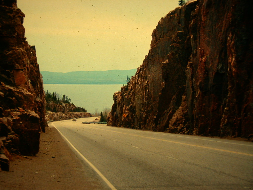
Highway 17 as it runs between Schreiber, Ontario and the cliffs associated with this portion of Lake Superior. (Credit: User P199 at Wiki Commons)

Schreiber is a town of approximately 900 people on the most northerly point on Lake Superior, about 2 and a half hours east of Thunder Bay.

Schreiber is known for being a railroad stop, its having an above-average perecntage of its population from Italian origin, being the home of scrappy Olympic boxer Dominic Filane, and for being the home of northern Ontario’s answer to Dean Martin, the apparently larger-than-life Cosimo Filane and his family.

The town was originally founded as Isbister’s Landing in the 1880s. It served as a railway camp and supply depot where Great Lakes ships could unload cargo for the Canadian Pacific Railways.

In the 1940s, Schreiber was the site of one of four work camps where Japanese-Canadians were interred during WWII. The federal government, which forcibly relocated Japanese families during the war, forced young men out to the Schreiber area to build portions of the TransCanada Highway between Schreiber and Jackfish.

Schreiber, Ontario, highway11.ca

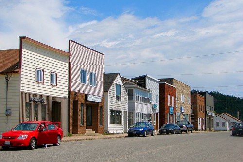
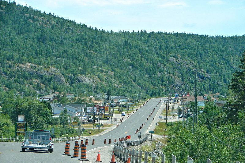
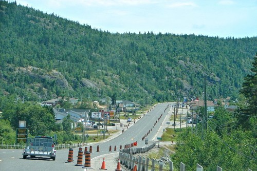
Schreiber, Ontario, in town off Highway 17. (Credit: User P199 at Wiki Commons.)

Interestingly, Schreiber is unique for its exceedingly high Italian population – I read online that at one point, more than half of the town’s residents traced their roots back to a single town in Calabria. One resident immigrated to Canada from southern Italy in 1905, and his letters of successful employment and good fortune with the railway attracted family members, friends, and fellow townsfolk from Siderno, Italy. Today, nearly all remaining citizens of Italian descent can trace their heritage back to that first guy. There’s a short documentary on the town and its Italian origins available on the web.

Schreiber is nestled between majestic Lake Superior and the rocky rises of the Canadian Shield. Even driving past on Highway 17, Schreiber’s surroundings are particularly scenic (in my opinion.)

Tourism opportunities include hiking, snowmobiling, trainspotting, and swimming at the local beach on Lake Superior. There’s a Junior A hockey team called the Schreiber Diesels. Schreiber also hosts some community festivals: Heritage Days in July, Superior Classiscs Drag Racing in August, and the Peel Off Carnival in February.

Schreiber ontairo beach lake superior

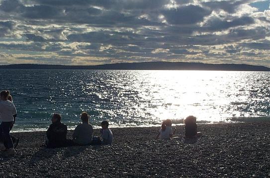
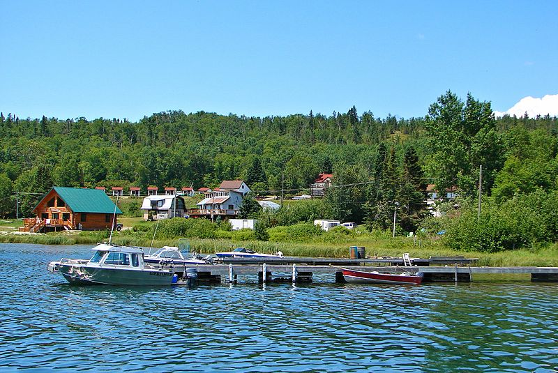
Lake Superior beach at Schreiber

In terms of services, Schreiber has a gas stations, a foodmart, four churches, a boxing gym, and a library, among the many other general services you would find in a small town. I’m not sure what kind of fast food is available, but there is a KFC Express in town. Diners include the Voyageur Restaurant, Villa Bianca, Rosie and Josie’s Restaurant, and Jimmy Shell’s Chip Stand. There are six motels in town, two of which are operated by the family of decorated Canadian boxer Domenic Filane.  Click here for an old pre-Olympic TV profile of Domenic Filane.  (Pronounced fill-ane?  Wow Italian last names sure lose their zip when they get anglicized.)

Up for some entertainment? Well, you’re in luck. You can do no worse than stopping in at Filane’s Entertainment Centre and Fallen Rock Motel to hear to sweet voice of local crooner Cosimo Filane. Cosimo is not only a musician but also an author (a book on minor hockey titled You Can’t Win Them All – Don Cherry says he found it “highly entertaining…I really enjoyed the book. Tells behind the scenes of coaching minor hockey. Blue enjoyed it too.” I had always pegged Blue as an avid reader…), and runs a family-based business that supplies baby needs and sportswear and gasoline and spring water and embroidery and hockey camps and food and dining and accommodations and entertainment and music and boxing lessons and a youtube channel.

It seems he has five albums of song from the great American song book. It’s almost as if his album titles aptly mirror stages in his career – from Small Town Boy they progress through This is It!; then Love Me the Way That I Am; then I’m Gonna Try it Again!; to Forget About It.

Five albums and a star in northern Ontario, Cosimo Filane rocks Schreiber and the north

I got this from Filane’s multi-faceted website and I had to post this here.  Why?  Well, I’m part Italian. And I love northern Ontario. So this makes my head want to explode in joy and pride and awesomeness. It just doesn’t get more northern Ontario Italian than this.  Honestly, I’m impressed.  Good for him.  (And because Cosimo in his younger days looks like my old boss, who still scared the **** out of me.)

Can’t make it to Schreiber? Then you need not worry, Cosimo is a 21st century songsmith with albums available online, care of the Filane’s link at the top of this page. Heck, take a listen to one of his tracks right now — click here for streaming audio.

In all seriousness, it’s pretty impressive that Schreiber’s Filanes have been so successful.  Just another cool story from a northern Ontario town.

Rossport

Rossport is a little hamlet of 200 people nestled between Lake Superior and the Transcanada Highway 17.

Rossport, Ontario on Highway 17 highway11.ca

Cutesy and quaint Rossport offers great Lake Superior access. (Credit: User P199 at Wiki Commons.)

While it started out as small settlement known as McKay’s Bay, like many of the other towns on this stretch of Highway 17, Rossport was truly built for the railway and named after an engineer that helped build the CPR. The town became an important fishing centre after the railway arrived in 1885, and was even served by a luxury steam liner which sank nearby in 1911.

Today Rossport is a small community which grows in the summer with cottagers and outdoorists. There is camping in Rainbow Falls Provincial Park, which also has hiking trails, a waterfront boardwalk, and access to both Whitesand Lake and Lake Superior. Interpretive programs are available on Saturdays and Sundays in the summer at the Park.

Highway 17 near Rossport

No, it’s this photo has not been Instagram-ed, this is Highway 17 near Rossport long before I ever traveled this stretch of the Highway

The Rossport Inn (click here for reviews) is the highlight of the town – originally built in the 1880s to serve the railway, today the inn serves meals and acts as a bed and breakfast. I’ve read about it online and in print, so it looks like it is worth visiting if you’re passing through.
There is talk of creating a Lake Superior Marine National Park, which would encompass parts of the Rossport Shoreline.

I didn’t have a chance to stop in Rossport so please feel free to send photos or add to this.  My email is info (at) highway11 (dot) ca