Pic Mobert: North / South

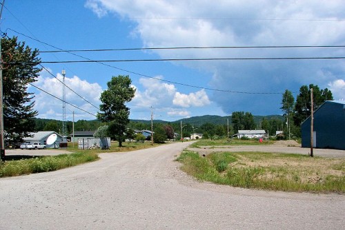
Pic Mobert North and Pic Mobert South are two First Nations communities approximately 25 minutes west of White River.

There are actually two separate communities within the Pic Mobert First Nation – Pic Mobert North and Pic Mobert South. Approximately 80 kilometres east of Marathon, the two communities have a population of about 400. I didn’t venture in since it’s off the main road and I still had hours of driving to go.

According the band’s website, the traditional name of the community is Netamisakoming, which in Ojibway describes the location of the settlement as being on the first lake past the big lake. The settlement was then named Montizambert when it served the CPR, and was shortened to Mobert in use since the 1970s. The towns are on White Lake, into which the Pic River flows, and used to be part of the Pic Heron Bay Band.

Mobert is a small community with the essentials, including gas, a health clinic, a rink, and police.

Pic Mobert hosts their annual pow-wow on the last weekend in July.

I did not venture into town so if you have any further information or any pictures, please help me add to this.  Email me at info (at) highway11 (dot) ca.
Pic River

Home of the Objibways of Pic River First Nation, Pic River is a small community of about 400 people southeast of Marathon.  You’ll have to detour south on road 627 off the TransCanada.

Apparently, the mouth of the Pic River was a trading spots for years before European arrival as it offered access to northern lands and a canoe route to James Bay. The halfway point for canoers travelling the north shore of Lake Superior, “the Pic” first appeared on European maps in the mid-seventeenth century (according to Wikipedia). First Nations began to trade furs with the French in the late 1770s, prompting a French trader to set up a permanent post there by 1792. The Hudson’s Bay Company operated the post from 1821 until encroaching settlement let to its relocation in 1888. In 1914 the Pic became a treaty reserve of its traditional inhabitants, the Ojibways of Pic River.

Pic River used to be a railway town, but with the trains diminishing in importance, forestry and hydro are the town’s mainstays.  According to Wikipedia, the town is known for pioneering “run of the river” hydroelectric developments, which harness natural energy potential without fully damming the river. In and around Pic River, three generating stations feed enough hydro into the Ontario grid to power 30 000 homes.
Pic River can serve as an access point to Pukaskwa National Park. The town also had a number of unique sandy dunes where the Little Pic River reaches Lake Superior. Pic River hosts their annual pow-wow July 12-14.

I did not venture off Highway 17 (I was in a rush and just how long this detour was really started to hit me after Marathon) so if you want to add to this page, please let me know by emailing me.  My address is info (at) highway11 (dot) ca.

Pays Plat

The Pays Plat First Nation is right in between Cavers and Rossport on Highway 11.  The community is nestled under some cliffs on the north side of the Highway and is easily accessible without much of a detour. A guy named Alexander McKay set up a fur trading post here in the 1860s. The place was named by the French, as it was the flat between two mountains (according to Wikipedia.)

The gas bar is open early and has gas, snacks, and drinks but no diner.  There is some beading for sale made by members of the First Nation.

Pays Plat First Nation, highway 11 ontario

Pays Plat in off Highway 17. (Credit: User P199 at Wiki Commons.)

I stopped in Pay Plat at 5 am to get some orange juice. Being 5 am I promptly paid for my juice and proceeded to leave it at the counter and drive away to Timmins without it, not noticing until I hit White River that I was juiceless.

I wasn’t in Pays Plat long enough to take any photos or get any more info, so if you have anything to add please send it to info (at) highway11 (dot) ca.