Hornepayne

Horneypayne three bears highway11.ca

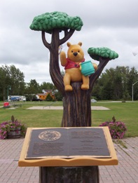
Hornepayne is home to three bears, as compared to White River‘s one

Hornepayne was founded in 1928.  The town sign doesn’t announce the population.  I don’t think it can be more than 500, although everything I’ve read since my visit says that it is closer to 1000.  It is about an hour and a half southwest of Hearst on Highway 631.

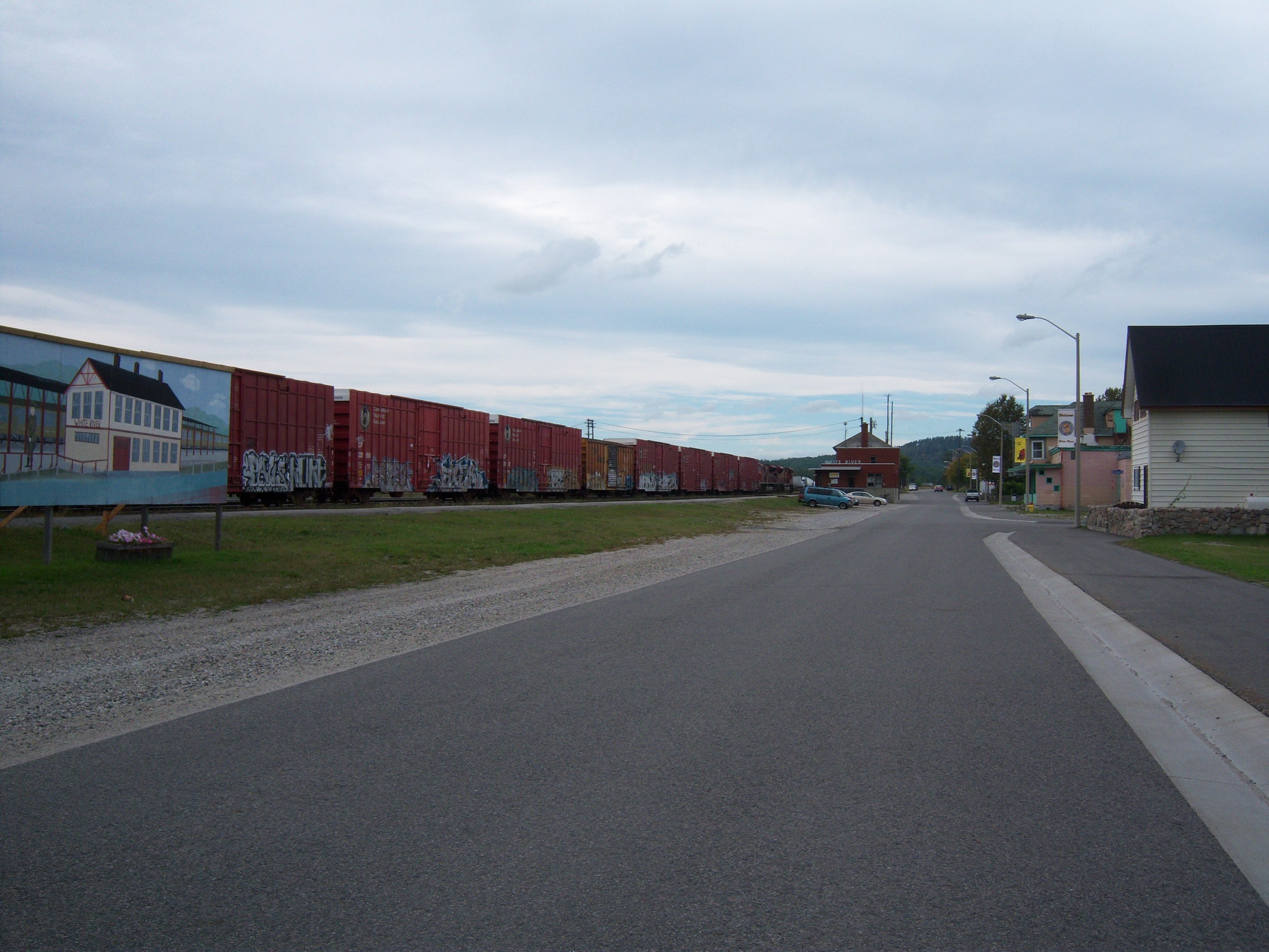
“Home of the three bears”, Hornepayne is a railway town that’s seems to be in a bit of decline now that the railway isn’t so important.  Hornepayne proudly boasts having one of the last indoor roundhouses in the world.  Via trains still stop here.

For food, there is the Packsack Deli in an old barn across from the train tracks (turn left at the three bears), as well as Virginia’s Diner which opens at 6 AM for breakfast.  There’s also what they call a mall with an LCBO, a Northern Store, Craig’s Bar, and a sign advertising “Bars, Rooms, Food” so I assume there is some kind of motel inside.  For shopping, there’s Cindy’s This and That and the Passtime General Store.

Hornepayne highway 631 highway11.ca

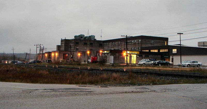
Hornepayne used to have a little mall, but it closed in 2011 after 29 years.  Sad.  (Photo credit: P199 from Wiki Commons)


Hornepayne, Ontario mural highway11.ca

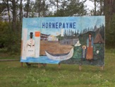
In the wilderness for the wilderness; Hornepayne, Ontario mural

I don’t know how much there is to do, although there is a snowmobiling club in the winter, and, of course hunting and fishing nearby.

And I can’t comment much more than that. Hornepayne is pretty out of the way, so I’ve only been through it once. And that time was at 7AM on a stat holiday so it was pretty quiet.  It is one of those visits where, in hindsight, I can’t believe I was willing to be so conspicuous as to take random photos of random things in a town so small and out of the way.  I guess I was gutsy in the summer of 2006.

If you’re stopping in Hornepayne to use a washroom, use the newer gas station south of the town.  The Esso north of town is cramped, and there are few spots to safely pull over your car on the road north of town if the wilderness arouses the call of nature while you’re on your way to Hearst.

Hornepayne highway11.ca

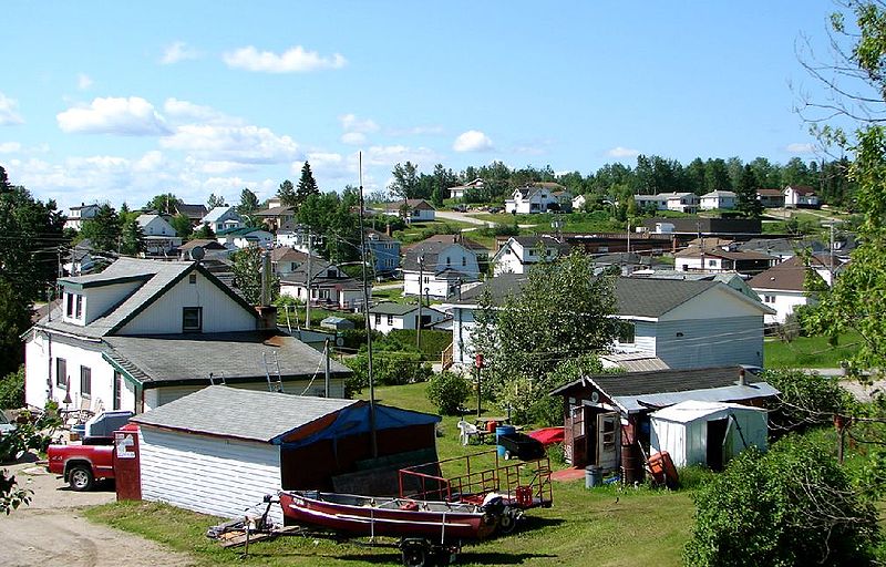
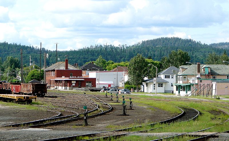
In the right light, Hornepayne can be kinda cute (Photo credit: P199 from Wiki Commons)

White River

When I arrived in White River I was a little grumpy as I had been driving for ages and I had no idea how long it would take to get to Hearst from there.  So ‘bear’ with me.
So I thought that there were many places that claimed the Pooh but in the end it all began in White River.  Hence the Winnie statue and the annual festival every third weekend in August.

Commemorative statue of Winnie the Pooh in White River

You can’t see it, but when I was here in 2006 someone had pout a cigarette on the top of his left ear.  No joke.

“Where it all began”, the town motto, actually stands for the story of Winnie the Pooh.  White River was the place where Canadian Armed Forces lieutenant Harry Colbourne bought a black bear cub from a hunter.  Being from Winnipeg, he named it Winnie, after his hometown.  To fast forward from there, he eventually went to London, the bear ended up in a zoo, some kid A.A. Milne was observing saw it, the kid liked it, the kid said the word “poo” after it, the bear got anthropomorphized and it became a huge Disney hit. OK, so I missed some steps along the way but you get the picture.

The sign when you enter White River states a population of 1000.  Any town that admits to having 1000 people probably has fewer people, because no town anywhere ever rounds down population-wise (unless you’re trying to sneak under the population threshold that means you have to have your own municipal police force instead of the OPP.  Only then it’s acceptable for northern Ontario towns to round down.)

White River, Ontario forest fire warning

Well this kills the mood as you enter White River. (Photo credit: Patrick)

Despite only being connected to the provincial road system in 1961, there are a whole line of truckstops on the highway providing food and gas.  It was in White River that I finally caved in and tried Robin’s Doughnuts.  But I didn’t get a doughnut. I’d had enough along the way. I decided to be original…I got a muffin. And it was fantastic.  Why doesn’t Tim Horton’s have an oatmeal chocolate chip muffin yet?

On the highway there’s also a motel, and for those looking for more than a snack Tom’s Family Restaurant promises friendly service. And, if you want to venture a bit off the main road, you can enter a contest to win a free house in Manitouwadge, according to a sign about 30 kilometres west of town. I’ve only been once, but I liked White River. White River has a slightly run-down charm that I really like in small towns. The fact that a town like this has survived this long is really impressive, in my opinion.

Train station in White River, Ontario highway11.ca

Train station in White River, Ontario.  (Photo credit: Patrick)

What was also weird is that to the right of the Pooh statue, there’s a “pet relief area.”  They really put aside an area 20 feet from the town’s main tourist attraction for pets to poop?  That’s gross! But handy!  I know they’re dedicated to poo(h) but this is too far!  I have never seen a pet relief area in my life.  What dog wants to wade into those long grasses?  What surprises will their paws find?  Hmm. I guess White River is “where it all began” for one Pooh, as well as “where it all ends” for the other poo.

White River Pet Relief area highway11.ca

Would you want to risk wading into those tall grasses to take a crap? No, but I know that my dog would probably fine with it.

In White River, well you could visit the giant thermometer (White River has recorded the coldest temperature ever in Canada, winning it the title of “The Coolest Spot in Canada!”), you can cross country ski, visit the railcar behind the Pooh monument, go fishing or fly out to a remote lake.  And of course, there’s a woodpile.

White River also made the news, for the wrong reasons, in 2008 when a man was stabbed on a Greyhound bus just outside of town, after the culprit had been put on the bus by police in Marathon (I believe.)

White River rail lines (Photo credit: P199 from Wiki Commons.)

White River rail lines (Photo credit: P199 from Wiki Commons.)

White River rail cars highway11.ca

Railway siding runs along White River, just outside of downtown.  (Photo credit: Patrick)

Pic Mobert: North / South

Pic Mobert North and Pic Mobert South are two First Nations communities approximately 25 minutes west of White River.

There are actually two separate communities within the Pic Mobert First Nation – Pic Mobert North and Pic Mobert South. Approximately 80 kilometres east of Marathon, the two communities have a population of about 400. I didn’t venture in since it’s off the main road and I still had hours of driving to go.

According the band’s website, the traditional name of the community is Netamisakoming, which in Ojibway describes the location of the settlement as being on the first lake past the big lake. The settlement was then named Montizambert when it served the CPR, and was shortened to Mobert in use since the 1970s. The towns are on White Lake, into which the Pic River flows, and used to be part of the Pic Heron Bay Band.

Mobert is a small community with the essentials, including gas, a health clinic, a rink, and police.

Pic Mobert hosts their annual pow-wow on the last weekend in July.

I did not venture into town so if you have any further information or any pictures, please help me add to this.  Email me at info (at) highway11 (dot) ca.

Hemlo

Hemlo is the site of two current gold mines that support Marathon and the surrounding hamlets.  Another mine used to be up and running, but shut down in 2005.  I read somewhere that you can tour Hemlo Mine for free every day during the summer at 2 PM.

I didn’t take any photos so if you have any, or want to add to this page, please let me know by emailing me.  My address is info (at) highway11 (dot) ca.

Pic River

Home of the Objibways of Pic River First Nation, Pic River is a small community of about 400 people southeast of Marathon.  You’ll have to detour south on road 627 off the TransCanada.

Apparently, the mouth of the Pic River was a trading spots for years before European arrival as it offered access to northern lands and a canoe route to James Bay. The halfway point for canoers travelling the north shore of Lake Superior, “the Pic” first appeared on European maps in the mid-seventeenth century (according to Wikipedia). First Nations began to trade furs with the French in the late 1770s, prompting a French trader to set up a permanent post there by 1792. The Hudson’s Bay Company operated the post from 1821 until encroaching settlement let to its relocation in 1888. In 1914 the Pic became a treaty reserve of its traditional inhabitants, the Ojibways of Pic River.

Pic River used to be a railway town, but with the trains diminishing in importance, forestry and hydro are the town’s mainstays.  According to Wikipedia, the town is known for pioneering “run of the river” hydroelectric developments, which harness natural energy potential without fully damming the river. In and around Pic River, three generating stations feed enough hydro into the Ontario grid to power 30 000 homes.
Pic River can serve as an access point to Pukaskwa National Park. The town also had a number of unique sandy dunes where the Little Pic River reaches Lake Superior. Pic River hosts their annual pow-wow July 12-14.

I did not venture off Highway 17 (I was in a rush and just how long this detour was really started to hit me after Marathon) so if you want to add to this page, please let me know by emailing me.  My address is info (at) highway11 (dot) ca.

Heron Bay

Heron Bay is a small community southeast of Marathon.  You’ll have to detour south on road 627 off the TransCanada, but it is only a ten minute drive.

I didn’t venture onto 627 – it was raining and I had been driving for hours and had to get to Timmins by nightfall.  Therefore, please send me any info or pictures you might have.  Email me at info (at) highway11 (dot) ca.

Marathon

Marathon is a town about 5 minutes south of Highway 17.  Originally named Peninsula (having to rename half the country, I guess the CPR was running out of names), Marathon was founded as a railroad town and once had a population of up to 40 000, almost all of which (according to Wikipedia) were men. The highway around Marathon isn’t particularly pretty.  Glimpses of Lake Superior ended around Terrace Bay. From here-on in, it is rocks and trees my friends.

Driving into Marathon you’ll see signs that warn you about forest fires, advise you of the town’s shopping amenities, and most importantly you’ll find out that Marathon is the home of Kris Wirtz, the male skater in the pair of Kristy Sargeant and Kris Wirtz which won a number of medals at the national level in pairs skating and competed at the Olympics and that I always get mixed up with Paul Martini.

Marathon billboard Kris Wirtz Ontario highway11.ca

When you’re famous in northern Ontario, you get a full fledged billboard outside of your hometown

Marathon is no disappointment in the awesome northern slogan race. “Built on Paper, Laced with Gold” is the latest phrase designed to capture the imagination, while “Marathon – Superior in the Long Run” is no slouch either.

Today Marathon is a town of about 3500 supported by a pulp and paper mill and two gold mines at Hemlo, thirty kilometers east on Highway 11.  Marathon is just north of Pukaskwa Park.  Marathon is one of the larger towns on the north shore of Lake Superior.  Marathon has a bit of a francophone community too.

Marathon is known for its pretty and geologically-unique pebble beach which is a nice spot for a picnic.  There is golf, fishing, swimming, camping and hunting nearby.  Lakeview Manor is a really nice bed and breakfast, while the local Travelodge looks pretty nice too.  It also serves at the gateway Pukaskwa National Park for most travelers.   As for other tourist things, you swim, picnic, fish, and hike.
With 3500 people Marathon has a fair amount of amenities, including a few motels, some restaurants, and a little mall with a Zellers.  There is gas both in town and just outside of town on Highway 17.  I saw the largest number of hitchhikers in Marathon – I counted a total of four in and around the rest-stops on the Highway.

Marathon - highway 17 highway 11 ontario

Highway 17 somewhere within 50 km of Marathon

There are diners and gas stations on Highway 17 just outside of town. If you really are short on time you can get food, drink, and gas on the main highway. (Marathon is not far off the highway.  For whatever reason, I remember driving maybe 15 minutes from the highway into town which has been disproven by submitted comments.  I must have been driving for too long, because Marathon is apparently only 4 km from the highway! So it’s not a huge hike or anything…so just, stop in.)

I didn’t take any photos so if you have any, or want to add to this page, please let me know by emailing me.  I’ve only been here once, when I turned into Marathon for some breakfast.  At the time, all I found open was a brand-new A&W which was apparently hosting a number of bikers who were grumbling about how far they had to come off the highway just to get some breakfast. (They must have been driving for too long too since it’s only a few kms from the highway.) My address is info (at) highway11 (dot) ca.

Jackfish

Jackfish is one of the many ghost towns nestled in calm obscurity in northern Ontario.

A former railway stop, Jackfish used to be a small rail depot close to Highway 17 and the north shore of Lake Superior between Terrace Bay and Marathon. The town, founded in 1881, was supported by rail, fishing, forestry, quarrying, and a noteworthy hotel that housed up to 300 men until its abandonment in 1961.

Jackfish, Ontario in 1906. Highway 17 highway11.ca

Jackfish, Ontario in 1906. Now abandoned.

Jackfish was settled because it had an excellent harbour, allowing big ships to unload coal on-site for use by the railway. But the decline of steam technology led to the eventual decline of the town, which was left for good in 1961 when a papermill was built in nearby Marathon.

The CPR demolished a lot of the leftover buildings, including the church, the school, and the rail depot.  The local hotel burned down however there are some buildings standing in Jackfish that you can go see.

I didn’t take any photos so if you have any, or want to add to this page, please let me know by emailing me.  My address is info (at) highway11 (dot) ca.

Noslo

Noslo is the place where the last spike was driven in the Montreal-to-Winnipeg portion of the CPR — the Last Spike at Noslo. Click here for a commemorative photograph of the event.

The first of the last spikes, Noslo was the point where the original thrust of the CPR (from Montreal to Thunder Bay) was finished on May 16, 1885, and the line was used to send troops to Manitoba to “deal with” Louis Riel soon after.

Noslo Lastspike highway 17

The last spike between Winnipeg and Montréal, photo from okthepk.ca

Today, there is a monument marking the place and the event. You’ll have to head off Highway 17 to reach it.