Dymond

One tourist guide I saw promotes Dymond as “the jewel of Temiskaming”.  While I think Earlton gives them a serious run for their money in the “jewel” department, Dymond is a nice little township of farms, big box stores, and fast food restaurants, where English and French are both spoken approximately equally.

Ms. Holstein, Queen of Dymond on Highway 11

Ms. Holstein, Queen of Dymond

Despite its southern Ontario feel, Dymond is a northern Ontario town and therefore has to have “some big weird thing”.  That would be Ms. Claybelt the Oversize Holstein, as well as the model Mack Truck at Gilli’s Truckstop, both on the main Highway 11.  (That is not me in the photo – my camera conked out in North Bay and didn’t get charged until Kirkland Lake so I had to steal this photo from the town’s website.)

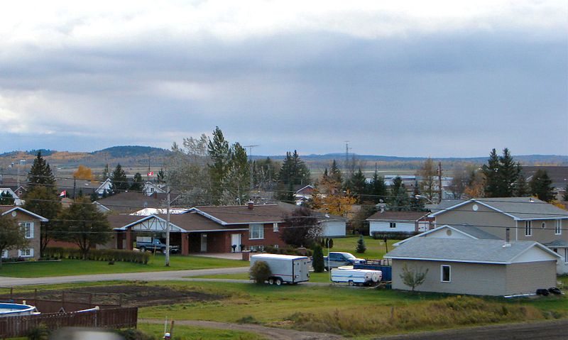
I thought that Dymond was in the Tri Towns but really it’s not, as the name refers to Haileybury, New Liskeard, and Cobalt.  Dymond was forced to merge with New Liskeard and Haileybury in the 1990s to form the municipality of Temiskaming Shores.  It is technically the oldest of the three townships, as it was founded in 1901.  Dymond has relied on its agricultural base to withstand the boom-bust economic of northern Ontario, and to this day retains a distinctly agricultural feel…that is, once you get past the strip malls.

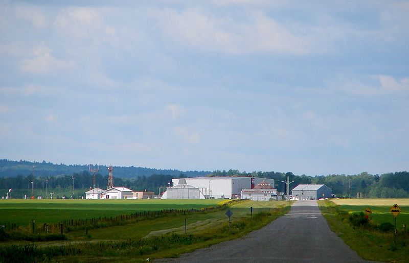
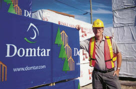
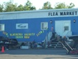
Dymond has recently become a big-box-store, fast food, and motel haven.  Dymond is essentially the last spot to do any real shopping on Highway 11 between North Bay and Thunder Bay without taking a fairly major detour off Highway 11 into Timmins.  (I hope this doesn’t draw business away from New Liskeard’s fairly quaint downtown.)  There’s a Walmart, a Zellers, a fairly big Canadian Tire, a new steak restaurant, and a number of different fast food outlets including McDonald’s and the last Harvey’s on the whole of Highway 11.

This is important so let me re-ierate this – if you’re travelling west toward Thunder Bay, Dymond has the last Harvey’s on the whole of Highway 11.
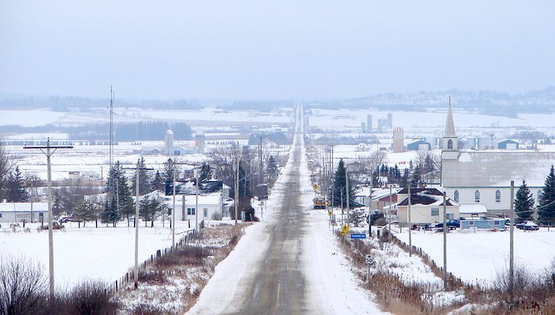
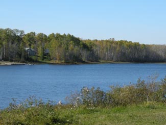
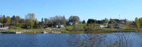
There isn’t a tonne to do in Dymond – most visitors would be likely to skip it for New Liskeard or Haileybury.  However there is a golf course and some hiking available – stop at the tourist building on Highway 11b for more info.  There is also the Little Claybelt Homesteaders Museum, chronicling the rise of agriculture and the founding of the Tri-Town.  On main Highway 11 (west of New Liskeard) there is a little lookout with a nice view of the Tri-Town.

Thornloe

Thornloe is a largely francophone hamlet on Highway 11 that is famous for cheese.

Thornloe Cheese Factory, Highway 11 OntarioIts cheese is relatively cheap, well made, and is particularly known for its cheddar and hot pepper colby, as well as its curds.  It has been known for people to travel from North Bay, and Timmins, and beyond just for Thornloe cheese.  The Thornloe Cheese Factory is so popular that the Ministry of Transportation gave the factory its own turning lane on Highway 11 for safety’s sake.

2006 protest in Thornloe, OntarioIn July 2006, Parmalat International announced that it was going to shut down the cheese plant.  This started a storm of anti-Parmalat sentiment in the area, and residents (battle-ready from Adams Mine and Bennett Incinerator fights) were mobilizing quickly. I was in the area at that time – it was a really big deal. I’ve been back since, and it seems they’ve done some renovations. There is a new sign, the cheese has neat new Thornloe-specific packaging – it’s all pretty well done. The cheese was good too – my partner and I devoured some curds, making sure to save some for the next day.

Twenty kilometres north of New Liskeard, Thornloe is a tiny quiet strip of farms with a population of about 120.  Established in 1916, Thornloe is about five minutes west of Highway 11 and always smells like a fall fair.  There is a gas station right on the highway.  There is a playground, an outdoor ice rink, and two churches in town (one of which is for sale.)  There is a pioneer cemetery that I didn’t have a chance to stop at.

Thornloe Cheese, Highway 11

This is where the magic happens!!!

Thornloe is cute, but there’s really nothing to see other than the nice green hills and the acres and acres of farms.  I saw a wonderful orange sunset in Thornloe.  The Temiskaming Farm Belt may not be exciting, but if you like rural farm country then it sure is beautiful.

Thornloe Ontario Highway11.ca

Maybe I’m nuts, but places like this just make me feel all warm and cozy.  Before I visited Temiskaming, I never expected scenes like this in northern Ontario (Credit: P199 at Wiki Commons)

Note that the Thornloe Cheese Factory is often closed after six pm, depending on the season.

Church for sale, Thornloe, Ontario, Highway 11

Church in Thornloe was for sale when I was there in 2006

Earlton

You can tell you’re in farm country in Earlton – 1) it has a John Deere dealership, and 2) the Earlton Country Store isn’t a craft outlet, it’s a real country store complete with seed, fertilizers, and farm tools.

Earlton hosted the International Plowing Match in 2009

Earlton hosted the International Plowing Match in 2009.  (Photo credit: Highgrader Magazine)

Earlton is a francophone farm hamlet of about 800 on Highway 11.  I love Earlton.  It reminds me of southern Ontario.  Upon driving in to Earlton you see the grain, corn, and dairy farms (I think they also grow some potatoes and berries up here too.)  Depending on the direction of the wind, the town sometimes smells like a barn.  But that’s why it is so neat.  Heck, there are cows practically right in the town itself.  Earlton is so cute – I love it.

Cow traffic jam!  Cattle graze near homes in Earlton, Ontario on highway 11

Honestly, these were right in the middle of town

Earlton is kind of the half-way point between North Bay and Cochrane, being about 200 kilometres in between both.  Earlton is about 30 kilometres north of New Liskeard. Earlton is the home of hockey’s true number 99, former Maple Leafs player Wilf Paiement, who recently appeared in a pretty-cheesy-but-not-unfunny Leon’s commercial (“You can make three easy paiements…”)

Earlton used to be well known for the Earlton Zoo – the only place in Ontario north of Toronto to have zebras and other African animals.  However that morphed into the Temiskaming Wildlife Centre, which took care or orphaned or rescued animals from across the north.  Apparently, according to posters below, the Centre is now shut down.

Earlton, Ontario on Highway 11 highway11.ca

(Credit: User P199 at wiki Commons.)

There is also Manitou, the famous bison statue that is (if I am correct) the world’s largest sculpture of a bison or buffalo.  If you get up close, you’ll see that it is made of everything from sheet metal to fibreglass to nuts and bolts (as hair.)  It is even anatomically correct, which I’m sure leads to many rude photos and pranks.

Earlton, Ontario Highway 11 Bison statue

Earlton’s anatomically correct bison

Earlton hosts a number of festivals.  As a farming town, Earlton hosts a farm fair the weekend after Labour Day.  Every July 15 and 16 Earlton hosts its annual Steam Days, where old steam powered machines are resurrected and displayed.  There is also the yearly Temiskaming Drag n’ Fly drag racing event held at the airport. Earlton was also the home to the 2009 International Plowing Match – the furthest north the IPM has ever been held. (Scroll down for a few IPM photos – thanks to Highgrader Magazine for the International Plowing Match photos.)

Earlton, Ontario 2006 protest

Local businesses and residents fought the closure of the Thornloe Cheese Factory, and won

In terms of services, Earlton has a caisse, a Scotiabank and Chartrand’s Grocery.  Hotel LaSalle (“the friendly place”) has takeout and dine-in food.  There are also two chip stands, a little bowling alley (it is northern Ontario still!) and a motel.  There is a baseball diamond and recreation centre at the west end of town.  There is gas just off Highway 11, and Real’s Barbershop is in town should you need a haircut on your roadtrip.

Earlton is definitely worth a stop, especially on a summer evening to watch the sun set over the local farms.  You’ll swear you’re in Perth County or Essex County, not Temiskaming.

Earlton, Ontario rural airport, highway11.ca

Earlton’s little airport, surrounded by countryside. (Credit: User P199 at Wiki Commons.)

Earlton, Ontario 2009 IPM Highway 11

2009 International Plowing Match. (Photo credit: Highgrader Magazine.)

Kenabeek

We’re detouring off Highway 11 for a bit, this time onto Highway 65.

Kenabeek is a cluster of houses 20 kilometres west of Thornloe on Highway 65 in the Temiskaming Clay Belt.
Kenabeek, Ontario off Highway 11Kenabeek is very very small.

There’s not much of a town, at least on the highway itself, although I assume that there are more houses and farms as you venture off onto the area’s dirt country roads.

As for services, it’s really all about the Kenabeek General Store, which has gas, food, and an LCBO outlet. However, another site I was on stated that the only gas on Highway 65 is in Elk Lake and Matachewan. A few months ago, someone posted on this site that diesel and gas are avialable at the Kenebeek General Store, but I accidentally lost the comments when I was changing some site details. I did see pumps, but didn’t stop in when I explored the area last. There is also Twin Bear Camp Resort offers hunting, fishing, camping, cottaging, canoeing, and even dog sledding nearby
Kenabeek hosts its annual fall fair, the Kenabeek Fun Fair, the last weekend in August.Kenabeek, Ontario

I’ve been told that there is a small conservative Mennonite community, which farms in the Kenabeek area. In order to sustain the community, it has not been unheard of for young men and women to marry into the community, traveling from more established Mennonite centres such as Wellington County in Southern Ontario, and even from Pennsylvania.

I’ve only visited Kenabeek once (in fall 2008), so maybe you can help fill me in on the community. Email me to add to this page at info (at) highway11 (dot) ca.

Oh, and if you can fill me in, how do you really pronounce Kenabeek? Every time it’s come up in coversation with me, I’ve heard (and used) “Ken-ah-beek.” On the Englehart and New Liskeard radio stations, I heard it pronounced “Ken-ah-beck.” If you know, let me know.

Elk Lake

Elk Lake is a community of about 800 people at the junction of Highways 65 and 560, on the banks of the Montreal River.  Equally anglophone and francophone, Elk Lake sits at the western edge of the Temiskaming Clay Belt and is primarily a forestry town. (Scroll down to the bottom of the page for more photos.)

Elk Lake, Highway 66, Ontario

Random photo at the Domtar mill in Elk Lake, with random worker from a random website

According to Museums North, remnants of pictographs on rocks show that the Elk Lake area was along trade routes used by the Cree and Anishnabai people. These routes were already well established prior to the establishment of the Fur Trade of the mid 1600s. Remnants of an Aboriginal graveyard that can be seen on the south side of town indicate that Elk Lake was settled long before Europeans arrived. The local Ojibway peoples named the lake after the huge herds of elk that roamed the area at this time.

Elk Lake church

Church in Elk Lake

Although forestry had been going on in the area since the mid 1800s, Elk Lake didn’t become settled by Europeans until silver was discovered in the area in 1906. The town was set up in 1909, road connections to Elk Lake were built (previously, you could only get there by steamboats on the Montreal River, from Latchford) and eventually there were 30 active mines in the area, and the town peaked with a population of 10 000. A line of the Temiskaming and Northern Ontario Railway was built to the town in 1913.

Elk Lake Today

Today, Elk Lake is home to about 400 people. The town straddles the shore of the Montreal River, which makes for some beautiful views, especially when the sun shines off the shimmering water. I was pretty impressed with how clean and tidy Elk Lake was – the village could make for a nice getaway if you’re willing to go off the beaten path in search of quiet, solitude, and relaxation. It’s also not too far from Long Lake, which has even more hunting, fishing, boating, and swimming opportunities.

Elk Lake River

Elk Lake River

Elk Lake’s major employer is the Elk Lake Planing Mill, owned by forest industry giant Domtar. You can call 678-2210 to go for tours in the plant. Mining has all but disappeared, although high metals prices have re-ignited exploration in the area. Being at the western edge of the Temiskaming Claybelt, there is also some agriculture in and around Elk Lake, largely beef and horse farms.

Bison farm, Elk Lake

The fence doesn’t inspire…

Elk Lake, surprising to some, has gotten a bit of a reputation for being a community with a green outlook. The town is known as a proponent of sustainable forestry. It is also the site of the Elk Lake Eco Resource Centre, a conference/banquet/retreat/hotel facility which was built with local economic and environmental sustainability in mind. Citizens of Elk Lake were also instrumental in the fight against Adams Mine, when the Ontario government was proposing to use the former Kirkland Lake mine site as a dumping ground for Toronto’s garbage.Farm country, Elk Lake, northern Ontario

As for services, I’ve only been to Elk Lake once so I can’t comment too much. In addition to the Eco Centre, there’s a chip stand (year-round!), an LCBO, gas, some motels, a small grocery store and an outfitters. I know there are a number of tourist camps, lodges, and cabin rental places in the area that offer outdoor activities such as hunting, fishing, snowshoeing, canoeing, and camping. Elk Lake is also home to a cross-country ski club that maintains about 15 kilometres of trails. The municipal campground has a boat launch, a beach, and hiking along the Bear Creek Rapids. The town is also close to the northernmost point of Makobe-Greys River Provincial Park.
In 2009, the Township of James (in which Elk Lake is situated) will celebrate their 100th Anniversary.

WOODPiLE! Elk Lake

Finally! It’s been so long since I’ve seen a woodpile!

Hayden – Elk Lake Serenade

Elk Lake, I think, is also the inspiration for the title of Hayden’s CD Elk Lake Serenade, which I can say (and can many others) is probably one of his best albums. (Hayden is a Toronto-based folk-rock musician, who was heralded as the next Beatles in the mid 1990s when he released a home-made tape recorded in his bedroom. Evidently, that level of fame never panned out, however, he is still a fantastic musician nonetheless.)Elk Lake River

Email me to add to this page at info (at) highway11 (dot) ca, or comment below

Charlton and Dack

Charlton is a small anglophone village in Dack Township in the northern part of the Temiskaming Clay Belt, near Englehart.  Charlton is not on Highway 11, instead just west of it on Highway 547 by about five minutes.Charlton, ONtario jsut west of Highway 11The surrounding area is largely rural and agricultural, made up of beef and dairy farms. When the whole township is taken into account, the population of Charlton and Dack is about 600.

Charlton is a pretty tiny village, but it’s peaceful, quiet, and well-kept.
I’ve only been through Charlton once. There is a general store, a gas station, a United Church, the Timberline and Moose Haven Lodges for accomodations and activities, and the D&R Variety and the Burger Barn for food. There is also a local Legion, and, of course, some houses. There is also a nice little river and waterfall, with a commemorative plaque about the Charlton Powerhouse. There is also a nice waterfront park with boat luanch access, a playground, and a little beach.Charlton, in northern Ontario

I did some searching on Charlton and Dack Township history, but couldn’t find much. So I don’t have too much to say.

Oddly enough, I also found an online listing for the Charlton Medical Marijuana Club.

You can see some more photos here and here.  Email me to add to this page at info (at) highway11 (dot) ca.

Charlton River, northern ontario

Charlton River

Englehart

Englehart is an anglophone town of 1500 on Highway 11.  Right at the north end of the Temiskaming claybelt, you can tell that it’s near the end of farm country as there are farms all around yet the major employer is the Grant Forest Products Mill, which dominates the town from Highway 11.  Englehart is about 30 minutes from Kirkland Lake.

Englehart Grant Mill, highway 11 ontario

I had my own photo of the mill but User P199’s at Wiki commons is so much better.  This view is facing south on Ontario Highway 11.

The town was founded in 1908 and named after Jake Englehart, an American who moved to Canada at age 19 in 1860s to setup oil refineries in southern Ontario.  After achieving success in the Petrolia area, he was appointed by the Province to run the ONTC rail line in 1905.  His management brought stability and expansion to the provincial agency.  But most importantly, Englehart helped rebuild the region after the devastating fires of 1911.  He even spent his own money to feed those left homeless by the fires – he posted a sign at one of his rail stations saying that no-one need pass the station feeling hungry. In its heyday, Englehart even had a small Jewish population which helped settle immigrants into farming communities like Krugerdorf, and later provide work when these homesteads were abandoned.

Englehart has a cute, quiet downtown.  It is a town of well kept houses, manicured lawns, and cute little parkettes.  The old Temiskaming Locomotive 701 has been restored and displayed downtown – it was the last steam engine to prowl the ONTC tracks.Small-town American 1950s downtown  right in Englehart, Ontario(A note to travellers – on my first trip to Englehart we stopped at the local library to use the washroom.  That was an uncomfy decision.  It was completely awkward – don’t forget that in a town like that, everyone knows you’re a stranger and it was completely conspicuous to walk in, pee, and walk out without so much as lifting a Chatelaine off the shelves.  I mean, don’t get me wrong, no one said anything, but I just felt so conspicuous. Go at one of the gas stations on Highway 11 instead.)

Englehart has a really nice little music store called Musical Strings n’ Things that recently moved into a larger location across form the town hall.  It’s worth a visit, especially if you want to try your hand at the banjitar.  Service is great.  I’ve stopped in three times, and received better service than in any music shop I’ve ever dropped into – and I’ve never purchased a thing. And they know I’m not going to buy anything.  I’m obviously from away, and it’s unlikely that I’m going stop in Englehart for a pee, a pop, and a mandolin.  But each time, the shopkeeper tells me they’re just filling in for the owner who has just stepped out, but I’m welcome to play, try, or ogle at anything in the store.

Music store, Englehart, Ontario Highway 11

The North’s Best Music Store, as decided by … me.

A former housemate named Tara had family from the region, and she informed me of the local specialty – the Island Burger. Apparently, the hamburger is served at a Cousin’s Restaurant and is named the “Island Burger” as the hamburger is essentially an island in a sea of hot gravy and cheese curds. Sounds fantastic.

For food and drink there is the Olde Town Inn and Restaurant, a Subway, and a Coffee Time (all on Highway 11.)  In town, there is Cousin’s for burgers or pizza (although I’m not totally sure if it is still open), Kim’s Pizza Plus, and a local diner, the Sister’s Cafe, which serves breakfast, lunch, and supper platters. My partner and I stopped in at Sister’s for a weekday lunch. Being not from Englehart, and more importantly being under the age of 65, we got some pretty surprised looks from the existing patrons and even the staff, but we survived, everyone was friendly, service was great and so was lunch.

There’s a new drop-in café catering to teens on 8th Avenue, the Oasis Teen Café.  There is gas on Highway 11 and a reasonable-sized Valumart in town for those who need groceries.  Englehart also has a full blown LCBO. In terms of shopping there is Memory Lane Antiques or Treasure Chest Antiques on Highway 11, as well as Marion’s Emporium and Christmas store in town.  There’s also a little home-run spa in town.

Englehart train, highway 11

First Cochrane, next Iroquois Falls, now Englehart’s turn with the old locos

Englehart has a few tourist activities – most notably the historical museum.  There are also walking trails, one of which goes to nearby Kap-Kig-Iwan Provincial Park and its picture perfect waterfalls.  Every June the town hosts the annual Black Fly Festival, and the weekend after Labour Day means it’s fall fair time.

Of course, with Grant Forest Products in town, Englehart also has a fairly substantial woodpile.

Thanks to Justin and Tara for the Englehart info.  Check out some more photos here, here and here.

Ramore

Ramore is a quiet community about one minute east of Highway 11 on road 572.  It is 15 kilometres south of Matheson and is made up of three streets (Fergus, Timmins, and one other street I forgot to write down.) Ramore, surprisingly, was the home of two air bases, part of the Mid-Canada and Pinetree Lines.

Ramore, Ontario church off Highway 11

Church at sunset in Ramore

Predominantly francophone, Ramore (and its cousin Holtyre) reminds me a bit of Val Gagné – small, quiet, clean, about 40 houses (probably more) – except with more agriculture.  The area is surrounded by farms – some fallow, others still producing – which gives the area a relaxed, summer feel and some pretty fields and old barns. (And for some reason, there’s a house with a Canada flag and a Barbados flag.)

Ramore was a railway town, forestry centre, and agricultural area, but in 1950, the Americans came to town and built a Pinetree Line radar station – not by accident. The mountain the radar site was located is a high-point in the region. The mountain next to it on the west side of the highway is called Kempis Mountain. Both are prehistoric volcanoes that are long dead. Near the Radar Base, is an airstrip – not widely known. Most still think that the military built it, but that is not so. The airfield was built in the 1930’s as a make-work program during the Great Depression. It was part of some sort of larger aerial mapping program. The strip was built, but WWII came along. Not sure how much use it really got, until the Air Base was built, nearby.

Ramore church shrine, Highway 11 Ontario

Shrine at the church in Ramore

The Air Base played a large role in the area, both socially and economically, from Kirkland Lake to Matheson. In 1962, the Americans turned the base over to the Canadians. It was part of a deal that resulted due to the cancellation of the famed Avro Arrow Program. Canada would “lease” 66 F-101 Voodoos and take over 12 Pinetree Radar Bases – this included Ramore. Supposedly due to budget cuts and changing technology, the Base was closed in 1974. A similar base at Lowther was dismantled in 1984.
Interestingly, up until the mid-60’s, Kempus Mountain had a small “air base detachment” separate from the Ramore base. This is because, Kempus Mountain was part of the Mid-Canada radar system. Kempus was a relay station for the Mid-Canada line (which was a different line of radar stations than the Pinetree line), which operated generally around the 60th parallel. This is one of the few places in Canada where the Mid-Canada Line and Pinetree Lines met. As the site of two former air bases, one can say, that Ramore had a very strong connection to the Cold War. Today, one of the bases lay abandoned and some people still explore it, however it is not recommended due to the physical hazards and the potential of running into harmful contaminants.  (Click here for photos of a visit to former base location in 2002.)

South of Ramore on Highway 11 is the Ramore Flea Market.  Albeit small, this is a real flea market, not like the North Cobalt Flea Market.  I haven’t had a chance to look around, but it’s worth a stop since it’s right on Highway 11.
Raymore also hosts a Country and Western Festival every September, complete with concerts, demonstrations, and competitions.  I don’t know if there is a midway.

Ramore Flea Market, Ontario Highway 11

Drove past at least 20 times. Always wished I had stopped by.

Ramore has a church, a baseball diamond, a small library, a caisse, and Bouchard’s Grocery and LCBO outlet, which is more like a convenience store with food.  Just south of the town is Rolly’s Motel and Home Cooked Meals, which has rooms and food but no gas.  There are blueberry stands both north and south of Ramore, as well as a family that sells vegetables from a stall.

Thanks to Dwight for the info and for pointing me towards the photos of the radar base.

For an archive of the 40 comments that were posted to Highway11.ca’s profile of Ramore between 2008 and 2012, please click here.

Holtyre

On the other side of the Black River, Holtyre is ten minutes east of Highway 11 on road 572.  Like its cousin Ramore, Holtyre is a tiny three-street (Euclid, Gleason, Pearl) francophone hamlet.

Holtyre, Ontario farm off highway 11

A farm in Holtyre

Dwight emailed me to tell me that Holtyre was built in the early 1930’s after gold was discovered. The town was named after 2 mines: Hollinger and Macintyre – hence the name Holtyre. The mine had high grade gold which was mined from 1935 to 1988 – over half a century.

Up until the late 70s there were 2 stores, a large hotel, bowling ally, 2 schools (English and French – K to 8) and gas station. There was (and is) a larger school bus business that first started by transporting miners to the Johns Mansville Asbestos mine site between Holtyre and Matheson after WWII – the business evolved from there.

Dwight also emailed to tell this story: supposedly in the mid-70’s the gold mine changed ownership and it was decided to save costs, close the smelter, and truck the raw ore to Timmins for smelting. Sounded logical, and for nearly 20 more years, this is what happened. In order to make room on the property, they decided to simply burn the old smelter building down – after all, it was over 40 years old and well used. The thing is, that inside of the structure had been in place since 1935 and was made of wood. Gold dust from the smelting process had been building in every crevice and crack in the old building. When they burned it down, there was enough pure gold that had melted into clumps on the ground, that when it was collected (as I understand in quite a surprising panic!), the new owners paid for the mine – that day. It was clear profit from then on. Who would have guessed – certainly not the previous owners !

Holtyre, Ontario

Does photography count? Uhm, probably…

I noticed some interesting houses with two level front balconies, kind of like in New Orleans, but less extravagant.  I wanted to take a photo, but Holtyre is so small that I felt oddly conspicuous and didn’t take any photos directly in town. (And hey, on my journeys I’ve been taking photos of everything and anything, so if I feel too out of place, then you know I felt weird!)  I think it was because the community was just so small and was also off the road.  I had no reason to be there, so it felt a bit weird.  So instead, I took some shots of a local farm. The tiny photo doesn’t do it justice…it was such a great summer evening the first time I was in Holtyre.

Holtyre has its own church, a playground, and an inordinate number of school buses.  I think there is a school bus operator in town, but there were also old buses in a few fields and yards, so I wonder what’s up.

I didn’t see any stores in town, but then again I skirted around and didn’t stop too long.  I’m sure there’s a variety store.  I don’t think there is a caisse or a gas station.  There is an abattoir outside of town, if you happen to have any animals that need butchering.

For more info, check out J. Charles Caty’s excellent history of Holtyre or the 25-minute documentary from 1971 on Holtyre that is online – you can watch it here, on Youtube.

Holtyre boys Highway 11

Photo of some cabin builders, maybe late 50s early 60s (posted at the request of a reader)

1966 Holtyre, Ontario public school photo 1-4

December 1966, Holtyre Public School Grades 1-4

HOltyre, Ontario public school photo 1996 5-8

December 1966, Holtyre Public School Grades 5-8


For an archive of the more than 450 comments (yes you read that correctly.  More than four-hundred and fifty!) that were posted to Highway11.ca’s profile of Holtyre between 2008 and 2012, please click here.

Porquis Junction

The hamlet of Porquis Junction is about 10 minutes from Iroquois Falls. Porquis Junction used to be a small agricultural centre, with its own agricultural hall and even a John Deere dealership (Jensen’s Sales and Service) which serviced farms from Iroquois Falls to Matheson up until the early 1990s.

Porquis Junction agricultural hall

Reminder of agricultural days of yore in northern Ontario

As far as I can tell, it is not pronounced Por-kee but Pork-wiss, which to me sounds like a brand of tinned ham.  The town should nominate someone as the official ‘Marquis of Porquis’ every year at the end of the Blues Fest or Ag Festival.  Why?  Because it just sounds cool.

Porquis must be the festival capital of the north as it hosts a number of different celebrations despite its relatively small size.  Known across the north, the Porquis Blues Festival is held on a small covered stage behind the community centre every July.   The town also hosts an Agricultural Fall Fair in August.  In 1986, the town made the news when the Porquis Fun Days festival attracted world-famous wrestler André the Giant, who then proceeded to eat the hamlet out of house and home.Porquis Jucntion blues festivalPorquis is about 10 minutes off Highway 11, on the way to Iroquois Falls.  This was the second time, after Opasatika, that I had been chased by a dog while taking pictures – I guess he was bored. Or just very protective of the Porquis Junction Agricultural Hall.

POrquis Junction Cunigold Mines truck highway11.ca

Old Cunigold Mines Truck, sent in by Linus