Pic River

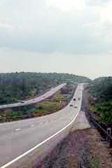
Home of the Objibways of Pic River First Nation, Pic River is a small community of about 400 people southeast of Marathon.  You’ll have to detour south on road 627 off the TransCanada.

Apparently, the mouth of the Pic River was a trading spots for years before European arrival as it offered access to northern lands and a canoe route to James Bay. The halfway point for canoers travelling the north shore of Lake Superior, “the Pic” first appeared on European maps in the mid-seventeenth century (according to Wikipedia). First Nations began to trade furs with the French in the late 1770s, prompting a French trader to set up a permanent post there by 1792. The Hudson’s Bay Company operated the post from 1821 until encroaching settlement let to its relocation in 1888. In 1914 the Pic became a treaty reserve of its traditional inhabitants, the Ojibways of Pic River.

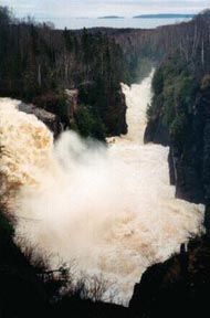
Pic River used to be a railway town, but with the trains diminishing in importance, forestry and hydro are the town’s mainstays.  According to Wikipedia, the town is known for pioneering “run of the river” hydroelectric developments, which harness natural energy potential without fully damming the river. In and around Pic River, three generating stations feed enough hydro into the Ontario grid to power 30 000 homes.
Pic River can serve as an access point to Pukaskwa National Park. The town also had a number of unique sandy dunes where the Little Pic River reaches Lake Superior. Pic River hosts their annual pow-wow July 12-14.

I did not venture off Highway 17 (I was in a rush and just how long this detour was really started to hit me after Marathon) so if you want to add to this page, please let me know by emailing me.  My address is info (at) highway11 (dot) ca.

Marathon

Marathon is a town about 5 minutes south of Highway 17.  Originally named Peninsula (having to rename half the country, I guess the CPR was running out of names), Marathon was founded as a railroad town and once had a population of up to 40 000, almost all of which (according to Wikipedia) were men. The highway around Marathon isn’t particularly pretty.  Glimpses of Lake Superior ended around Terrace Bay. From here-on in, it is rocks and trees my friends.

Driving into Marathon you’ll see signs that warn you about forest fires, advise you of the town’s shopping amenities, and most importantly you’ll find out that Marathon is the home of Kris Wirtz, the male skater in the pair of Kristy Sargeant and Kris Wirtz which won a number of medals at the national level in pairs skating and competed at the Olympics and that I always get mixed up with Paul Martini.

Marathon billboard Kris Wirtz Ontario highway11.ca

When you’re famous in northern Ontario, you get a full fledged billboard outside of your hometown

Marathon is no disappointment in the awesome northern slogan race. “Built on Paper, Laced with Gold” is the latest phrase designed to capture the imagination, while “Marathon – Superior in the Long Run” is no slouch either.

Today Marathon is a town of about 3500 supported by a pulp and paper mill and two gold mines at Hemlo, thirty kilometers east on Highway 11.  Marathon is just north of Pukaskwa Park.  Marathon is one of the larger towns on the north shore of Lake Superior.  Marathon has a bit of a francophone community too.

Marathon is known for its pretty and geologically-unique pebble beach which is a nice spot for a picnic.  There is golf, fishing, swimming, camping and hunting nearby.  Lakeview Manor is a really nice bed and breakfast, while the local Travelodge looks pretty nice too.  It also serves at the gateway Pukaskwa National Park for most travelers.   As for other tourist things, you swim, picnic, fish, and hike.
With 3500 people Marathon has a fair amount of amenities, including a few motels, some restaurants, and a little mall with a Zellers.  There is gas both in town and just outside of town on Highway 17.  I saw the largest number of hitchhikers in Marathon – I counted a total of four in and around the rest-stops on the Highway.

Marathon - highway 17 highway 11 ontario

Highway 17 somewhere within 50 km of Marathon

There are diners and gas stations on Highway 17 just outside of town. If you really are short on time you can get food, drink, and gas on the main highway. (Marathon is not far off the highway.  For whatever reason, I remember driving maybe 15 minutes from the highway into town which has been disproven by submitted comments.  I must have been driving for too long, because Marathon is apparently only 4 km from the highway! So it’s not a huge hike or anything…so just, stop in.)

I didn’t take any photos so if you have any, or want to add to this page, please let me know by emailing me.  I’ve only been here once, when I turned into Marathon for some breakfast.  At the time, all I found open was a brand-new A&W which was apparently hosting a number of bikers who were grumbling about how far they had to come off the highway just to get some breakfast. (They must have been driving for too long too since it’s only a few kms from the highway.) My address is info (at) highway11 (dot) ca.

Terrace Bay

Terrace Bay sunset, highway 17Terrace Bay is a town of 2000 on Highway 17 and the last major town until Marathon.  It is about two hours east of Thunder Bay.  Terrace Bay is named for a number of underwater terraces carved by glacial movement in Lake Superior.

Companies noticed that Terrace Bay was a good place for hydro and paper development, and in the 1940s Kenogami and Aguasabon Rivers were diverted to power a new town built in 1947.

Terrace Bay Highway 17 caribou slate islands

This guy will stare you down if you get too close to his home on the Slate Islands

Terrace Bay is a ‘model town’ like Kapuskasing that was supposed to be a model for future urban development.  Unfortunately for Terrace Bay, its status as a model for the rest of the country was short-lived as it never really grew out of its original plans as a company pulp and paper town.

Terrace Bay seems pretty neat although I did not stop in for a visit.

Slate Island is one of the most interesting features is nearby.  Just outside of Terrace Bay in Lake Superior, Slate Island is uninhabited by humans but habited by its own herd of caribou.  This isolated population comes under much study by naturalists and researchers.  You can visit Slate Island Provincial Park, replete with caribou, and a little lighthouse via an arranged boat tour.

Aguasabon Falls near Terrace Bay, Ontario highway 17 highway 11

Aguasabon Falls near Terrace Bay, Ontario

Aguasabon Falls is also just outside of town, you can visit the roaring waters and the gorge at the local provincial park.  There is a local beach, canoeing, swimming, and fishing in the area.  The town hosts an annual dragfest in August and a Fall Fair in September.  For golfers, there is the Aguasabon Golf Course and for hikers Terrace Bay is the end of the 47 kilometre Voyageur hiking trail that links it to Rossport and Schreiber.

Terrace Bay is sort of a low-to-medium size for a northern Ontario town.  There is the Red Dog inn, the Coach House and Imperial motels, a home hardware, a family food market, a mini Pizza Hut, a few shops, and some gas stations.  Roy’s serve pizza and subs while Wah’s serves Chinese, although I don’t know if it’s true Northern Ontario Chinese Food or not.

I don’t know if there is a mall or not – if not, you can hit Marathon about an hour and a bit to the east.  There is an A&W in town, I’ve read about the Northern Lites diner serving a good breakfast.  It is supposedly located next to the municipal bureau and the local Amethyst Monument.

Terrace Bay is essentially the last pretty coastal town on Highway 17.  After this the highway moves inland and the views subside.  Enjoy towns like Rossport, Schreiber, and Terrace Bay while you can.

Terrace Bay, Ontario lighthouse Highway 17 highway11.ca

Another lighthouse! A bit bigger than Barwick‘s. (Credit: User P199 at Wiki Commons.)

Slate Islands off Terrace Bay

Slate Islands off Terrace Bay

Rossport

Rossport is a little hamlet of 200 people nestled between Lake Superior and the Transcanada Highway 17.

Rossport, Ontario on Highway 17 highway11.ca

Cutesy and quaint Rossport offers great Lake Superior access. (Credit: User P199 at Wiki Commons.)

While it started out as small settlement known as McKay’s Bay, like many of the other towns on this stretch of Highway 17, Rossport was truly built for the railway and named after an engineer that helped build the CPR. The town became an important fishing centre after the railway arrived in 1885, and was even served by a luxury steam liner which sank nearby in 1911.

Today Rossport is a small community which grows in the summer with cottagers and outdoorists. There is camping in Rainbow Falls Provincial Park, which also has hiking trails, a waterfront boardwalk, and access to both Whitesand Lake and Lake Superior. Interpretive programs are available on Saturdays and Sundays in the summer at the Park.

Highway 17 near Rossport

No, it’s this photo has not been Instagram-ed, this is Highway 17 near Rossport long before I ever traveled this stretch of the Highway

The Rossport Inn (click here for reviews) is the highlight of the town – originally built in the 1880s to serve the railway, today the inn serves meals and acts as a bed and breakfast. I’ve read about it online and in print, so it looks like it is worth visiting if you’re passing through.
There is talk of creating a Lake Superior Marine National Park, which would encompass parts of the Rossport Shoreline.

I didn’t have a chance to stop in Rossport so please feel free to send photos or add to this.  My email is info (at) highway11 (dot) ca

Cavers

Cavers is a small town on Highway 17 about 50 minutes east of Nipigon.  While I remember passing a sign that said Cavers, I don’t really remember much.  I assume the town is slightly south of the Transcanada.

The Gravel River Provincial Nature Reserve is just a bit west of town on the shore of Lake Superior.  Unless you need gas immediately, I’d wait until Schreiber to get off Highway 17.

If you have any information or any photos, please send them my way.  My email is info (at) highway11 (dot) ca.