Trout Creek

Trout Creek, ontario, powassan, community centre, highway 11,

Community Centre and ball diamonds, Trout Creek, Ontario on Highway 11

Trout Creek is a small hydro town of less than a 1000.  My time in Trout Creek has always been brief – usually passing through on an early morning drive up or down Highway 11.  And each time I’ve been through, no matter what hour or what weather, there are always a few people milling about outside the general store.  Small town life always surprises you.

Settlers came up in 1880s when railroad was being built.  With the creation of a rail station and a few other amenities, settlers came in to log nearby Algonquin Provincial Park, and with the discovery of a waterfall, tap the rivers for a sawmill and for electricity.  A hotel was eventually built but unfortunately, everything was destroyed in 1892 by fire.

Today Trout Creek still has logging and still has a sawmill.  There is a little library in town, as well as a few shops and stores.  The Trout Creek Hotel and TJ’s Restaurant and Motel have room and board both, while the Princess Motel and Tracy’s Fresh Abundance Restaurant have room and board, respectively.  Trout Creek hosts a winter carnival every February and a fishing derby in July.

Trout Creek is the home of former Boston marathon winner James Corkery.

Trout Creek, Ontario, HIghway 11, lumber, mill, yonge street, powassan

Trout Creek, Ontario lumber yard or lumber mill? I’m not sure. But at six am on a Monday, I wasn’t going to get out and ask.

Trout Creek, Ontario, Highway 11, Church, fishing derby, yonge street

Evidence of creeping northernOntarioness in the upper-south: a fishing derby, and an our lady of sacred something, in Trout Creek, just south of North Bay.

Trout Creek, Ontario, on Highway 11

I wanted to get a shot of the general store on Main Street, but as is my luck a bunch of guys were sitting outside having a smoke at six in the morning.  So, instead, I give you Trout Creek, Ontario, on Highway 11 (Photo: User P199 at Wiki Commons.)

Powassan

20-MK-Powassan-powPowassan is kind of funny because if it was north of North Bay it’d be considered a freakin metropolis fairly large town.  When I first wrote up most of this website, I was in my northern traveller mode.  When you’re used to places like Latchford or Jellicoe, Powassan seems pretty big.

We had been staying at Piebird Farmstay B&B, just west of Powassan in Nipissing Village.  But five-plus years removed from my northern Ontario adventures, just having finished a short hike in Restoule Provincial Park and promising the ravenous wife a reasonable diner meal, I headed 40 minutes east to Powassan based on hazy comparisons of Powassan to places that truly were dots on a map.  It must have a place we can get a sandwich.  A Tim Horton’s maybe, even.

I distinctly remembered a two story building in the downtown.  So it had to be pretty “big”, right?

Downtown Powassan, ON

Downtown Powassan, Ontario on Highway 11 / Yonge Street

There was the China Garden, and the Hawk n’ Eye Pub and …well…that’s it.  Strange for a Saturday, for this urbanite at least, the café was closed.  There wasn’t much else.  Jugding by the packed parking lot, everyone, it seems, was spending their Saturday lunch at the arena.  Despite being the largest town between Huntsville and North Bay, Powassan is really just one of many small towns found along Highway 11.  (If you can, arrange a dinner at Piebird.  You won’t be disappointed.)

Powassan is a First Nations word that means “bend.”  I’m assuming that’s not a command but a description of a place on the river.  I’m not sure exactly how it is pronounced, but I sure hope it is old-school Adam West Batman-style.

Anthony was kind enough to send in some info about Powassan. First, yes, the name Powassan means “bend in the river”. Second, that river is Genesese Creek, which flows into the South River, eventually making it to Lake Nipissing. And third, Powassan is the only place in the world named Powassan.

Founded in 1905, Powassan soon became the site of a lumber and grist mill.  Today it is focused on power generation, lumber, maple syrup and some small scale agriculture.  It is also the unfortunate namesake of Powassan Encephalitis – a tick-spread virus I used to joke about on here until I found out that it could kill you.  It’s killed 40 people in the US alone since 2008.

Can you believe this?  "Sappy" at the syrup festival in Powassan, highway 11

I can’t get over this. This is so awesome. Awesome name (“Sappy”). Awesome costume (syrup can). This kid is my hero. I WANT TO BE THIS KID.

I adore small towns.  Each time I’ve been here Powassan has had that feel.  There are some nicely restored buildings on Main Street.  In the summer there’s a small farmer’s market.  There are two seasonal fairs – the Agricultural Society Fair on Labour Day Weekend and the Maple Syrup Festival (with ‘Sappy’ the mascot) in the fall.

Powassan is also home to a lookout on Powassan Mountain, (which I’m sure is a “mountain” in the same spirit of Hamilton’s “mountain”.)   A space conservatory is in the planning stages for Powassan. I have to be honest, I’m not sure what a space conservatory is. A planetarium maybe? I dunno.  Maybe they can pick up the Dunlap Observatory, drive it 307 kilometres north, and plunk it down in Powassan?

Powassan, Ontario, highway11.ca

I don’t see Powassan Mountain.  (Photo credit: User P199 at Wiki Commons)

Horse farms and stables, just north of Powassan's downtown drag

Knowlton Ridge horse farm and stables, just north of Powassan’s main drag

I used to get dragged to my Mom's work at a preschool in a church basement every PD Day.  I wish it was Powassan's church basement - there's a bookstore down there!

As a kid, I used to get dragged to my Mom’s work at a preschool in a church basement every PD Day. I wish it was Powassan’s church basement – there’s a bookstore down there!

Backroads just northeast of Powassan, Ontario near Highway 11

Backroads just northeast of Powassan, Ontario near Highway 11

North Bay

Although considered to be in northern Ontario, if you look at it North Bay really isn’t that far north.

“Just north enough to be perfect” according to its slogan, North Bay is the second city of Ontario’s near north (after Sudbury.)

Considering what southern Ontario considers to be ‘north’, maybe “just north enough to be perfect” should be Barrie’s slogan? Kidding…!North Bay, Ontario, Highway 11

Explored by Samuel de Champlain, North Bay wasn’t founded until 1891.  Primarily a railway town, North Bay once harboured massive ambitions of being Canada’s Panama – there were plans for a canal stretching from the Ottawa River through the town to Lake Nipissing, which would have essentially been a massive shortcut for boats en route from Thunder Bay.  This never materialized.  North Bay did however play an important role during the silver rushes in Cobalt as it was the hub of both the CPR and the ONTC line up to northeastern Ontario. Today, North Bay is largely a university, military, and (most importantly) a transportation town.

Highway 11 ontario north bay highway11.ca

Highway 11 heading out of North Bay (Credit: P199 from Wiki Commons)

I’ve driven through North Bay five times, and stopped in a couple of other times for visits of a few hours.  It has all the amenities a trveller could need – from motels to real hotels, from diners to chain restaurants, from no name doughnut stops to Tim Horton’s.

North Bay is essentially the last place to get a full range of big city shops, services, and franchises before Timmins, or if you plan to stay solely on Highway 11, the last place before Thunder Bay.. I was once told by a facetious friend that North Bay is Cree for “a place on the lake where the gas is cheaper.”  While that’s obviously a joke, the general point about gas prices is true – sometimes as much as 15 cents cheaper than its more northern counterparts.

Lake Nipplesing, North Bay, highway 11

Lake Nippissing under clouds.

North Bay is home to a really nice restored theatre – the Capitol Centre – that hosts plays and concerts. (I got dragged to an Anne of Green Gables play while we were there…and I can’t believe I’m admitting this but it was actually kind of good.  The island, the island, we’re from Prince Edward Island…we’re island, we’re island throughandthrough…)  Although the theatre doesn’t immediately catch the eye (it’s on Main St, or Oak St, I can’t remember) the inside is really quite nice. There truly isn’t a bad seat in the house.

North Bay was home to Mike Harris, a two-term Ontario Premier during the late 1990s in Ontario whose name pretty much became a curse-word if you were a public school student at the time.  He’s famous for the coining the phrase “common sense revolution.” Oh, and the Dionne Quintuplets were born in nearby Corbeil Callander.  Their exploitation brought a fair amount of money to North Bay during the depression.  Kids in the Hall comedian Scott Thompson was born in North Bay (I think he grew up in Scarborough though), as is weatherperson Susan Hay and a pretty not so great band called High Holy Days.

Plan in North Bay, highway 11, Ontario

North Bay’s “some big weird thing” is a bit more refined than some other northern Ontario towns

North Bay is also famous for being the hometown of Roy Thomson, the founder of the Thomson media empire and the namesake of Toronto’s Roy Thomson Hall, one of Canada’s premiere music venues. Roy Thomson started out selling radios door-to-door in North Bay. This interest in radio led to him taking over the local radio station, taking over or establishing more radio stations, then expeanding into newspapers – eventually making him one of Canada’s most successful businessmen.

North Bay cruise tour highway 11

I once chuckled at an acquaintance who recounted their engagement story, which occurred under a Tuscan sunset.  I shouldn’t have laughed – I almost proposed on a boat tour of Lake Nipissing

Tourist activities include the Commanda boat tours on Lake Nipissing, and the beach, walkways, and mini train ride at the city’s waterfront.  There are plays (Nipissing Stage Company) and festivals (The Heritage Festival every August Civic holiday.)  The Dream Catcher Express used to run a day-trip train to Temagami to view the leaves in the fall – but that’s been cancelled since the government shut down the ONTC. There is also the original Dionne House, where to Dionne quints were born (the house pictured second from top on the left), which has been moved into town and turned into a little museum. The museum is open from Spring to late October, and entrance is about 3$ each, and is worth a visit if you’re in town.

Dionne House Museum, Ontario, Highway 11

I never cease to amaze myself with how crap my photos can get. This is the Dionne Quints Museum house.

What else can I say about North Bay?  You know, this site is kinda focused on the more northern towns, like Timmins, so I guess I’m not always putting as much content up about places like Barrie or North Bay, etc. I guess since North Bay is a bit bigger than the average town on this site, there is less I have to tell you. North Bay is pretty nice, it seems like a good place to live and a great place to grow up – but this site is a bit more about the smaller, more remote towns to its north. (I got flack from a poster on the Huntsville page for this site’s north-centric focus, I’m waiting for same flack to be posted on behalf of North Bay too…)

Fun in North Bay, Highway 11

For a while I had no photos of North Bay, and this was the first that came up in google

Cobalt

Cobalt, OntarioIn my travels along Highway 11 I’ve noticed that some towns are:

And then there are some that are just plain cool.

Enter Cobalt.

Cobalt is just really neat.  Part of it is the history.  Part of it is the town’s independent streak.  But mostly, it’s just so old and, well, old, that it’s really interesting.

From “Yikes” to “Cool”

My first impression of Cobalt was “oh god.”  And not in a good way.  But boy was I wrong. Cobalt is the kind of town that would have five taverns but no grocery store. And that’s what makes it so interesting.Abandoned storefront in Cobalt, a reminder of its heydey

Cobalt headframe, hgihway 11 Ontario

Preserved mine headframe in Cobalt – really cool

It was when I stopped to take a break from driving that I really saw my surroundings.  I realized that what looked old and run down was simply historic.  That was looked grotty and old really had a tonne of character. That instead of tearing down older buildings and erecting cheap, shoddy new ones in their place, Cobalt had preserved its history. A history they were proud of. This place wasn’t run down, it was preserved.  Cobalt was named Ontario’s most historic town for a reason.

Sure, there aren’t a tonne of stores or boutiques.  But at least there aren’t a tonne of places selling crap either.  There is no grocery store left in town (it closed in 1992 when the store owner cleared out the remaining products and held dance parties in the store to commemorate its closing), but what else is there is because it needs to be there – like museums, mine shafts, and bars.  More than a few of them.
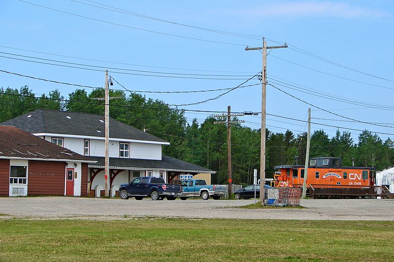
Cobalt Train Station, Highway 11

Cobalt ONTC station

Highway 11 Book Shop, now closed. Cobalt, Ontario
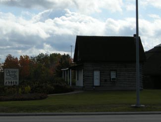
The Highway Book Shop was a classic tourist destination that never feels like a tourist destination.  It was a family-run used bookshop on Highway 11 just outside of Cobalt and it is not only worth a visit, it is worth some time.  Maps, books, magazines, teaching materials, kid’s lit, old books, new books, big books, rare books – you wouldn’t have believed all the crap they have in there.  I think I spent an hour on two separate occasions perusing the cramped store. It might smell like your grandmother’s basement, but it’s really neat, and no visit to Temiskaming is complete without a stop, in my opinion. Sadly, the icon has closed.  Ready to retire for years, the owners couldn’t find anyone to take the store on and had to shut one of Highway 11’s best attractions down.

Cobalt Classic Theatre is the only remaining theatre from Cobalt’s heyday in 1920s.  While other towns were using economic development funds to build golf courses, Cobalt restored the old Classic Theatre in 1993 and now hosts students, playwrights, and actors from across Ontario. The theatre is restored to what it looked like in the 1920s and is a focal point for the community.

Cobalt, mining equipment, Highway 11

Antique mining equipment on display at the lakefront.  Other towns would have just thrown this stuff out.  Cobalt, refreshingly, doesn’t run from its roots.

Mine headframe now a bar, Cobalt, Ontario

This headframe is now the world’s only bar in a mine headframe! That’s revitalization, northern Ontario style.

The Cobalt Mining Museum has the world’s largest display of silver and offers the only underground mine tour that I’ve seen outside of Timmins.  The Bunker Military Museum has a good collection of memorabilia, the Great Canadian Mine show displays mining technology, and there is also a firefighter museum in town.

Cobalt also has two separate self-guided walks.  The Cobalt Walking Tour brings you through town past historic buildings and historical places, while the Heritage Silver Trail is a self guided tour of many of the abandoned mine headframes in the area.

There’s more.  There is Fred’s Northern Picnic, an annual music festival that the local Member of Parliament usually plays at (he’s a musician by trade) and where you get three days of music and free camping for like $60.  The Silver Street Cafe has good food and decent prices, and they also cater local events with real food (forget hamburgers and hot dogs, think steak on a bun and pulled pork with onions.)  The Silverland Inn and Motel is a restored hotel from Cobalt’s mining heyday and also serves food.  There is a stained glass shop, a gem shop, and Iddy Biddy Petting Farm.  Cobalt also has more murals than Nipigon.

Fred's Northern Picnic, featuring MP Charlie Angus, Cobalt, ON

Not sure if they’re still running Fred’s Northern Picnic, but that’s where I saw Serena Ryder before she was big, and the local MP get up and do a set too

History of Cobalt Mural, Cobalt Highway 11Hockey, Streetcars, and Casa Loma

I read in the James Bay tourist brochure that there is a legend that Cobalt blacksmith Fred Larose threw his hammer at a fox, uncovering a rich vein of silver in the process.  Further silver and mineral deposits were found in 1903, triggering a mining rush like no other in northern Ontario.  The significance of the Cobalt finds supposedly led to riots over mining stocks in New York City.  Others say that Cobalt built Bay Street (Toronto’s Wall Street.)  A testament to the town’s wealth, the Cobalt Silver Kings played the 1909 season in the NHA, the NHL’s precursor. Another first in Cobalt include the Temiskaming Streetcar Line, which was installed between Cobalt and Haileybury, and was the first streetcar system north of Toronto.

Mining ruins, Cobalt, Highway 11 Ontario

Mining ruins east of town

Cobalt Lake, Ontario

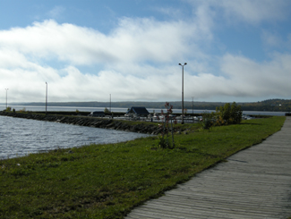
Cobalt Lake, once drained, then filled, now restored

In addition, the mines of Cobalt built Casa Loma, the famous “castle” built upon Spadina Heights in Toronto. Sir Henry Mill Pellatt was a wealthy Canadian mine owner (some say Canada’s richest man at the time.) It was his mining operations in Cobalt that allowed him to gather the immense wealth to build Casa Loma. Construction began in 1911 and took more than three years, 3.5$ million, and more than 300 full-time workers. With 98 rooms, it was the largest residence in Canada at the time. Pellat eventually lost his residence, as the Depression and the decline of mining in Cobalt led to his financial ruin. Casa Loma was essentially built with the revenues Sir Henry Mill Pellatt gained by draining Cobalt Lake for silver mining.

The Cobalt rush eventually produced more than $260 million worth of silver, countless myths and stories about how and where silver was found, who struck it rich, and who lost their pants in speculation. The Cobalt silver rush resulted in a whole little Cobalt culture developing – embodied by the Cobalt Song (click here to download the sheet music.) Cobalt led to the founding towns like North Cobalt (a bedroom town for miners) and Haileybury (a bedroom town for wealthy mine owners.) The mining boom in Cobalt also paved the way for exploration further north, which led to massive gold finds in Timmins and Kirkland Lake, both of which far exceeded the value of the mines of Cobalt in the long-run.

Cobalt, Ontario, downtown, highway11.ca Ontario Highway 11

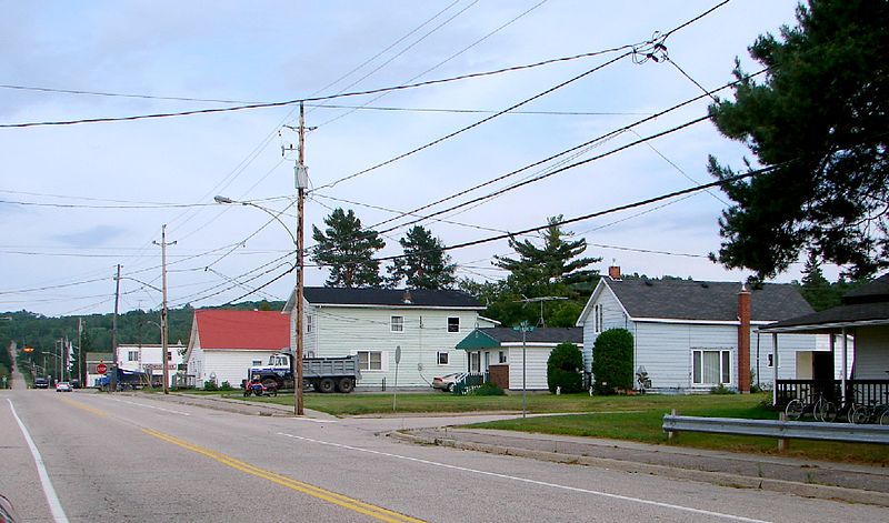
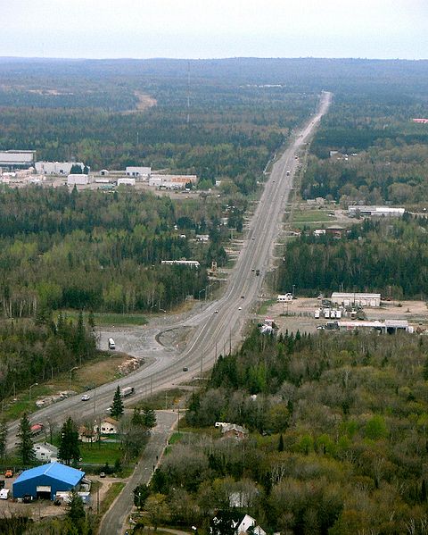
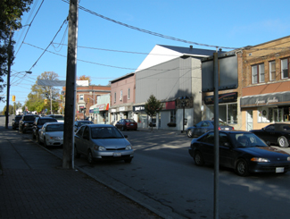
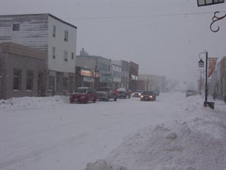
I could move this photo of downtown Cobalt closer to the text that talks about downtown Cobalt but in wordpress moving photos around is a pain in the rear. (Credit: User P199 at Wiki Commons.)

Although Cobalt survived the usual northern Ontario disasters, including a typhoid outbreak in 1909, and Great Fire of 1922, it couldn’t survive the decline of mining.  Well, it survived, but it’s much smaller today and mining no longer exists.  There is some exploration for diamonds, but I don’t think they’ve been found.  I’ve heard that many of the old mines still have minerals in them, but that it’s just not economical to mine such old shafts for minerals at today’s prices. But, in the end, the history of Cobalt is one of a town that conbtinually gets kicked, but then manages to find its way back up.

Cobalt is considered the third part of the Tri Towns along with New Liskeard and Haileybury.  But for some reason it didn’t amalgamate into Temiskaming Shores in the late 1990s when the province forced municipalities to squish together.  Maybe it’s too far away.  Maybe old hostilities with North Cobalt scuppered a move.  Maybe the town is too independent.  Maybe there is still an old hockey rivalry between Cobalt and Haileybury from the one season both towns had a team in the NHA.  I’m sure someone in the town of 1200 put up a fight.  I don’t know.

I haven’t spent as much time as I would like in Cobalt, and, I must admit, haven’t visited any of the touristy things here other than the Highway Book Shop.  But I’m sure I’ll be back again.

Old mining carts, Cobalt, Ontario

My grandfather worked in coal mines in Europe for a time.  Seeing these things, all I could think of was my disbelief that people actually went underground with these things…that’s ballsy

The Cobalt Song Mural, Cobalt, Highway 11 Ontario

New Liskeard

I just have to get my bias out of the way – I love Liskeard.

I was driving up to Kirkland Lake to scope out the town when I decided to stop in New Liskeard.  And was I ever surprised – Haileybury was nice, and New Liskeard is even nicer!

New Liskeard, farms, Highway 11, Ontario

Farms outside of New Liskeard

Some years ago, New Liskeard was the first town in northern Ontario I had ever really stopped in. “This can’t be northern Ontario” I thought, my stereotypes being left shattered.  And boy was I wrong.  It’s too bad my camera was toast or else I would have taken some shots of the downtown on my first trip.  I made a trip up that way a couple of years later, so this page will have a mix of my shots, as well as the random photos from the internet that I had used up until that time.

New Liskeard has a small but quaint downtown that is actually relatively full of stores.  There’s a nice waterfront with a walkway, a beach, and boat launch facilities.  There are restaurants, there is accommodation, there is even a Tim Horton’s, and an independent coffee shop and bookstore with fancy fair trade coffees and books in both English and French (The Chat Noir.)  If you drove through New Liskeard you’d proclaim that small town Ontario is alive and well and living in Temiskaming. Right at the base of the Temiskaming claybelt, New Liskeard may actually live up to the billing on guidebook gave it, as a “northern oasis” and the “heart of the scenic north”.

Downtown New Liskeard, Ontario, Highway 11

Downtown New Liskeard feels like Elmira or Walkerton

Founded in 1903, two years after its northern neighbour Dymond, New Liskeard quickly grew to be a northern hub during the forestry and mining booms in northern Ontario.  But the heart and charm of New Liskeard lies in farming. Thanks to its agricultural base, it has remained a fairly vibrant town despite the ups and downs of industry in northern Ontario. Today New Liskeard is one of the few towns in northern Ontario (and for that matter southern Ontario as well) that has maintained its downtown with both chains and independent stores.  Heck, there are two shoe stores downtown.  I don’t even know where to buy shoes in Timmins and it has ten times the population!  There’s a museum, an art gallery, a Carnegie library, as well as a big waterfront park (with a marina and a mile of beach and boardwalk on Lake Temiskaming) – the downtown is definitely worth a visit. With 5500 people (aprroximately 30 percent francophone), New Liskeard is the largest of the Tri Towns (Cobalt and Haileybury being the other two.)

New Liskeard Carnegie Library

Carnegie library

New Liskeard hosts a number of different events throughout the year.  Winter sees Ontario’s largest snowmobile rally, while the annual Fall Fair showcases local agriculture and is generally regarded as the biggest fall fair in northeastern Ontario, with the best in produce, livestock, and of course midway rides drawing people from as far as Cochrane and Timmins.  Every Canada Day Holiday Summerfest draws people from across Temiskaming.  There is the annual Bikers reunion which draws people from across Ontario to raise money for cancer research.  And, of course, this is all in addition to the usual camping, boating, hiking, golfing, mini putt, etc., etc.

Boardwalk on Lake Temiskaming, New Liskeard

Boardwalk on Lake Temiskaming

Don’t get me wrong, if you go to New Liskeard for a holiday you won’t be inundated with city activities. You won’t be roboting in any clubs or partying the night away at waterfront festivals. But this level of activities and amenities is significant for any northern Ontario town. And when added to just how cute New Liskeard is, makes the town impressive. There is something friendly, something alive, something cute, something quaint. All the best of southern Ontario and northern Ontario together. It has a great vibe.

New Liskeard's annual Bikers Reunion

Port Dover North?

New Liskeard has a fair amount of amenities for travellers, including banks and a caisse.  For evening festivities, the King George has karaoke (Wednesdays) and live music (weekends) and Sam’s Place features country-ish music and karaoke on Wednesday nights.  There are four restaurants in New Liskeard:  Country Kitchen, Rooster’s, and two northern Ontario Chinese food places.  Some chip stands open in the summer too.
Accommodation ranges from the Wheel Inn Motel, to BnBs, and from beach camping to the expensive Waterfront Inn (and everything in between.)  There is a small bunch of motels, fast food, and big box stores in Dymond, a few minutes north where Highway 11 and 11b meet.

I loved New Liskeard and after my first trip I was always kind of sad that I didn’t stop for more than coffee, a stretch, and some midol (the latter being not for me.)  Thankfully, I had a the chance to make a trip up since then, and it’s confirmed my little crush on New Liskeard. It may someday be a goal of mine to move there. Well, then again, it’s a goal of mine to move up north regardless of where. But New Liskeard It’s a quaint and interesting place with a small but vibrant little downtown.Downtown New Liskeard

Thanks to Johnny O for the info on the Tri Towns. If you’d like to see a bit of New Liskeard on film, check out the 2005 National Film Board documentary Harvest Queens, about the New Liskeard Fall Fair’s annual Harvest Queen contest, where local teenage girls compete to be crowned Harvest Queen.

Porquis Junction

The hamlet of Porquis Junction is about 10 minutes from Iroquois Falls. Porquis Junction used to be a small agricultural centre, with its own agricultural hall and even a John Deere dealership (Jensen’s Sales and Service) which serviced farms from Iroquois Falls to Matheson up until the early 1990s.

Porquis Junction agricultural hall

Reminder of agricultural days of yore in northern Ontario

As far as I can tell, it is not pronounced Por-kee but Pork-wiss, which to me sounds like a brand of tinned ham.  The town should nominate someone as the official ‘Marquis of Porquis’ every year at the end of the Blues Fest or Ag Festival.  Why?  Because it just sounds cool.

Porquis must be the festival capital of the north as it hosts a number of different celebrations despite its relatively small size.  Known across the north, the Porquis Blues Festival is held on a small covered stage behind the community centre every July.   The town also hosts an Agricultural Fall Fair in August.  In 1986, the town made the news when the Porquis Fun Days festival attracted world-famous wrestler André the Giant, who then proceeded to eat the hamlet out of house and home.Porquis Jucntion blues festivalPorquis is about 10 minutes off Highway 11, on the way to Iroquois Falls.  This was the second time, after Opasatika, that I had been chased by a dog while taking pictures – I guess he was bored. Or just very protective of the Porquis Junction Agricultural Hall.

POrquis Junction Cunigold Mines truck highway11.ca

Old Cunigold Mines Truck, sent in by Linus

Hearst

There’s something really interesting about Hearst.

Hearst is the frontier of northern Ontario – you either live in Hearst, east of Hearst, or you live waaaaaaaaaaaaaay west of it.  It even has a Northern Store (how’s that for remote.)

Hearst, Ontario on Highway 11

Hearst from the air

Where else would a town of 6000 have so many bars, the “northern ballet”, and yet still have four or five churches?

What other place keeps you in their town by telling you just how far away everywhere else is?  I mean, Longlac is 210 kilometres west, with nothing in between.  Hearst has the last McDonald’s for 500 kilometres – I know it because I checked, in person. There isn’t another McD’s until Thunder Bay

The tourist office in Hearst. Highway 11

The tourist office in Hearst. So awesome.

I once applied for a government job in Hearst, but never got an interview.  To be fair, I realize now that I was woefully underqualified.  I swear that the ad had listed French as “an asset”.  Well, no French isn’t an asset – in Hearst, it’s a requirement.

One of the most interesting things about Hearst, however, is that it is the most francophone community in Ontario – something like 85-90 percent.  Hearst even has residents that only speak French, and no English.  Rue George is the downtown drag and it’s really cute, with small shops, a library, a diner, and a movie theatre showing French-language movies.  It’s reminds me of Penetanguishene, but more with more French.

Hearst, OntarioI (h)EART (h)EARST

Erst (as it is pronounced locally) is a pretty special town.  It has:

•    The motto: “The Moose capital of Canada” (or so they boast)
•    The only tin man on Highway 11 (he keeps watch over an appliance store)
•    The most millionaires per capita (or so someone emailed, apparently it’s due to the local forestry?)
•    The largest moose sculpture on Highway 11 (Believe me, I’ve seen them all)
•    The most suburbs (two) of any small town Highway 11 town (take that, King Kirkland or Geraldton East)
•    The most truckstops per capita (or so I’ve calculated, roughly)
•    The biggest woodpile on Highway 11 (I’ve seen them all too)

Trust me.  When it's not getting snowbombed, Hearst's downtown is super cute

Trust me. When it’s not getting snowbombed, Hearst’s downtown is super cute.  The problem is that it gets hammered all the time.

Heck, I’ve been to Hearst three times.  Most of the photos here are from the first time that I hadn’t been snowed in (because it was August.)  Both other times, I was stuck for three days in storms even that locals found nasty.

Set on the Mattawishkwia River, Hearst is a forestry town (hence the massive woodpile.)  It also has a tourism industry set around hunting, outfitters, and its proximity to three Provincial Parks:  Fushimi Lake, Missinaibi and Nagagamisis.  It is also the end of the Algoma Line, which runs fall colours rail tours from Sault Ste. Marie to Hearst.

Despite its francophone heritage, Hearst was once the site of a Slovak settlement.  Bradlo, nestled 11 kilometres south of Hearst, the community persisted until the 1950s when the residents realized that the land was agriculturally marginal, and wouldn’t support farming in a modern economy.

Sculpture jsut outside of Hearst

Hearst is so cool, this wolf vs. moose sculpture doesn’t even count as their “some big weird thing”…

Hearst tin man, Highway 11

…instead, this does!

Food and Fun in a Frontier Town

Hearst is a center for most of the little communities west of Kapsukasing, and is the largest town between Thunder Bay and Kapsukasing on Highway 11.  And probably for Hornepayne on Highway 631, about an hour and a half south.  (Head off-route and take a trip along 631 here.)

No McDonald's for 500 km in Hearst, Highway 11

I’ve used this photo about a twenty-two times on this website and it never gets old

Therefore, Hearst has an abundance of services.  It has the only McDonald’s and Tim Horton’s that you’ll see until Thunder Bay.  In addition to the 24-hour garage and towing company that is advertised throughout northern Ontario, there are shops downtown and food everywhere.  Hearst also has an overabundance of places that serve Northern Ontario Chinese Food.

Hearst has something for everyone – the northern ‘hotel’ scene (the Waverly or the Windsor), cafés (although Café Duo doesn’t serve coffee, go figure), fast food (McDonald’s, KFC, Subway, and the only Pizza Pizza west of Timmins), authentic chip stands (Micko’s is great), sit down restaurants (Mom’s, John’s, Pizza Place has ok pasta), fine dining (you can find filet mignon, steak, and Cuban cigars at Ailleurs), and even a little night club (OK, fine, it’s the bar at the Companion.)

Snowstorm, Hearst, Highway 11

Highway 11 in Hearst, getting walloped, again

There are motels aplenty in Hearst so you should have no trouble finding a place to stay.  (A note to those staying at the Queens Motel, keep your kids away from the funny channels at the end of the TV dial there!)  There is also hockey in the winter – in fact, Hearst is the hometown of Claude Giroux, Philadelphia Flyers superstar, as well as Pierre LeBrun, a hockey commentator who has appearanced on TSN, ESPN, and Hockey Night in Canada. Hearst is home to the local team les Elans de Hearst. And, there is bowling.

Come on, it’s northern Ontario. Of course there is bowling!

Super awesome Hearst woodpile, Highway 11

Hearst – simply the best woodpile of any Highway 11 community

Hearst, Ontario highway11.ca

And this is what happens to a woodpile on Highway 11, in Hearst (Credit: Wiki Commons contributor P199)


Hearst, Ontario airport

Not sure why I took a photo of Hearst’s airport

Nakina / Aroland

North of Geraldton you’ll find two towns on opposite ends of Highway 548 – Nakina, and Aroland.

Nakina is village of approximately 500 people on Highway 584. The village is situated approximately 60 kilometres north of Geraldton – making Nakina one of Ontario’s more remote towns on the road network.

Nakina highway ending, Ontario highway11.ca

At the end of one of the most northerly stretches of road in Ontario are Nakina and Aroland

With 500 people today, Nakina is essentially the remnants of an old railway town. The town was founded in 1913 due to the junction of the railway – after Nakina the rail lines branch southwards towards Toronto or east towards Quebec. This made Nakina an ideal spot for a railway centre. In its heyday, Nakina has a fully functioning roundhouse, with fuel, servicing, and train-turning facilities.

The 1940s saw Nakina get a radar base. Built in World War Two, the base was designed to protect the important locks between Lakes Huron and Superior at Sault Ste. Marie. Like many of Canada’s old radar bases, it was operated by the United States, but dismantled soon after the Second World War.

Nakina, Ontairo way up north a fair bit off Highway 11

Nakina, harkening back to the old days of northern Ontario railway towns (Photo: User P199 at Wiki Commons.)

Nakina hit a boom in the 1970s when, in addition to its railway functions, the town was home to a large paper mill. This boosted the population to nearly double what it is today. Currently, however, minerals exploration and tourism are the largest industries today. Nakina is a starting point for many northern fly-in lodges. You can fly to lakes such as Makokibatan, part of the Albany River system. Fish for walleye, northern pike as well as brook trout.With both the pulp and railway industries definitely on the wane, it may be hard for Nakina to stem out-migration and beat the odds of being such a remote, northern town.

Train station in Nakina, Ontario Highway 11 Homepage

Nakina’s train station

Nakina advertizes along Highway 11 with its mascot, the “Nakina Mosquita”… I wish I had taken a photo of one of those signs. Thanks to Keith for sending in the photos of the rail station and of the end of Highway 584.

Aroland is an Oji-Cree First Nations town about 20 kilometres northwest of Nakina off Highway 584 on Highway 643. Approximately 300 people live in the community.

The surrounding area was a traditional camping ground in the late 18th and early 19th centuries due to good hunting, fishing and trapping. The Hudson Bay Company set up a trading post at nearby Kawpaskagami Lake in the early 1900s. The railway expanded to the area in 1911. According to the Chiefs of Ontario website, the Arrow Land and Logging Company, which operated in the area from 1933 to 1941, employed many Band members and contributed to the establishment of a permanent community.

The community is made up of members from many First Nations across the north, including former members from Long Lake, Fort Hope, Marten Falls, and Fort William Bands. The Aroland settlement is within the boundaries of the Robinson-Superior Treaty of 1850 and the James Bay Treaty of 1905 (known across the north as Treaty 9.)

Nipigon

Located on the most northern point of Lake Superior, Nipigon is pretty much the only true town between Geraldton and Thunder Bay.

You know what this means.

Out of the way Tim-Br Mart.

Move over Home Hardware.

Nipigon has a Canadian Tire…!

Nipigon, Ontario, highway11.ca marina lake superior

Even Nipigon’s little port is cute!  The lookout is up at the top of that hill in the back of the photo. (Photo: User P199 at Wiki Commons.)

When you drive into many northern towns, there’s usually a sign telling you that they’re the home of a semi-famous Canadian celebrity.

Well, fooling around on the internet one day I found out that a crater on Mars was named after Nipigon.

Why isn’t this on a sign beside the highway?  You could put “Nipigon – we’re so out of this world they named a crater on Mars after us!” or something like that.  Moonbeam would kill for this! I’d pledge 50$ toward that…

Nipigon shrine Ontario Highway 11Instead, you’re greeted by a sign that tells you that churches are open Sundays and are directed to a ‘scenic lookout’ which looks out over a cemetery.  Is this considered a God’s-eye view?  Nipigon does have an abundance of churches, and the town’s Catholic Church even has a little shrine beside its virgin Mary statue.

Hydroelectricity, fishing, forestry, tourism are the mainstays of Nipigon’s 2000 people. (I wonder if they did the census in the summer, and how that would impact the head-count – there seem to be some cottages in the area.) Nipigon is blessed with a scenic little harbour, complete with a waterfront park, a boat launch, and hiking trails.  It even has a nice kid’s bookshop, and a stained glass store to boot.  This is not your average Highway 11 town.

Paintings and Big Things

Nigion is full of murals Highway 11 OntarioWell, I take that last statement back.  Nipigon is your average Highway 11 town because, of course, it has to have its share of weirdness.  Of course, there is the mandatory “big weird thing in town”, but also in this case, it is public art.

Nipigon seems to love murals.  I counted four, plus the town museum which has paintings on it as well.  The one on the Legion celebrates forestry.  Another recognizes the history of the railroad.  A third shows the town’s first general store.  A fourth celebrates ‘northern Ontario time’ – encouraging workers to call in sick in order to go fishing.  It’s a great idea. I’m a sucker for any kind of public art.

Nigion is full of murals Highway 11 OntarioLike most northern Ontario towns, Nipigon has a festival and a some big weird thing displayed in town.  Every August long weekend the town celebrates the Blueberry Blast festival, although I was there on the long weekend and didn’t see any blueberries raining down anywhere in the town.  In the “some big weird thing” category, Nipigon has two entries, 1) a historic turbine taken from the electrical plant up the river, and 2) a big trout on the highway.

Big weird thing #2 - Nipigon's trout, on Highway 11

Nipigon’s big weird thing #1 – Nipigon’s trout, on Highway 11

Nipigon is the best stop to eat or refuel before you hit Thunder Bay or Geraldton.  There is a foodmart, a Robin’s Doughnuts, multiple gas bars, a Beer Store, a Mac’s Milk, a few motels, a bank or two, a Subway where I waited 70 minutes to get a sub (beware of people coming in from camps and ordering 12 subs each), and a Pizza Pizza/KFC outlet.  Out on the highway there’s Gus’ Broasted Chicken, for those wanting a non-fast food meal.

Lots of people end up leaving Highway 11 for Highway 17 after Nipigon.  If you’re interested, check out the towns that run along Lake Superior’s shore by going off-route here.

Other random stuff

Nipigon Ontario - big weird thing #1 - hydro turbine

…and Nipigon’s big weird thing #2, an old hydro turbine

Oddly, east of Nipigon past Highway 11 there is an ad for construction company in based in Hearst.  That’s past Highway 11.  In the opposite direction of Hearst.  Really, it’s nowhere at all near the town.  Do the owners know where they’re being advertised?

Nipigon is also the town that got me in trouble in Grade Four.  Whilst playing Cross-Country Canada in computer class, Mme. Bennedsen caught me and three other kids giggling at the computer screen.

Now, this long before the advent of the internet, so in hindsight there wasn’t much risk we were up to anything particularly nefarious.  But maybe she was having a bad day, or maybe she was practicing her walk-stare-scold combo for use in future computer classes once the internet became a fixture of public education – whatever the reason, she rushed up toward us, eyes glaring, finger pointing, heels clicking ominously.

We looked at each other.  Once of us would have to come clean.  After multiple protestations from us that we were up to nothing, she finally flushed it from us.  And I took the hit for the four of us.  I was forced to stand before the class, head bowed, and admit out loud that there was, in fact, no town in Ontario named Nipplegone.

Red Rock

A former forestry and mill town of approximately 1000 people, Red Rock is about nine kilometres miles from Highway 11.

Red Rock, highway11.ca, Highway 11 Ontario

If this is Red Rock, it is freakin’ gorgeous. (Photo: Wiki Commons user P199)

I didn’t venture off the highway but Red Rock known for wonderful views of the local cliffs, as well as for continuing the proud Highway 11 tradition of summer musical festivals – Red Rock hosts the annual Live from the Rock Folk Festival which takes place the second week of August.

The town also hosts an annual mountain run.  The town also features a beachfront, marina, and boardwalk – just turn south at the abandoned tavern.  The Red Rock Inn provides accommodation in town.

Red Rock Inn, Highway11.ca

The Red Rock Inn. (Credit: User P199 at Wiki Commons.)