Jellicoe (and Nezan and/or Nezah, and Tansleyville)

Jellicoe, Ontario, west of Geraldton on Highway 11 (Photo credit: Wiki Commons User P199)

Jellicoe, Ontario, west of Geraldton on Highway 11 (Photo credit: Wiki Commons User P199)

Depending on the map you’re using, one, two, or all of three of Nezan, Nezah, and Tansleyville exist as dots on the map west of Jellicoe.

Although they exist on my map, they didn’t exist on the road as I drove it – I saw one house that might be Tansleyville, while I found an intersection that might qualify as Nezan, or possibly Nezah.  And that’s it.

Jellicoe is the kind of place that makes the francophone hamlets like Mattice and Moonbeam on Highway 11 look big.  There are about a dozen houses and cottages in Jellicoe, many of which are on the shores of a small lake that had beautiful emerald-green water the day that I visited.  (Too bad it didn’t turn out in my photo.)

This photo doesn't show it, but the lake was serene and green (in a good way)

This photo doesn’t show it, but the lake was serene and green (in a good way)

The town is pretty small. It was really quiet the day I was there. The church was closed, there were some other buildings – some cottages, a few boarded up – and some old election signs up on a few trees. It was really really quiet.

As for services, there’s a hunting store and gas station, and that’s all I noticed on that day.  When going to Geraldton (50 kilometres away) is considered a trip to the city, you know you’re remote.

TB-04-Jellicoe-Church

Jellicoe also features Colimar Lodges and Chalets about five minutes west of town. I’ve only been through once so please fill in anything I missed below.

Red Rock

A former forestry and mill town of approximately 1000 people, Red Rock is about nine kilometres miles from Highway 11.

Red Rock, highway11.ca, Highway 11 Ontario

If this is Red Rock, it is freakin’ gorgeous. (Photo: Wiki Commons user P199)

I didn’t venture off the highway but Red Rock known for wonderful views of the local cliffs, as well as for continuing the proud Highway 11 tradition of summer musical festivals – Red Rock hosts the annual Live from the Rock Folk Festival which takes place the second week of August.

The town also hosts an annual mountain run.  The town also features a beachfront, marina, and boardwalk – just turn south at the abandoned tavern.  The Red Rock Inn provides accommodation in town.

Red Rock Inn, Highway11.ca

The Red Rock Inn. (Credit: User P199 at Wiki Commons.)

Hurkett

As I went through the site to reformat and redo it after losing all of my content in early 2013 (thank you, wonderful internet!), I collapsed a number of tiny entries into single pages.  Mainly to save website space and to improve the viewer’s navigation experience – anything in the name of efficiency.

But there is one town whose page I refuse to combine with any other: Hurkett.

Because if I did, I might find a price on my head.  OK, more likely I’d get inundadted with nasty emails…but more on that later.

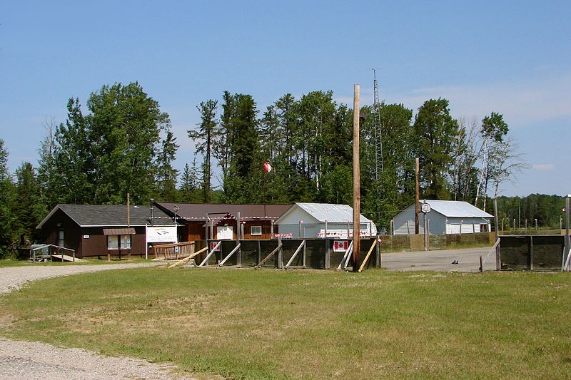
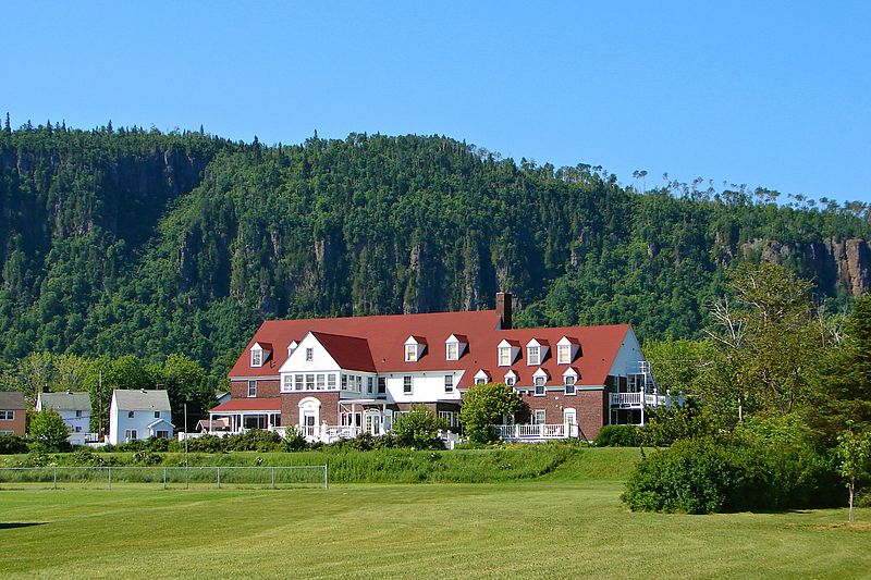
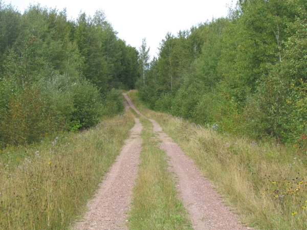
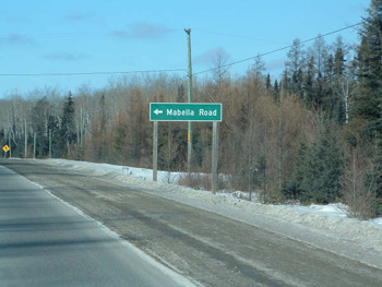
Hurkett is actually three kilometres south of Highway 11.  At first glace, I thought that there wasn’t much there.  I counted about three houses near the highway, and another three further in. In all it was a five minute detour.

So I posted these impressions online, and promptly started developing a really bad reputation with the local population.

Hurkett Ontario Highway 11 Yonge Street Thunder Bay

Is there more to Hurkett than this?

One resident sent an email incensed that I had gotten things so wrong about her community.

Another told me that some townsfolk were reporting that there was a website stating that there was nothing in Hurkett, and that, according to this emailer, “well, that just couldn’t be true..”

One particularly memorable email stated that us southerners (they assumed) just couldn’t give a crap about the north (they assumed), and that I wouldn’t know a nice town if it smacked me in the head and if I had any eyes, ears, or brains at all (did they assume I had any? Or that I didn’t have any? I will assume that they assumed the latter) well then I’d have seen this wonderful little community, but because I come from Toronto (they assumed), a place where people are shot on the street on a daily basis, then I must be another half-wit southerner (they assumed) who should just stay the heck out of the north. Wow.

However, there were also some much more reasonable emails from Hurkettians (sp?) informing that I had, indeed, misrepresented their community.

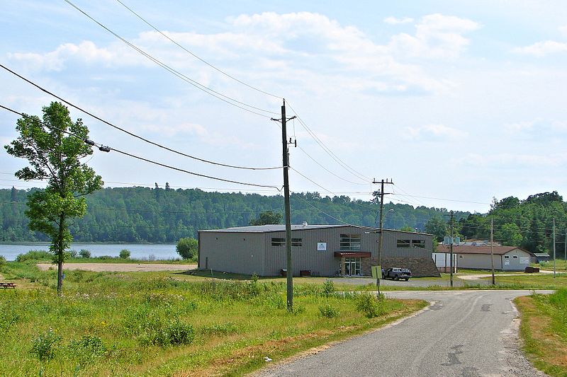
Dawn emailed me to tell me that I had, once again gotten things wrong. It turns out that Hurkett is community of approximately 100 households (not 6!) and 300 people just off the Highway. My apologies to the poeple of Hurkett for missing the essence of their community.

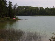
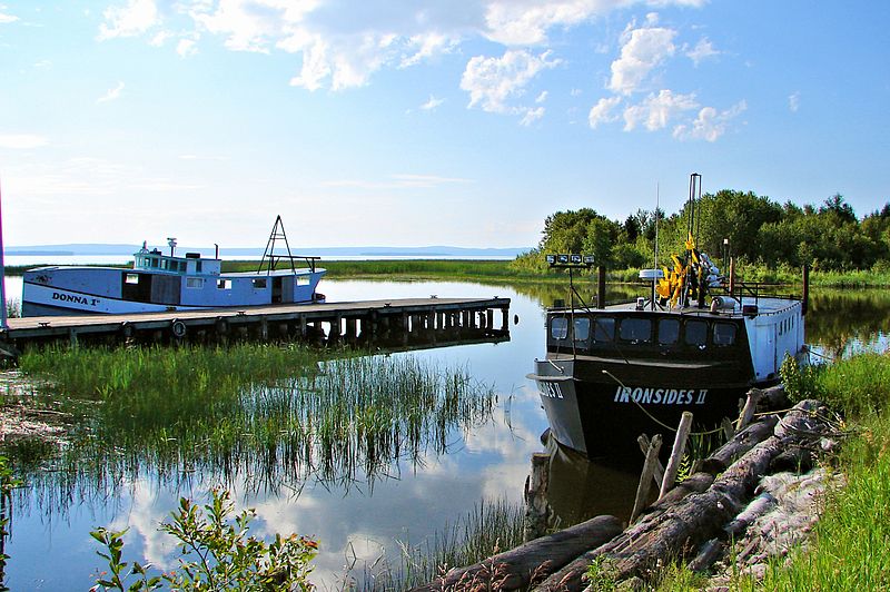
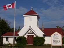
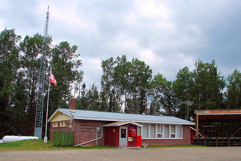
Dale emailed to tell me that Hurkett has a nice public dock on Black Bay where you can fish (there is a local fly fishing company in town.) There is a community centre, a fire station, an arena that was volunteer-built (like Iroquois Falls), and nearby is the Hurkett Cove Conservation Area.

Hurkett Ontario habour Lake Superior highway 11 yonge street thunder bay

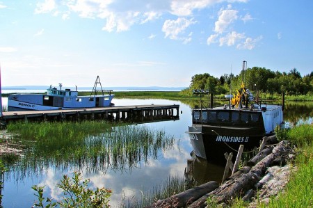
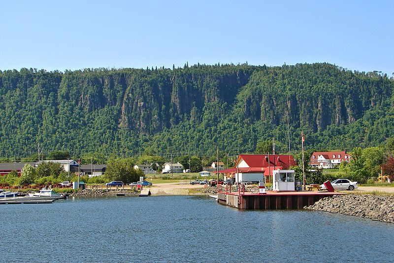
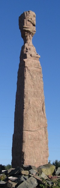
There sure is! This is Hurkett’s little harbour on Lake Superior. (Photo Credit: Wiki Commons P199)

On my quick drive through, the things I noticed were a wetland, a strawberry farm, a tree nursery, and a “walk-in cooler for all your cold storage needs.” I’m hoping to add to this with more about Hurkett’s past and present, if I can.

Email me at info (at) highway11 (dot) ca. Thanks to Dale and Dawn for the info on Hurkett, and my apologies to the other Hurkettites (sp?) that I offended with my earlier profile of Hurkett.

Pearl / Dorion

Welcome to Ontario’s “Canyon Country…”

Dorion gas station mural canyon country pearl highway 11 yonge street thunder bay ontario

The mural at the now-abandoned gas station at Dorion, near Pearl on Highway 11

Situated between the Wolfe River and Coldwater Creek, Dorion is your typical Highway 11 dot-on-the-map.  There are some scattered houses and an abandoned motel, but nowhere really to turn off the highway, at least that I have seen in my drives for work along the road.

Dorion indian head ontario highway 11 thunder bay rock statue canyon country

Dorion’s Indian Head on Highway 11. I’m really not saying the human head or face here…

Dorion is home to Canada’s largest wildlife mural – but not in the local gallery, or the town hall, or the café, but ….drumroll… at the Esso station.  The station is painted on all three sides, with moose, fish, and wolf representing Dorion’s place in “Canyon Country”.

As well, the station features a recreation of an Aboriginal sculpture known as the Indian Head.  (Both are pictured here.)  This sculpture is a recreation of Indian Head, a rock formation found in nearby Ouimet Canyon Provincial Park.  This is pure Highway 11 – random things in a completely random place.

Highway 11 randomness #347b: random fake animals near Pearl, Ontario

Highway 11 randomness #347b: random fake animals near Pearl, Ontario

Dorion is in the middle of what is called “Canyon Country” as Ouimet Canyon Provincial Park is approximately 12 kilometres north of the ‘town’. Nearby Eagle Canyon is a private park that has built Canada’s longest suspension bridge over the Ouimet Canyon – 600 feet across and more than 200 in height.

Dorion is also home to a bottled water works, Ontario’s largest fish culture station, the Trillium Motel, a bait shop, and a bible camp.

Pearl wasn’t on the map.  In Pearl you can find the Rocksville Amethyst Shop, some animal statues (which are small by Highway 11 standards), and a few bush side-streets.


Pass Lake

When you take frequent road trips (or make a website about a street) you learn a few lessons very quickly:

  • Lesson #1 – Always keep your keys in your pocket – lest you get locked out in the middle of nowhere.
  • Lesson #2 – Always follow the map – lest you get lost in the middle of nowhere.
  • Lesson #3 – Maps always lie.

Although my provincial highway map seems to suggest others, once again Pass Lake isn’t on Highway 11.  It has a gas station and a few homes on the highway, but the town is five kilometres south of the highway, towards Sleeping Giant Provincial Park.

Pass Lake has two interesting aspects to its history.  First, the area was first populated by the Aqua-Plano Aboriginals 9000 years ago.  The Aqua-Plano built a society around the hunting of large game animals, building specialized tools to prolong their existence.

Second, the area was the site of a special settlement of Danish homesteaders during the Great Depression.  It was hard for Danes to own land at home, some they came to Canada, cleared the land, built a settlement, and in 1932 erected Salem Lutheran Church, which still stands today.  A quick scan of local mailboxes showed names like Hansen, Salem, Sorensen, and Riemer, showing that descendants of original settlers remain to this day.A local resident obviously wouldn’t let a bad acronym get in the way either her own name or the joys of alliteration – Kathy’s Karen’s Kountry Kitchen serves home cooked meals on what must be one of Ontario’s most serene patios.  There is a beach at the lake with some cottage and camping facilities.  Beyond that, the town was hard to find.  There was an arrow for a community centre, but it looked to be far into the bush on a red dirt road.  The houses are spaced out and there is no focus to the town.

Pass Lake hosts an annual fall fair and offers some great views of Sleeping Giant Provincial Park, which is approximately 25 kilometres further down the peninsula from the town.

Wild Goose

Sunset near Wild Goose, off Ontario Highway 11Wild Goose isn’t actually on Highway 11.  It’s about five minutes south of it on Lakeshore Drive in the Township of Shuniah, which was the first municipality founded in northwestern Ontario.  Shuniah is a local aboriginal word for silver, which was mined in the area.

I stayed in a great hostel here – the Thunder Bay International Hostel.  For $20 a night you get your own room.  Camping is even cheaper.  Hiking and the river are nearby.  Lloyd and Willa and great hosts, and Lloyd knows all the best spots for swimming.  I never went swimming.  I hope I didn’t disappoint.

Wild Goose has a nice park where you can swim across from the ever-present Sleeping Giant.  There is an LCBO outlet and a variety store.  Silver Harbour Conservation Area is a two minute drive from Lakeshore Road.

River near Wild Goose

River near Wild Goose (Credit this and the above photos:  Lloyd)

Wild Goose Shuniah, Highway 11 Ontario highway11.ca

Municipal building for Shuniah Townshoip, near Wild Goose Ontario (Credit: User P199 at Wiki Commons.)

Shebandowan / Shebaqua Corners

She-ban-do-wan, ooby do dooby do do She-ba-qua-qua

That’s not a real song.  I’ve just always thought that Shebandowan and Shebaqua Corners (well, minus the ‘Corners’) sounded like an improvised line from a minor Frankie Valli hit.

Highway 11 Lake Shebandowan

Lake Shebandowan at dusk (Photo credit: Linda)

It’s kind of funny to think that even parts of Ontario as remote and in the wilderness as north-west Ontario have their own cottage countries.  Or, as they like to call them up here, “camps”.  Shebandowan is one such area – I guess if the hustle and bustle of Fort Frances or Rainy River is too much for you, you can escape here.

Seventy kilometres west of Thunder Bay, Shebandowan has access to three lakes (upper, middle, and lower) for swimming, boating, and fishing.  Inco used to run a mine on the south side of the lake.  There used to be a hotel in the area, but all that remains are some scattered stores.  I’m told that this area of north-western Ontario is beautiful.

Linda emailed me the photo above and to let me know that there is more going on than I’ve reported.  American visitors often frequent Beda’s Lodge. There is great pizza at the old Burstrom’s and the Shebandowan Pie Sale in August is the annual must go to event to see everyone, have a drink or two and go home with a fresh baked pie.

Shabaqua Corners is a small hamlet on Highway 11 west of Thunder Bay.  What’s kind of neat about Shebaqua Corners is that every single vehicle either coming or going by way of Manitobagoes through this spot as there is no other way to get through Northern Ontario from out west.

As in most truck-stop towns, Shabaqua Corners has a local diner, an LCBO, a gas station, and a store.  There used to be a hotel in town…Chris emailed to tell me that it is still open.

Shebandowan, Highway 11 Ontario highway11.ca

Is that a bandstand beside the municipal office in Shebandowan? If so, I wanna be on their council. (Photo: User P199 at Wiki Commons.)

Sapawe / Kashabowie

The watershed mark at Sapawe.

The watershed mark at Sapawe.

Don’t get me wrong.  Sapawe and Kashabowie are two separate places.

On the old site I used to have separate pages for Sapawe and Kashabowie as they are definitely two individual dots on the provincial highway map.

But when I had to re-do the site (thanks, Paypal, for not notifying me that they had arbitrarily cancelled my payement to the webhost, who subsequently deleted my website for non-payment of fees!) keeping Sapawe and Kashabowie separate just seemed so inefficient.

A reader tells me there isn’t a lot in Kashabowie, but that it’s a good fishing supply area with access to many lakes, a gas station, and an LCBO.

This is near Kashabowie.  Or at least somewhere within 30 kms.

This is near Kashabowie. Or at least somewhere within 30 kms.


Seine River Village

Seine River Village is a small First Nations community but I haven’t been able to find much on it.  Internet searches only revealed weather information and some random results about Parisian history.

Seine River Village is a fairly isolated spot between Fort Frances and Atikokan on Highway 11.  When you look at the map there doesn’t seem to be much around the town.  So I’m pretty stuck for photos.  Hence the photos here, including the one of a bridge about 10 kilometres east of Seine River Village, sent in by Keith.

Seine River Village, highway11.ca, Ontario Highway 11

And then I found this photo of Seine River Village in the gallery of Wiki Commons user P199.

Ontario Highway 11, highway11.ca, Seine River Village.

This is the best I have for photos: a small bridge 10 km east of Seine River Village. (Photo: Keith)

Mine Centre

Mine Centre is on Highway 11 in between Fort Frances and Atikokan.

The regional tourist guide says that Mine Centre is “a small community…a great place to stop for a bite, get supplies, or talk to friendly locals.”  However, when you’re considered a small community in a place where every town is small, then you know Mine Centre truly must be another small Highway 11 hamlet.

Nearby, Bad Vermillion Lake is good for fishing – pike, bass, trout (supposedly “huge and tasty!” according to one site), walleye, and northern pike can all be found near Mine Centre.  There is the Turtle River wilderness area for those who wish to canoe or kayak.  I haven’t found many tourist listings on the internet but there seem to be a few cabin/camp operators near Mine Centre.

Keith emailed me to say that between Mine Centre and Fort Frances there is a place called Bears Passage, 7 km east of the intersection of Highway 11 and Highway 502. This area is mostly cabins and cottages but some people live year round. A nice lookout exists at the Bears Passage Bridge looking out on to Rainy River.